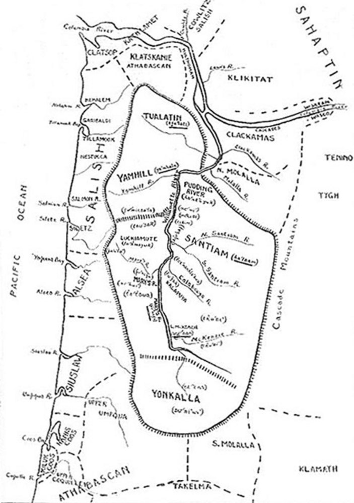
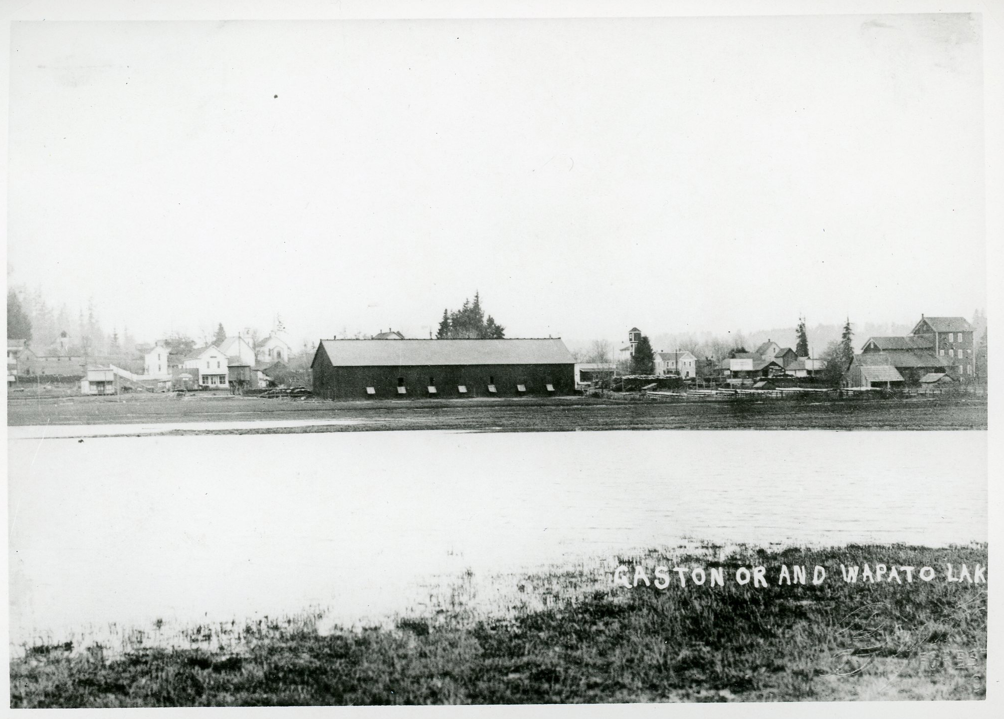
The City of Tualatin is twelve miles south of Portland, on the southeastern edge of Washington County and extending into Clackamas County. The town was an early EuroAmerican settlement in the Tualatin Plains, a highly productuve agricultural area with wide, open areas and fertile soil which attracted many emigrants during the mid-nineteenth century. The Atfalati (also known as Tualatin) band of the Kalapuya lived on the Tualatin Plains for centuries. The land’s suitability for farming was partially the result of the Atfalatis’ practice of controlled burning, which they used to clear and maintain large, open areas for foraging and hunting.
By the 1830s, when retired Hudson’s Bay Company employees began to settle on the Plains, Native communities had been decimated by disease. By the 1840s, most of the residents of the area were Oregon Trail emigrants. In the 1850s, they began building a plank road—now called Canyon Road—to connect the Willamette River port at Portland to the Tualatin Plains and its agricultural and lumber products.
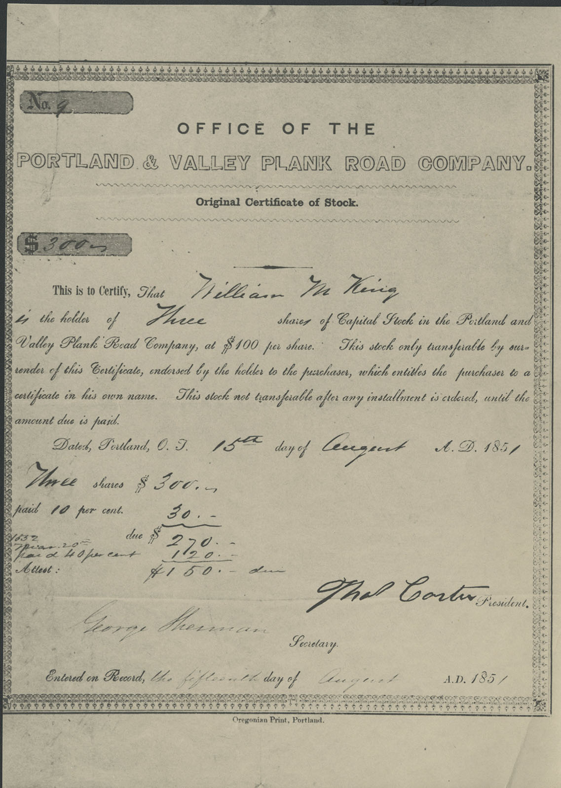
By 1853, white settlers had filed some thirty Oregon Donation Land Claims in the area that is present-day Tualatin. They cleared land, constructed covered bridges, cut roads, and built a log school, a smithy, and a store. Starting in 1852, John Taylor operated a ferry across the Tualatin River. He cut and planked a road from the ferry to Portland; called Taylors Ferry Road, it was eventually incorporated into Highway 99W.
The town was named Galbreath in 1853 after an early pioneer family. In 1856, residents changed the name to Bridgeport, reportedly a reference to one of the area’s first permanent bridges across the Tualatin River. The name of the first post office, opened in 1869, was Tualitin.
John Sweek sold land to the Portland & Willamette Railway Company in 1886, platted the northern part of his 320 acres, and named the town Tualatin. His house, which he had built in 1858, is on the National Register of Historic Places. The Southern Pacific Railroad eventually bought the P&WRC line and built a depot. The town soon had a store, a church with a steeple and stained-glass windows, and two saloons.
In 1890, John L. Smith moved to Tualatin, where he established a sawmill and a brickyard and ran a steamboat upriver to fetch logs. When the Oregon Electric Railway built a line through Tualatin in 1906, Smith constructed a large corner store across from the depot and platted a new town center.
The town of Tualatin was incorporated in 1913, which allowed it to tax liquor sold within its jurisdiction. Before long, the town had streetlights, wooden sidewalks, graveled roads, and a gas station. Thad Sweek, John Sweek’s son, was the first mayor. In 1918, the town elected John Nyberg mayor, an office he held for twenty-six years.
As the original Donation Land Claims were divided and sold, the town became ringed with family farms, onion fields, hopyards, dairies, orchards, and hatcheries. Farm work was the primary means of employment during the 1930s, and work in Portland’s shipyards helped many families pay off their mortgages during World War II.
By 1960, the population of Tualatin was 359, city wells were going dry, septic tanks were overflowing, and the river was badly contaminated. With the completion of I-5 through Oregon in 1966, the city began to change. Tualatin named its first city manager, Yvonne Addington, and Mayor Jim Brock recruited local businesses to fund a connection to the Bull Run watershed. Federal grants funded the building of reservoirs and a tertiary sewage treatment plant. Over the next four decades, Tualatin’s population increased to over 27,900 people. In 2013, Legacy Meridian Park Hospital, built in 1973, was the largest employer in Tualatin, with over eight hundred employees.
In the 1990s, Tualatin’s downtown was redeveloped into the Tualatin Commons, a gathering place around a created lake. Ten parks and wetlands comprise over 175 acres in the city. The Tualatin Community Park on the Tualatin River was the site of the annual August Crawfish Festival from 1959 to 2022. Browns Ferry Park, located on land settled by Zenas Brown in 1850, is home to the Willowbrook Summer Arts Program (currently on pause for 2024), which Althea Pratt-Broome started in 1982.
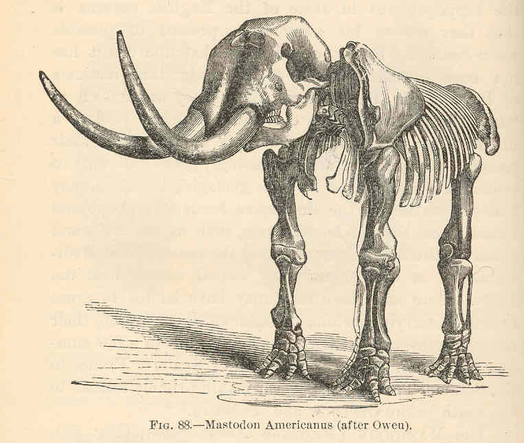
The Tualatin Historical Society continues to accumulate information about Tualatin’s history. Its collections include a half skeleton of a 14,000-year-old mastodon, the sacrum of a giant sloth, and erratics washed down in ice-age floods. These archaeological finds are on exhibit in the City Library and the Tualatin Heritage Center.
-
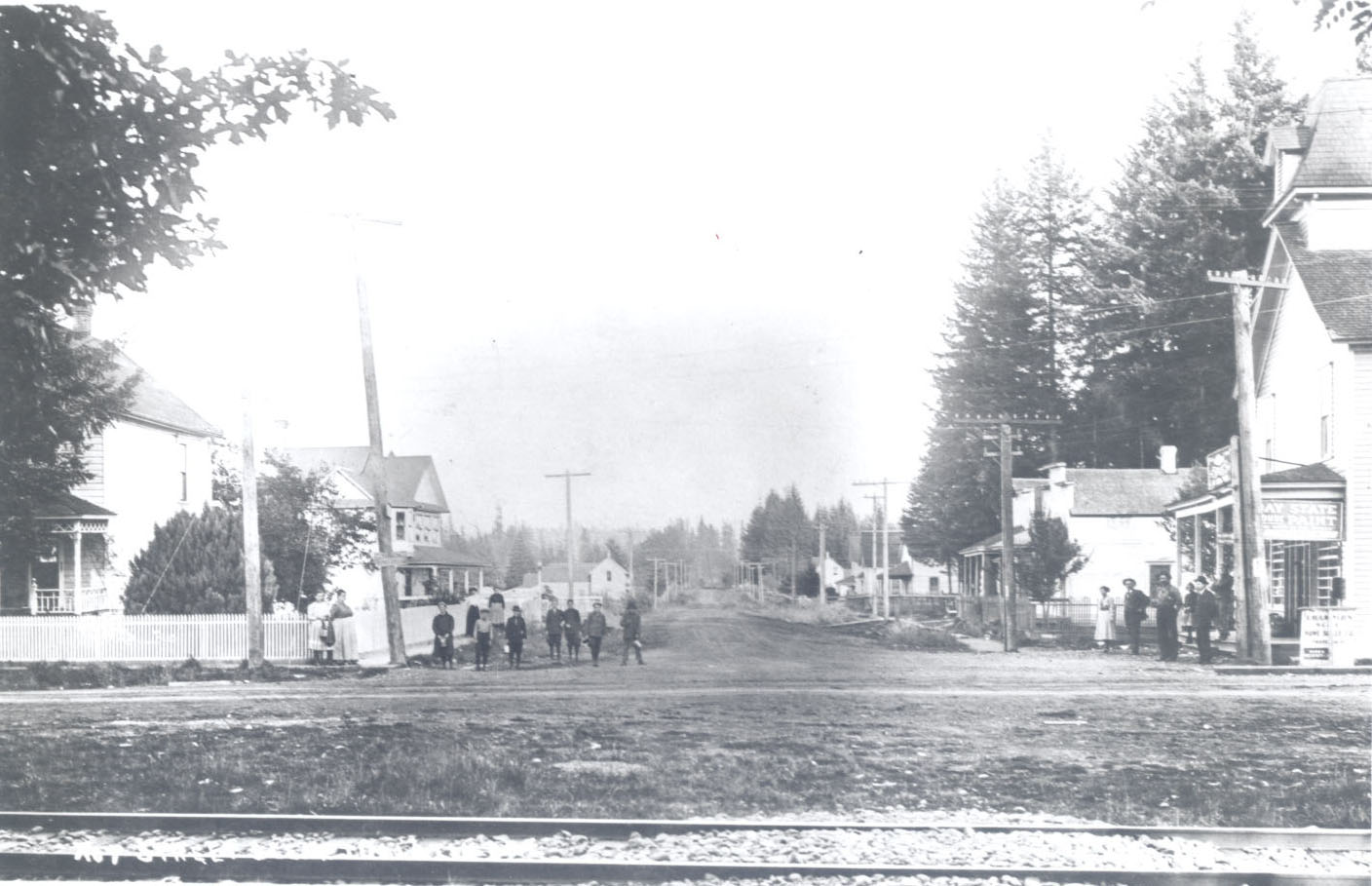
![Tualatin, c.1910, looking east on Boone's Ferry]()
Tualatin, c.1910, looking east on Boone's Ferry.
Tualatin, c.1910, looking east on Boone's Ferry Courtesy Oreg. Hist. Soc. Research Lib., neg. no. 23641
-
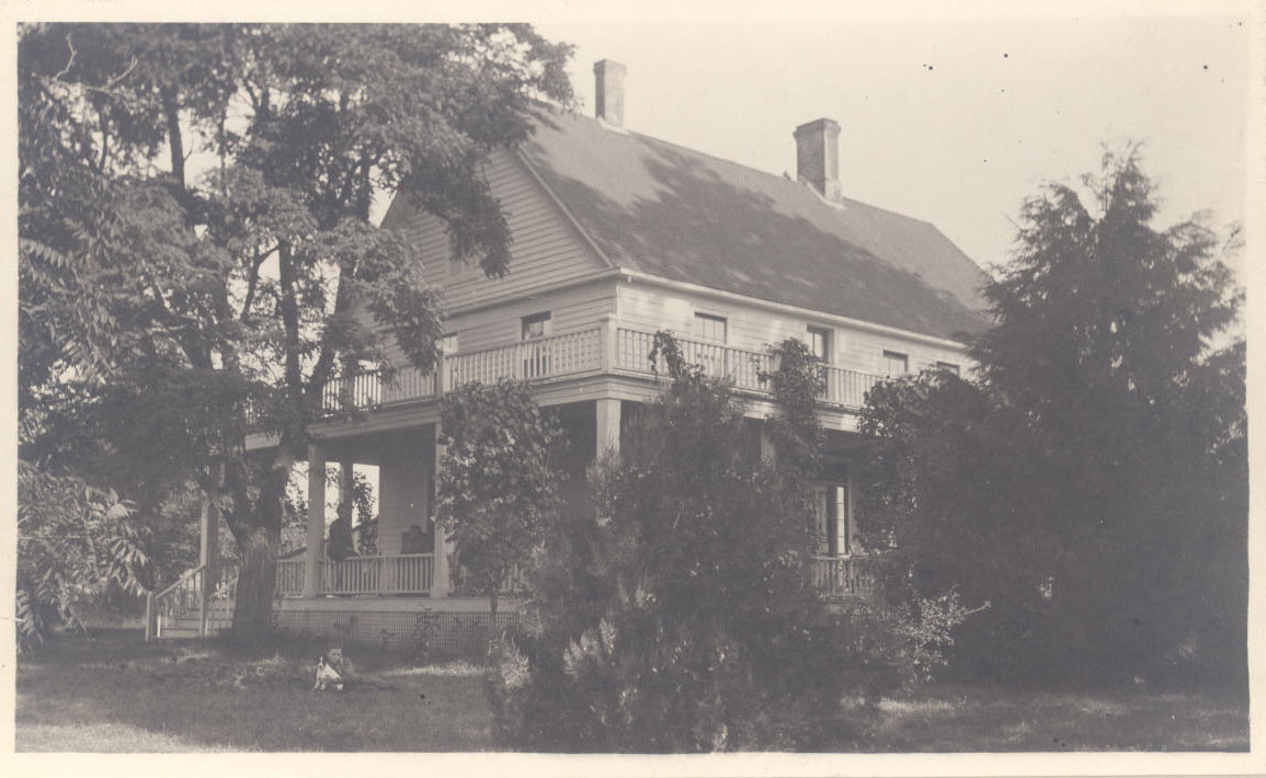
![Residence of John Sweek, 1902]()
Residence of John Sweek, 1902.
Residence of John Sweek, 1902 Courtesy Oreg. Hist. Soc. Research Lib., neg. no. 64570
-
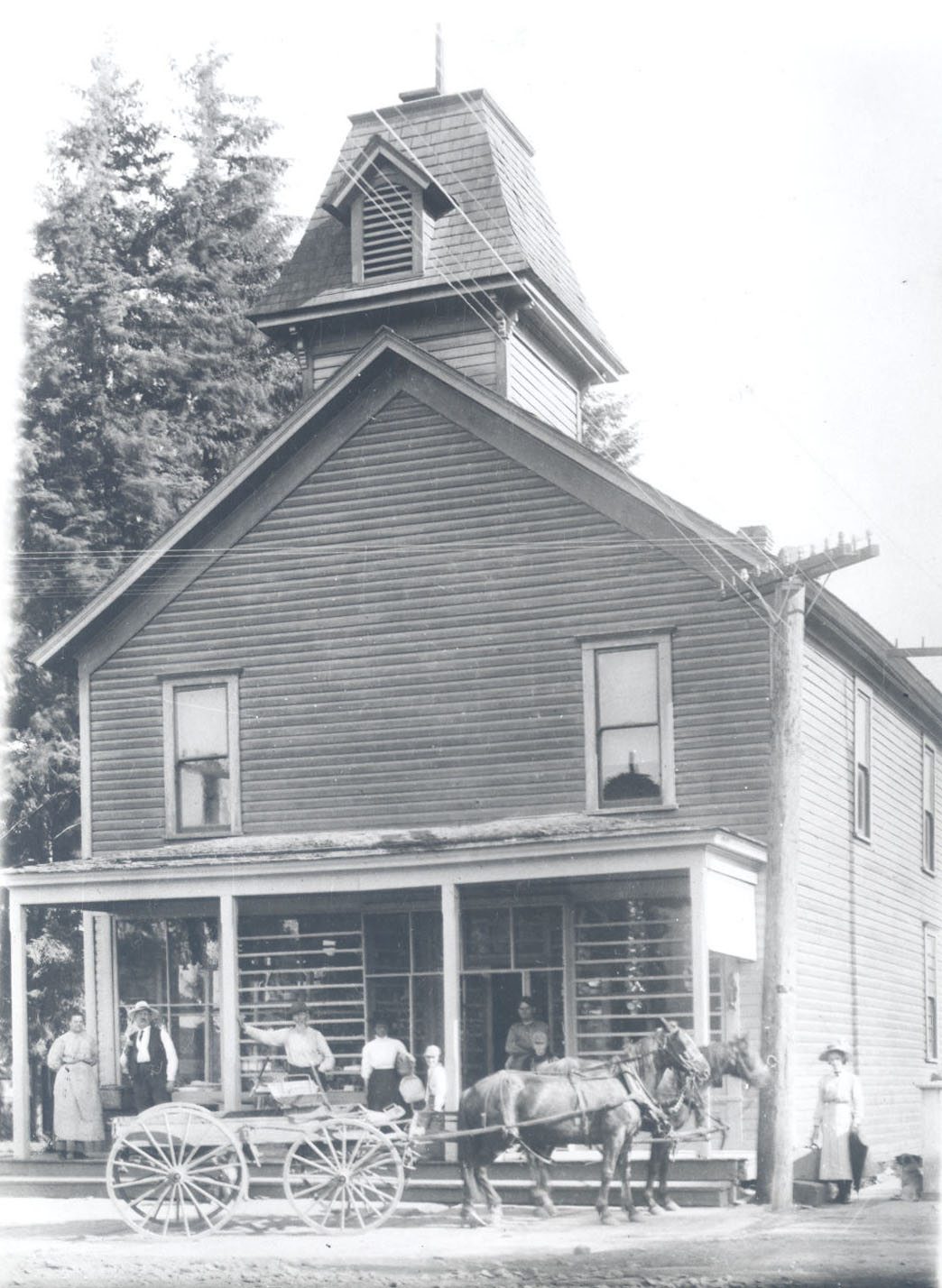
![Robinson's first store on Boone's Ferry Rd., 1910]()
Robinson's first store on Boone's Ferry Rd., 1910.
Robinson's first store on Boone's Ferry Rd., 1910 Courtesy Oreg. Hist. Soc. Research Lib., neg. no. 23634
-
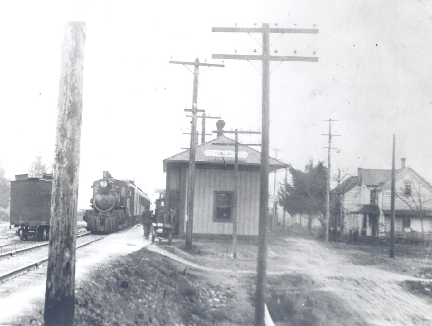
![Tualatin depot, c.1910]()
Tualatin depot, c.1910.
Tualatin depot, c.1910 Courtesy Oreg. Hist. Soc. Research Lib., neg. no. 23640
-
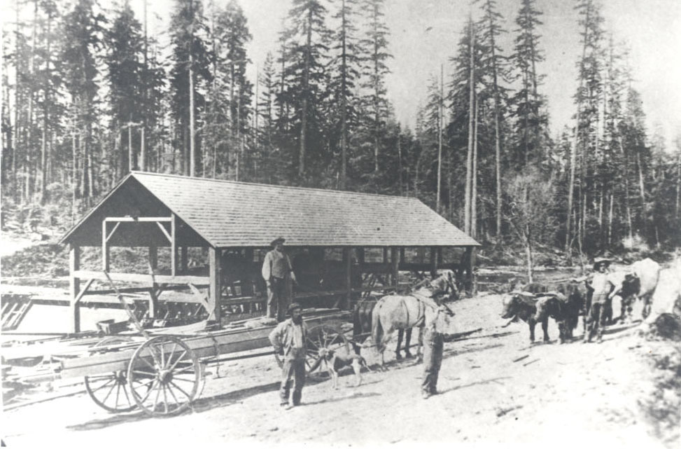
![George Saum's sawmill on Borland Rd., c.1890s]()
George Saum's sawmill on Borland Rd., c.1890s.
George Saum's sawmill on Borland Rd., c.1890s Courtesy Oreg. Hist. Soc. Research Lib., neg. no. 71592
-
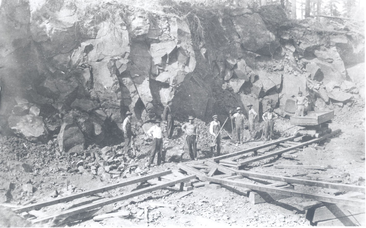
![Rock quarry on John Nyberg farm, 1910]()
Rock quarry on John Nyberg farm, 1910.
Rock quarry on John Nyberg farm, 1910 Courtesy Oreg. Hist. Soc. Research Lib., neg. no. 23637
-
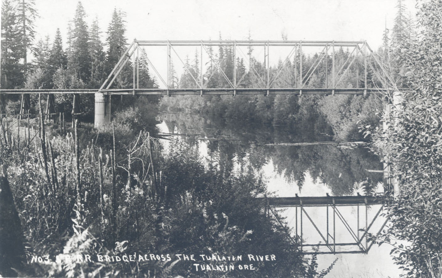
![]()
SPRR bridge over the Tualatin River, 1910.
Courtesy Oreg. Hist. Soc. Research Lib., neg. no. 23635
-
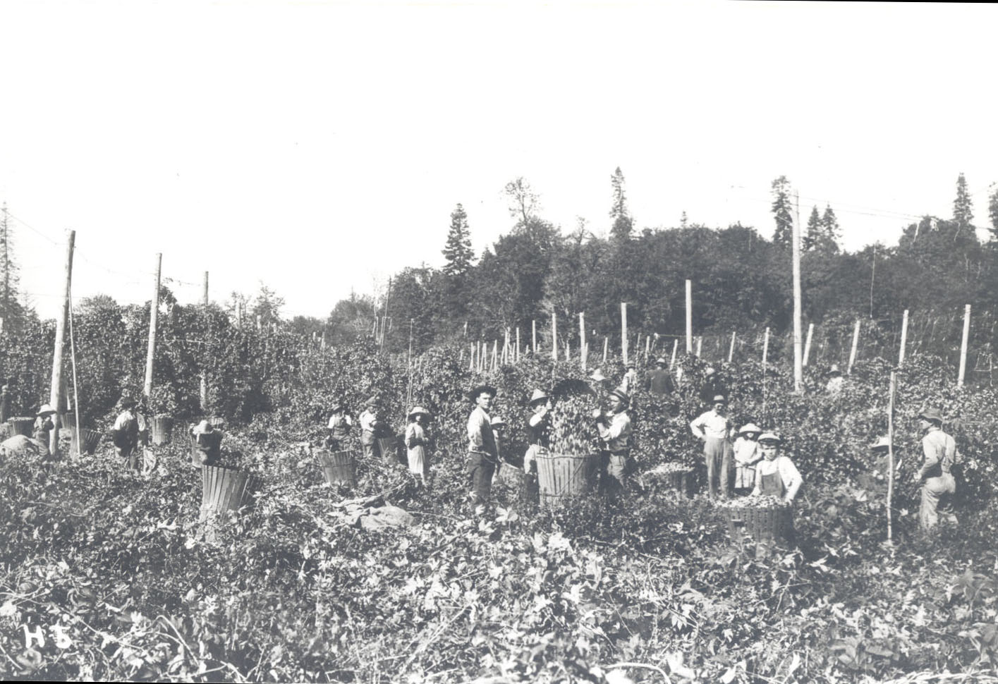
![Tualatin, hops field, 1910]()
Tualatin, hops field, 1910.
Tualatin, hops field, 1910 Courtesy Oreg. Hist. Soc. Research Lib., neg. no. 23636
Related Entries
-
![Great Plank Road]()
Great Plank Road
The Great Plank Road, constructed in 1856, connected productive agricul…
-
![Kalapuyan peoples]()
Kalapuyan peoples
The name Kalapuya (kǎlə poo´ yu), also appearing in the modern geograph…
-
![Kalapuya Treaty of 1855]()
Kalapuya Treaty of 1855
The treaty with the Confederated Bands of Kalapuya (1855) is the only r…
-
![Mastodons in Oregon]()
Mastodons in Oregon
The mastodon (Mammut americanum) has captured the American imagination …
-
![Tualatin peoples]()
Tualatin peoples
Tualatin (properly pronounced 'twälə.tun in English) was the name of a …
-
![Tualatin Riverkeepers]()
Tualatin Riverkeepers
Tualatin Riverkeepers, a community-based organization that works to pro…
-
![Willamette Valley Treaties]()
Willamette Valley Treaties
From 1848 to 1855, the United States made several treaties with the tri…
Map This on the Oregon History WayFinder
The Oregon History Wayfinder is an interactive map that identifies significant places, people, and events in Oregon history.
Further Reading
Martinazzi, Loyce and Karen Lafky Nygaard. Tualatin...From the Beginning. Tualatin: Tualatin Historical Society, 1994 and 2004.