Prineville, the county seat of Crook County, sits on ceded land once belonging to members of the Confederated Tribes of Warm Springs, displaced by the Treaty of 1855. The town is located on the Crooked River at the mouth of Ochoco Creek in the Crooked River Caldera. It is encircled by prominant remnant gravel terraces, formed by lava flows from the nearby Newberry volcano. Prineville is the only incorporated community in Crook County and continues as an important supply center for the Ochoco and Crooked River country.
The town was founded in 1870 by Monroe Hodges, on a section of his land claim. It was named for Frances Barney Prine, the town’s first merchant, who in 1868 built “a dwelling house, store, blacksmith shop, hotel, and saloon.” According to an early resident, the buildings “were constructed of willow logs, 10 by 14 feet in size, one story high, and all under one roof. His first invoice of goods cost $80.”
The first post office for the town of Prine was established on April 13, 1871; William Heisler was the first postmaster. The name was changed to Prineville on December 23, 1872. With a population of about four hundred people, Prineville was the only town of consequence in the Deschutes River drainage; it was incorporated in 1880. It grew during the 1870s and 1880s as cattle ranching was established in the region. Ranchers drove their stock over the Cascade Mountains and into the surrounding High Desert to take advantage of the abundance of bunchgrass.
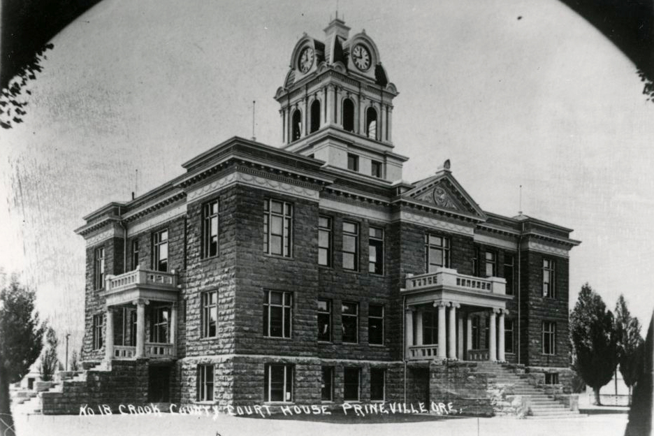
In October 1882, when the southern part of Wasco County broke off to form Crook County, the Oregon legislature chose Prineville as the county seat, a decision confirmed by voters in the 1884 election. The first courthouse in town was built in 1885; but the wooden structure was deemed too unsafe to hold the county’s records, and a large stone and brick structure was erected in 1909, which still stands today. By 1910, the population of the town had grown to 1,042.
The Sheep and Cattle Wars dominated central Oregon during the 1890s, and Prineville was caught in the center of the action. While cattle ranchers had grazed over the High Desert since the 1870s, the arrival of sheepherders by the 1890s led to significant conflict as the range grew overcrowded. The ensuing war reached its climax in the Prineville region in 1904, when cattlemen killed as many as ten thousand sheep and murdered several sheepherders. The conflict ended in 1907 when stockmen were granted grazing allotments by the federal government that defined specific areas of land where they were permitted to exclusively graze their stock.
With the creation of Jefferson County in 1914 and Deschutes County in 1916, Crook County shrunk substantially in size, from 8,600 to 2,991 square miles. The newer counties were formed largely in response to the arrival of the Oregon Trunk Line in 1911, connecting Madras (future county seat of Jefferson County) and Bend (future county seat of Deschutes county) with an extensive national railroad network that allowed for large-scale economic exploitation of the area's natural resources. Soon after, Prineville ceded its role as the major town in central Oregon to Bend, which quickly became the region’s dominant city. In 1918, a municipal railroad finally connected Prineville to the Union Pacific line three miles west of town, increasing trade in the area around Prineville and allowing for large-scale timber harvesting in the Ochoco National Forest.
Irrigating the High Desert land for farming was a major concern of early Prineville settlers, and the first successful irrigation of the Ochoco Creek occurred in 1921 with the construction of a dam. The reservoir was rarely filled to capacity, however, and landowners began serious lobbying efforts for a dam on the much larger Crooked River. In 1956, the Crooked River Project was authorized by Congress, resulting in the construction of the Bowman Dam. The Prineville Reservoir created a reliable water supply and was successful in bolstering agricultural production in the region.
In 1952, former newspaperman Les Schwab purchased his first tire store in Prineville and soon opened tire shops in nearby Bend and Redmond. As of 2015, the Les Schwab Tire Center chain boasted 478 stores throughout the western states. Schwab, who died in 2007, lived with his family on an 80,000-acre ranch southeast of Prineville.
Agriculture and forestry are its dominant industries, with more recent developments in tourism, recreation, and high-tech computer server farms strengthening its economy. The diverse geology of the Prineville area has made it a popular rock-hunting site. Both Facebook and Apple have installed server farms in the city, attracted by tax breaks and inexpensive power. The population of the town in 2020 was 10,736.
-
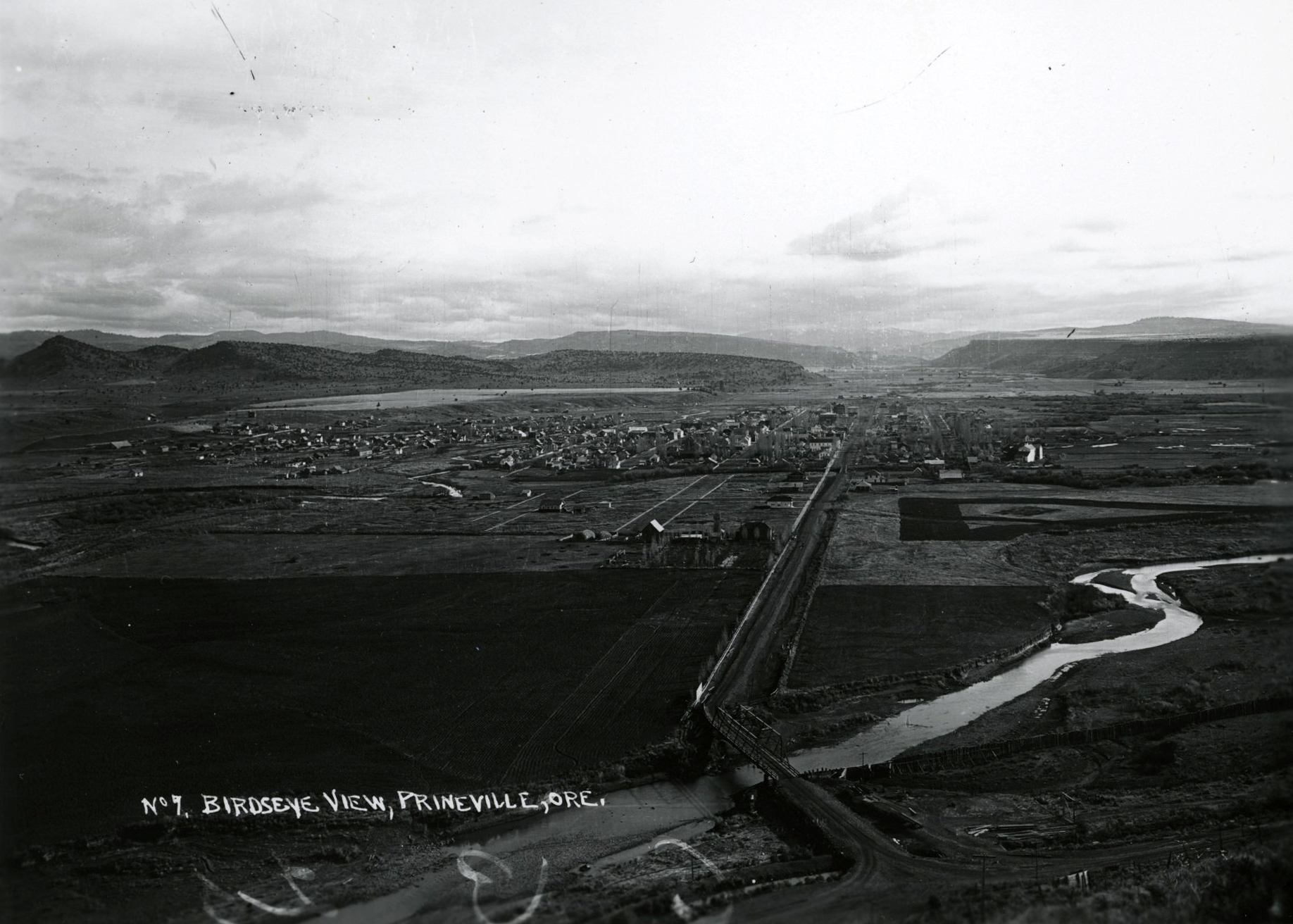
![]()
Prineville.
Courtesy Oregon Hist. Soc. Research Lib., ba014902
-
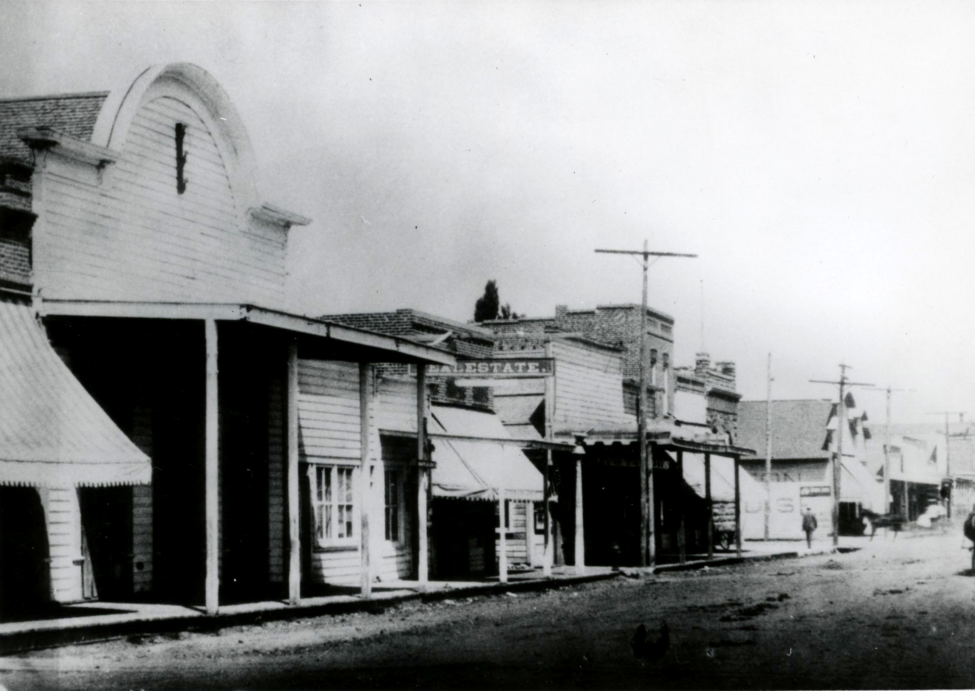
![]()
West side of Main St., Prineville, c.1890.
Courtesy Oregon Hist. Soc. Research Lib., 37706
-
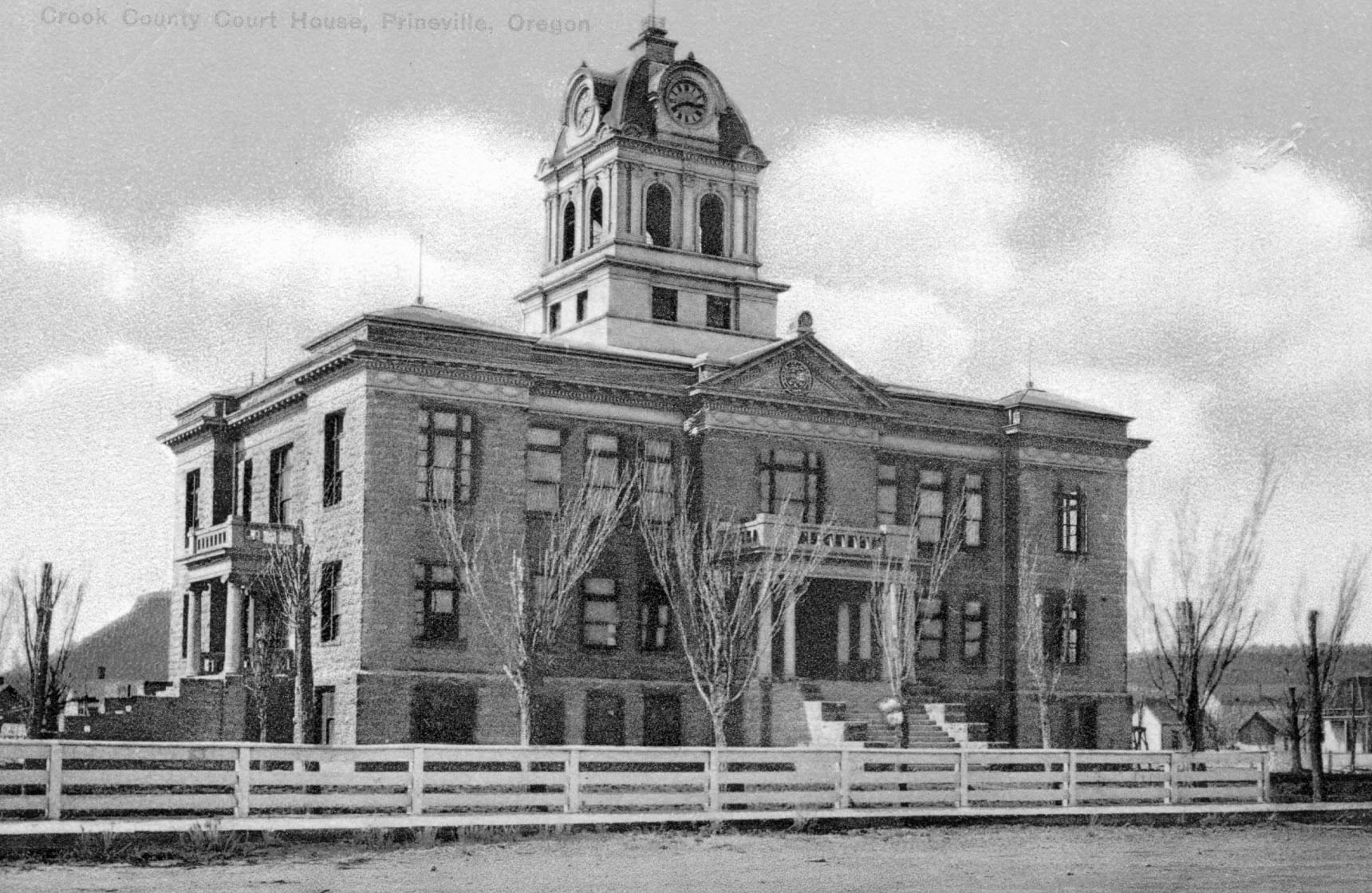
![]()
Crook County Courthouse, Prineville.
Courtesy Oregon Hist. Soc. Research Lib., Orhi17673
-
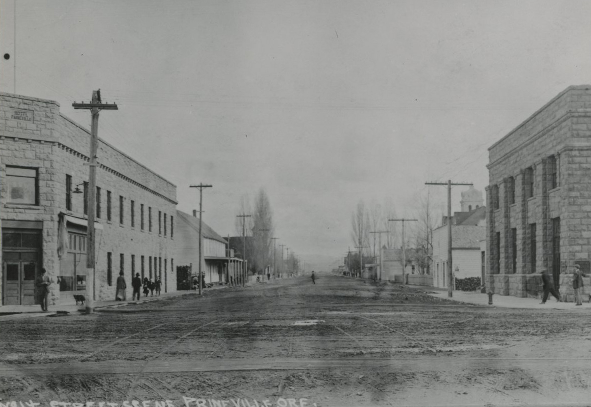
![]()
Prineville, c.1915; Hotel Prineville on the left.
Courtesy Oregon Hist. Soc. Research Lib., 003729
-
![]()
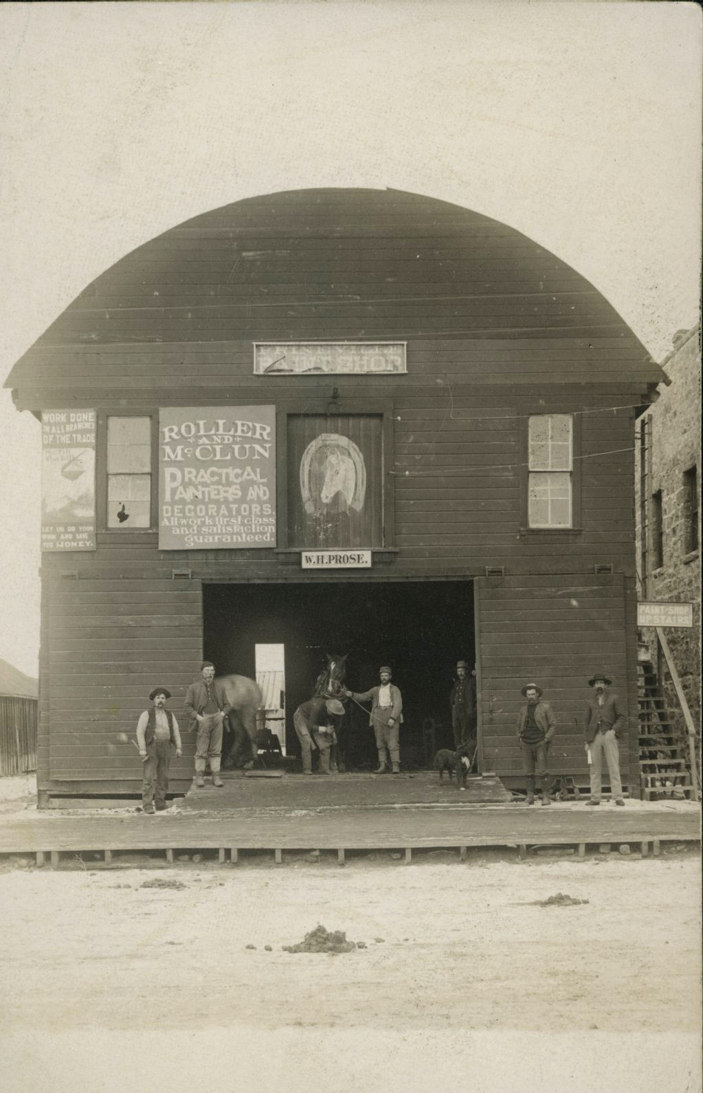
William (left) and Gus (right) Prose in front their Prineville shop .
Courtesy Oregon Hist. Soc. Research Lib., Orhi91542
-
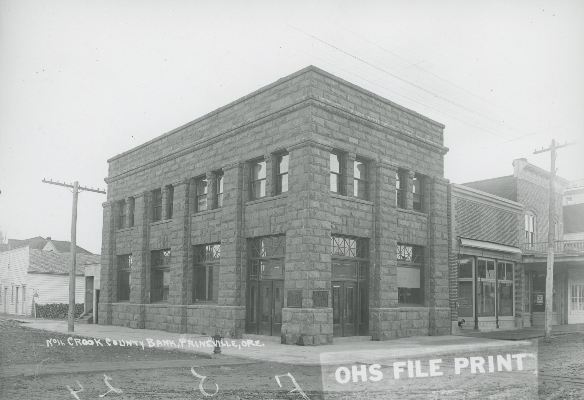
![Now the A.R. Bowman Memorial Museum]()
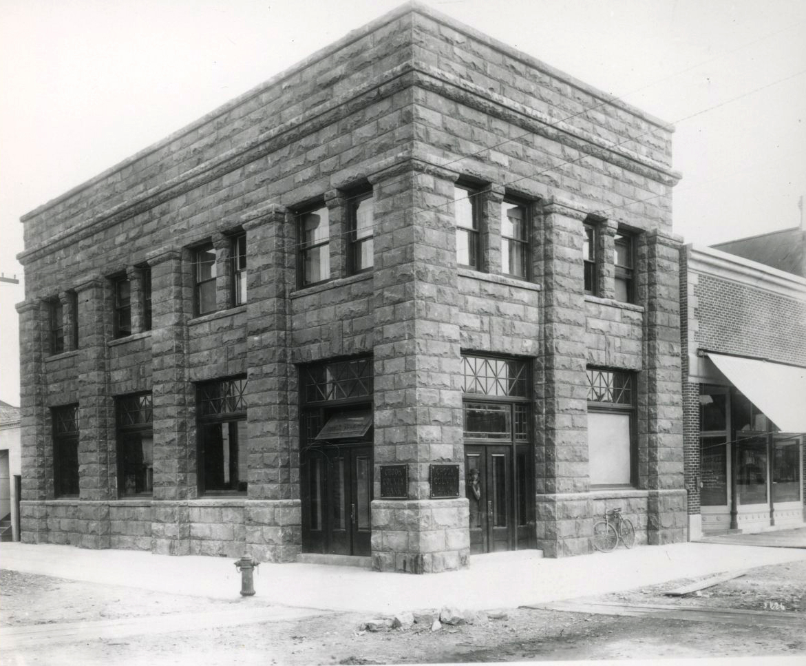
Crook County Bank, Prineville.
Now the A.R. Bowman Memorial Museum Courtesy Oregon Hist. Soc. Research Lib., 018801
-
![]()
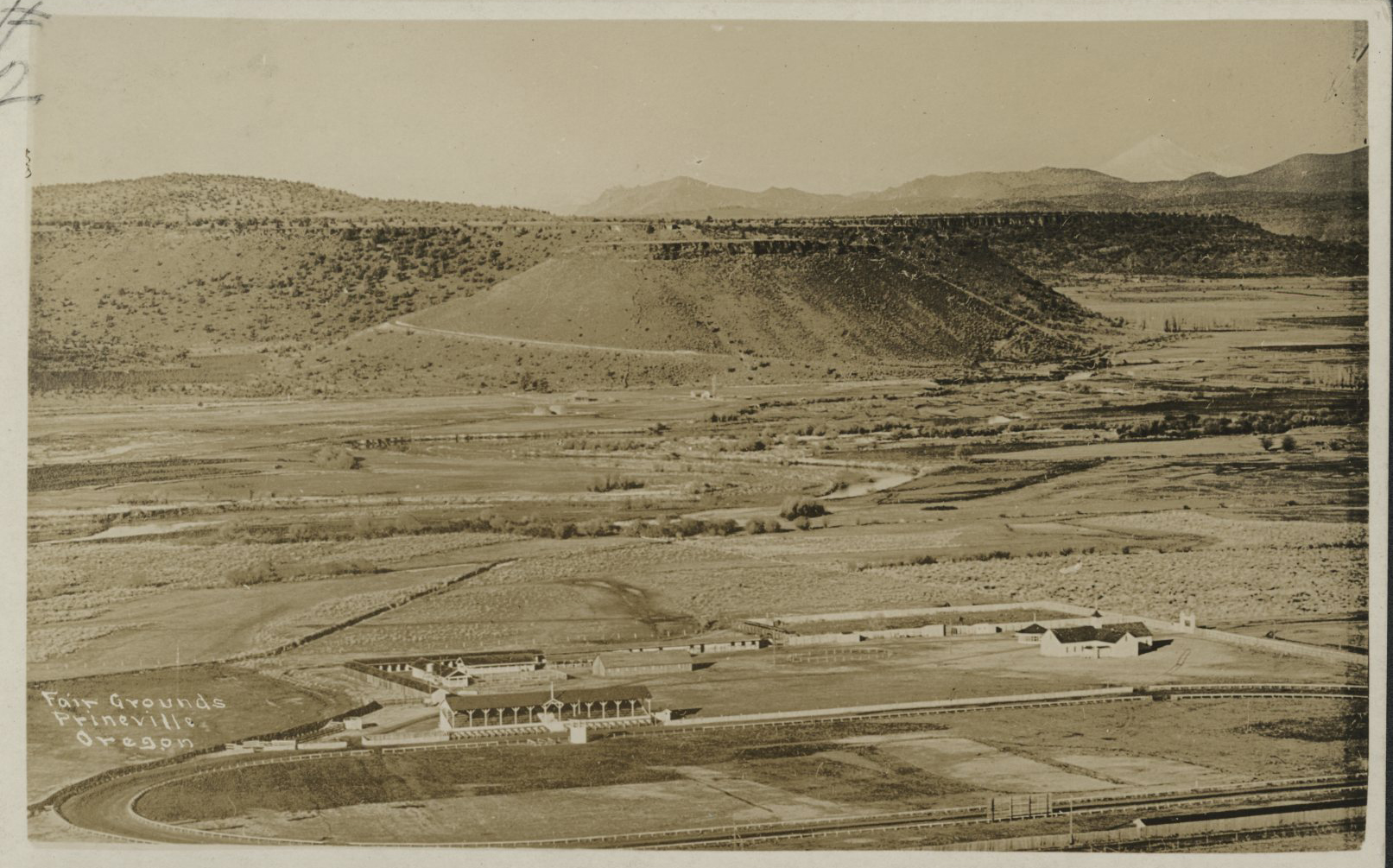
Crook County Fairgrounds, Prineville.
Courtesy Oregon Hist. Soc. Research Lib., ba014870
-
![]()
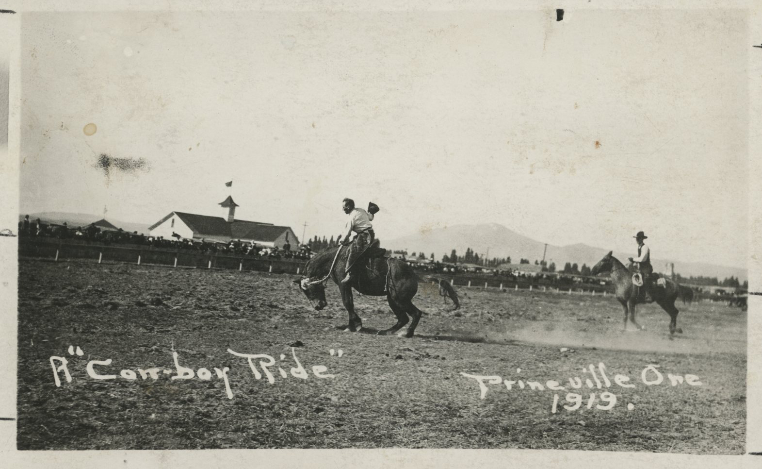
Crooked River Roundup, Prineville, 1919.
Courtesy Oregon Hist. Soc. Research Lib., Orhi9783
-
![]()
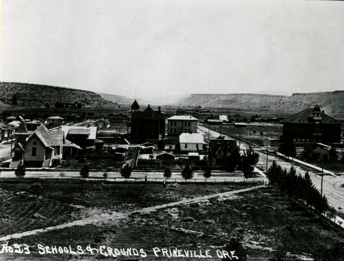
Prineville, c.1935.
Courtesy Oregon Hist. Soc. Research Lib., 008326
-
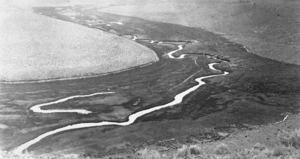
![]()
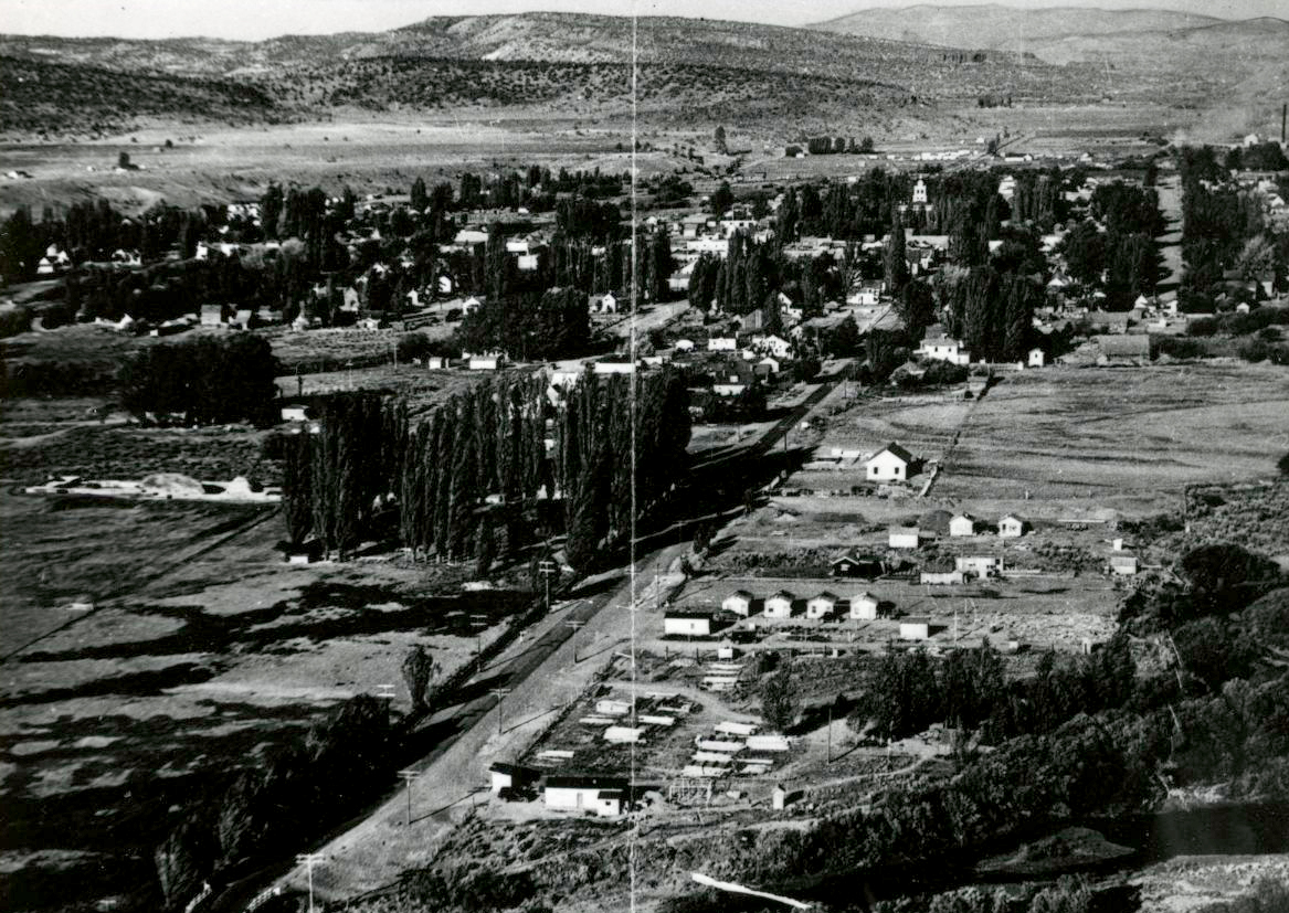
Aerial of Prineville, July 1939.
Courtesy Oregon Hist. Soc. Research Lib., 013362
-
![]()
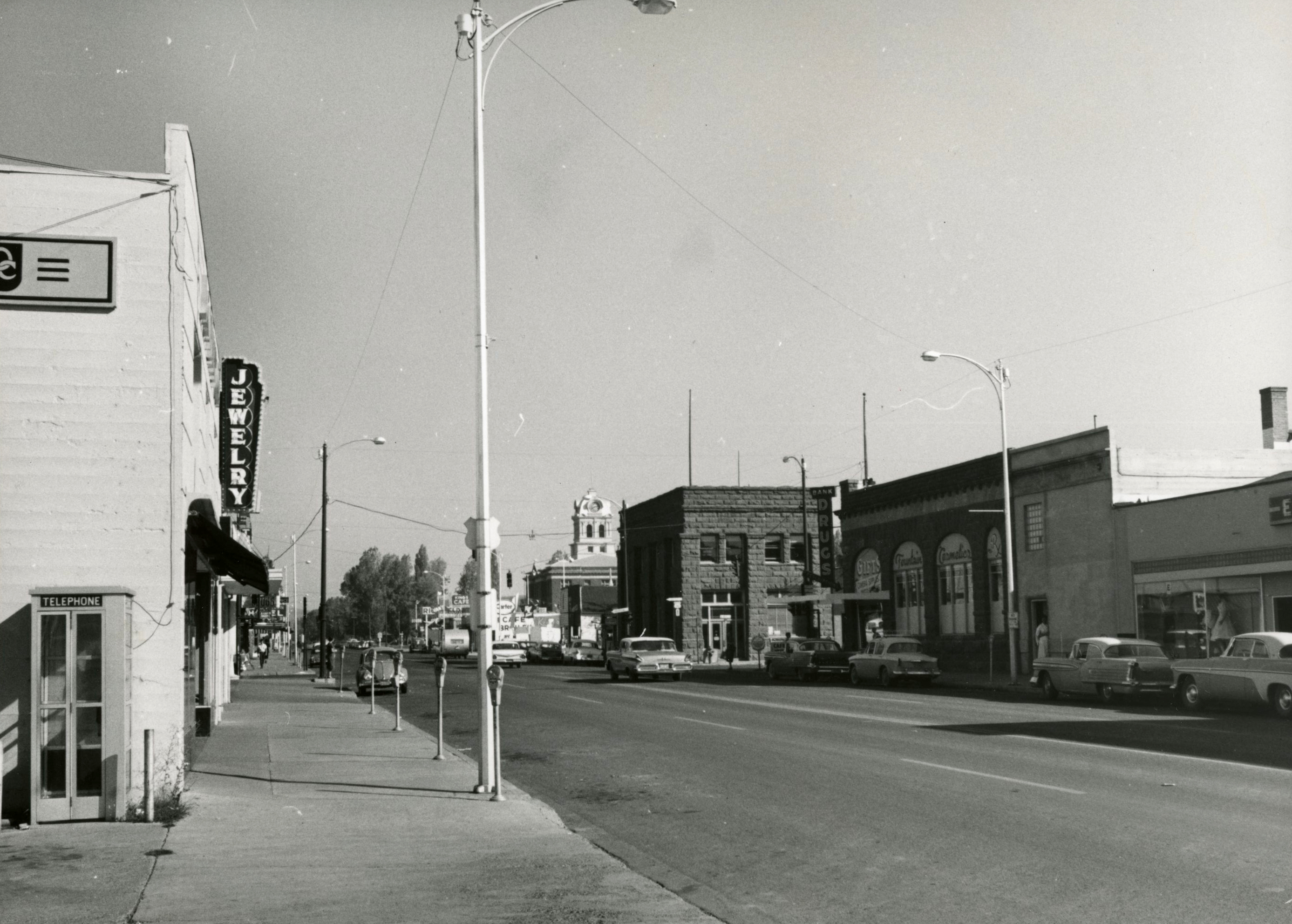
Main St., Prineville, 1959.
Courtesy Oregon Hist. Soc. Research Lib., ba014932
-
![]()
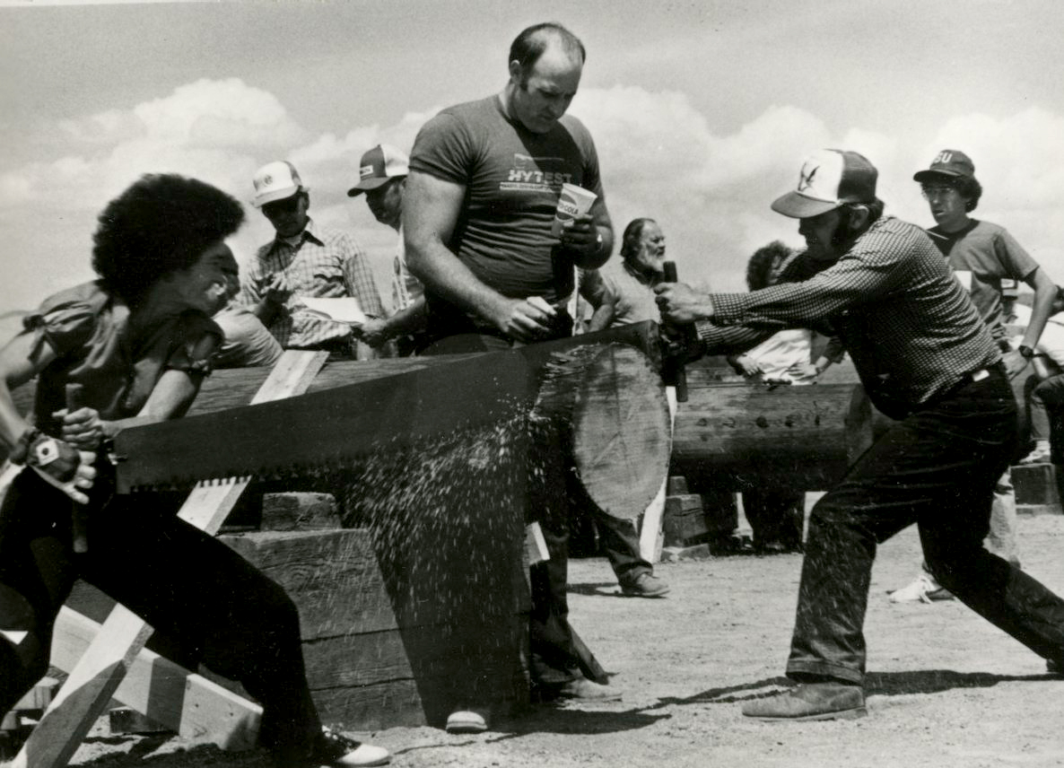
Prineville Timber carnival, 1982.
Courtesy Oregon Hist. Soc. Research Lib., 023702
-
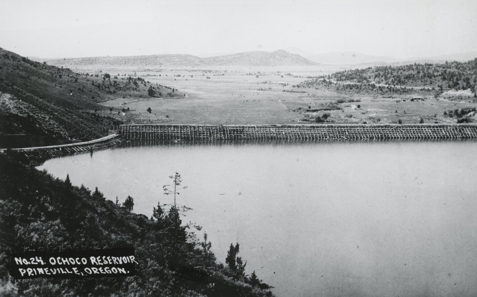
![]()
Ochoco Dam.
Courtesy Oregon Hist. Soc. Research Lib., ba014894
Related Entries
-
![A. R. Bowman Memorial Museum]()
A. R. Bowman Memorial Museum
The A.R. Bowman Memorial Museum, operated by the Crook County Historica…
-
![Crook County Courthouse]()
Crook County Courthouse
The Crook County Courthouse in Prineville was completed in 1909, built …
-
![Crooked River]()
Crooked River
The Crooked River Basin lies in the heart of central Oregon, east of th…
-
![Crooked River Project]()
Crooked River Project
In 1956, with the help of Oregon senators Wayne Morse and Richard Neube…
-
![High Desert]()
High Desert
Oregon’s High Desert is a place apart, an inescapable reality of physic…
-
![Historic Prineville Roads (1870s–1930s)]()
Historic Prineville Roads (1870s–1930s)
Prineville, the seat of Crook County in central Oregon, was established…
-
![Les Schwab (1917 - 2007)]()
Les Schwab (1917 - 2007)
Founded in 1952 as a two-man tire store in Prineville, Les Schwab Tire …
-
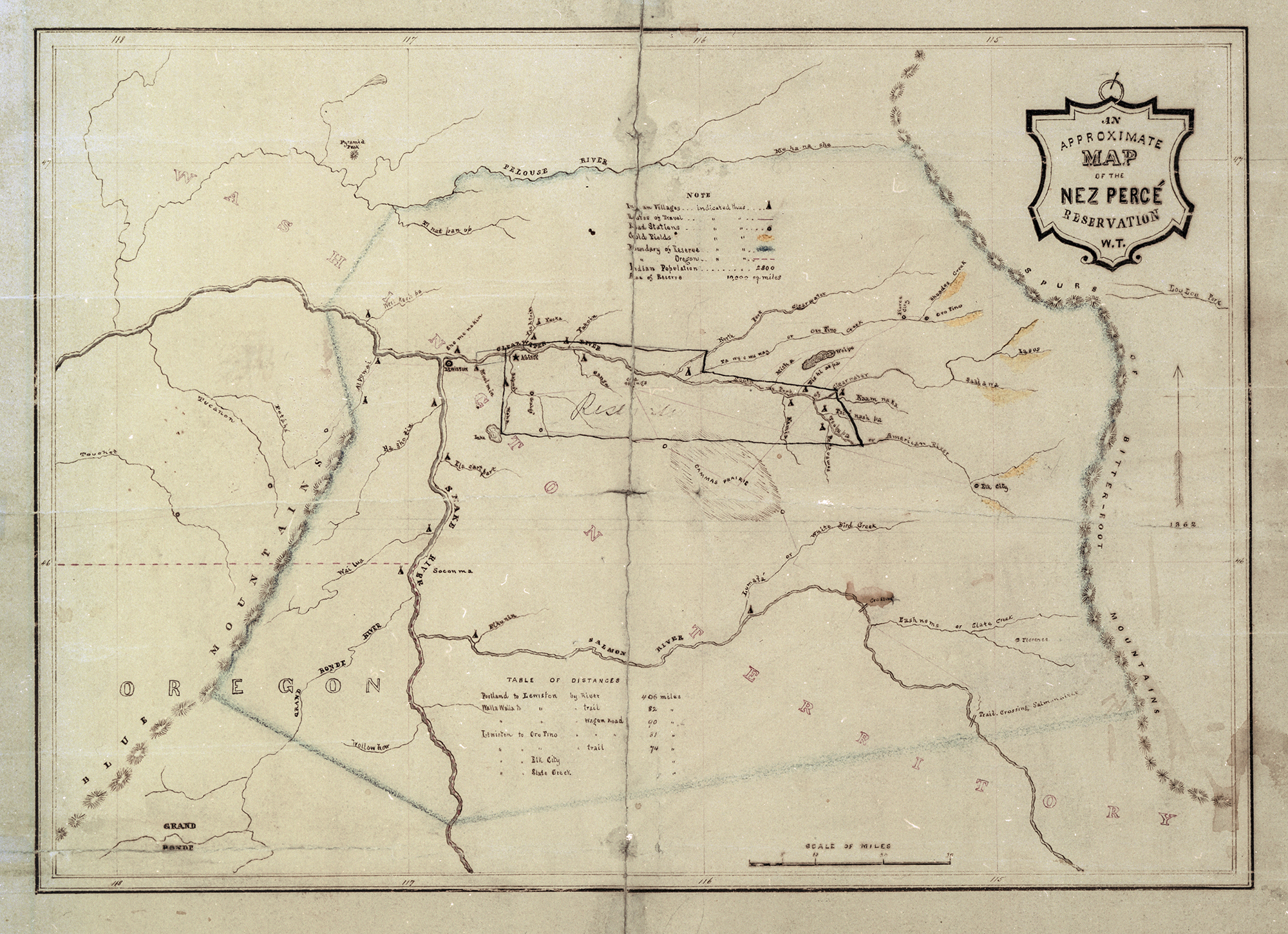
![Native American Treaties, Northeastern Oregon]()
Native American Treaties, Northeastern Oregon
After American immigrants arrived in the Oregon Territory in the 1840s,…
-
![Newberry National Volcanic Monument]()
Newberry National Volcanic Monument
Newberry Crater, as it is commonly known, is a large shield volcano eas…
Related Historical Records
Map This on the Oregon History WayFinder
The Oregon History Wayfinder is an interactive map that identifies significant places, people, and events in Oregon history.
Further Reading
"An Oregon Mill Town Learns to Love Facebook and Apple," New York Times, March 6, 2018.
Corning, H. M. Dictionary of Oregon History. Portland: Bindford & Mort, 1989.
Lent, S. Central Oregon Place Names, Volume 1: Crook County. Bend: Maverick Publications, 2001.
State, T. O. Crook County History.
Workers of the Writers' Project of the Work Projects Administration. Oregon: End of the Trail. Portland: Bindford & Mort, 1940.