


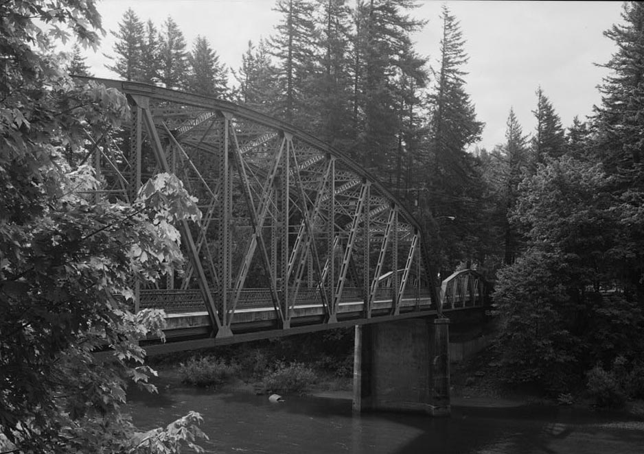
The Stark Street Bridge, opened in 1915, is one of the oldest steel truss highway bridges in Oregon. The bridge spans the Sandy River east of Troutdale and west of Springdale and is aligned northwest to southeast across a bend in the river where Southeast Stark Street (once Baseline Road) terminates at the Historic Columbia River Highway (HCRH).
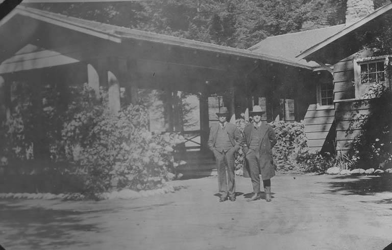
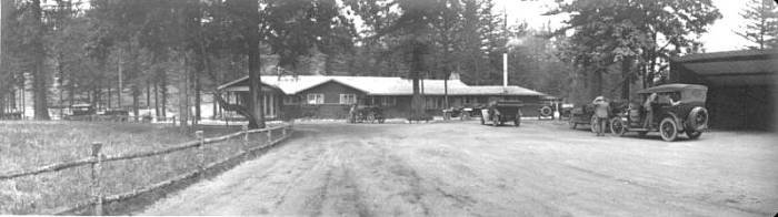
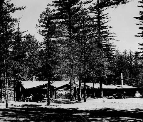
In the late-nineteenth and early twentieth centuries, the bridge connected the extensive rural lands of the Sandy River Delta region in east Multnomah County to Portland markets. In the early twentieth century, the Portland Automobile Club established a camp for its members to the southeast of the Stark Street Bridge to provide easy access to what is now the Historic Columbia River Highway (constructed between 1913 and 1922). Today, the Stark Street Bridge serves as a primary connector for residents in the eastern part of the county and is part of the scenic route along the Columbia River. The Stark Street Bridge is owned by Multnomah County and is recorded in the Historic American Engineering Record (HAER).
The Sandy River, from its source on Mount Hood to its confluence with the Columbia River near today’s Troutdale, was well known to Chinook peoples. The Clackamas and Watlala canoed it as part of an extensive network of waterways for trade, travel, and access to food, and Cascades and other tribes hunted the region. When William Clark crossed the river on foot in 1805, he wrote in his journal that the river bottom was “quick Sand, and impassable.” The river is prone to frequent floods, and the dense sediment in the waters impacts secondary channels, affecting fish runs, dams, and river crossings. Once an essential water route, the Sandy has become an impediment to cross.
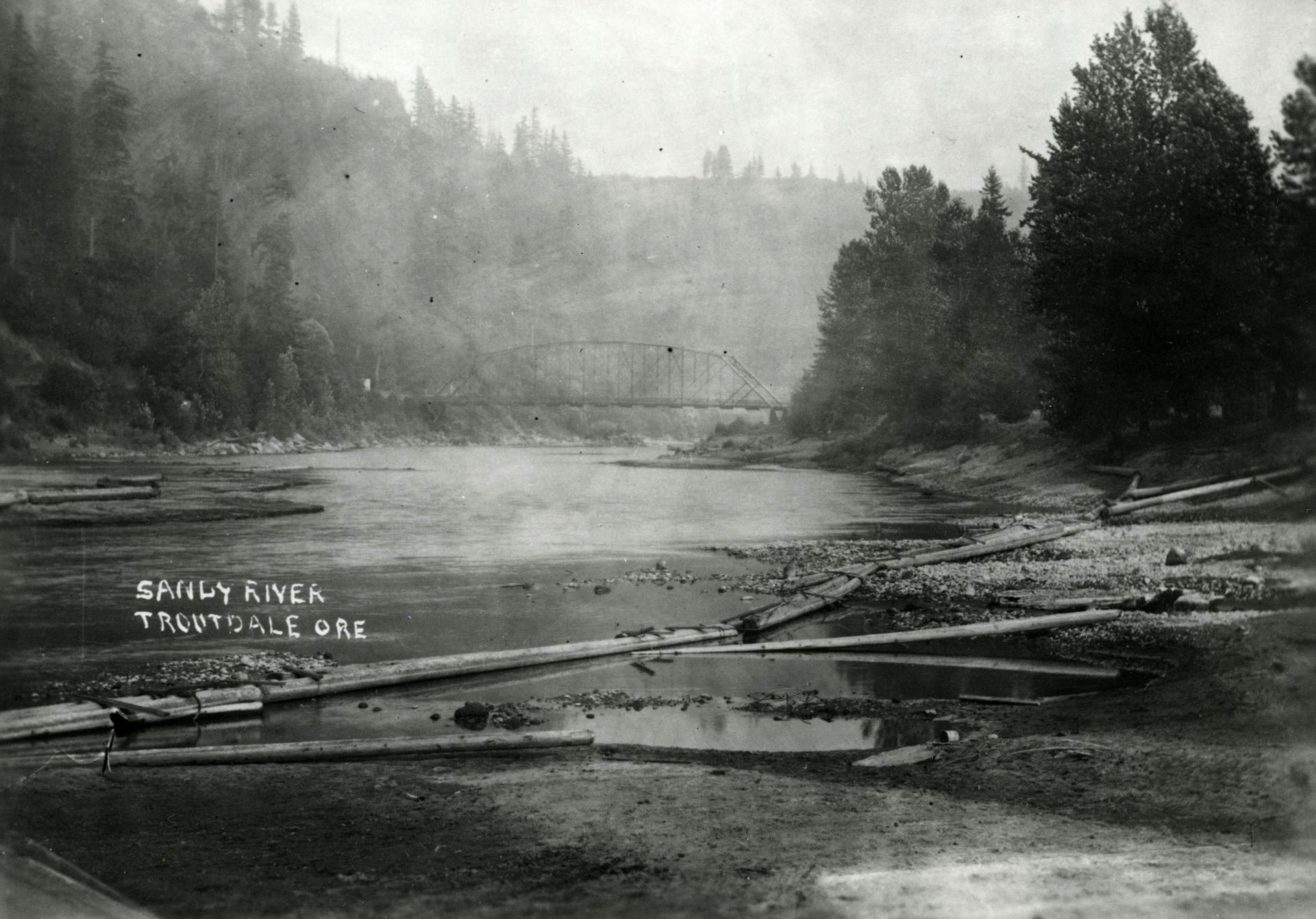
The first bridge built at the site of the Stark Street was a wooden truss locally known as the Nielson Bridge, likely completed sometime in the 1880s. After reports of the bridge “sway[ing] mightily in the breezes that blow up and down the Sandy,” the decking of the wooden bridge finally failed on Good Roads Day, April 25, 1914, when a five-ton truck hauling gravel broke through and fell thirty-five feet into the river below. This collapse and subsequent demolition of the wooden bridge hastened the construction of a new bridge, built in the exact location of its predecessor, including the placement of its footings.
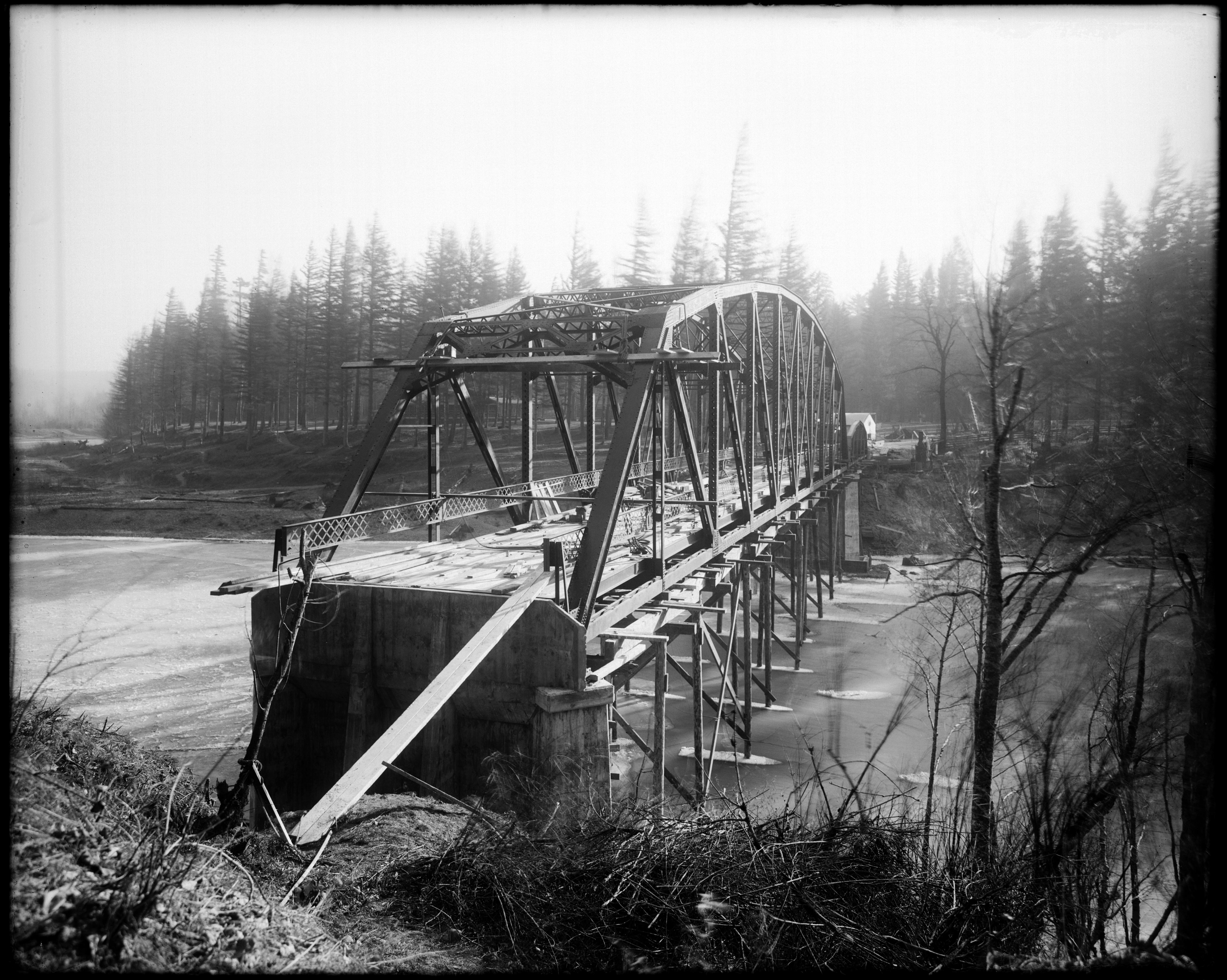
Construction of the new bridge began in 1914 and was completed in February 1915; the bridge was opened to traffic by March 1915. It took less than a year to build and, along with the construction of the nearby Sandy River Bridge in 1912, was built to meet the increasing demands of automobile travel in the region. The bridge was designed by K. P. Billner of the Oregon State Highway Department and constructed by George Griffin and the Portland Bridge Co., at a total cost of $21,040.40.
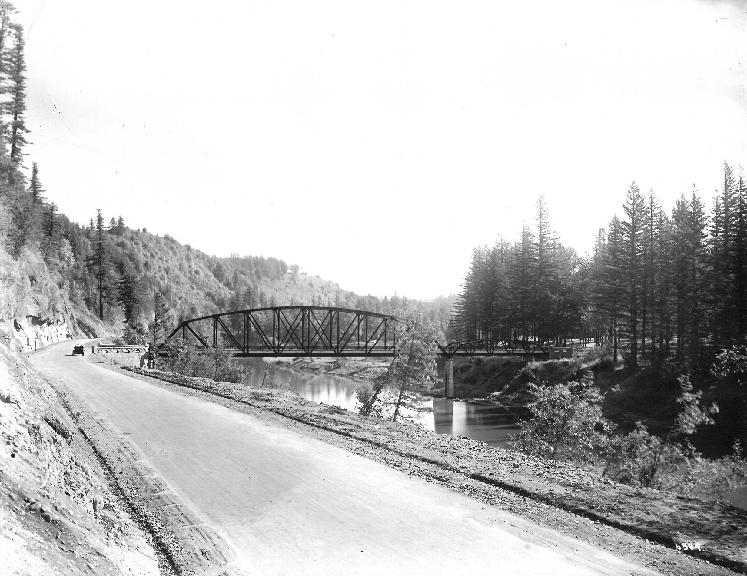
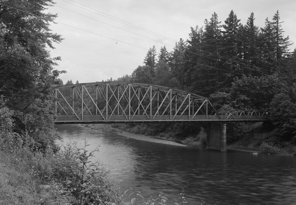
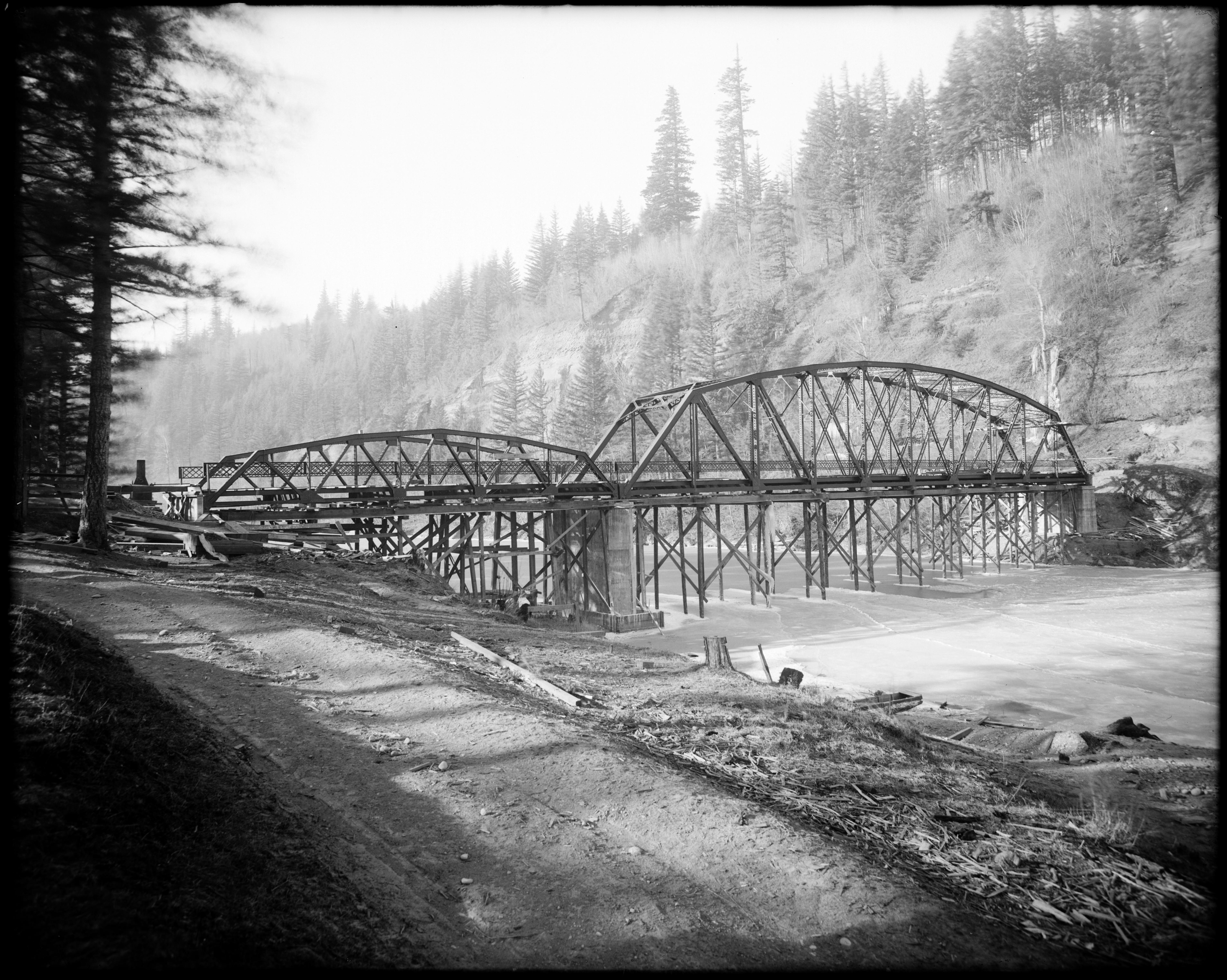
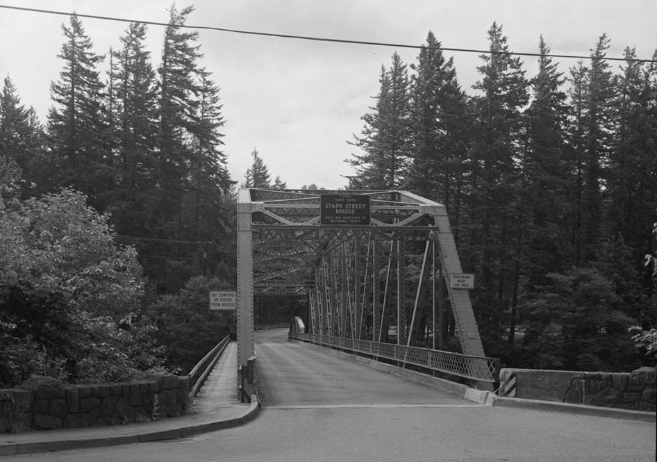
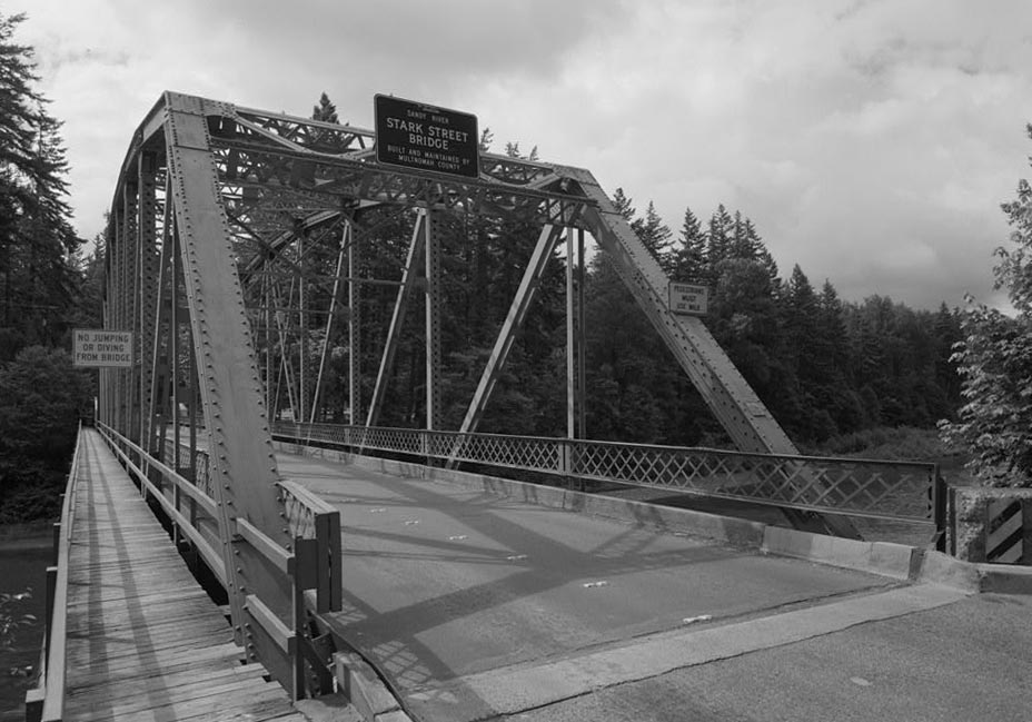
Although Multnomah County refined and modified the roadway and bridge site over time, the overall appearance of the Stark Street Bridge has remained largely unchanged. As originally constructed, the bridge consists of two unequal spans. The primary span is a 200-foot-long Pratt camel-back through-truss comprised of 10 steel panels held together by 2.5-inch rivets. The flat-bottomed Pratt truss (named for its designer) was modified with exactly five primary horizontal beams (also called upper chords) of various slopes at the top of the truss. The steepening of the angles of the beams create a single-humped camel-back shape. A through-truss refers to traffic traveling through the bridge structure, as opposed to above it.
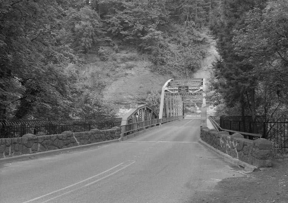
The second span, on the south end of the bridge, is 77.5 feet long and has 5 panels. It is a Warren truss, which alternates diagonal and vertical beams to create structurally strong triangles. While the steel truss sections of the Stark Street bridge have received periodic maintenance, including painting and flame straightening treatments in the late 1980s, the historic bridge structure retains a high level of preservation.
The Stark Street Bridge is marked as Historic Mile Post 16.7 on the Historic Columbia River Highway, surrounded by countryside, small residential developments, and agricultural land, including cane berry fields and fruit tree orchards. The bridge still connects the agricultural lands east of the Sandy River to cities on the west side, such as Troutdale, Wood Village, and Gresham.
In 2024-2025, the county made emergency repairs to the supports at the ends of the bridge, called wingwalls, and to the northern approach, which had been damaged by repeated collisions by oversized vehicles attempting to make the turn to the bridge from the highway onto the narrow 18-foot wide, 2-lane roadway. Despite the damage, the bridge has remained an important Sandy River crossing to access the HCRH. Multnomah County, however, determined in 2025 that the bridge is near the end of its service life and has developed a plan for its replacement.
-
![]()
Stark Street Bridge over the Sandy River.
Oregon Historical Society Research Library, Gifford 6509, Photo File #271-A
-
![]()
Stark Street Bridge, East Elevation, Looking 194 Degrees South.
Courtesy Library of Congress, Historic American Engineering Record, or0363 -
![Angelus Studio Photographs.]()
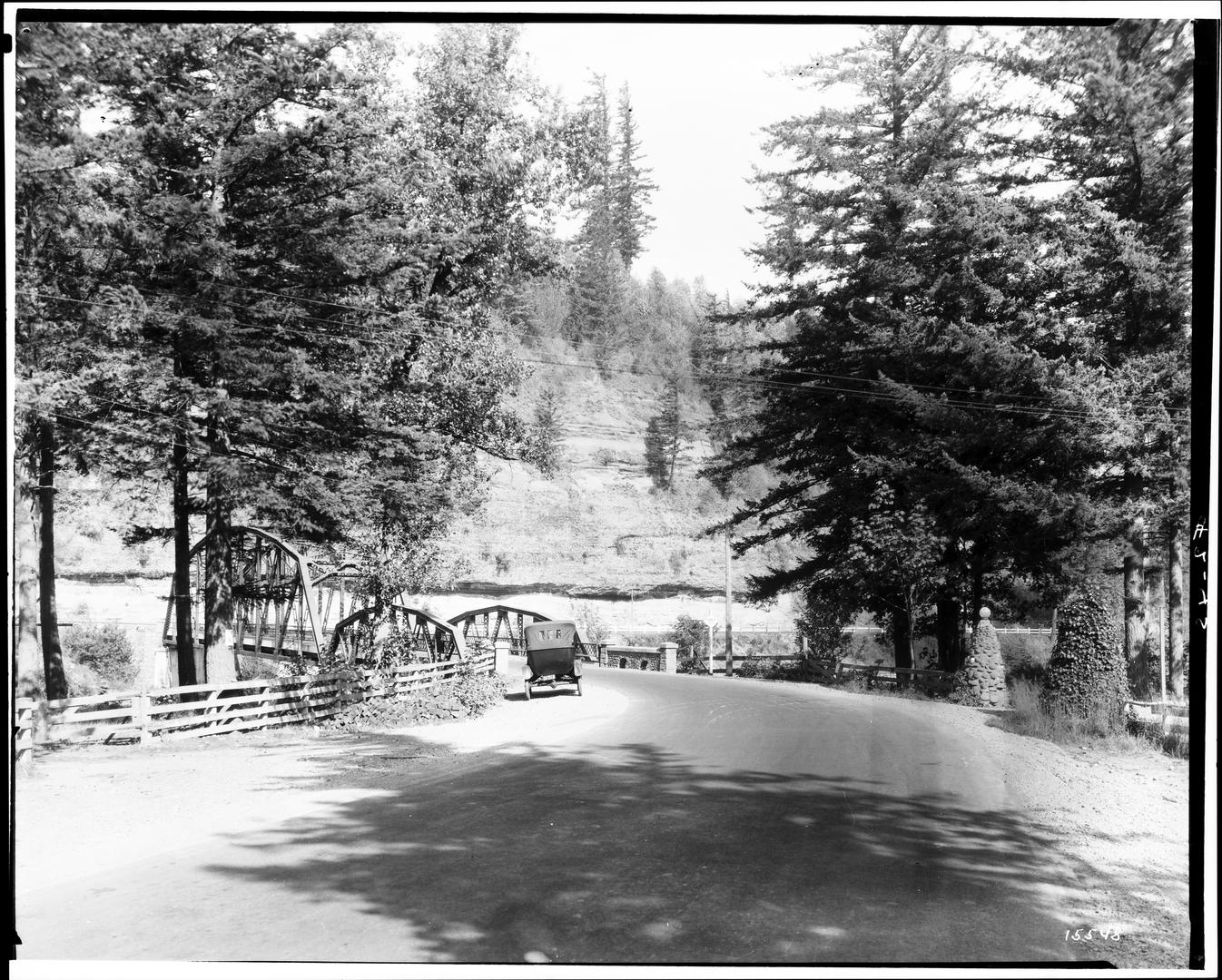
Approach to bridge crossing of Sandy River. Auto parked along road in front of bridge, c.1914.
Angelus Studio Photographs. Angelus Studio photographs, 1880s-1940s, University of Oregon. "PH037_b146_S00784 Angelus Studio Photographs" Oregon Digital -
![Angelus Studio Photographs.]()
Sandy (Stark) River Bridge Construction, c.1914.
Angelus Studio Photographs. Angelus Studio photographs, 1880s-1940s, University of Oregon. "PH037_b011_BR00107 Angelus Studio Photographs" Oregon Digital -
![Angelus Studio Photographs.]()
Sandy (Stark) River Bridge under construction, c.1914.
Angelus Studio Photographs. Courtesy Angelus Studio photographs, 1880s-1940s, University of Oregon. "PH037_b011_BR00108 Angelus Studio Photographs" Oregon Digital -
![]()
L.A. Padden and Smith in front of Portland Auto Club, Troutdale, Oregon, between 1914 and 1924.
Courtesy University of Washington Libraries, Special Collections, TRA1648 -
![]()
Portland Auto CLub House, 1915.
Courtesy Bush House Museum, Salem Art Association, bhp0037 -
![]()
Motorists stop at the Portland Automobile Club building on the west side of the Stark Street Bridge, 1916.
Oregon Historical Society Research Library, 004295 -
![]()
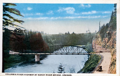
Columbia River Highway at the Sandy (Stark) River Bridge in Oregon.
Courtesy Clark County Historical Museum Photographs Collection, P14.1.1, Cat.5578B -
![]()
Historic Columbia River Highway, Stark Street Bridge, Spanning Sandy River on Stark Street.
Courtesy Library of Congress, Historic American Engineering Record, or0363 -
![]()
Stark Street Bridge, North End, Looking 163 Degrees South.
Courtesy Library of Congress, Historic American Engineering Record, or0363 -
![]()
Stark Street Bridge, South End, Looking 295 Degrees West-Southwest.
Courtesy Library of Congress, Historic American Engineering Record, or0363 -
![]()
Stark Street Bridge, West Elevation, Looking 118 Degrees East-Southeast.
Courtesy Library of Congress, Historic American Engineering Record, or0363
Related Entries
-
![Columbia River]()
Columbia River
The River For more than ten millennia, the Columbia River has been the…
-
![Columbia River Gorge National Scenic Area]()
Columbia River Gorge National Scenic Area
Established by Congress in 1986, the Columbia River Gorge National Scen…
-
Columbia River Highway
The Columbia River Highway, now known as the Historic Columbia River Hi…
-
![Sandy River]()
Sandy River
In 1805, William Clark called the 55-mile-long Sandy River the “quick S…
Related Historical Records
Map This on the Oregon History WayFinder
The Oregon History Wayfinder is an interactive map that identifies significant places, people, and events in Oregon history.
Further Reading
Columbia River Gorge Commission and U.S. Department of Agriculture, Forest Service. Management Plan for the Columbia River Gorge National Scenic Area. Revised. October 2020
Mershon, C.E. The Columbia River Highway: From the Sea to the Wheat Fields of Eastern Oregon. Portland, Ore.: Guardian Peaks Enterprises, 2006.
O’Connor, Jim. "The Evolving Landscape of the Columbia River Gorge: Lewis and Clark and Cataclysms on the Columbia." Oregon Historical Quarterly 105.3 (2004): 390–421.
"Stark Street Bridge." Oregon Historic Sites, OR SHPO, 2024. OHSD Resource No. 669239.
"Paved Highway Near Sandy River Bridge." Portland Oregonian, December 31, 1915, p. 25.
Parametrix, "Cultural Resources Assessment for the Stark Street Bridge." #11112 North Wingwall Emergency Replacement and Approach Safety Improvements Design. Multnomah County, Ore.:David Evans and Associates, Inc., 2024.