Gresham, a suburban city in East Multnomah County, is the fourth largest city in Oregon, with an estimated population of 114,247 people in 2020. With its northern tip on the Columbia River near Blue Lake Park, the city borders Portland to the west and the small towns of Wood Village, Fairview, and Troutdale on the northwest corner. Much of the city adjoins rural areas of Multnomah and Clackamas Counties, including the unincorporated communities of Damascus and Hillsview.
Most of the land that Gresham now occupies was once part of the seasonal hunting and camping grounds of an upper branch of the Clackamas Chinook, who lived in villages on the Columbia River and hunted and gathered along Johnson Creek. But disease introduced by Europeans and Americans devastated those villages, and the local Native population had largely moved to other locations by the time white settlers began to arrive in significant numbers in the mid-nineteenth century.
The first EuroAmericans to settle in the Gresham area, brothers Jackson and James Powell, established adjoining land claims in 1851 on the site of present-day Historic Downtown Gresham, along one of the main routes connecting Portland to the Oregon Trail (now Powell Boulevard/U.S. Highway 26). Other white resettlers soon followed, forming a rural community in what is generally referred to as Powell's Valley or Campground, a camp meeting ground where people gathered to hear sermons from circuit riders. The camp’s location, at the intersection of two main roads, became the center of the modern downtown.
Through a clerical error, the town received two post offices in 1884, Campground and Gresham. When the Postal Service realized the mistake, it revoked the Campground post office, and Gresham entered use as the settlement’s official name. The man for whom Gresham was named, U.S. Postmaster General Walter Quintin Gresham, never visited his namesake town.
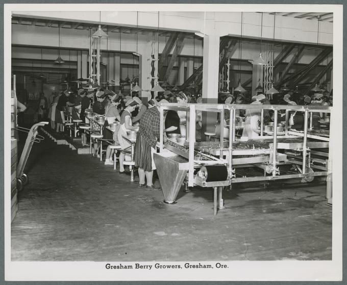
Dense old-growth Douglas-fir forests made farming impossible in early Gresham, and lumber dominated the town’s economy. The twenty-three square miles comprising modern Gresham had as many as five lumber mills from the 1860s through the 1890s, but families transitioned into farming as the land was cleared. The nutrient-rich soil and temperate climate made Gresham ideal for growing crops such as corn, grain, potatoes, lettuce, and hops. During the 1910s, farmers began to grow filberts, strawberries, and Cuthbert raspberries, which became Gresham’s best-known crops. Berry farming, processing, and packing were the town’s main industry for fifty years.
Most early settlers were European or American, but Gresham was also home to a community of Japanese immigrants. The earliest were Miyo Iwakoshi, her younger brother Rikichi, and her adopted daughter Tama Nitobe, who settled east of Gresham in 1897 with Iwakoshi's Scottish husband Andrew MacKinnon. They may have been one of the first Japanese families to settle in Oregon. Iwakoshi was known for helping other Japanese settlers (Issei) find their footing in a new and often hostile culture, where nonwhite immigrants were often prevented from owning land and were barred from U.S. citizenship until the passage of the Immigration Act of 1952. Immigrants relied on their children, if they were citizens, or white friends to purchase property. MacKinnon founded the Orient Sawmill east of Gresham, which gave its name to the small community of Orient, now within the Gresham city limits; both were likely named in honor of Iwakoshi.
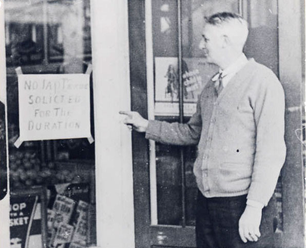
Early Gresham included a sizable Japanese and Japanese American (Nisei) population, many of whom worked as farmers until Executive Order 9066 mandated their removal to concentration camps during World War II. During the war, whites took over many properties owned or occupied by Japanese farmers, both in Gresham and elsewhere in Oregon. Although some Issei and Nisei chose to return to Gresham after the war ended, the Japanese population in East Multnomah County had been fractured and reduced, as in many other communities along the West Coast.
With the arrival of the Springwater Division Rail Line from Portland in 1903, Gresham had a population surge, as accessibility to Portland made the town attractive to business owners and prospective residents and increased the profitability of nearby farms. Gresham also became a destination for Portlanders who wanted to vacation in the country. Some purchased homes in rural Gresham, and in 1919 a group of wealthy businessmen established the planned summer community of Ambleside on the rail line east of town.
A city council was formed in 1904, and the City of Gresham was incorporated the following year. The population continued to grow throughout the early twentieth century, as Gresham received electricity, running water, and paved roads. During the Great Depression, the population rose from 1935 to 1951 as many new families arrived in the area, where farmland was still plentiful.
During the 1950s and 1960s, the interstate highway system set Gresham on the path from sleepy farming town to sprawling suburb. Interstate 80N (now Interstate 84) replaced a portion of U.S. Highway 30 in the early 1960s, including the section that followed Gresham's northern boundary. As the California berry industry began to out-compete Oregon farms and agriculture became less profitable, farmers sold their land to developers, and subdivisions took over the agrarian landscape. The City of Gresham annexed the communities of Rockwood, Powell Valley, Orient, and Pleasant Valley, further increasing its population and geographical area. Gresham’s population tripled every decade for thirty years, starting at 3,944 in 1960 and ending at 65,235 in 1990. The city has continued to grow due to continued development and piecemeal annexations.
Mt. Hood Community College (MHCC) opened in northeast Gresham in 1966, arriving on a tide of statewide demand for secondary education by the baby boomer generation. The growing population of east Multnomah County, combined with the large expanses of land still available at Gresham's semi-rural eastern fringe, made the area ideal for an expansive community college campus. Today, MHCC employs nearly 1,300 local residents and supports an enrollment of 30,000 students per year, serving a district that encompasses 950 square miles of east Multnomah and north Clackamas Counties. Gresham is also served by the Gresham-Barlow, Centennial, and Reynolds public school districts. Gresham residents primarily work in the health care, retail, and manufacturing sectors, followed by food service, education, and construction. Major employers include Boeing of Portland, U.S. Bank Processing Services, ON Semiconductor, and Microchip Technology.
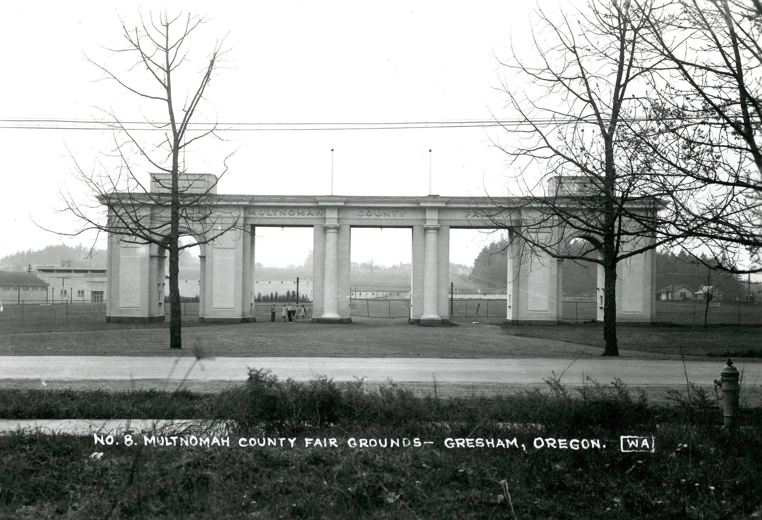
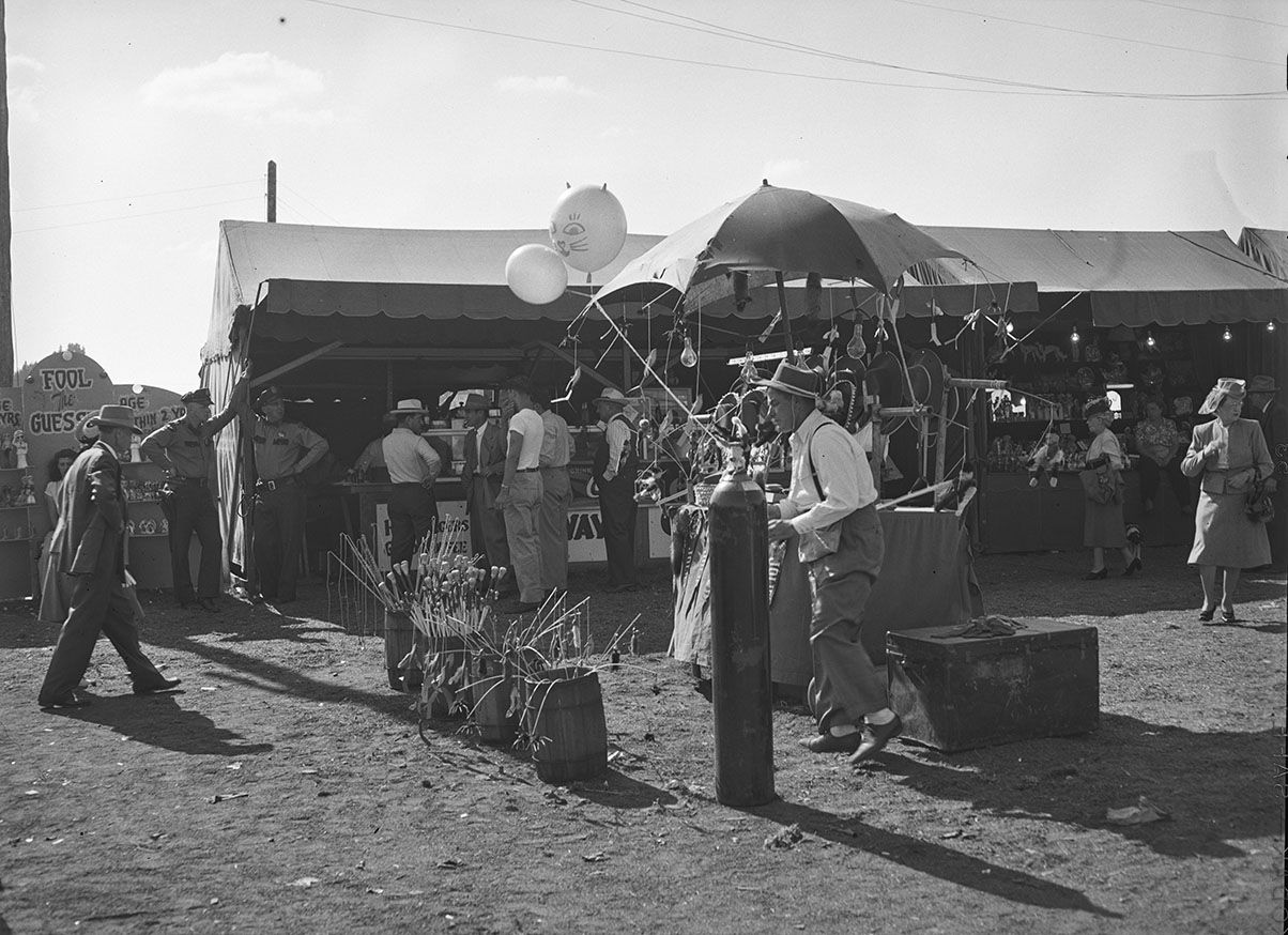
The Multnomah County Fair, held in Gresham's downtown, drew thousands of visitors each year from 1907 to 1969. Fairground amenities included horse races, exhibition halls, live performances, food stands, and rides. In 1970, the fair moved to the Portland Expo Center and has been held in Portland ever since. The Mt. Hood Festival of Jazz, a popular annual event held at MHCC beginning in 1982, placed Gresham on the national arts and culture map, drawing audiences from across the country with headline performers such as Ella Fitzgerald, Kenny G, Dave Brubeck, Tito Puente, Dizzy Gillespie, and Mel Tormé. The last Mt. Hood Festival of Jazz was held in 2014, with plans to revive it virtually in 2021. Today, the Gresham cultural calendar centers on the Gresham Arts Festival (formerly the Gresham Art Walk), an annual open-air showcase of local art. Other annual cultural events include the Portland Highland Games, held at MHCC since 1988, and the Skosh Festival, a celebration of Japanese culture organized by the Gresham-Ebetsu Sister City Association.
Since it became a city in 1904, Gresham's landscape has changed from old-growth forest to farmland to suburb. A few historic structures, most of them near Historic Downtown Gresham, have weathered the changes. The oldest, the 1868 home of John and Ruth Roberts, is near the intersection of Powell Boulevard and Wallula Avenue. The city's first public library, built in 1913 with a grant from Andrew Carnegie, houses the Gresham Historical Society, a museum and resource for local history. Near Gresham’s north boundary, the 1874 Zimmerman House is part of the Zimmerman Heritage Farm Museum, operated by the East County Historical Organization. Several of Gresham’s historic properties are on the National Register of Historic Places. Other more immutable features include a meandering segment of Johnson Creek as well as a series of buttes, all within the Boring Volcanic Field.
-
![]()
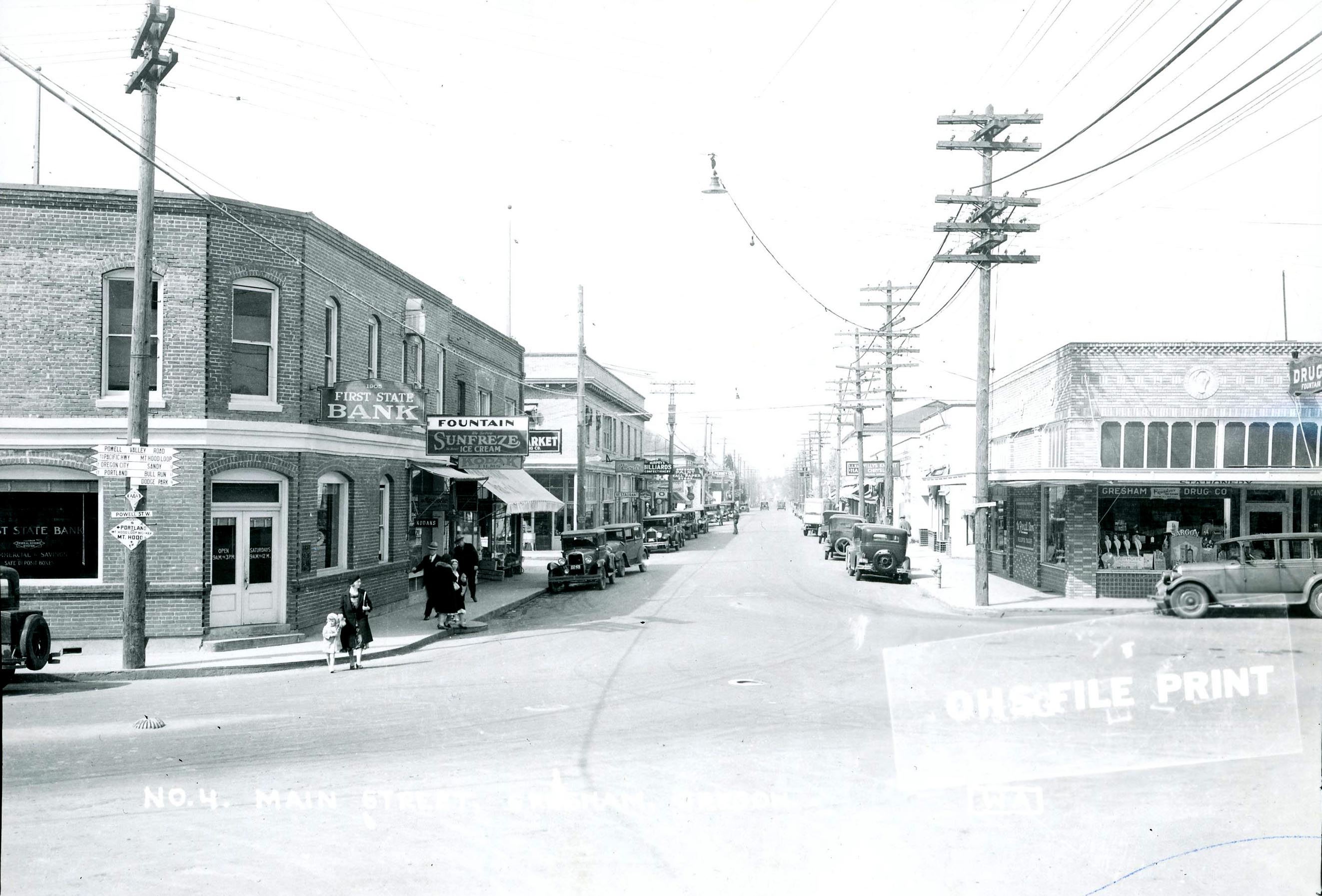
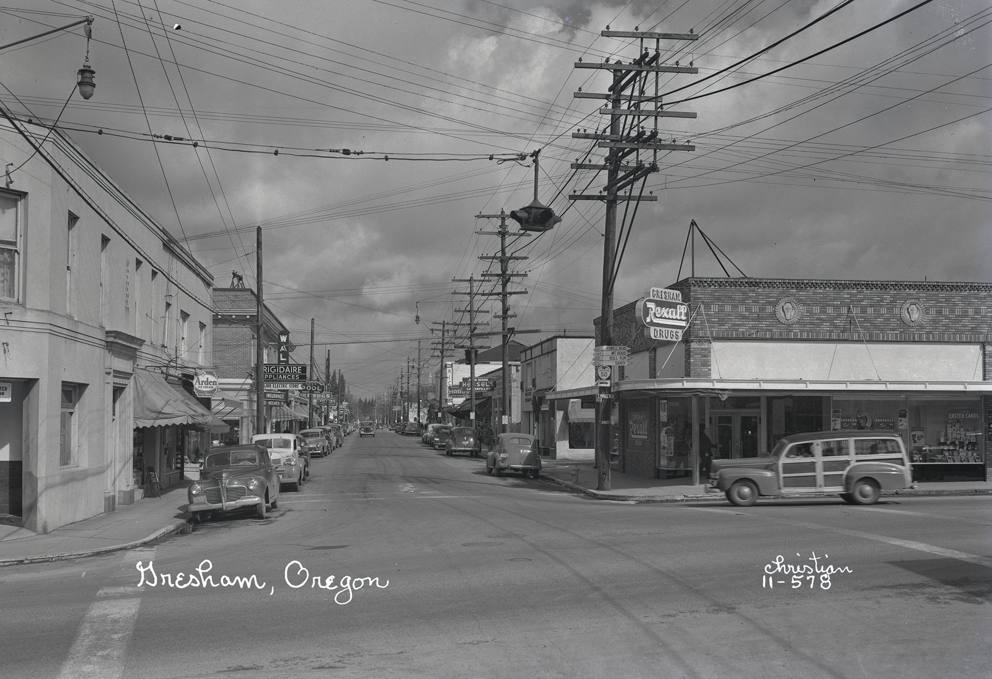
Main St., Gresham.
Oregon Historical Society Research Library, photo file 461b
-
![]()
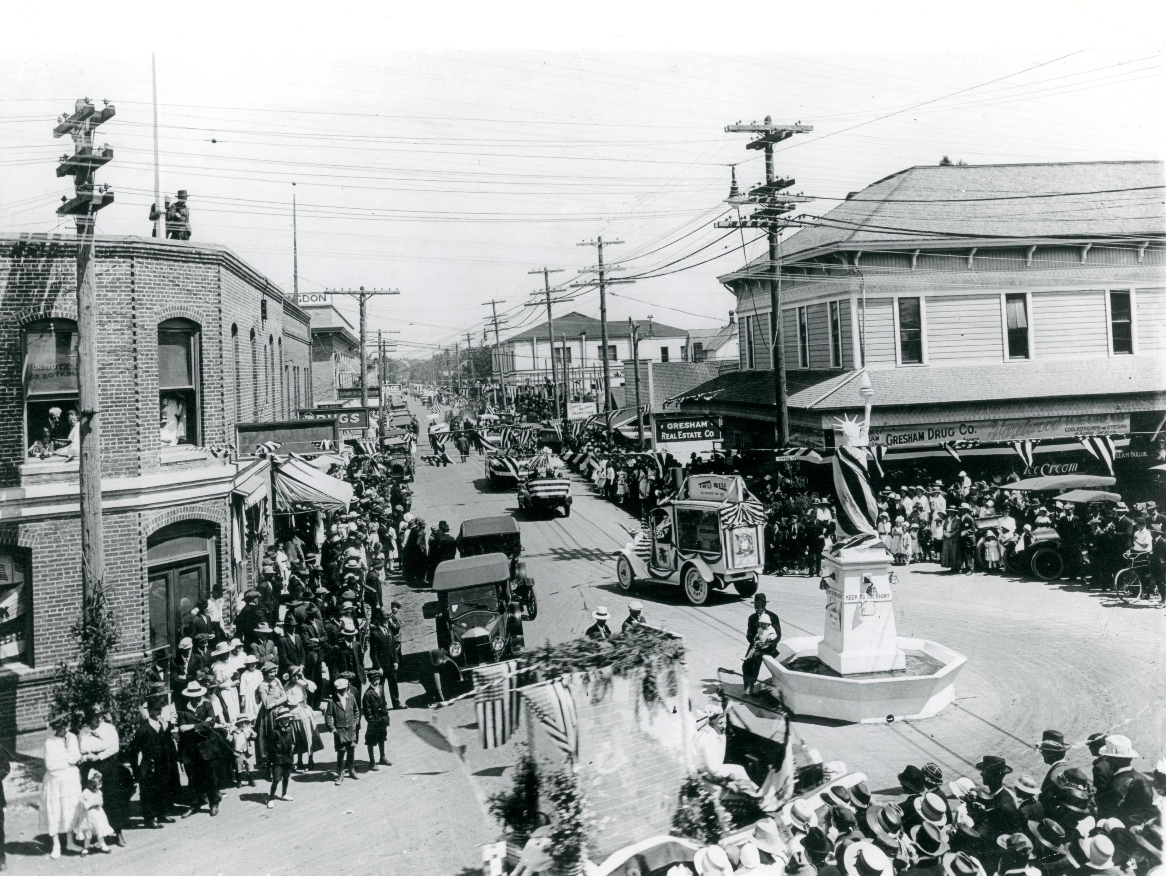
July 4 parade, Gresham, 1919.
Oregon Historical Society Research Library, bc005952, photo file 461b
-
![]()
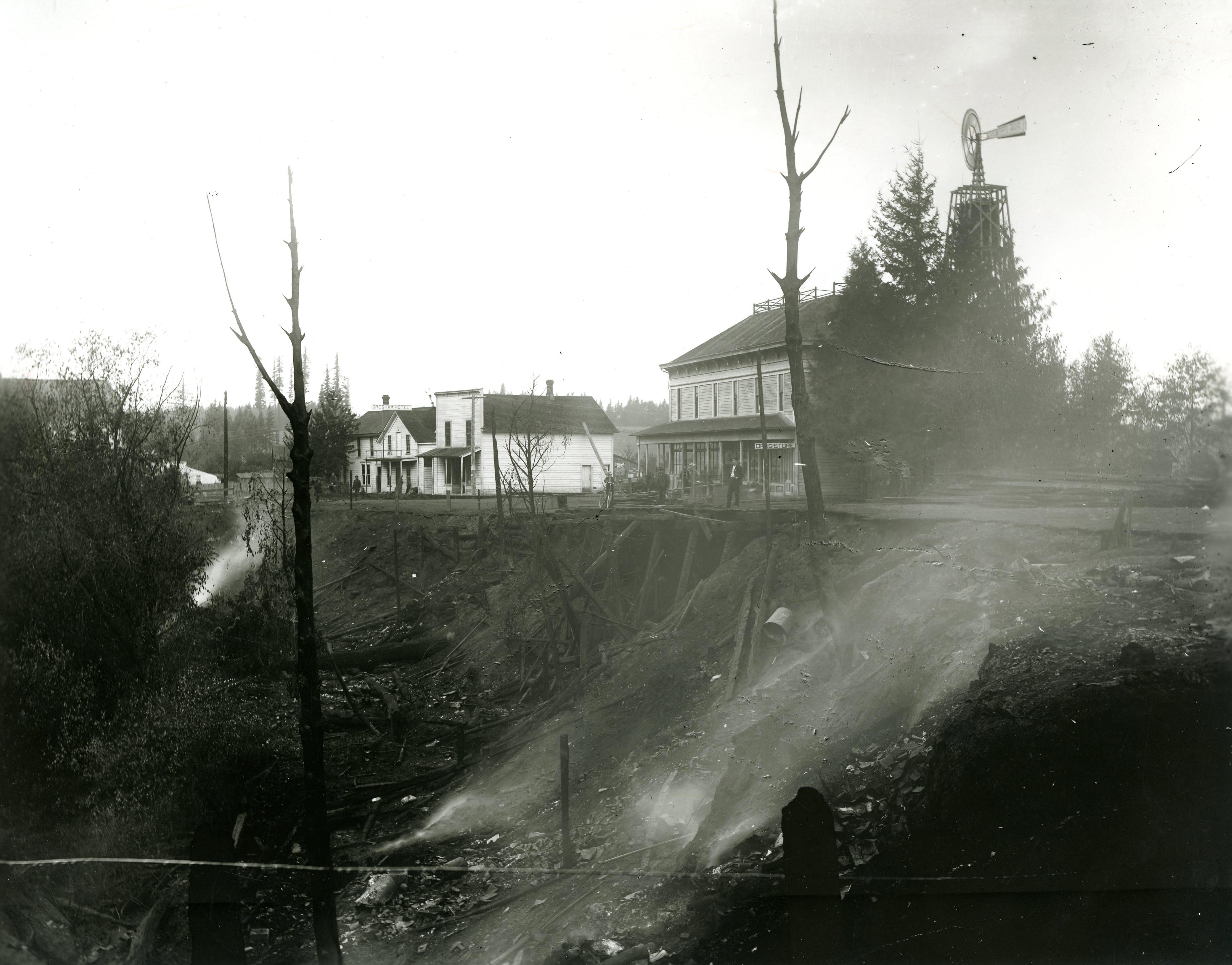
Gresham Hotel, Main and Powell Valley Road, 1905.
Oregon Historical Society Research Library, 26919, photo file 461b
-
![]()
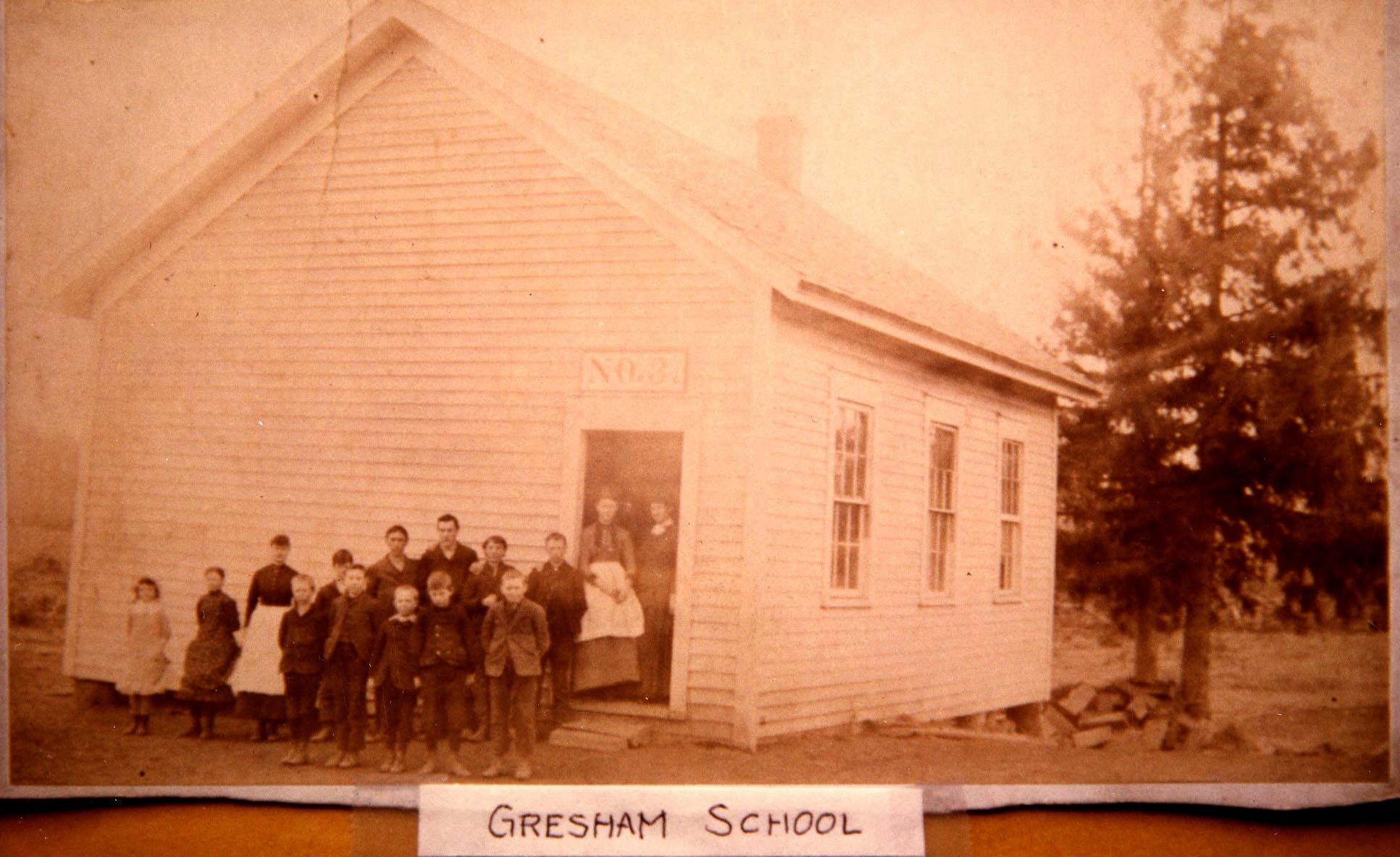
Early school in Gresham.
Oregon Historical Society Research Library, acc28104, photo file 461b
-
![]()
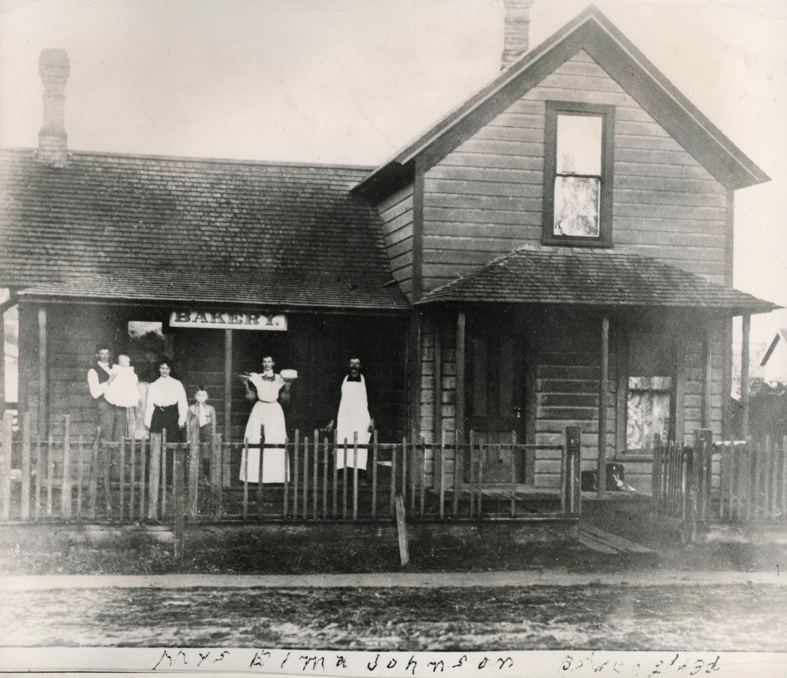
One of Gresham's earliest bakeries, Main and 2nd, owned by Elma Johnson, 1907.
Oregon Historical Society Research Library, Orhi97117, photo file 461b
-
![]()
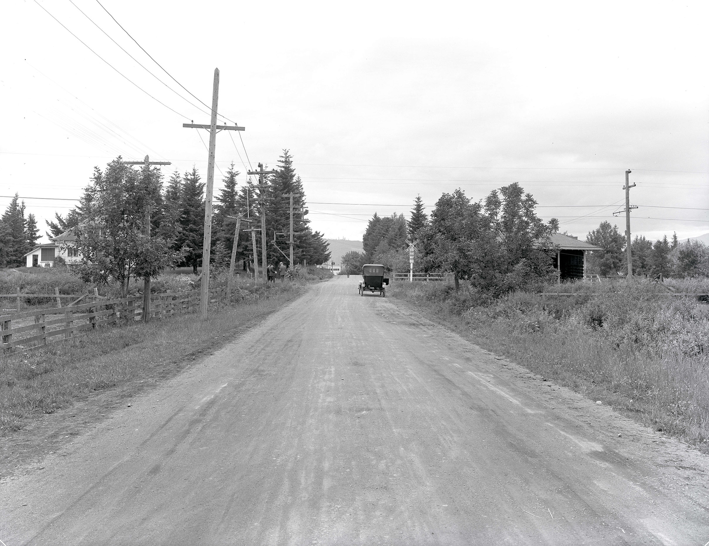
Fairview, c.1918.
Oregon Historical Society Research Library, Org. Lot 151 PGE130-67 -
![]()
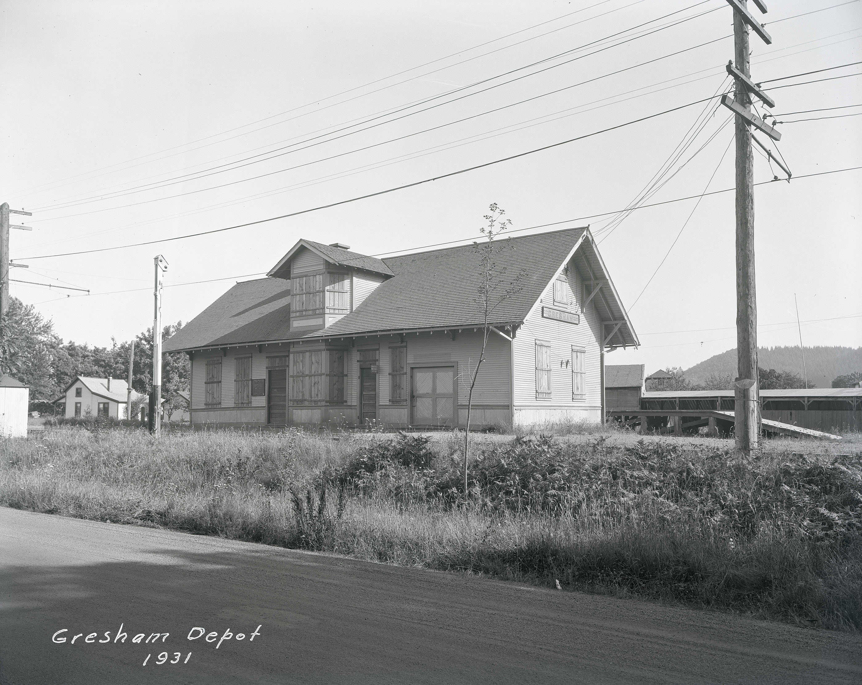
Gresham railroad depot, 1931.
Oregon Historical Society Research Library, Org Lot 151, PGE 133 -
![]()
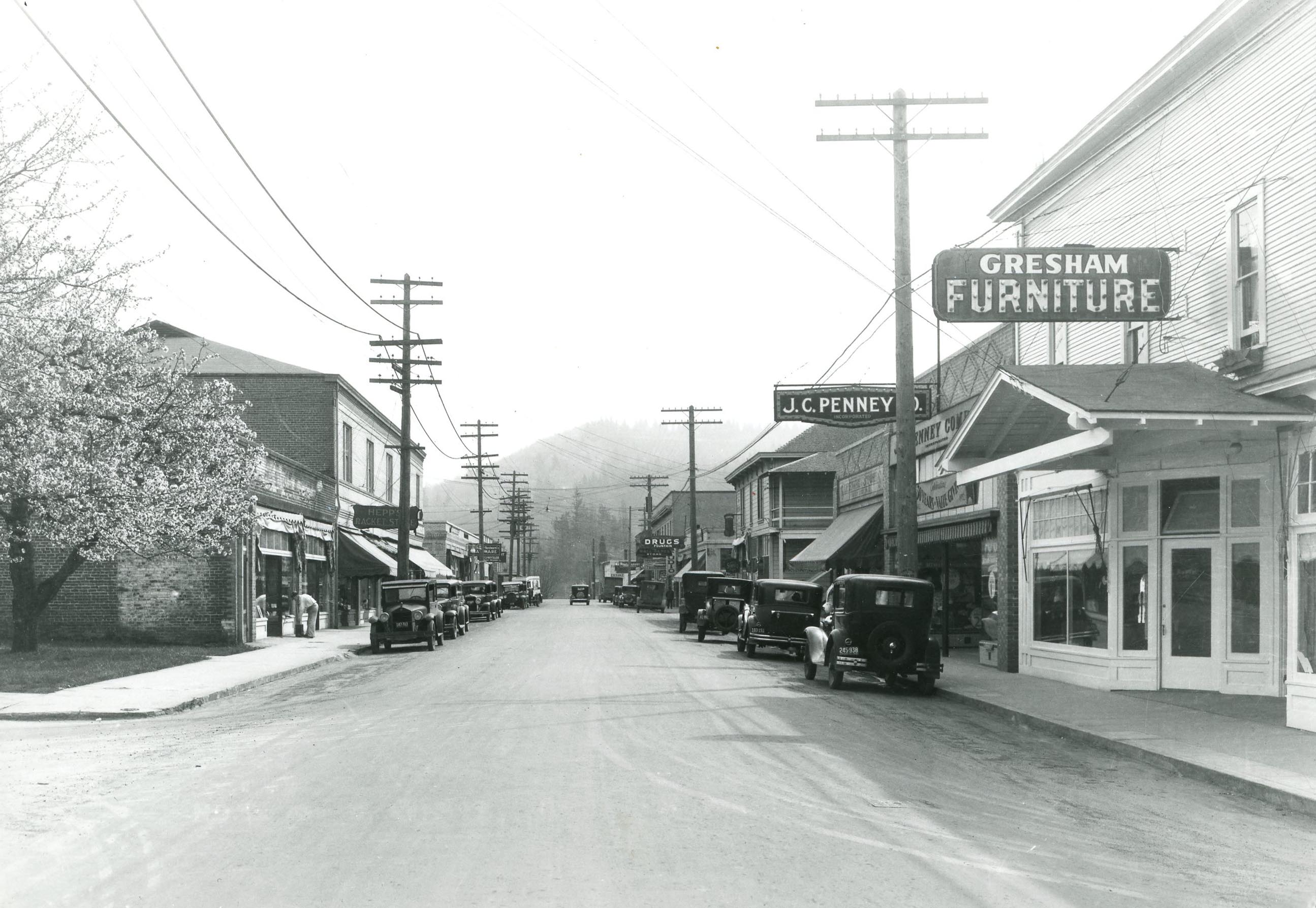
Main St., Gresham, c.1932.
Oregon Historical Society Research Library, 15675, photo file 461b
-
![]()
Multnomah County Fair Grounds, Gresham.
Oregon Historical Society Research Library, 15679, photo file 461b
-
![]()
Gresham Berry Growers, c.1940.
Courtesy Oregon State University Libraries -
![Store owner in Gresham posts "No Jap Trade Solicited for the Duration" in his window.]()
Gresham store owner with anti-Japanese sign, 1945.
Store owner in Gresham posts "No Jap Trade Solicited for the Duration" in his window. Courtesy Oreg. Hist. Soc. Research Lib., 011187
-
![]()
Multnomah County Fair, Gresham, 1947.
Oregon Historical Society Research Library, OrgLot 1284_1276_2 -
![]()
-
![]()
-
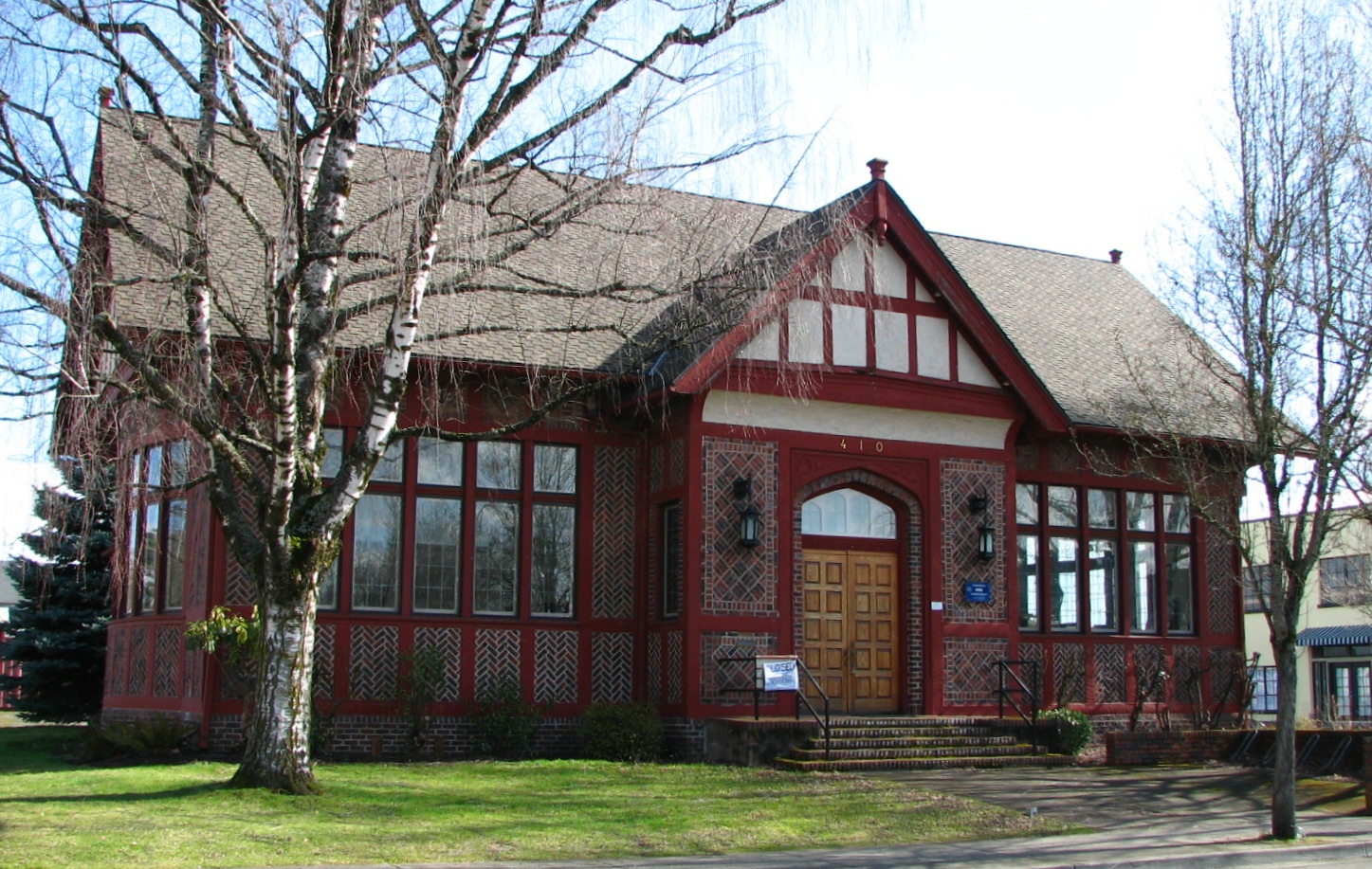
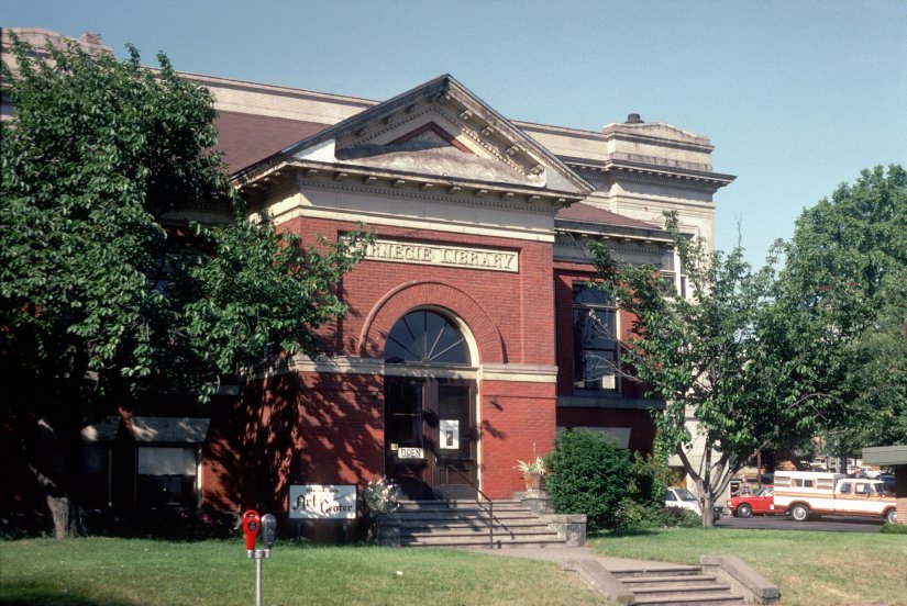
![Carnegie Library, Gresham, 2008]()
Carnegie Library, Gresham, 2008.
Carnegie Library, Gresham, 2008 Courtesy UO Libraries, pna_20603
-
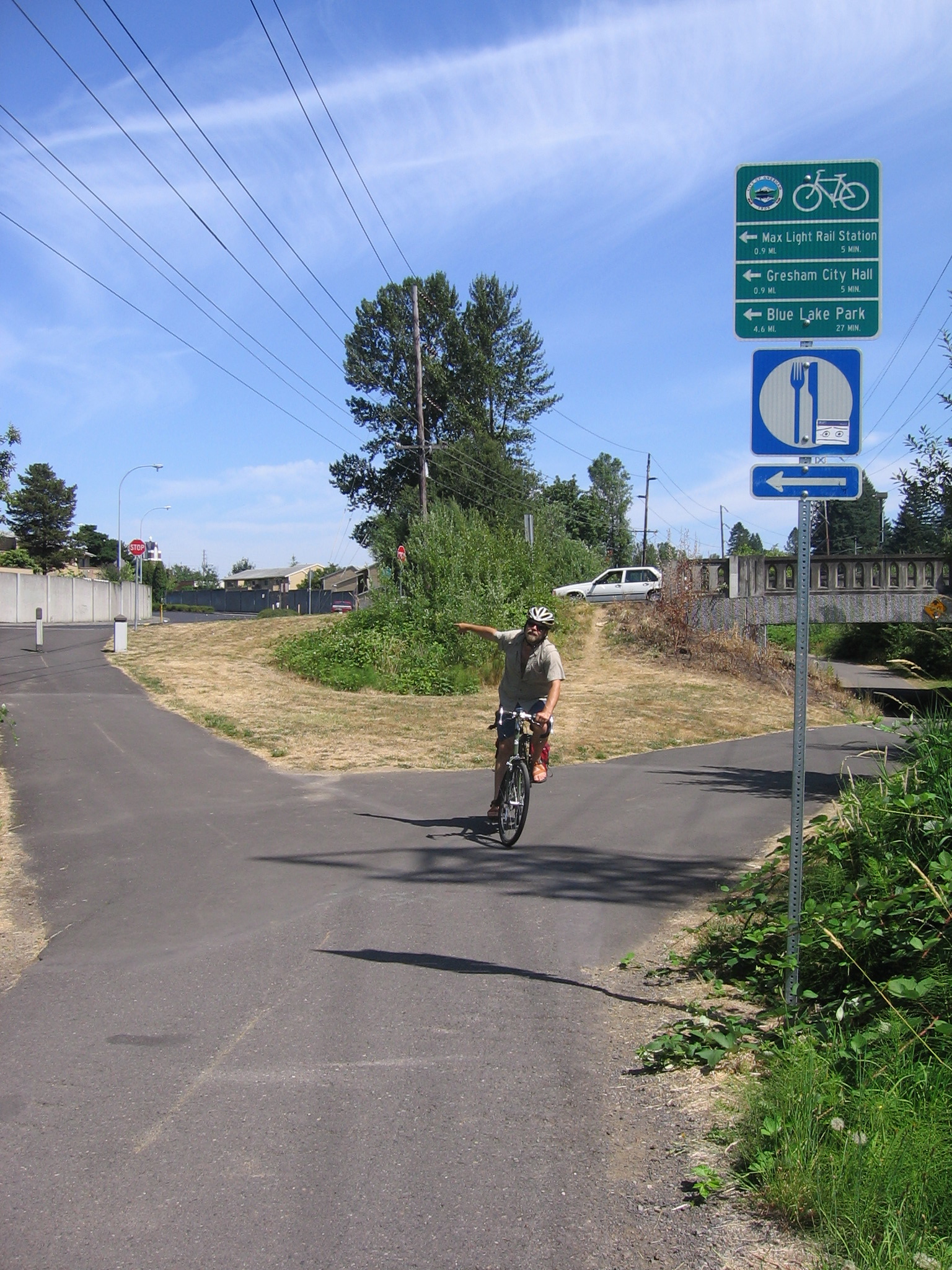
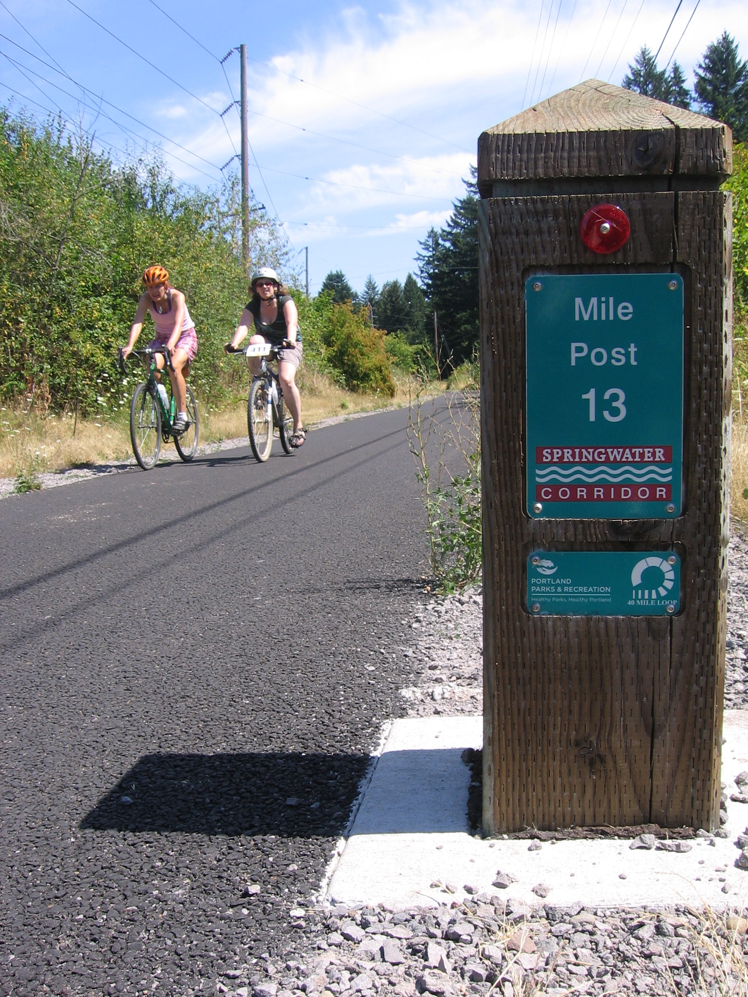
![Springwater Corridor Trail, Gresham, Aug. 21, 2011.]()
Springwater Corridor, Gresham sign, Aug 21 2011.
Springwater Corridor Trail, Gresham, Aug. 21, 2011. Photo James V. Hillegas

Related Entries
-
![Ambleside Summer Homes Tract]()
Ambleside Summer Homes Tract
Ambleside Summer Homes Tract, located on Johnson Creek near Gresham, wa…
-
![Carnegie Libraries in Oregon]()
Carnegie Libraries in Oregon
Of the 1,679 public library buildings funded in the United States by An…
-
![Gardenburger Inc.]()
Gardenburger Inc.
Leftovers at a vegetarian restaurant in Oregon gave birth to the world’…
-
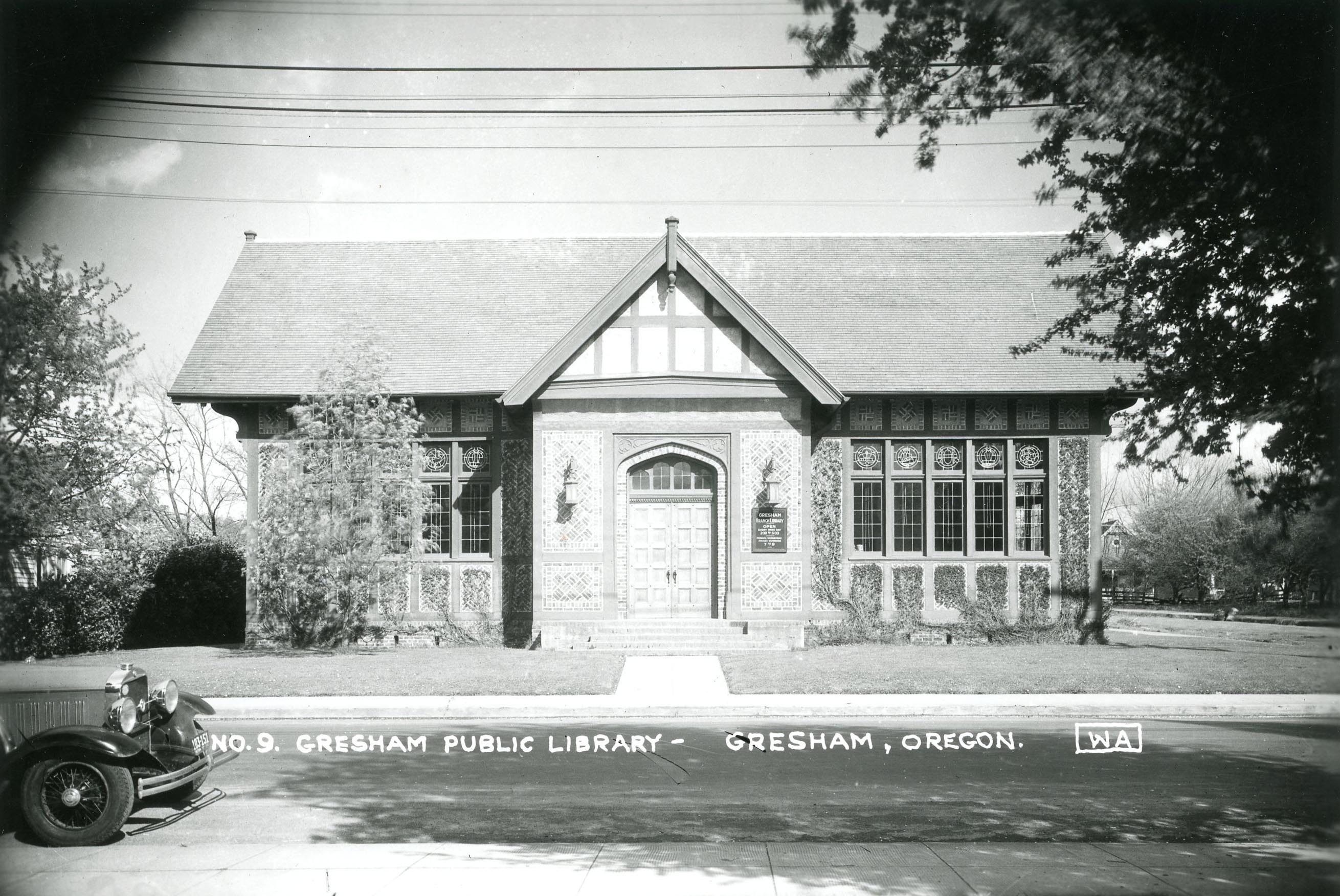
![Gresham Carnegie Library]()
Gresham Carnegie Library
The Gresham Carnegie Library building is one of the finest examples of …
-
![Japanese Americans in Oregon]()
Japanese Americans in Oregon
Immigrants from the West Resting in the shade of the Gresham Pioneer C…
-
![Springwater Corridor]()
Springwater Corridor
The Springwater Corridor is a 21-mile-long recreational trail stretchin…
-
![Zimmerman Heritage Farm]()
Zimmerman Heritage Farm
The Zimmerman Heritage Farm in Gresham consists of an 1874 farmhouse on…

Related Historical Records
Map This on the Oregon History WayFinder
The Oregon History Wayfinder is an interactive map that identifies significant places, people, and events in Oregon history.
Further Reading
Chilton, W.R., ed. Gresham: Stories of our Past: Campground to City. Gresham, Ore.: Gresham Historical Society, 1993.
Chilton, W.R., ed. Gresham: Stories of our Past: Before and After the World Wars. Gresham, Ore.: Gresham Historical Society, 1996.
Nagae, Peggy. "Asian Women: Immigration and Citizenship on Oregon." Oregon Historical Quarterly Vol. 113.3 (Fall 2012): 334-359.