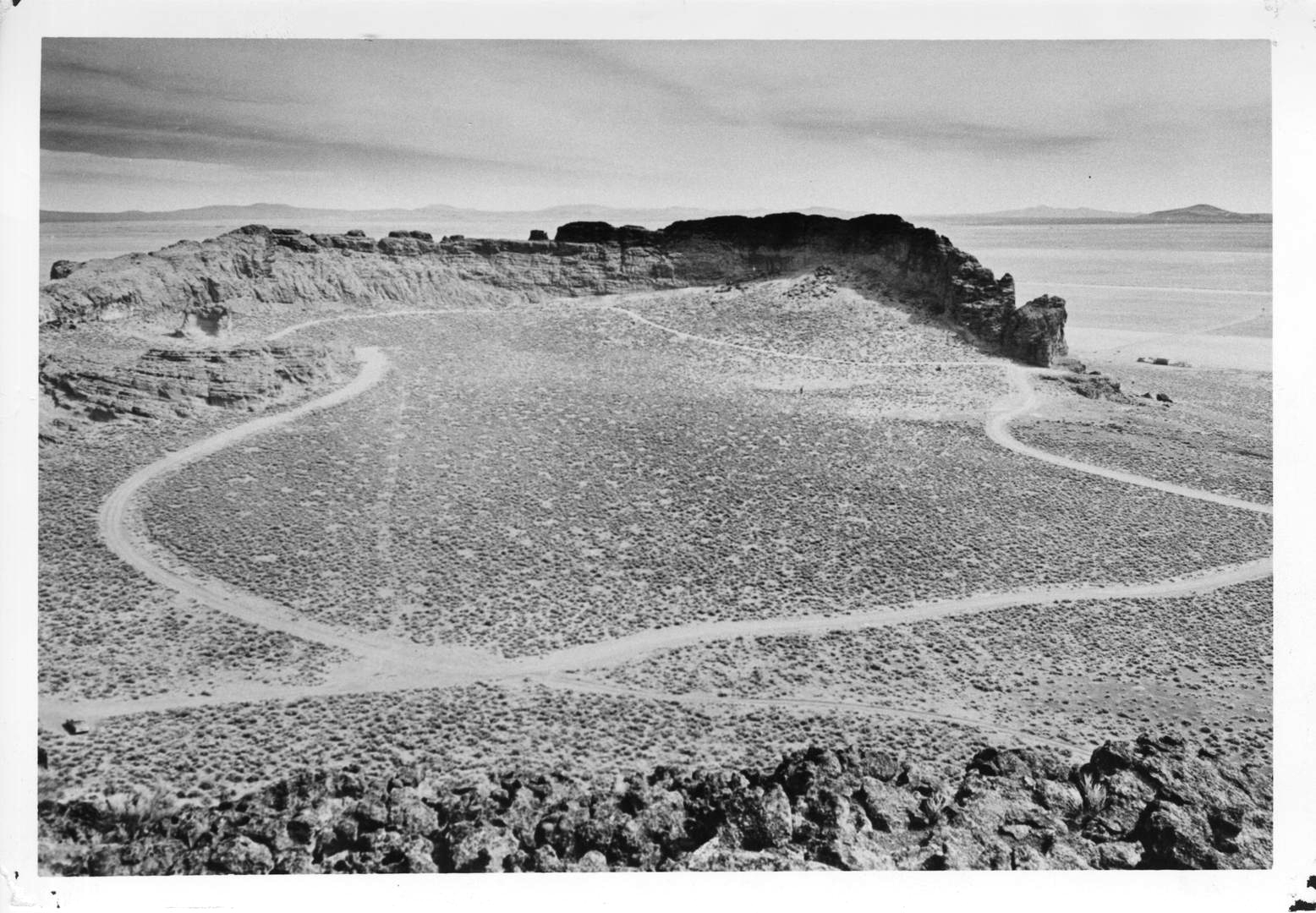
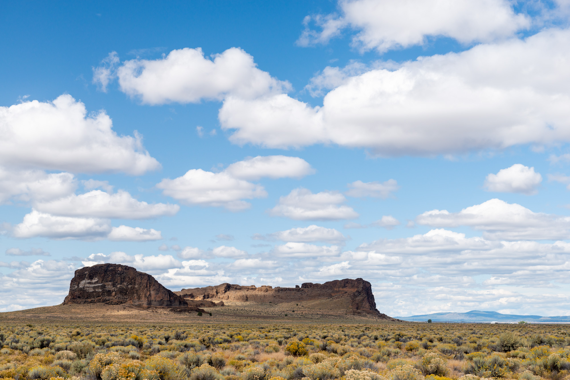
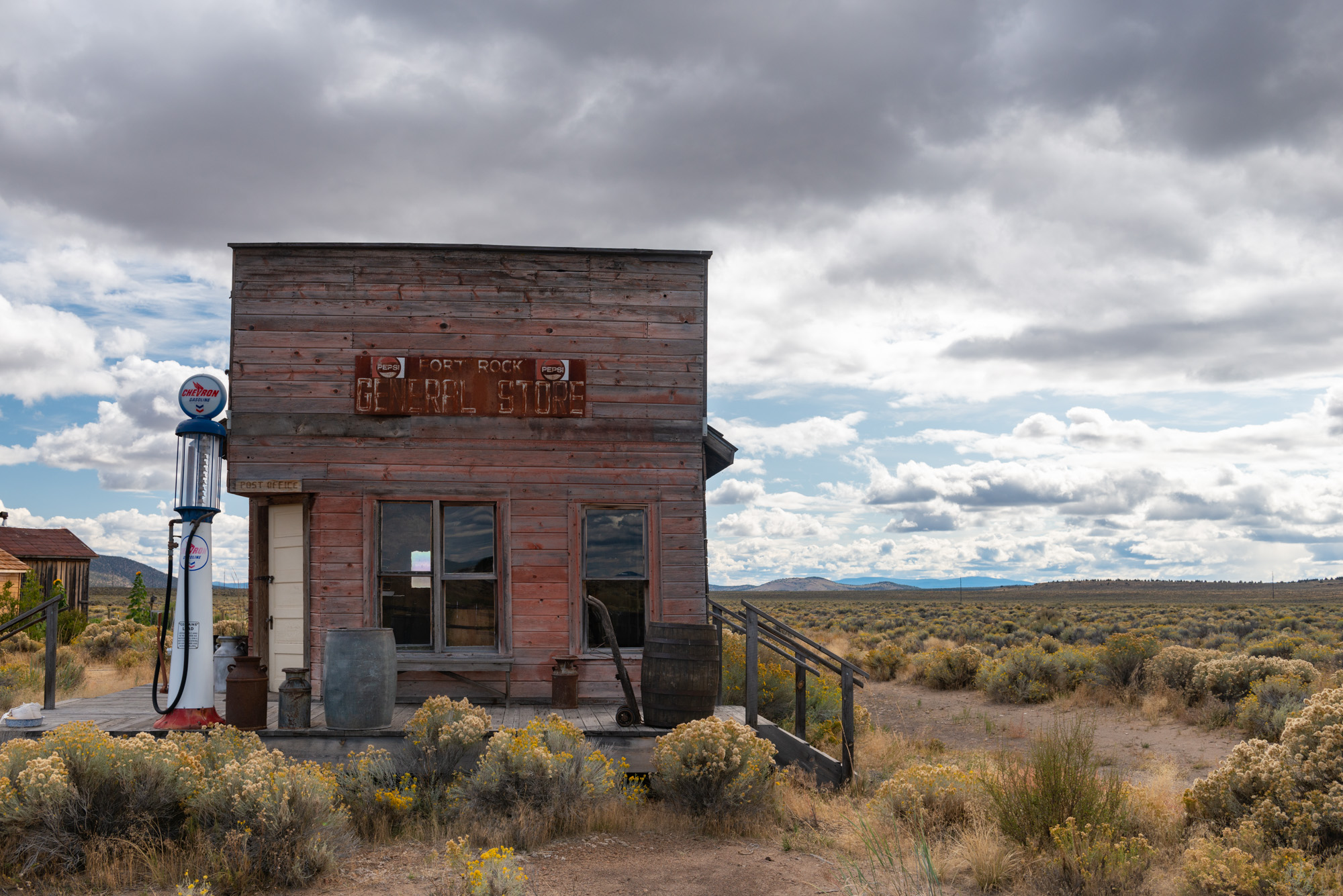
Fort Rock is a volcanic citadel at the western end of the Fort Rock Valley of central Oregon, its cliffs rising nearly 260 feet (ft.). Geologically, the formation is a tuff ring, “tuff” being the term for well-cemented ash deposits. When viewed from above, the boldly outcropping part of Fort Rock forms an oblong ring with an opening to the southeast, much like a distorted horseshoe. Measured rim to rim, the ring is about 2,300 ft. (northeast-southwest) by 1,700 ft. (northwest-southeast) (fig. 1). The formation encircles a vent from a brief eruption long ago. As named, “Fort” owes to the landform’s shape and has nothing to do with a military site or fur-trade post.
Fig. 1
Tuff ring eruptions typically produce circular rims, and segments of the Fort Rock rim line show two or more semi-circular forms, suggesting the vent migrated sporadically a few hundred feet during the eruption, each time destroying part of an existing ring and building anew (fig. 1). Thus, the modern rim is a composite of smaller rings, each originally circular and ranging from 1,000 to 1,600 ft. in diameter. Fort Rock’s total height is 350 ft. from summit to basin floor when including the sloping lower part of the formation, and its volume is about 0.02 cubic kilometers, or about twice the volume of Lava Butte, a well-known cinder cone along Highway 97 south of Bend, Oregon.
Geologic History
Fort Rock grew upward and outward by a series of explosions similar to those that produced cinder cones elsewhere in Oregon (such as Lava Butte), but with a key difference: the presence of abundant water. The presence of a pluvial lake during the eruption provides a suitable explanation for the magma-water interaction, but abundant shallow groundwater also suffices. Upon encountering ground or surface water, the incandescent basaltic magma—with temperatures in excess of 2,000°F—flashed the liquid water to steam. The reaction created a steam gas expansion that intensified the vertical and lateral thrust of the eruption and sent surges of moisture-laden ash, scoria, and bedrock blocks in all directions from the vent. The debris from the lateral surges and vertical showers was deposited in layers to create rock resembling a poorly sorted, coarse sandstone. The deposits are entirely volcanic, however, not waterlaid in origin.
Sections of the vent walls sloughed into the volcanic throat during the eruption. The freshly exposed outcrop faces were then plastered anew with volcanic debris from renewed surges. The evidence for remnant walls is seen most easily on the west side of the crater, where beds that slope steeply down into the crater lie against truncated beds that slope outward away from the vent (figs. 2 and 3). The trace of the westside sloughed-wall boundary continues south and around to the southeast side of the tuff ring, across flattish ground where the rim has been destroyed (fig. 1). Therefore, breaching of the tuff ring may have been chiefly by crater wall failure, later modified by pluvial lake wave action.
Figs. 2 and 3
Although Fort Rock’s precise age is unknown, the eruption likely occurred sometime between 1.6 million years and about 16,000 years ago, given the dating of similar features in the Fort Rock Valley and adjacent upland. The time required to build Fort Rock was probably less than three weeks, given the feature’s erupted volume and effusion rates known from historic tuff-ring eruptions.
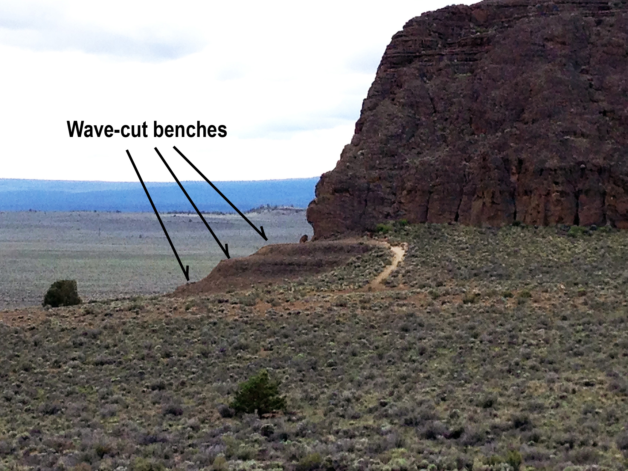
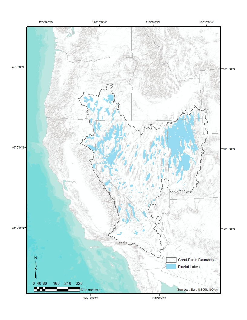
Wave-cut rock benches are etched into the cliffs at Fort Rock. Most prominent are benches at the 4,440-ft altitude, found on the south and southeast sides near the public parking area. Their promontories are the most popular hiking destinations. The benches mark a major stillstand (persistence of a particular lake level) and also the highest stand of water that seems to have affected the Fort Rock edifice. That stillstand is thought to have occurred shortly before 16,000 years ago. (The highstand level in Fort Rock Lake reached about 4,500 feet, as indicated by shoreline deposits that ring parts of the basin; but the age of those shoreline deposits is unknown and may predate Fort Rock.) Though fainter in the rock record, notches and poorly developed benches at lower altitudes provide evidence of stillstands at lower lake levels. There is no evidence of wave-cut remnants higher than the 4,440-ft. level. Nor is there evidence that Fort Rock, whose rim lies entirely above 4,500 ft. and summits at 4,695 ft., was overtopped by lake water.
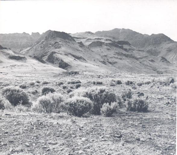
Fort Rock’s cliffs are pitted by cavernous weathering, which is the weakening of the rock matrix by mineral salt deposits. Today, the pitting provides roosts and nesting sites for rock pigeons, ravens, and prairie falcons. Indeed, public access is closed to nesting areas during falcon brooding season from February 15 to August 30. White-throated swifts nest in the larger cracks in the cliff faces, and cliff swallows build their mud-daub nests beneath overhangs.
Human History
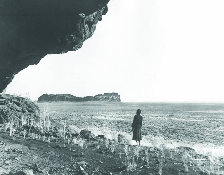
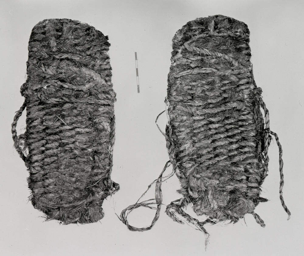
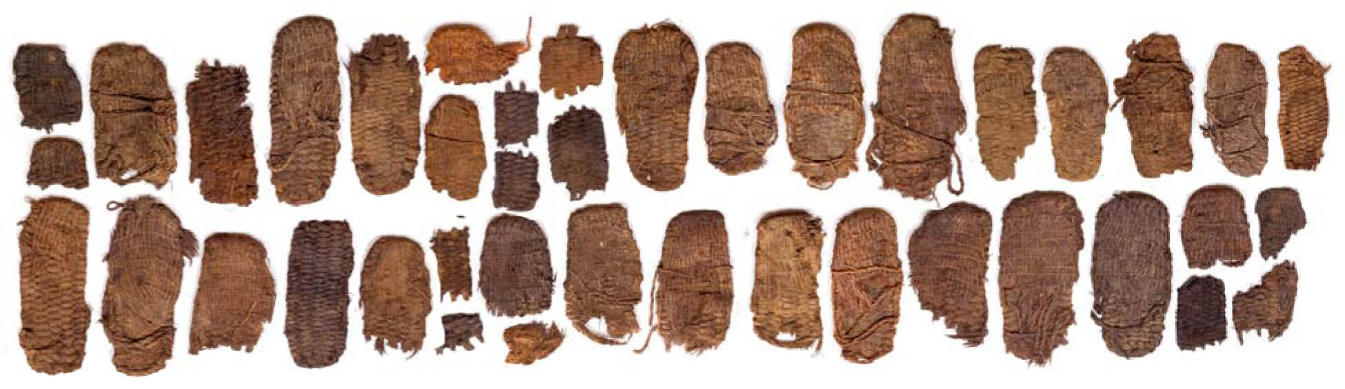
Ancestors of the Klamath, Modoc, and Yahooskin bands of the Northern Paiute lived in the Fort Rock basin over 11,000 years ago. Fort Rock was an island during some periods of human occupation, when pluvial Fort Rock Lake grew from shallow marsh to water depths of 115 ft. in the area of Fort Rock itself. Throughout the Holocene—the period since about 11,700 years ago—human occupation in and around Fort Rock coincided with times when sandy playas filled with water and formed lakes and marshes teeming with life-sustaining plants and animals. Native artifacts once abounded in the soil of the Fort Rock Valley, though many have been taken by collectors. The famous Fort Rock sandals, despite their name, were not found at Fort Rock but in a cave about a half-mile west.
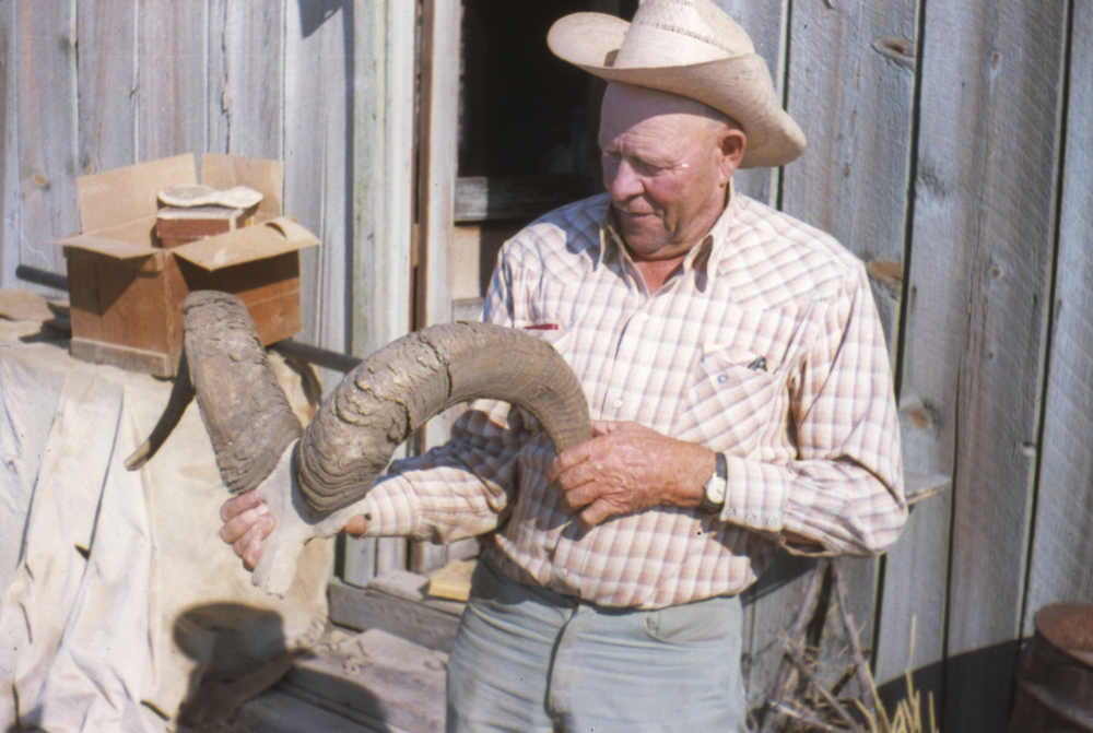
By the time EuroAmerican settlers moved into the Fort Rock area in the nineteenth century, the area was primarily Northern Paiute land. The U.S. government used treaties and armed conflict to relocate the Paiute to reservations, while also luring farmers to the region with nearly free land. The high desert, however, is semi-arid, and despite benefitting from a temporary wet period from 1905 to 1920, homesteaders suffered through drought and deadly frosts. Most left the area to be replaced by cattlemen, who reportedly used Fort Rock’s natural amphitheater as a round-up corral. An early photograph shows a fire lookout structure on the south bluff of Fort Rock in the mid-1920s, its position marked until recently by a benchmark of similar vintage.
Fort Rock and its surroundings were gifted to the State of Oregon in 1962 by landowners Reuben and Norma Long. The formation was designated a National Natural Landmark in 1976, a “striking example of a circular volcanic outcrop,” distinct and well-shaped. It forms the centerpiece of Fort Rock State Natural Area (once Fort Rock State Park), the boundaries of which enclose the rock’s cliffs and sloping base. The Natural Area’s extent, 349 acres, ranks it among the top 20 percent, by area, in the Oregon parks system.
-
![Photo by Peter Marbach.]()
Fort Rock State Natural Area.
Photo by Peter Marbach. Oregon Historical Society
-
![]()
Wavecut bench and notch on southeast promontory, from near parking area.
Courtesy Oregon State Archives -
![]()
View north to Fort Rock from Lake County Road 5–10. May 1, 2024.
Courtesy David Sherrod
-
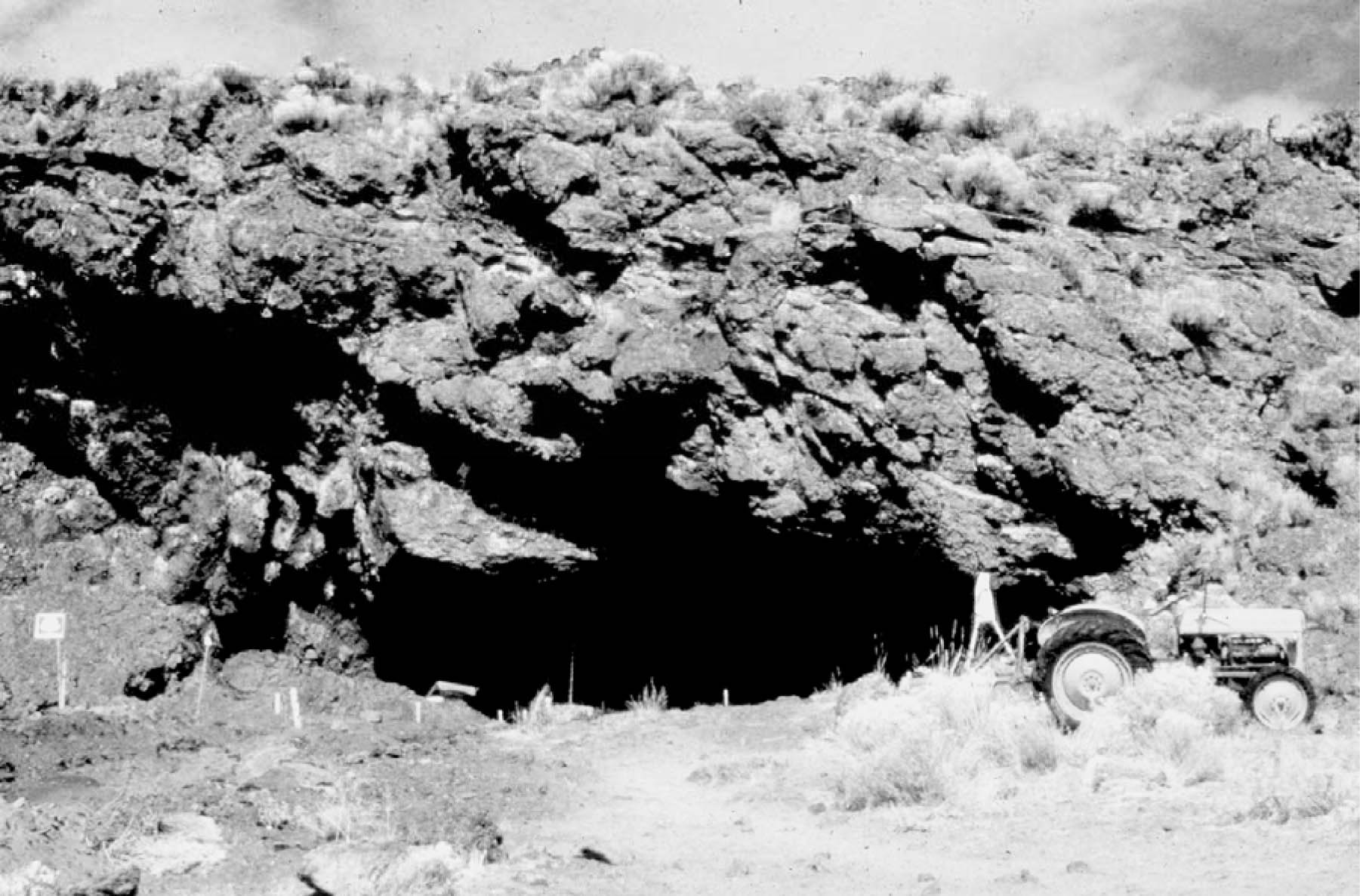
![Fort Rock Cave is located in rock formation slightly right and farther back in photo.]()
Aerial view west to Fort Rock, 1970.
Fort Rock Cave is located in rock formation slightly right and farther back in photo. Courtesy Robert Henderson
-
![]()
Fort Rock with small lookout structure on west promontory, 1921.
Oregon Historical Society Research Library, Merritt Parks Photograph Collection, Org. Lot 801, Folder 1, OrHi 88552
-
![]()
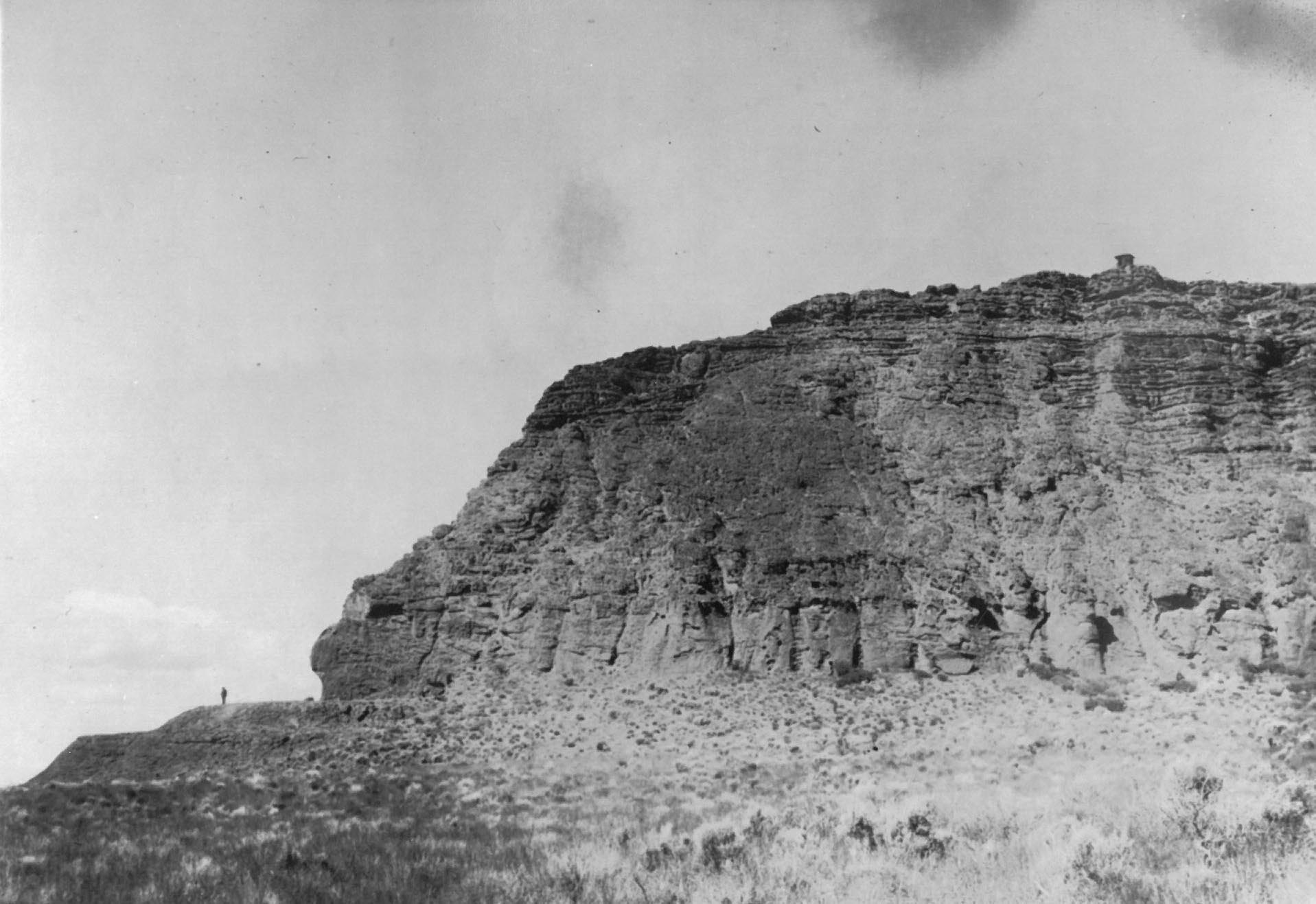
West promontory of Fort Rock, 1922.
Oregon Historical Society Research Library, Merritt Parks Photograph Collection, Org. Lot 801, Folder 1, OrHi 88533
-
![]()
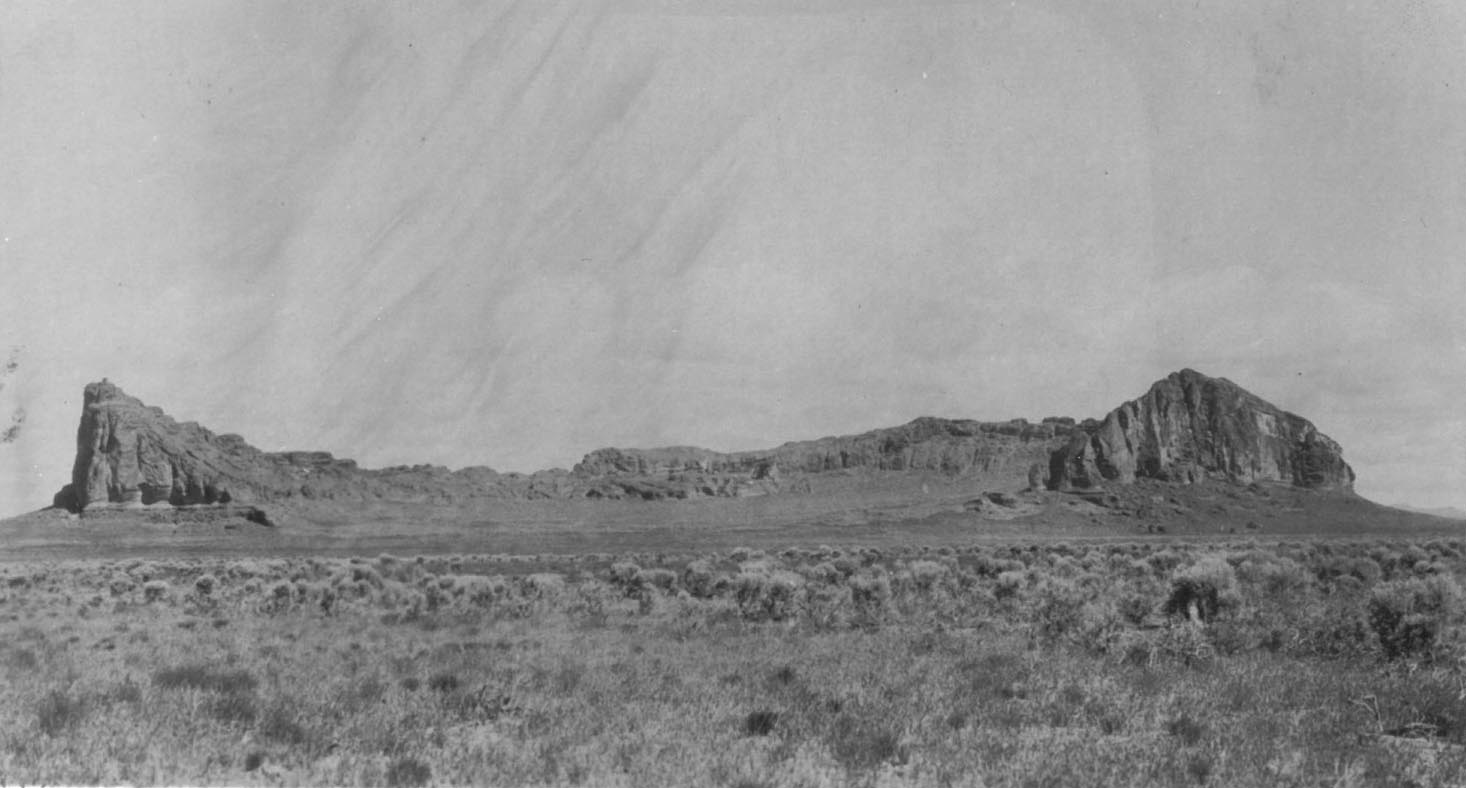
Fort Rock Valley looking south from the base of Fort Rock, c.1922.
Oregon Historical Society Research Library, Merritt Parks Photograph Collection, Org. Lot 801, Folder 1, OrHi 88575
-
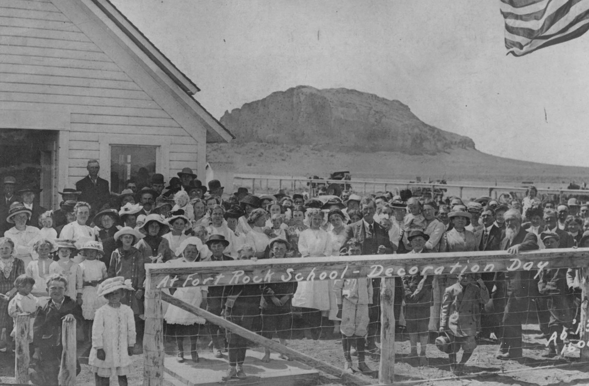
![]()
Fort Rock School when located one mile north of the village, c.1914.
Oregon Historical Society Research Library, Merritt Parks Photograph Collection, Org. Lot 801, Folder 5
-
![]()
Fort Rock, Lake County, Oregon.
UO Archives Photographs, University of Oregon. "Archaeology [4] (recto)" Oregon Digital. -
![]()
Wave-cut benches on southern prong of Fort Rock’s wall, May 24, 2016.
Courtesy Thomas Connolly
-
![]()
Fort Rock.
Courtesy Oregon State Archives -
![]()
Fort Rock Cave opening and view east to Fort Rock, 1966.
Courtesy Oreg. Hist. Soc. Research Lib. OrHi80012
-
![]()
Fort Rock Cave, c. 1966.
Courtesy University of Oregon Museum of Natural and Cultural History (UOMNCH)
-
![Sagebrush sandals excavated at Fort Rock Cave by Dr. Luther Cressman, 1938.]()
Fort Rock sandals, 1938, bb006673.
Sagebrush sandals excavated at Fort Rock Cave by Dr. Luther Cressman, 1938. Luther Cressman photo, courtesy Oreg. Hist. Soc. Research Lib., bb006673
-
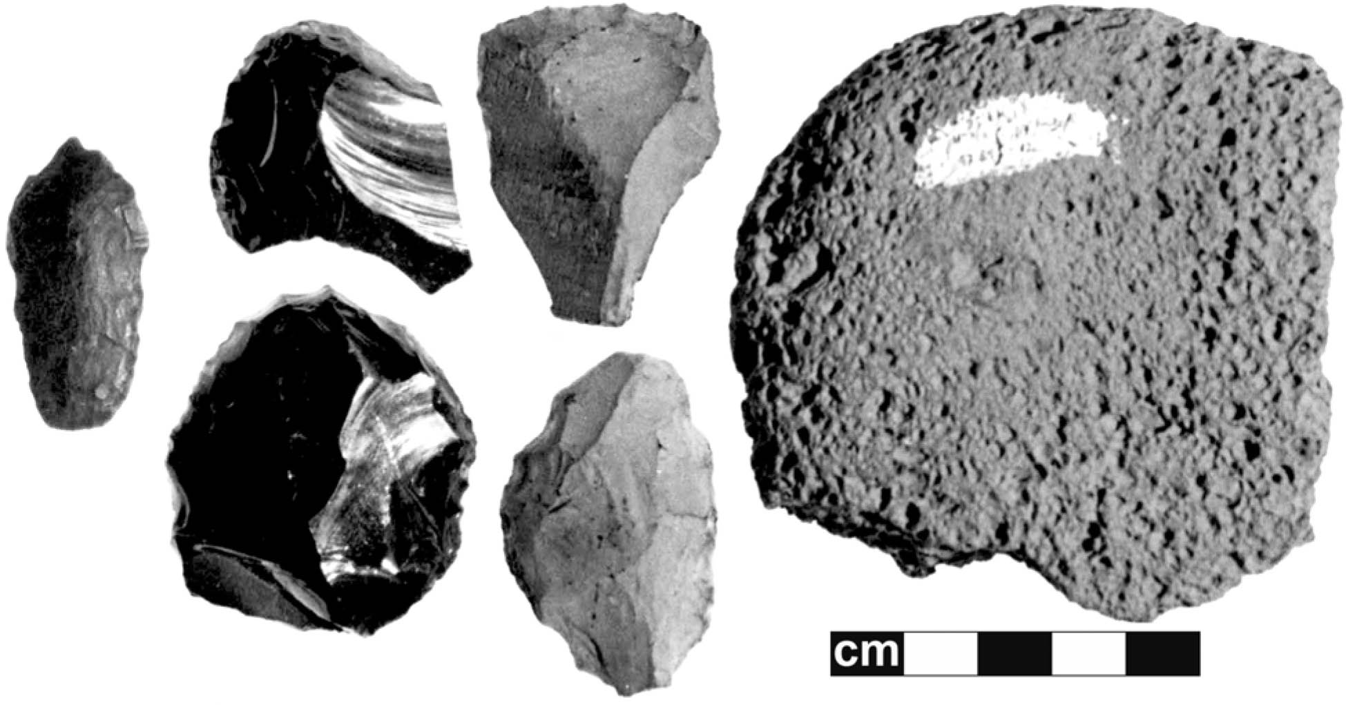
![Early tools excavated from Fort Rock Cave]()
Early tools from Fort Rock Cave.
Early tools excavated from Fort Rock Cave Courtesy UOMNCH
-
![Fort Rock sandal, ca 9490 yrs ago (l); Catlow sandal, 9300 yrs ago (r)]()
Fort Rock sandal (left); Catlow Cave sandal (right).
Fort Rock sandal, ca 9490 yrs ago (l); Catlow sandal, 9300 yrs ago (r) Courtesy UOMNCH
Related Entries
-
![Fort Rock Cave]()
Fort Rock Cave
Fort Rock Cave is located in a small volcanic butte approximately half …
-
![Fort Rock Sandals]()
Fort Rock Sandals
Fort Rock sandals are a distinctive type of ancient fiber footwear foun…
-
![Fort Rock (town)]()
Fort Rock (town)
The town of Fort Rock is an unincorporated community in northern Lake C…
-
![High Desert]()
High Desert
Oregon’s High Desert is a place apart, an inescapable reality of physic…
-
![Pleistocene Pluvial Lakes]()
Pleistocene Pluvial Lakes
During the Last Glacial Maximum, from about 24,000 to about 18,000 year…
-
![Reub Long (1898-1974)]()
Reub Long (1898-1974)
A generation after his death in 1974, Reuban A. "Reub" Long still figur…
-
![The Northern Great Basin During the Ice Age]()
The Northern Great Basin During the Ice Age
During the Ice Age, from about 25,000 to 11,700 years ago, the Northern…
Related Historical Records
Map This on the Oregon History WayFinder
The Oregon History Wayfinder is an interactive map that identifies significant places, people, and events in Oregon history.
Further Reading
Bedwell, S. F. Fort Rock basin—prehistory and environment. Eugene: University of Oregon Books, 1973.
Donnelly-Nolan, J. M., R. A. Jensen, D. E. Champion, M .E. Stelten, and J. E. Robinson. "Geologic map of Newberry Volcano, Oregon." U.S. Geological Survey Scientific Investigations Map, scale 1:50,000. In press.
Hatton, R. R. Pioneer homesteaders of the Fort Rock Valley. Portland, Ore.: Binford and Mort, 1982.
Heiken, G. H. "Tuff rings—examples from the Fort Rock-Christmas Lake Valley basins, south-central Oregon." Journal of Geophysical Research 76.23 (1971): 5615–5626.
Parks, M. Y. "Fort Rock basin—valley in transition." Oregon Historical Quarterly 98.1 (1997): 56–90.
Cabin Lake 7.5-minute topographic quadrangle. U.S. Geological Survey, 1981. Map.
Fort Rock 7.5-minute topographic quadrangle. U.S. Geological Survey, 1981.