During the Ice Age, from about 25,000 to 11,700 years ago, the Northern Great Basin in present-day Oregon and northern Nevada was in many ways a place very different from the one we know today. Mammoths and other large herbivores and carnivores grazed in the valleys, enormous freshwater lakes dominated the landscape, and winters were harsh. In some ways, though, the basin would have felt familiar, with populations of rabbits, waterfowl, and pronghorn living on expansive sagebrush steppes and mountains covered with pine and juniper forests. We know that people entered this Ice Age landscape by around 14,500 years ago, because archaeologists have recovered the delicate remnants of their everyday activities in caves, rockshelters, and marshside locations in south-central Oregon. The lives of those people were surely filled with challenges, particularly during the cold months of the year; but without question they adjusted and thrived, as did their generations of descendants.
The Ice Age is a common name for the geologic epoch known as the Pleistocene, which lasted between about 2.5 million and 11,700 years ago. It was the last time the Earth went through waxing and waning glaciations, and a tremendous amount of geologic and climatic change occurred during that time. The last glacial advance peaked between about 25,000 and 20,000 years ago, and it was during the waning period of that last glacial advance, from about 16,000 to 11,700 years ago, that the earliest people were present in the Americas, including in the Great Basin.
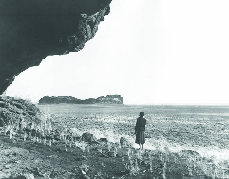
The Great Basin physiographic region stretches from present-day central Oregon south to the Mojave Desert in California and from the Rocky Mountains west to the Sierra Nevada and the Cascade Mountains. In Oregon and northern Nevada, a region sometimes referred to as the Northern Great Basin, a number of preserved geologic features and archaeological sites contain some of the oldest evidence of people in North or South America. It is a rich laboratory for studying the Ice Age.
Landscape and Climatic History
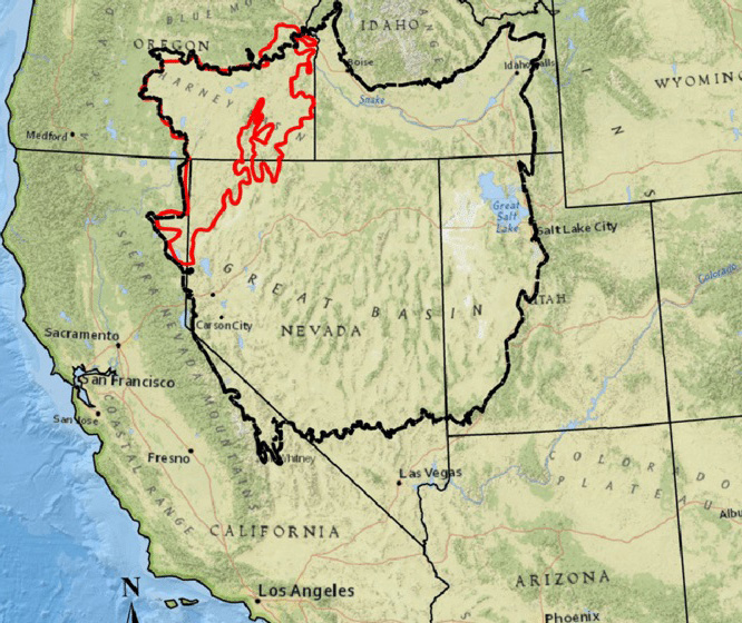
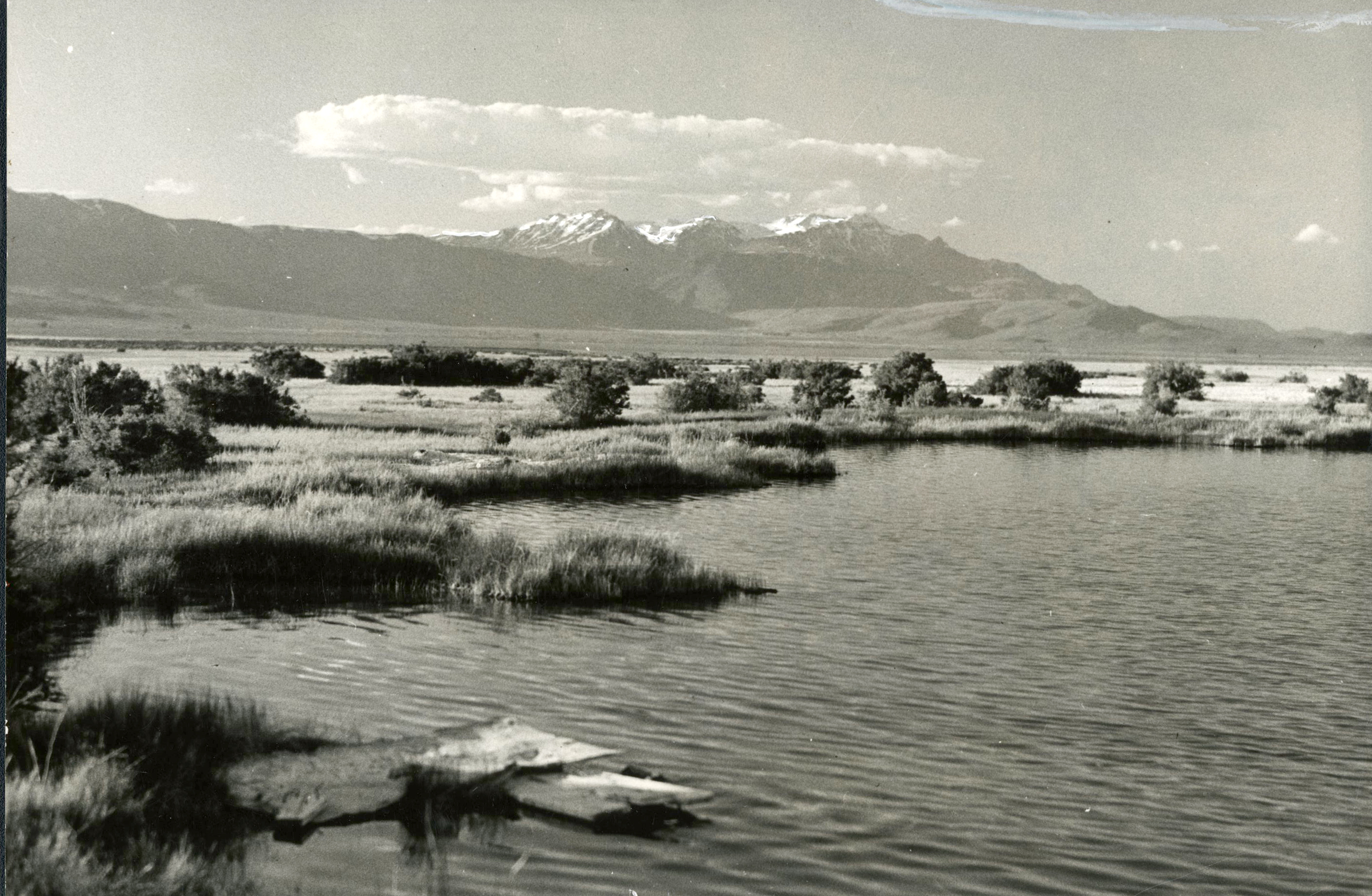
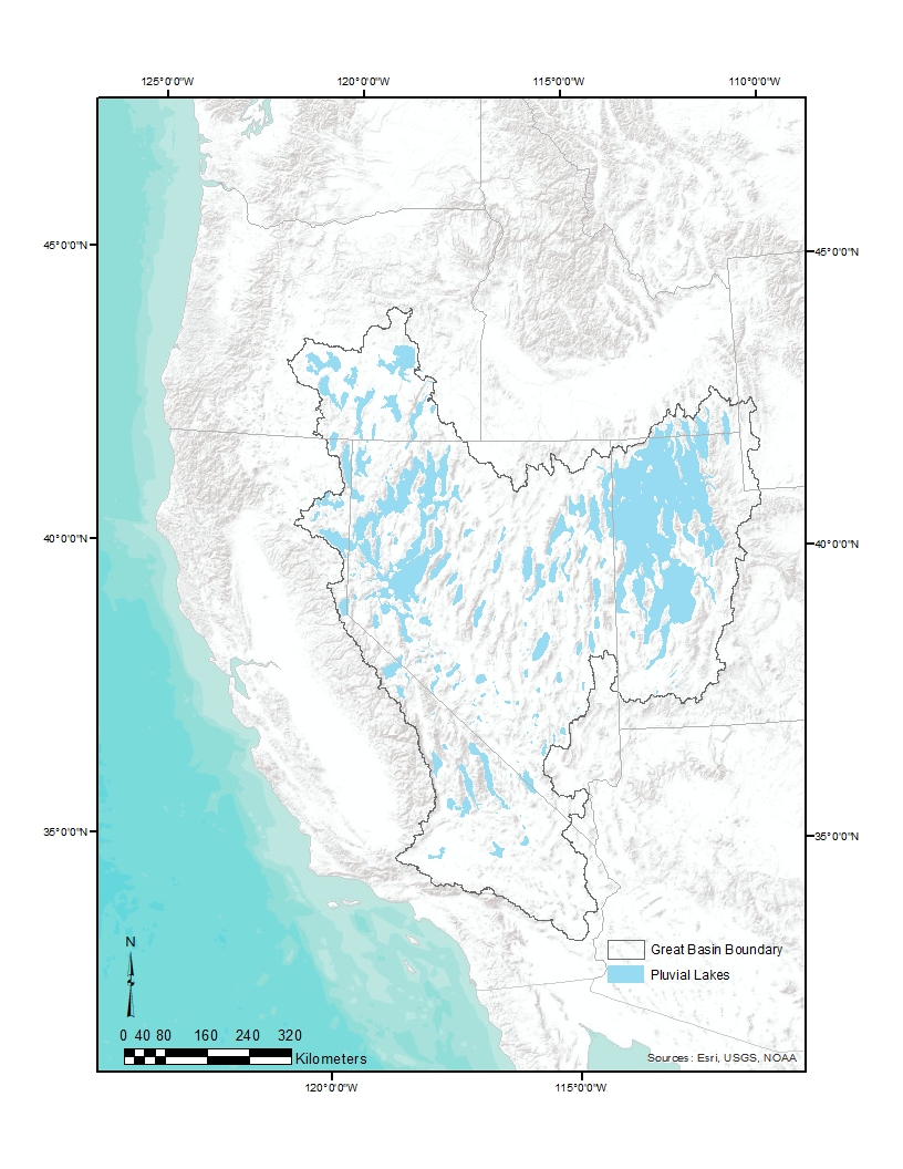
Because there are no hydrologic outlets (such as a connecting river) to the sea in the Great Basin, the history of the Ice Age in the region is connected to the rising and falling of pluvial lakes—that is, lakes fed by rain. During times of increased precipitation and decreased evapotranspiration, the arid Great Basin changed as it became dotted with an estimated 27,860,000 acres of lakes, marshes, and shallow-water ecosystems. This is also partially due to the geologic history of the region, characterized by pre-Pleistocene faulting of the volcanic-flow landscape. While remnant lakes remain today—such as Summer Lake, about seventy-five miles southeast of Bend—it was during the Ice Age that pluvial lakes played a significant role in shaping the landscape and determining how and where plants, animals, and humans lived. Evidence of those waterbodies is in remnant shoreline features carved by the wave action of the huge lakes (Figure 2), including Lake Bonneville (about 20,000 square miles and 1,220 feet deep) in present-day Utah and Lake Lahonton (about 8,300 square miles and 900 feet deep) in present-day Nevada. No lake that large ever existed in present-day Oregon, but numerous pluvial lakes formed, including Lake Fort Rock (751 square miles), Lake Chewaucan (480 square miles), Lake Warner (483 square miles), and Lake Malheur (about 919 square miles) (Figure 1).
The histories of the Northern Great Basin that are most relevant here occurred during the final two climatic periods of the Ice Age: the Bølling–Allerød warming event (about 14,700 to 12,900 years ago) and the Younger Dryas cooling event (about 12,900 to 11,700 years ago). Lake Chewaucan supported a large lake during the Bølling–Allerød, which may mean that other basins did too. The Younger Dryas was a global climatic return to glacial conditions—that is, cooler but more arid than the Bølling–Allerød but cooler and wetter than the Holocene epoch we currently live in. In the Great Basin, that meant there were fewer lakes and a florescence of marsh, riverine, and shallow-lake ecosystems that supported diverse flora and fauna during the Younger Dryas. Those were the conditions that existed for people, plants, and animals about 15,000 years ago.
Flora and Fauna During the Great Basin Ice Age
Using pollen preserved in lakes and archaeological sites, paleoecologists have determined that the Northern Great Basin during the Bølling–Allerød supported large lakeside plant communities, sagebrush grasslands and steppes around waterbodies, and alpine grasslands and forests at higher elevations. Vegetation communities during the Younger Dryas appear to have had more of a mosaic of marsh and other shallow-water environments adjacent to sagebrush grasslands and steppes, with conifers growing at lower elevations than they do today.
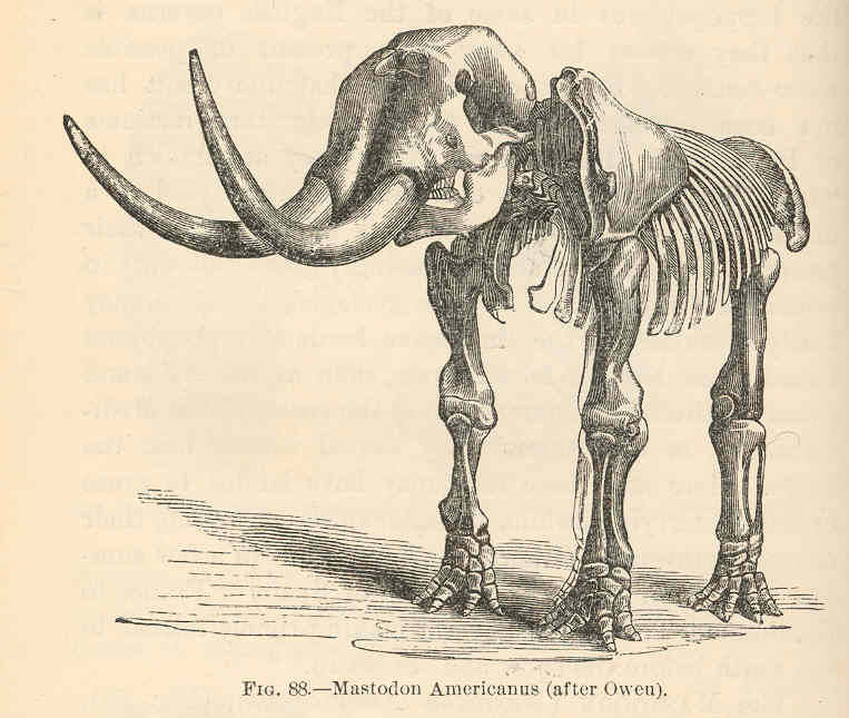
We know from bones and tracks found at Fossil Lake in the Fort Rock Basin that the Northern Great Basin sometimes had populations of Columbian mammoths (e.g., Mammuthus columbi) and ground sloths that were as long as ten feet and weighed as much as a ton (e.g., Paramylodon harlani). At the Paisley Caves in the Chewaucan Basin, one of the oldest archaeological sites in the Americas (see Figure 1), archaeologists found some of the youngest fossil remains of an extinct species of horses (Equus conversidens) and camels (Camelops hesternus and Hemiauchenia macrocephala) from North America, radiocarbon dated to between about 15,000 and 13,500 years ago. Researchers also recovered remains of extant bighorn sheep (Ovis canadensis), including one with human-made cut marks that is about 14,500 years old. Also at Paisley, archaeologists uncovered at least one bone fragment from a large felid, likely an American lion (Panthera atrox).
The analysis of ancient feces, or coprolites, at the Paisley Caves shows DNA and lipids that are characteristic of camels and American lions. The presence of these animal taxa at the caves matches with the paleoenvironmental studies that indicate that grasslands were more abundant throughout the region during the Bølling–Allerød. There is also evidence at Paisley Caves of mule deer (Odocoileus hemionus), pronghorn (Antilocapra americana), jackrabbits (Lepus californicus), and sage grouse (Centrocercus urophasianus) during this time.
By the onset of the Younger Dryas, about 12,900 years ago, most of the horses, camels, mammoths, and mastodons in the region had gone extinct, and the animal communities we now associate with the Northern Great Basin were established. For instance, archaeologists have found the remains of elk, bison, and mountain sheep in Younger Dryas deposits at the Connley and Cougar Mountain Caves in the Fort Rock Basin (see Figure 1). After that, bison only appear in the archaeological record of the Great Basin during wetter climatic periods, which is another indicator that the Ice Age was a relatively wet period in the region.
Another paleoenvironmental indicator present at both the Connley and Paisley Caves is the pika (Ochotona princeps). In the present era, pika only live at high elevations, and they are extremely heat sensitive, perishing if they are exposed to temperatures above 80°F for more than a few hours. During the Younger Dryas and the Bølling–Aller, however, pika lived at lower elevations near the valley floors, attesting to the differences in climate between then and now. The same caves that contain ancient faunal and floral remains also contain records of human activities during the Ice Age that are found only in a few other places in the Americas.
People in the Northern Great Basin During the Ice Age
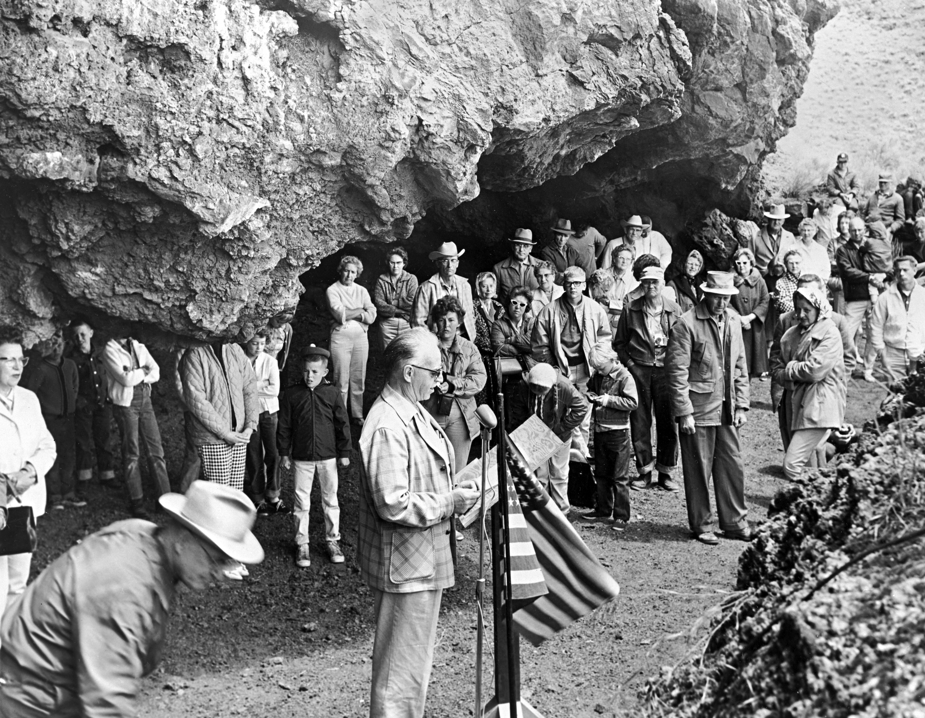
The Northern Great Basin is the homeland of the Klamath, Modoc, and Northern Paiute, who today are mostly members of the Klamath Tribes, the Burns Paiute Tribe, the Confederated Tribes of Warm Springs, the Fort McDermitt Paiute and Shoshone Tribe, and the Fort Bidwell Indian Community. What we know about the first peoples in the Northern Great Basin largely comes from the archaeological sites at the Paisley, Connley, and Cougar Mountain Caves. Rockshelter sites, which are protected from the elements and cycles of wet and dry climate conditions, preserved archaeological evidence of the technology and experiences of people during the Ice Age.
Archaeologists uncovered coprolites (dessicated, or dried out, feces) with human DNA and lipids dating back 14,200 years at the Paisley Caves, evidence that people coexisted with and probably hunted now-extinct megafauna such as horses and camels. Alongside the coprolites were obsidian tools used for cutting and scraping, the debris from making stone tools, a fragment of a basket weft, polished rocks used for processing meat and plants, and a tool made of bear bone likely used for scraping animal hides. Based on this evidence, we know that people stopped at Paisley Caves to do minor maintenance on their tools and possibly to process animals they had hunted.
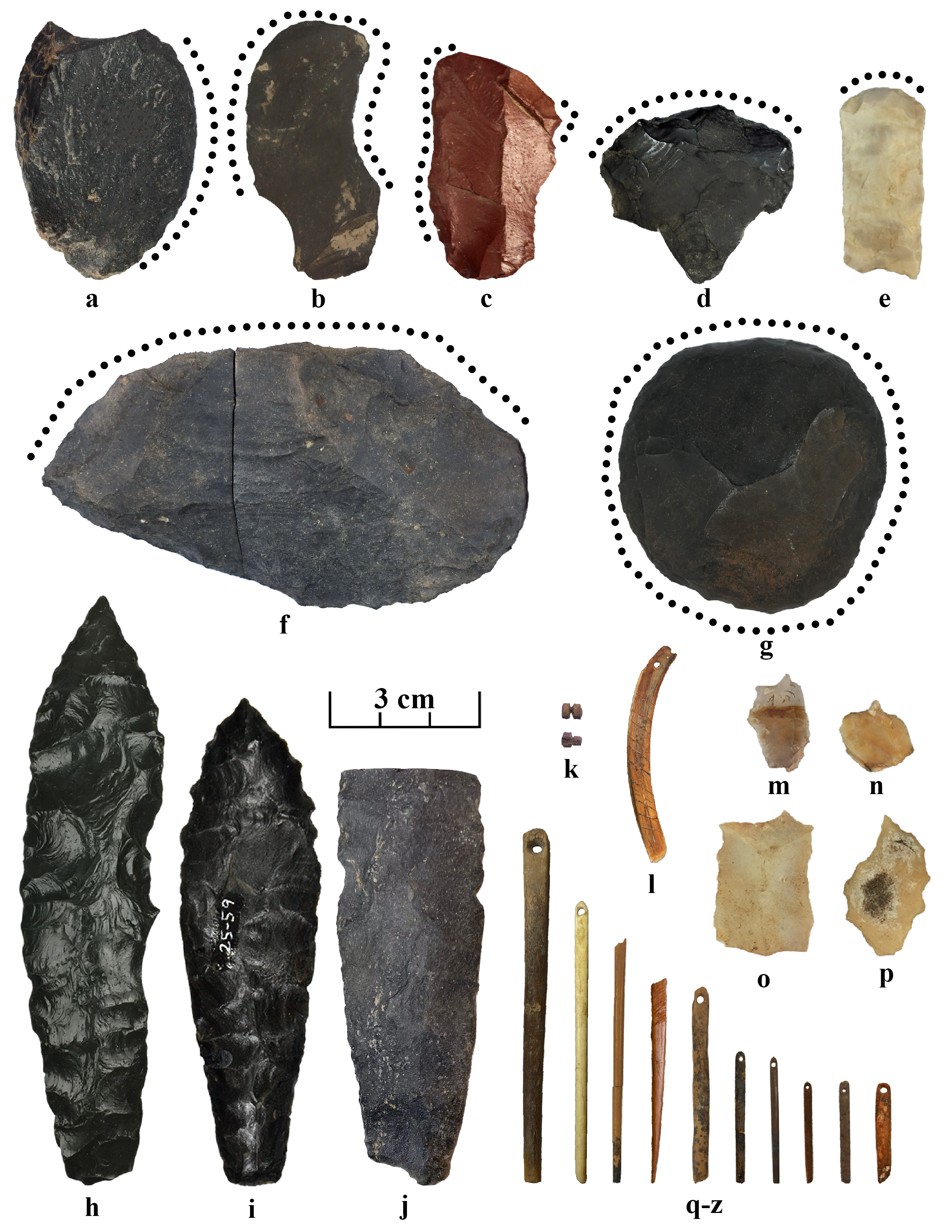
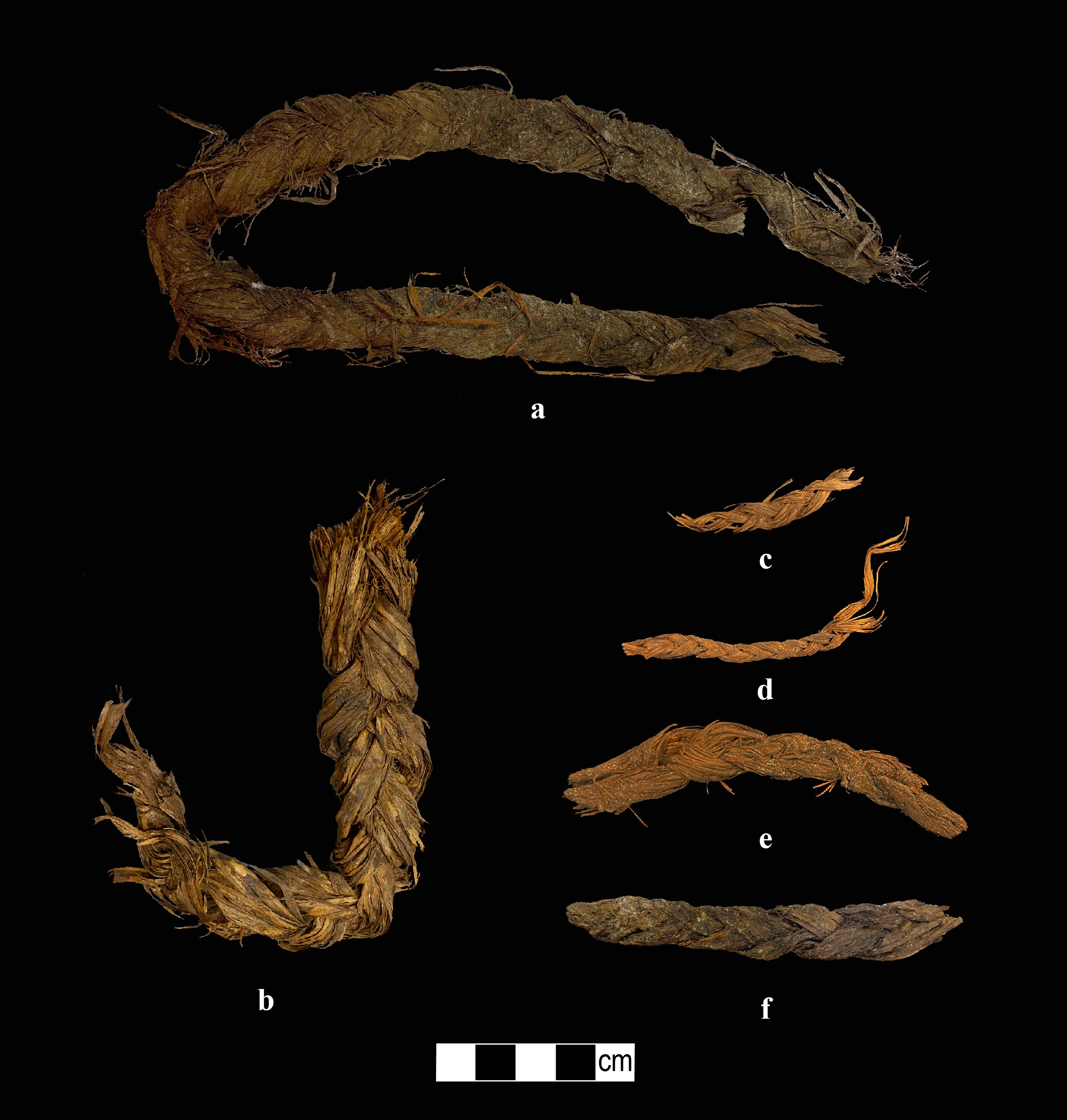
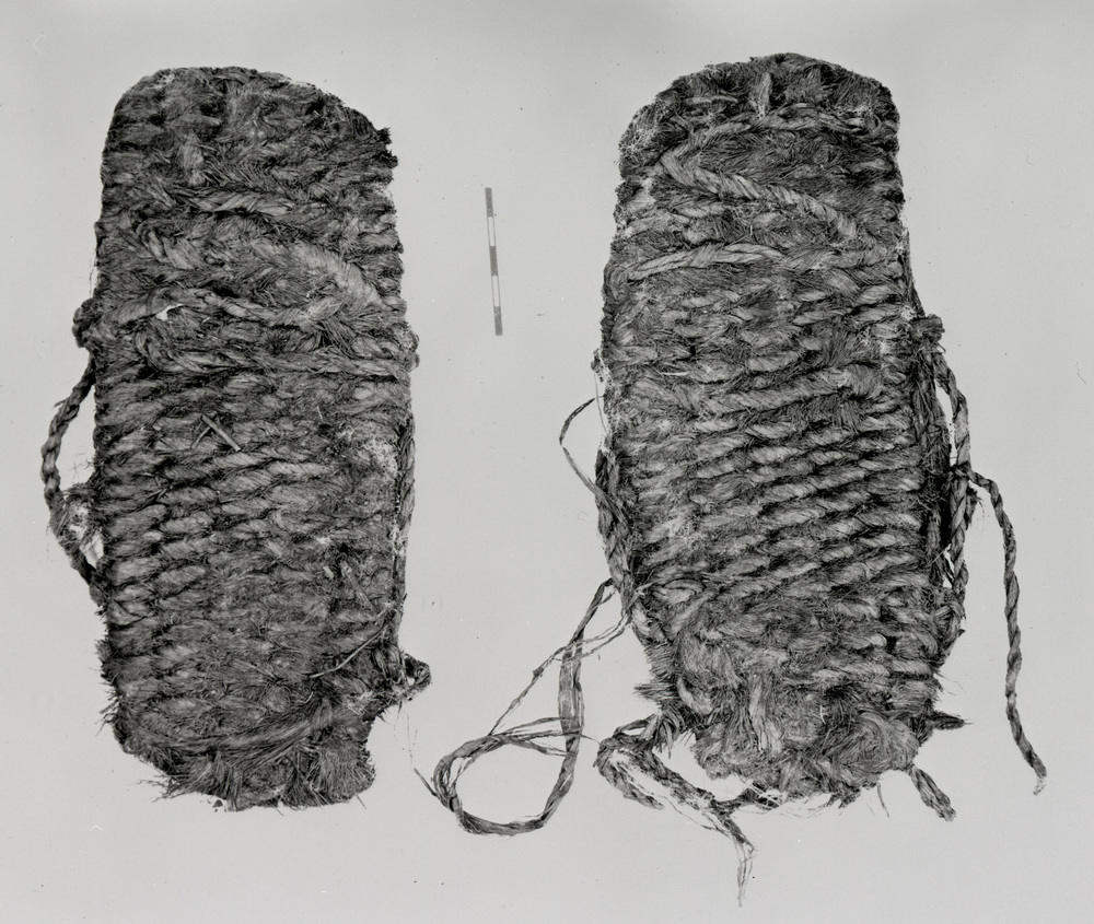
The Paisley, Connley, and Cougar Mountain Caves in Oregon and the Tule Lake rockshelter in California contain a style of spear/dart point called Haskett, delicate eyed bone needles, and a variety of other stone tools (Figure 3). At the Cougar Mountain and Paisley Caves, there are radiocarbon dated braided and twisted cordage—that is, fine rope—made from sagebrush bark dating to the Younger Dryas, which are some of the rarest items of this age anywhere in the Americas because there are few sites that preserve these delicate organics (Figure 4).
A well-preserved stratum in Paisley Cave 2, called the Botanical Lens, represents a 12,300-year-old floor of the cave, with evidence of cordage-making and the butchering and processing of a pronghorn and several rabbits. The Botanical Lens is so named because of the extraordinary preservation of organic materials, including small bits of tissue on some of the bones and concentrations of pronghorn hair with human-made cut ends.
At the Connley Caves, archaeologists found dense concentrations of scraper tools and eyed bone needles. It is probable that people used the caves as a place to process animal hides and make clothing to protect them during the winters. These events also likely served as important social and cultural gatherings, just as communal rabbit drives did for Paiutes into the twentieth century. Firepit features at the Connley and Paisley Caves, as well as coprolites from Paisley, contain a variety of small seeds, fruits, and leafy greens still used by Indigenous people today.
-
![Application of Ecological Site Information to Transformative Changes on Great Basin Sagebrush Rangelands.]()
-
![a-g: scrapers; h-j Haskett points; k-l possible bone and tooth adornment items; m-p graver tools used for making needles and other tasks; q-z bone needles.]()
Representative examples of tools found in Younger Dryas-aged (12,900-11,700 years ago) archaeological components at the Connley, Cougar Mountain and Paisley caves.
a-g: scrapers; h-j Haskett points; k-l possible bone and tooth adornment items; m-p graver tools used for making needles and other tasks; q-z bone needles. Courtesy Richard Rosencrance
-
![]()
Younger Dryas-aged (12,900 – 11,700 cal BP) cordage from Cougar Mountain (a, b, and f) and the Paisley caves (c-e).
Courtesy Richard Rosencrance
-
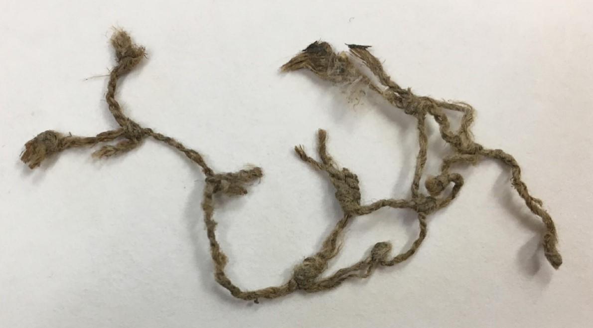
![]()
Dogbane net fragment, Paisley Caves, 2,345-2,180 years old.
Courtesy Museum of Natural and Cultural History, University of Oregon -
![]()
Northern Great Basin in Oregon, map.
Courtesy Oregon Conservation Strategy -
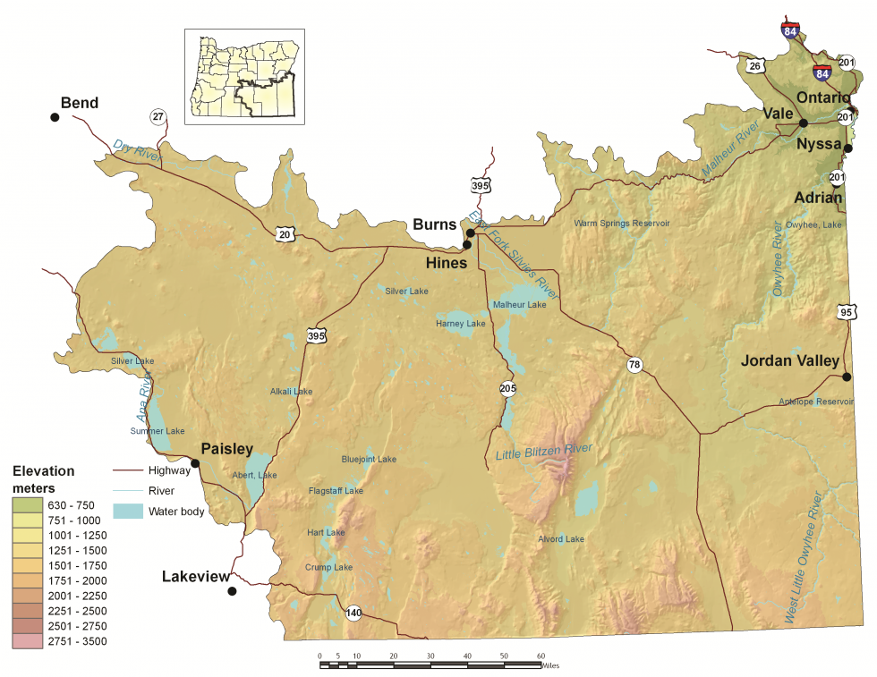
![Abert Rim, 1940]()
Abert Rim, 1940.
Abert Rim, 1940 Courtesy Oregon State Univ. Archives, P089:316
-
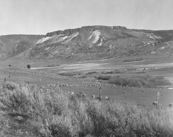
![]()
Pelicans and cormorants, Malheur Lake, 1919.
Courtesy Oregon Hist. Soc. Research Lib., OrgLot369_FinleyD0201
-
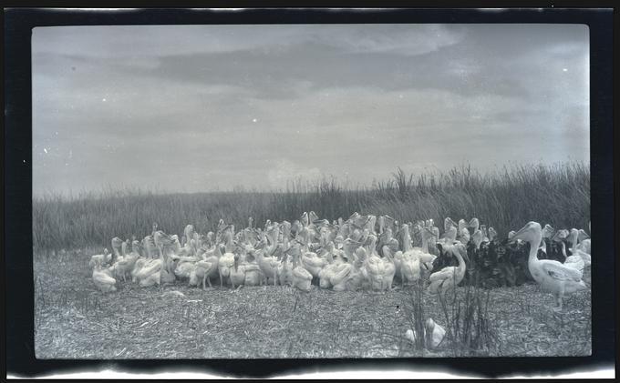
![]()
Alvord Ranch near the Steens, 1951.
Courtesy Oregon Hist. Soc. Research Lib., Journal, Al Monner, ba25001, pf474a
-
![]()
Borax Lake, with Steens Mountain in the back, 1941.
Courtesy Oregon Hist. Soc. Research Lib., Journal, Al Monner, 93272, pf474a
Related Entries
-
![Fort Rock Cave]()
Fort Rock Cave
Fort Rock Cave is located in a small volcanic butte approximately half …
-
![Fort Rock Sandals]()
Fort Rock Sandals
Fort Rock sandals are a distinctive type of ancient fiber footwear foun…
-
![Mastodons in Oregon]()
Mastodons in Oregon
The mastodon (Mammut americanum) has captured the American imagination …
-
![Paisley Caves]()
Paisley Caves
The Paisley Caves—more formally known as Paisley Five Mile Caves—in sou…
-
![Pleistocene Pluvial Lakes]()
Pleistocene Pluvial Lakes
During the Last Glacial Maximum, from about 24,000 to about 18,000 year…
Map This on the Oregon History WayFinder
The Oregon History Wayfinder is an interactive map that identifies significant places, people, and events in Oregon history.
Further Reading
Grayson, Donald. Giant Sloths and Sabertooth Cats: Extinct Mammals and the Archaeology of the Ice Age Great Basin. Salt Lake City: University of Utah Press, 2016.
Erlandson, Jon M., et al. "Eyed Bone Needles from a Younger Dryas Paleoindian Component at Tule Lake Rock Shelter, Northern California." American Antiquity 79.4 (January 2017): 776–781.
Gilbert, M. Thomas P., et al. "DNA from Pre-Clovis Human Coprolites in Oregon, North America." Science 320. 5877 (May 2008): 786–789.
Grayson, Donald K. "Holocene Bison in the Great Basin, western USA." The Holocene 16.6 (September 2006): 913–925.
Hockett, Bryan S., and Dennis L. Jenkins. "Identifying Stone Tool Cut Marks and the Pre-Clovis Occupation of the Paisley Caves." American Antiquity 78.4 (October 2013): 762–778.
Hockett, Bryan S., et al. "Late Pleistocene Subsistence in the Great Basin: Younger Dryas-aged Faunal Remains from the Botanical Lens, Paisley Cave 2, Oregon." Journal of Archaeological Science: Reports 13 (June 2017): 565–576.
Hudson, Adam M., et al. "Reconstructing Paleohydrology in the Northwest Great Basin since the Last Deglaciation using Paisley Caves Fish Remains (Oregon, U.S.A.)." Quaternary Science Reviews 262 (June 2021).
Jenkins, Dennis L., et al. "Geochronology, Archaeological Context, and DNA at the Paisley Caves." In Paleoamerican Odyssey, edited by Kelly E. Graf, Caroline V. Ketron, and Michael R. Waters, 485–510. College Station: Texas A&M University Press, 2015.
Jenkins, Dennis L., et al. "Younger Dryas Archaeology and Human Experience at the Paisley Caves in the Northern Great Basin." In Stone, Bones, and Profiles: Exploring Archaeological Context, Early American Hunter-Gatherers, and Bison., edited by Marcel Kornfeld and Bruce B. Huckell, 127–205. Boulder: University of Colorado, 2016.
Kennedy, Jaime L. "A Paleoethnobotanical Approach to 14,000 Years of Great Basin Prehistory: Assessing Human-environmental Interactions through the Analysis of Archaeological Plant Data at Two Oregon Rockshelters." Ph.D. dissertation, Department of Anthropology, University of Oregon, 2018.
McDonough, Katelyn N., et al. "Expanding Paleoindian Diet Breadth: Paleoethnobotany of Connley Cave 5, Oregon, USA." American Antiquity 87.2 (2022): 303-332.
Minckley, Thomas A., Cathy Whitlock, and Patrick J. Bartlein. "Vegetation, Fire, and Climate History of the Northwestern Great Basin During the Last 14,000 years." Quaternary Science Reviews 26 (2007): 2167–2184.
Rosencrance, Richard L., et al. "Reinvestigating Cougar Mountain Cave: New Perspectives on Stratigraphy, Chronology, and a Younger Dryas Occupation in the Northern Great Basin." American Antiquity 84.3 (2019): 559–573.
Rosencrance, Richard L., et al. "Dating and Analysis of Western Stemmed Toolkits from the Legacy Collection of Connley Cave 4, Oregon." PaleoAmerica 8.3 (2022): 264–284.
Shillito, Lisa-Marie, et al. "Pre-Clovis Occupation of the Americas Identified by Human Fecal Biomarkers in Coprolites from Paisley Caves, Oregon." Science Advances 6.29 (July 2020)
Waters, Michael R. "Late Pleistocene Exploration and Settlement of the Americas by Modern Humans." Science 365.6449 (July 2019)
Wriston, Teresa A., and Geoffrey M. Smith. "Late Pleistocene to Holocene History of Lake Warner and its Prehistoric Occupations, Warner Valley, Oregon (USA)." Quaternary Research 88.3 (2017): 491–513.