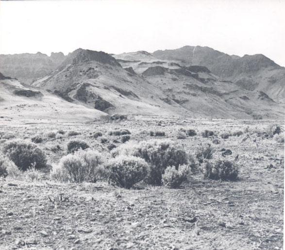
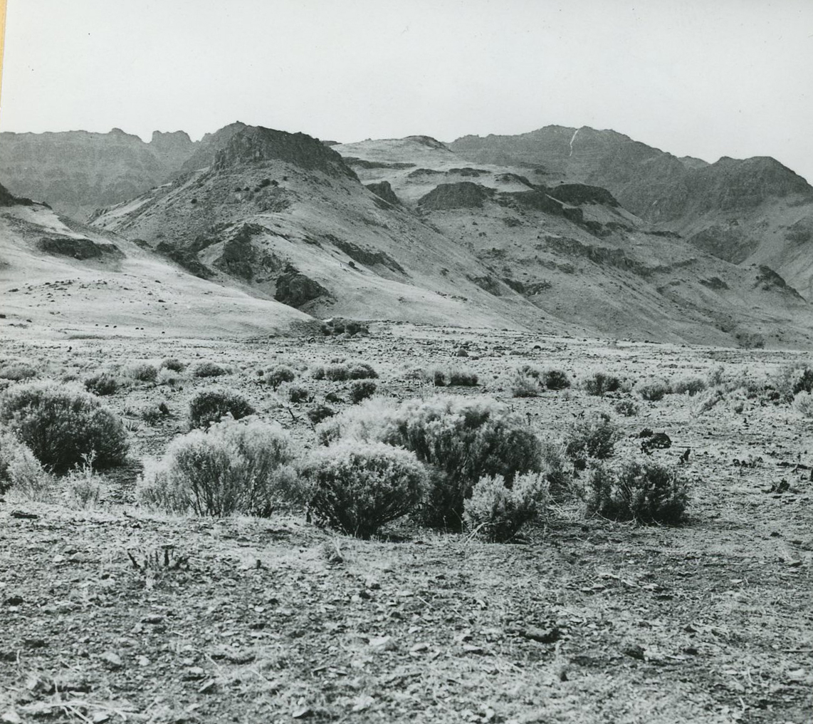
Located in Oregon’s High Desert, Burns is the county seat of Harney County, the largest county (in physical size) in Oregon. The town is thirty miles north of the Malheur Wildlife Refuge and Malheur Lake in the Harney Basin, near Steens Mountain and the Steens Mountain Wilderness area, and had a population of 2,730 as of 2020. With its proximity to areas of significant natural beauty, Burns is a launching point for outdoor recreational pursuits such as bird watching, hiking, hunting, fishing, and camping.
The area around Burns is the traditional homeland of the Wadatika Band of the Northern Paiute, who lived off game and plants harvested at such places as Malheur Lake. In 1872, President Ulysses S. Grant signed an executive order establishing the 1.8-million-acre Malheur Indian Reservation for “all the roving and straggling bands in eastern and southeastern Oregon.” Mounting pressure from white resettlers, however, prompted the federal government to redraw the reservation boundaries, opening the north shores of Malheur Lake to resettlement and allowing resettlers to graze cattle on reservation land. The Paiutes abandoned the reservation during the Bannock War of 1878 and took shelter on Steens Mountain. After the war ended, the reservation was closed and many captive Paiutes were relocated to the Yakama and Warm Springs Reservations. Some Paiutes reconvened on reservation allotments near Burns in 1897.
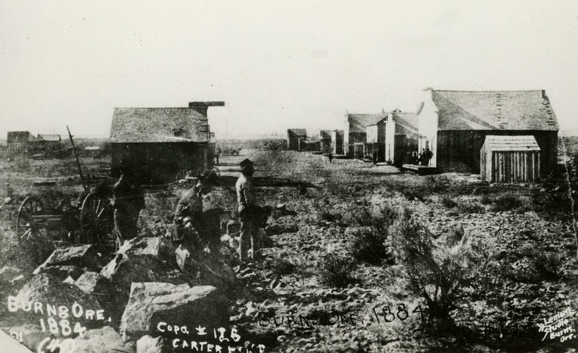
White resettlement in the Harney Basin increased as EuroAmericans found that the grass-filled countryside was well suited to grazing cattle. The tiny town of Egan sprang up in 1882, where George McGowan opened a general merchandise store, while a rival merchant, P.F. Stenger, opened a store two miles away at present-day Burns. McGowan and Stenger determined that the location of Stenger’s store was best suited for their mutual efforts, so they joined forces and Egan became a ghost town. McGowan called the new town Burns in celebration of Scottish poet Robert Burns.
Burns grew quickly as resettlers moved into the Harney Basin during the 1880s. A post office was established in 1883, and the Harney Valley Items began publishing in 1885, followed two years later by the Eastern Oregon Herald. By 1888, Burns had a blacksmith shop, a livery barn, a harness and saddle store, a drug store, a hardware store, a saloon, a jewelry store, and a sawmill, in addition to McGowan's hardware store and Stenger's general store. By 1890, the census recorded 264 people living in Burns. Many of the stone structures built during the first decades of the town still stand, including the Brown Building (1896) and the Odd Fellows (1909) and Masonic (1910) Halls.
The Oregon legislature split Harney County from Grant County in 1889. Burns lobbied hard against the town of Harney to become the county seat, and won the honor by a small majority in a county election. Burns organized its city government in 1891 and elected Captain Harrison Kelley as mayor.
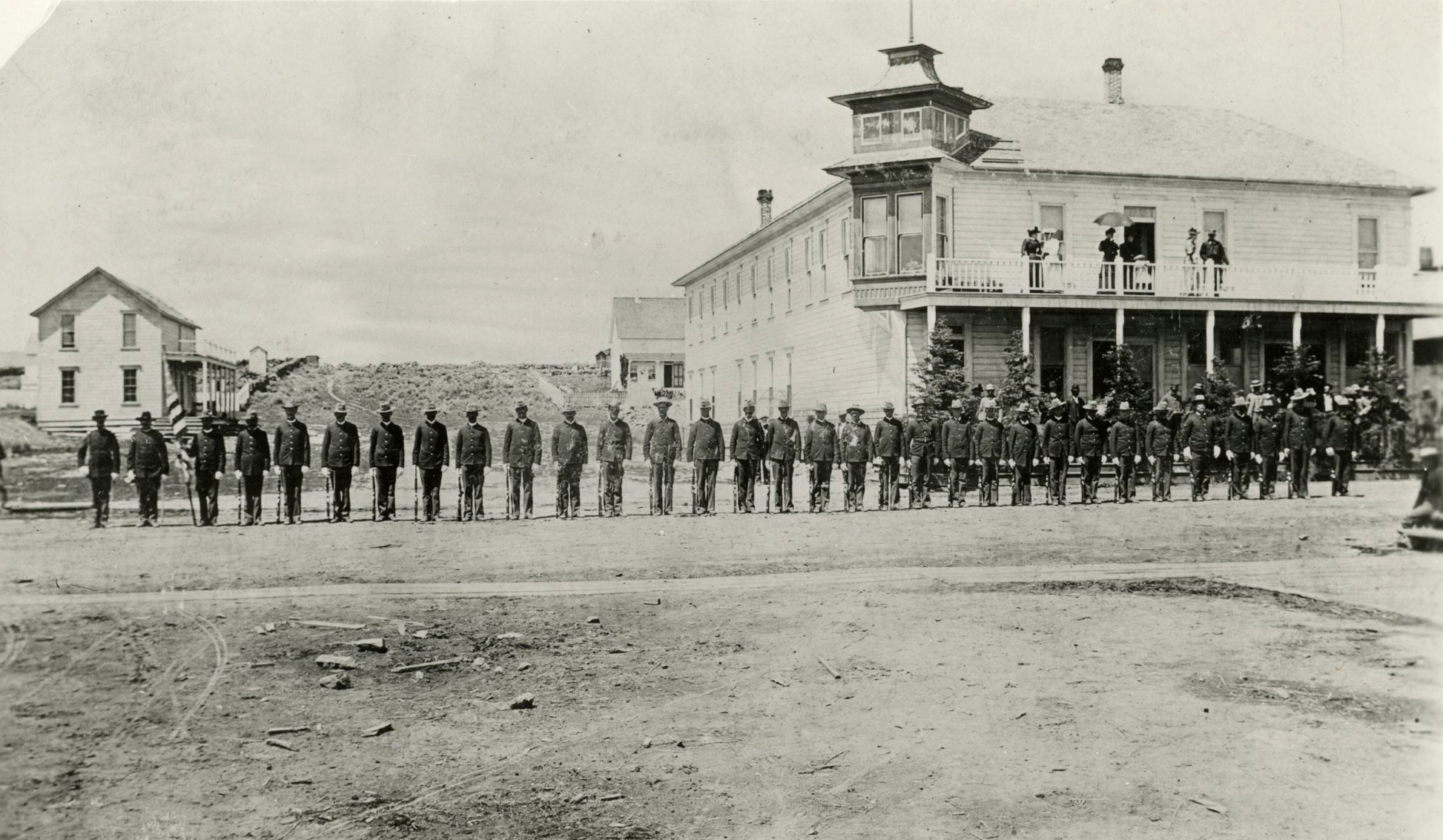
Burns saw a steady increase in population throughout the 1890s, nearly doubling to 547 residents in the 1900 census. By 1902, five hotels operated in the town, along with three churches, five saloons, a public school, and a business college. The Ladies Afternoon Club formed the genesis of the Burns library in 1903 (now the Harney County Library system).
Timber harvesting began in earnest near Burns in the 1920s, when the Hines Lumber Company acquired timber rights from the U.S. Forest Service to log in the Blue Mountains. The company paid for the construction of a railroad that linked Burns with Seneca, fifty miles north of Burns, where the company focused its timber efforts. The Hines Company, which constructed the company town of Hines near Burns, operated the town’s mill until 1968. The population of Burns increased at a slow but steady pace from 1890 until 1980, when it peaked at 3,579 people in 1980.
The U.S. government officially recognized the Burns Paiute Tribe in 1972. The Burns Paiute Reservation was established on 770 acres north of Burns, and the tribe owns nearly 14,000 acres in reservation and trust land throughout Harney County. The tribe opened the Old Camp Casino near Burns in 1998. The casino was closed in 2012 because of safety concerns regarding the building’s structure, and the tribe plans to eventually replace it with a new building.
Burns received international attention in January and February 2016 when the Citizens of Constitutional Freedom, an armed private militia led by activist Ammon Bundy, occupied the Malheur Wildlife Refuge for forty-one days. Local residents nearly unanimously agreed that they wanted the militants to leave the Refuge, although many expressed sympathy with the complaints against the federal government made by the group. The Burns Paiute Tribe called on the protestors to leave, stating that their presence had displaced federal authorities charged with protecting traditional religious and archaeological sites.
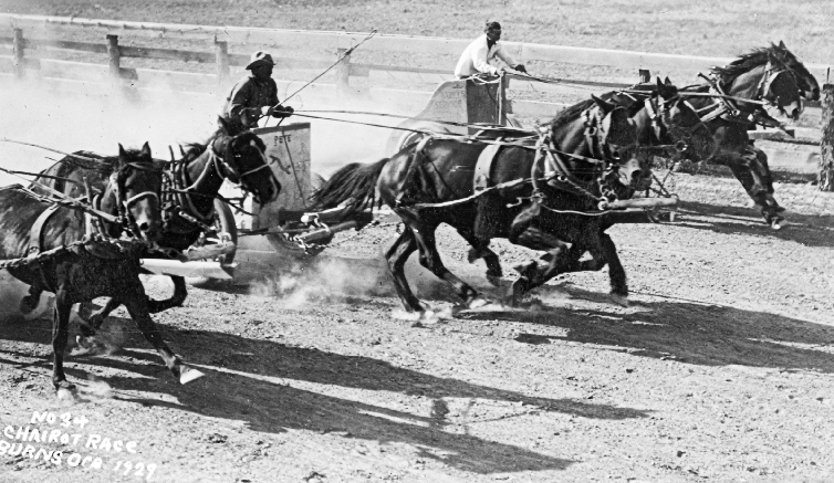
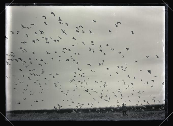
Tourism, ranching, sheep raising, and timber drive the local economy. Each April, the town hosts the John Scharff Migratory Bird Festival and Art Show, when birders witness the migration of birds through the Malheur Wildlife Refuge. The Country Music Jamboree, hosted by the High Desert Fiddlers, is held each June, and the Harney County Fair and Rodeo is in September. The Burns Times-Herald is now the only newspaper in town. It is owned by five staff members who purchased the paper in 2006, the first staff buyout of a newspaper in Oregon.
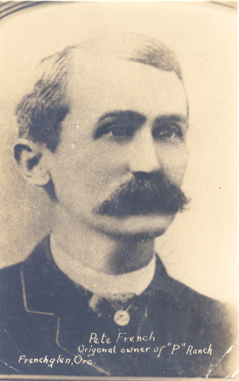
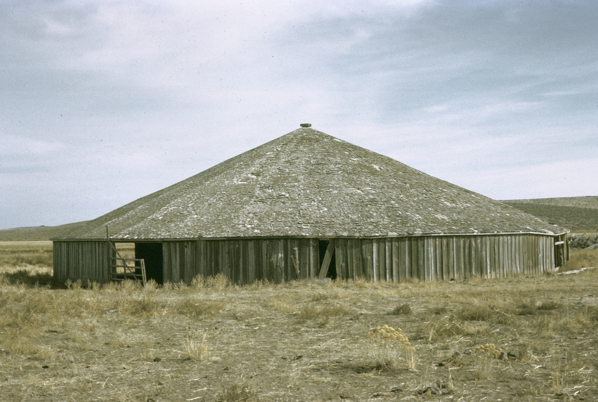
The Harney County Historical Museum and the Harney County Library maintain a substantial western history and oral history collection related to the resettlement of Harney County. Several buildings in or near Burns are on the National Register of Historic Places, including the Allison Ranger Station, the Double-O Ranch, the Pete French Round Barn, the P Ranch, and the Sod House Ranch.
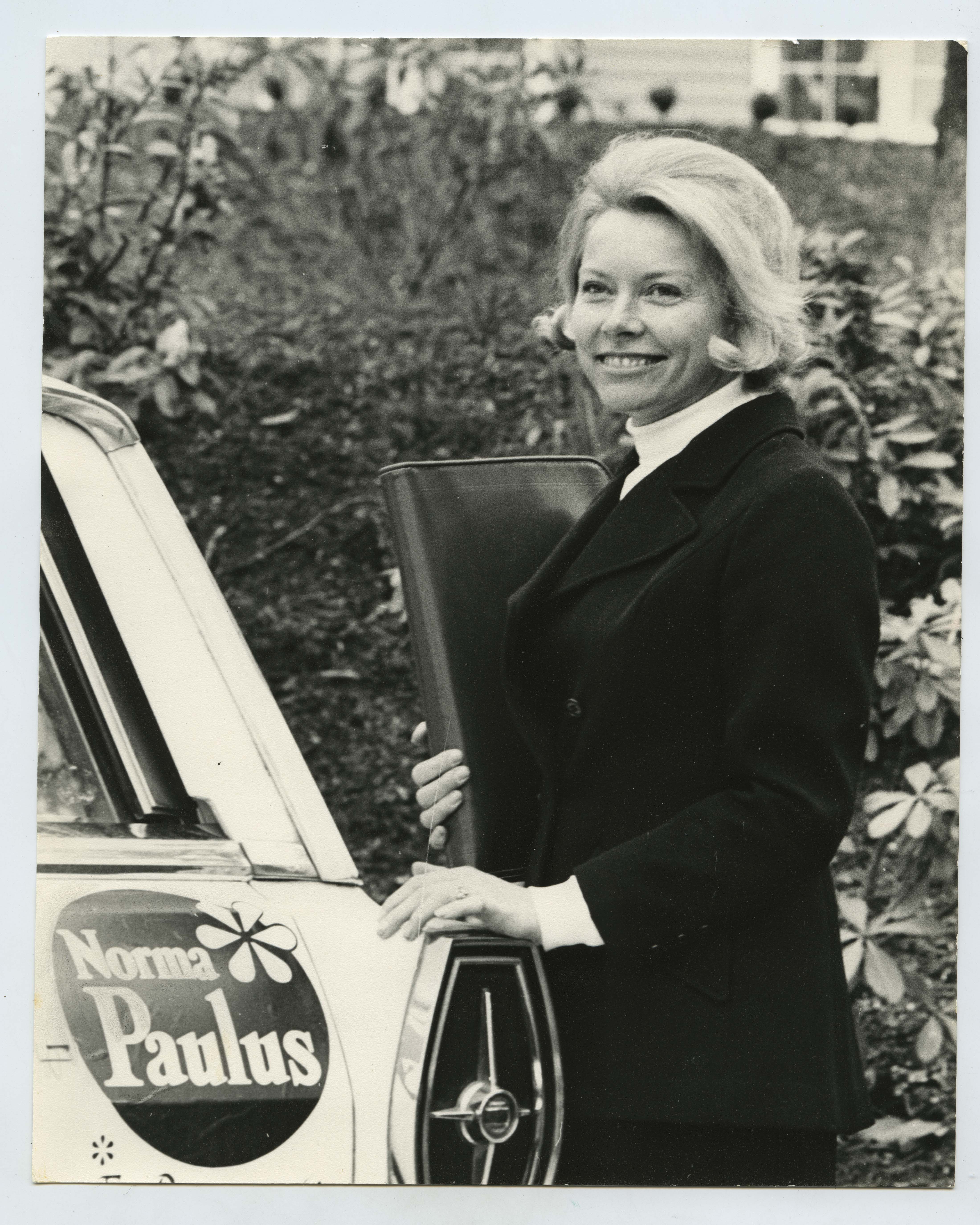
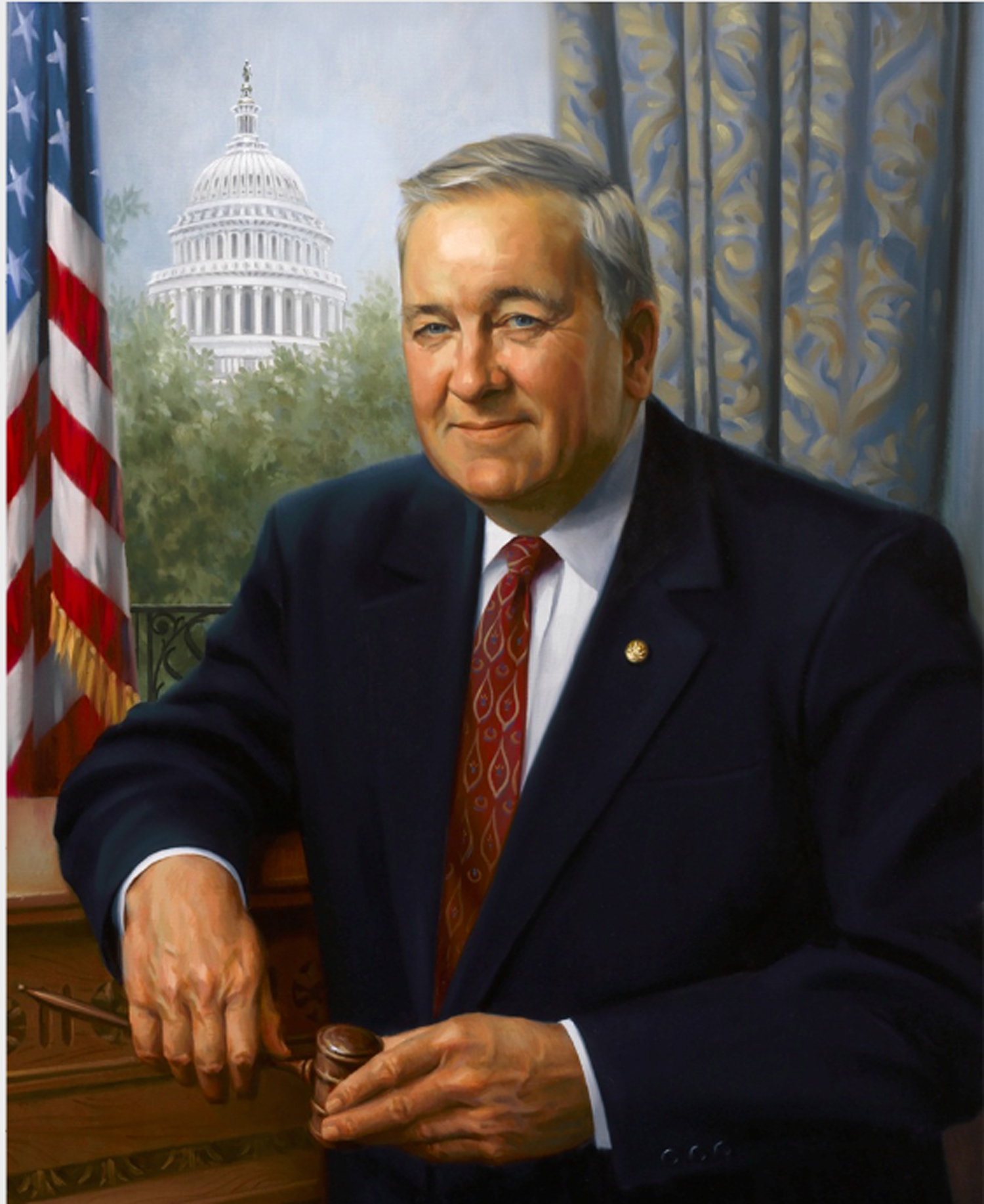
Former residents of Burns include Kellen Clemens, National Football League quarterback; Norma Paulus, Oregon Secretary of State (1976-1984) and the first woman elected to statewide office in Oregon; and Robert Smith, U.S. congressman from Oregon’s Second District (1983-1995, 1997-1999).
-
![]()
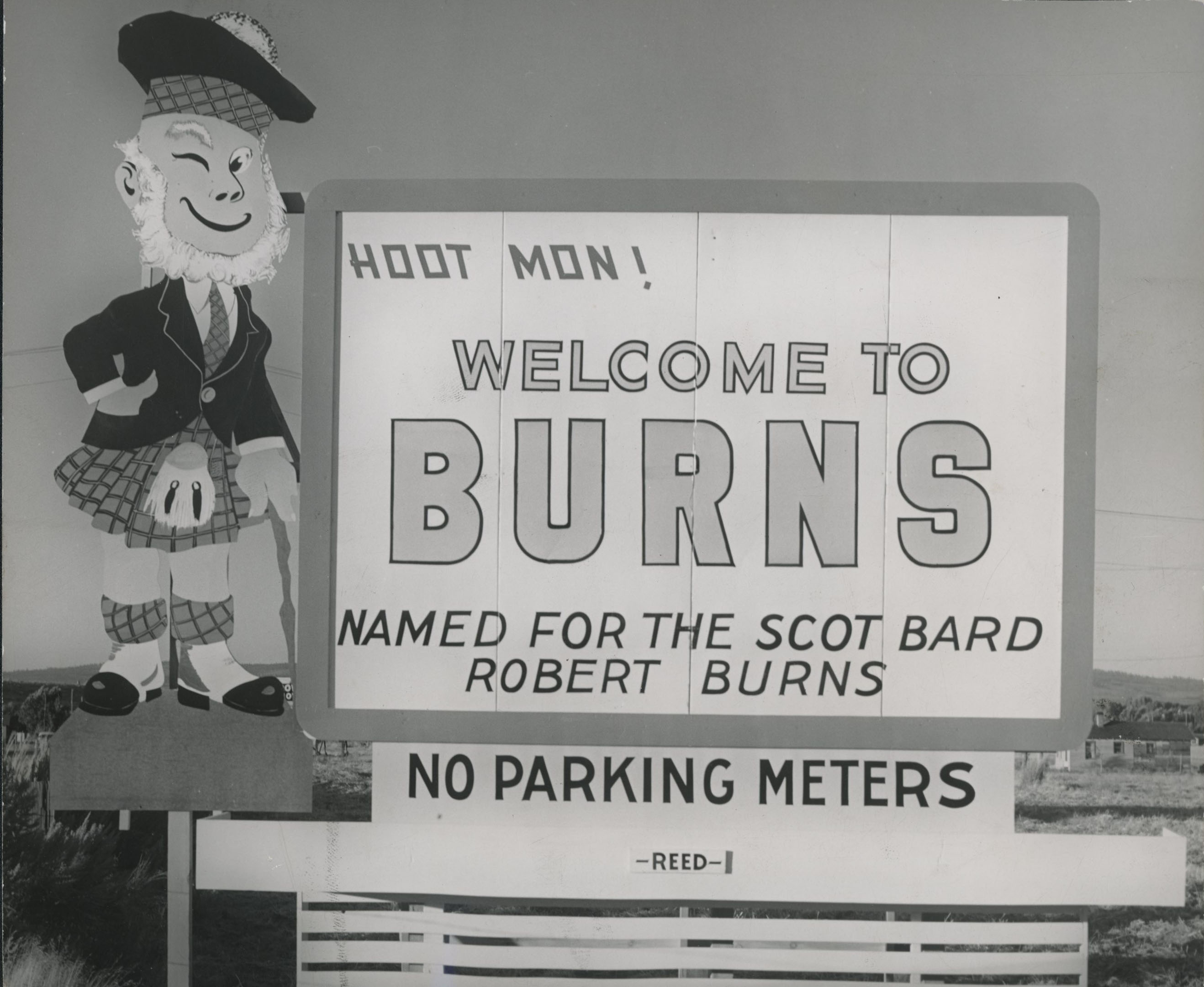
Burns, Oregon, welcome sign, 1955.
Courtesy Oregon Hist. Soc. Research Lib., Orhi105517
-
![]()
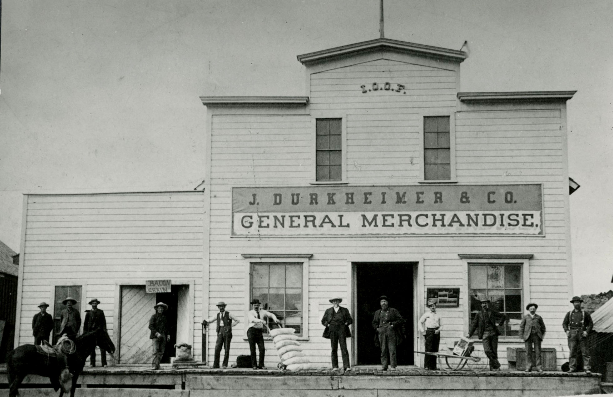
Mayor Julius Durkheimer's store (he stands at center with hand truck), Burns, c.1890.
Courtesy Oregon Hist. Soc. Research Lib., bc004886
-
![Owned by Thomas Stepgens and Scotty Bailey, possible inspiration for Mutt and Jeff comic]()
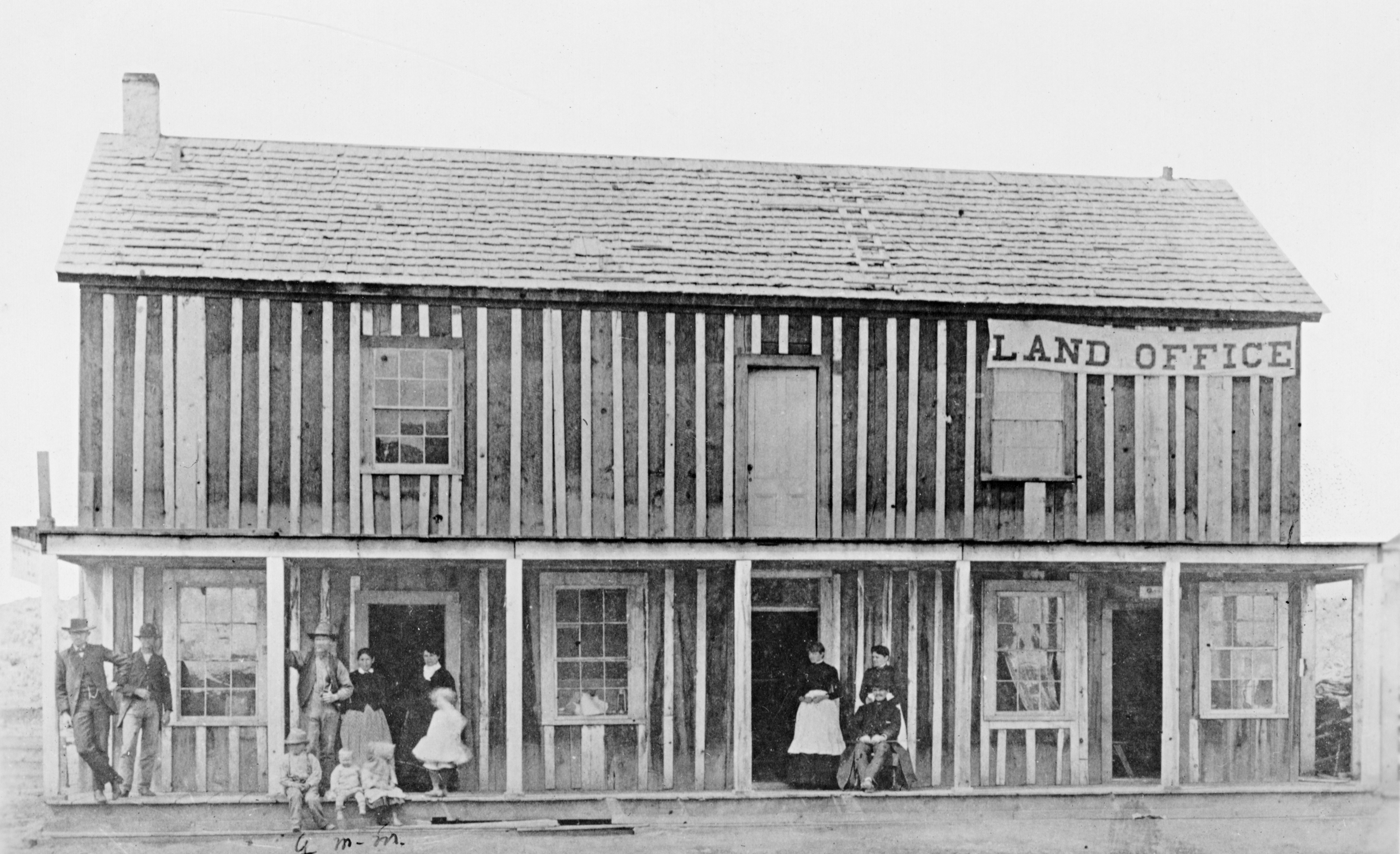
Burns Hotel and Land Office.
Owned by Thomas Stepgens and Scotty Bailey, possible inspiration for Mutt and Jeff comic Courtesy Oregon Hist. Soc. Research Lib., Orhi4131
-
![Courtesy Oregon Hist. Soc. Research Lib., 26236]()
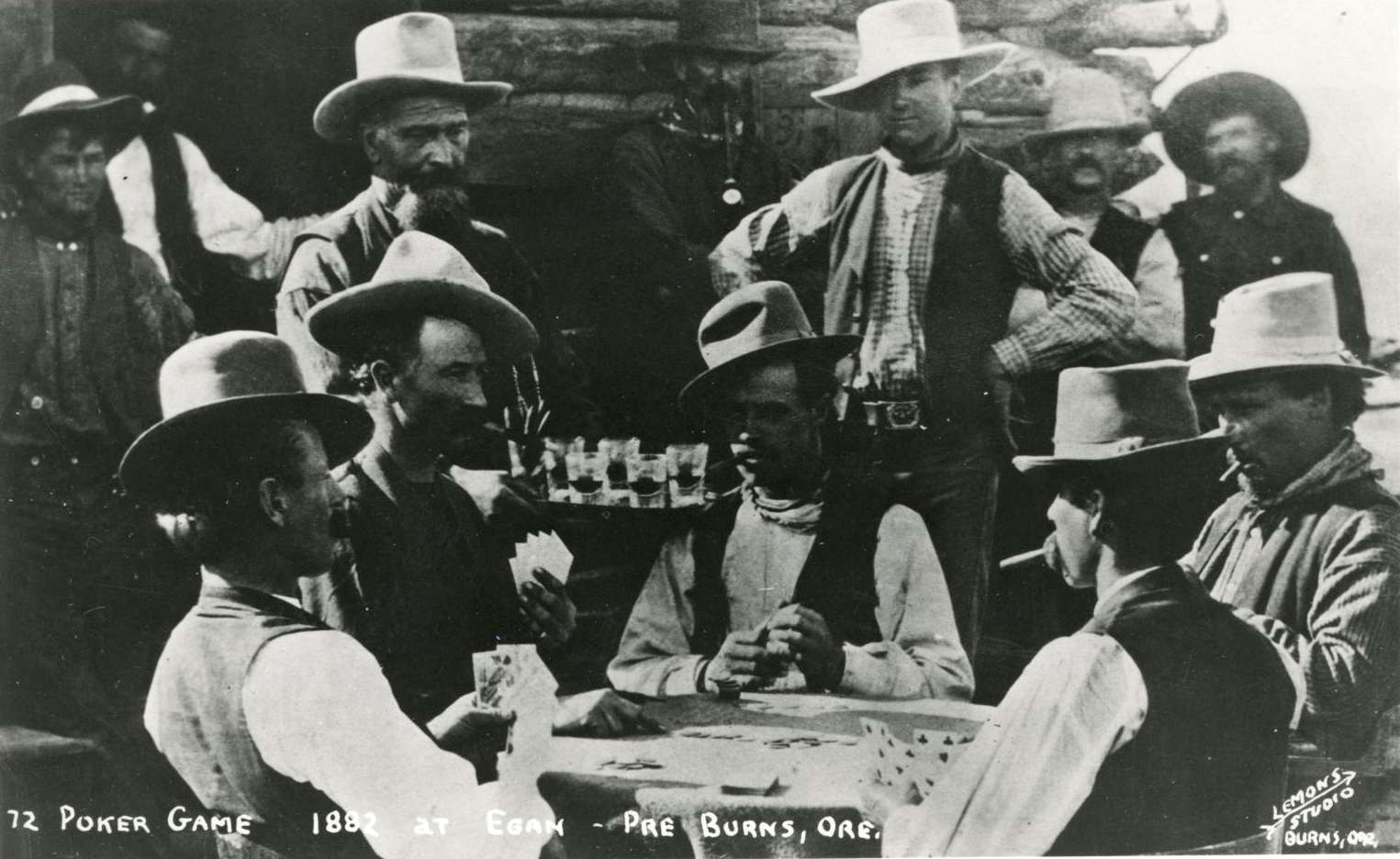
Poker game in Egan, Oregon, c. 1882.
Courtesy Oregon Hist. Soc. Research Lib., 26236 Courtesy Oregon Hist. Soc. Research Lib., 26236
-
![Courtesy Oregon Hist. Soc. Research Lib., Orhi4130]()
Horace Dillers (man on rock) published the first paper in Burns, 1884.
Courtesy Oregon Hist. Soc. Research Lib., Orhi4130 Courtesy Oregon Hist. Soc. Research Lib., Orhi4130
-
![Courtesy Oregon Hist. Soc. Research Lib., 4128]()
The Burns militia, 1890s.
Courtesy Oregon Hist. Soc. Research Lib., 4128 Courtesy Oregon Hist. Soc. Research Lib., 4128
-
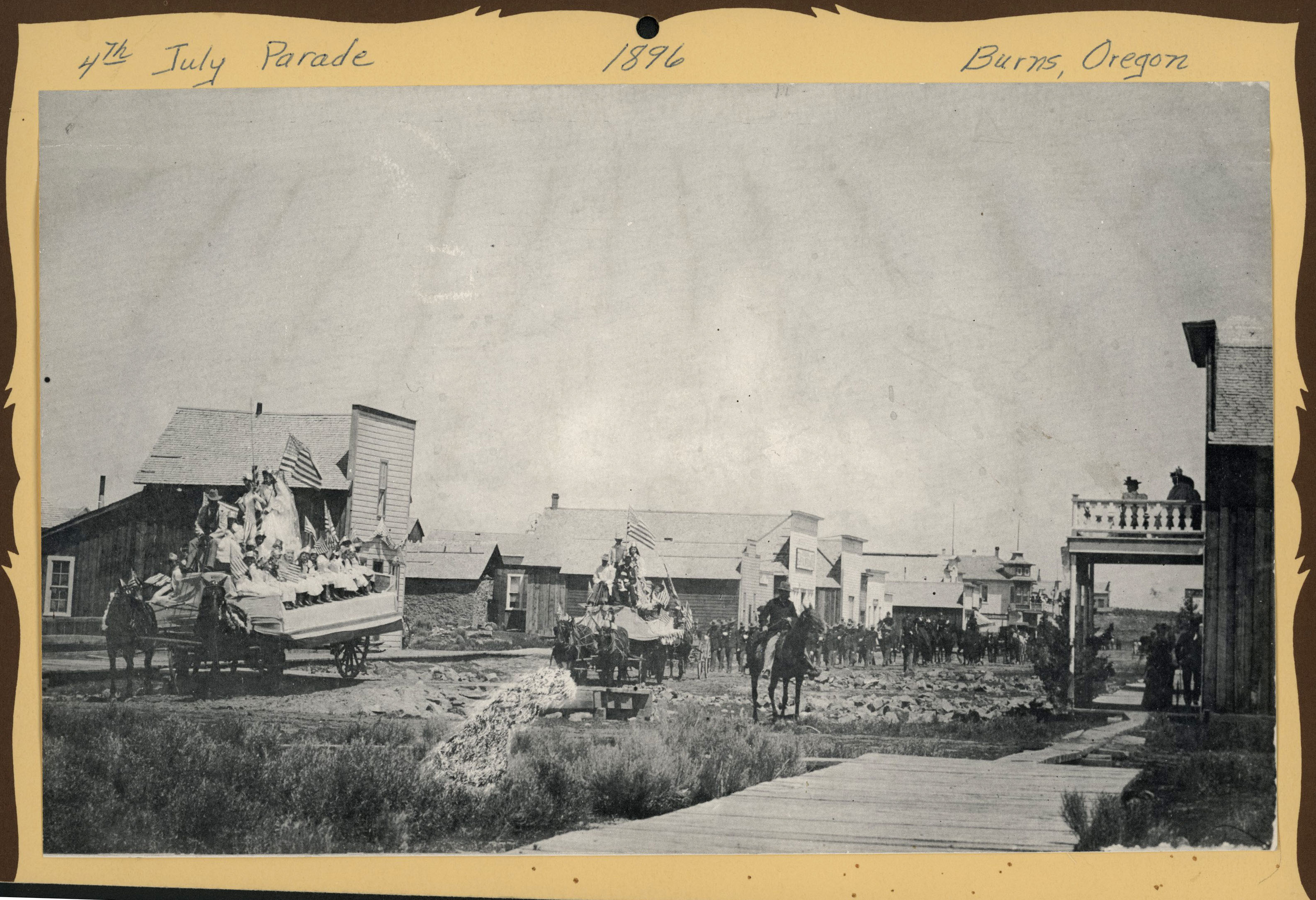
![Courtesy Oregon Hist. Soc. Research Lib., 52477]()
Fourth of July parade, Burns, 1896.
Courtesy Oregon Hist. Soc. Research Lib., 52477 Courtesy Oregon Hist. Soc. Research Lib., 52477
-
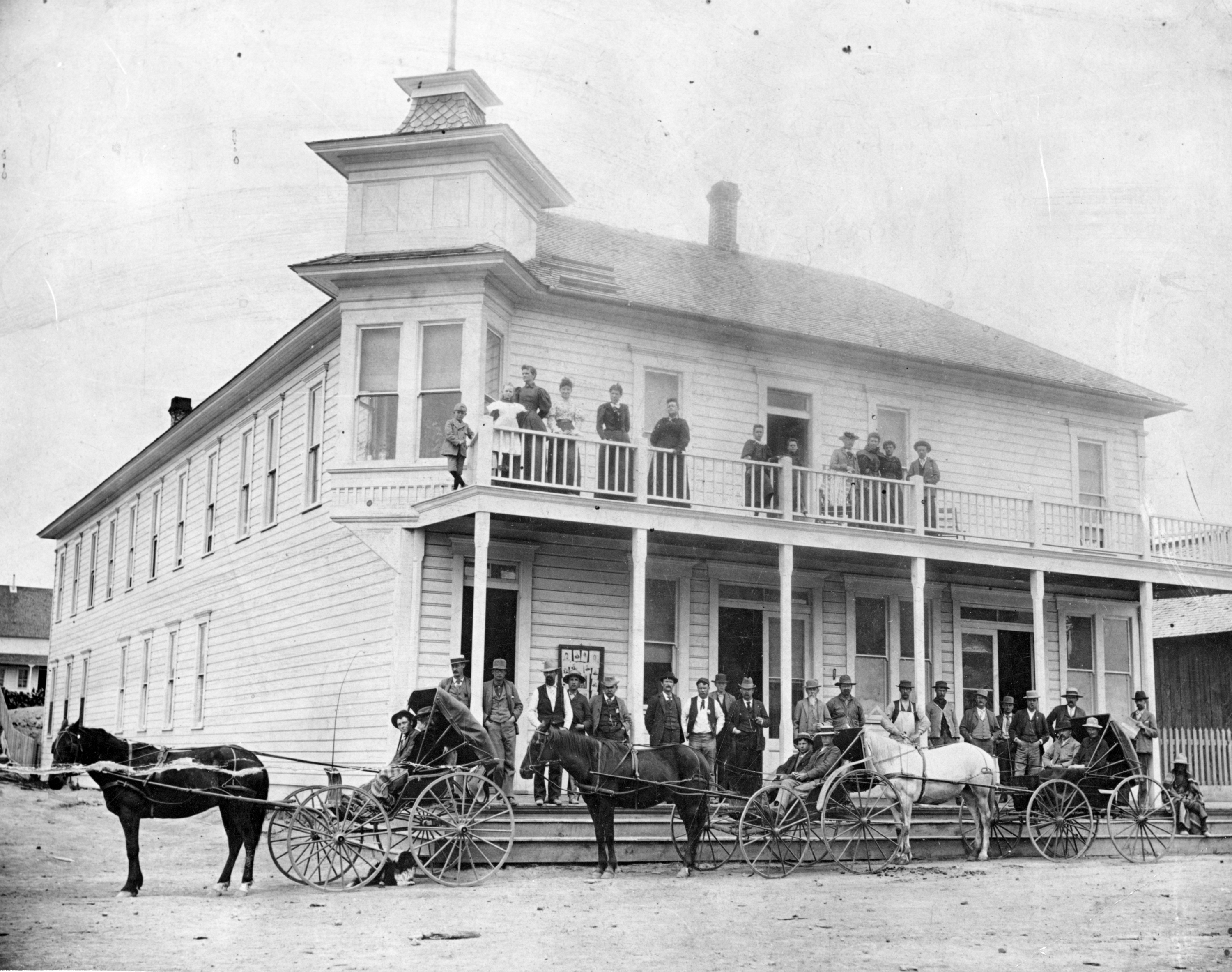
![Courtesy Oregon Hist. Soc. Research Lib., Orhi44237]()
Burns Hotel, 1900.
Courtesy Oregon Hist. Soc. Research Lib., Orhi44237 Courtesy Oregon Hist. Soc. Research Lib., Orhi44237
-
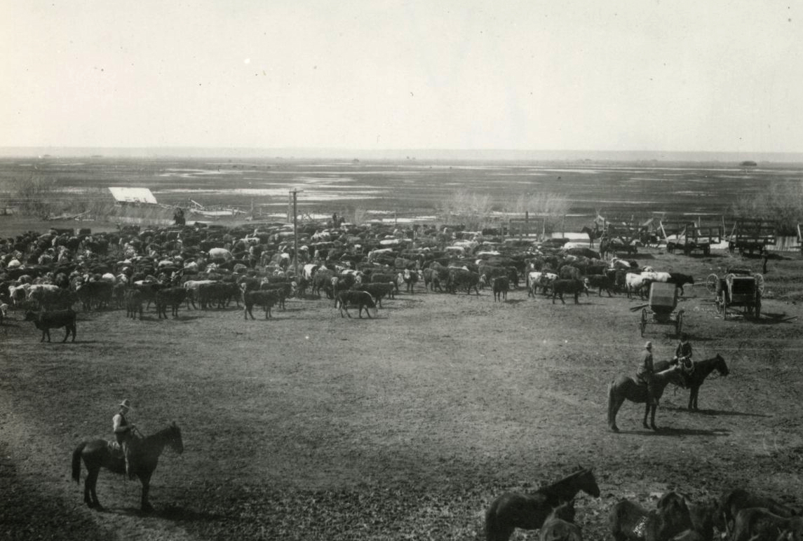
![Courtesy Oregon Hist. Soc. Research Lib., Orhi4400]()
Cattle and cowboys on the Hanley "Bell A" Ranch in Harney County near Burns, c.1910.
Courtesy Oregon Hist. Soc. Research Lib., Orhi4400 Courtesy Oregon Hist. Soc. Research Lib., Orhi4400
-
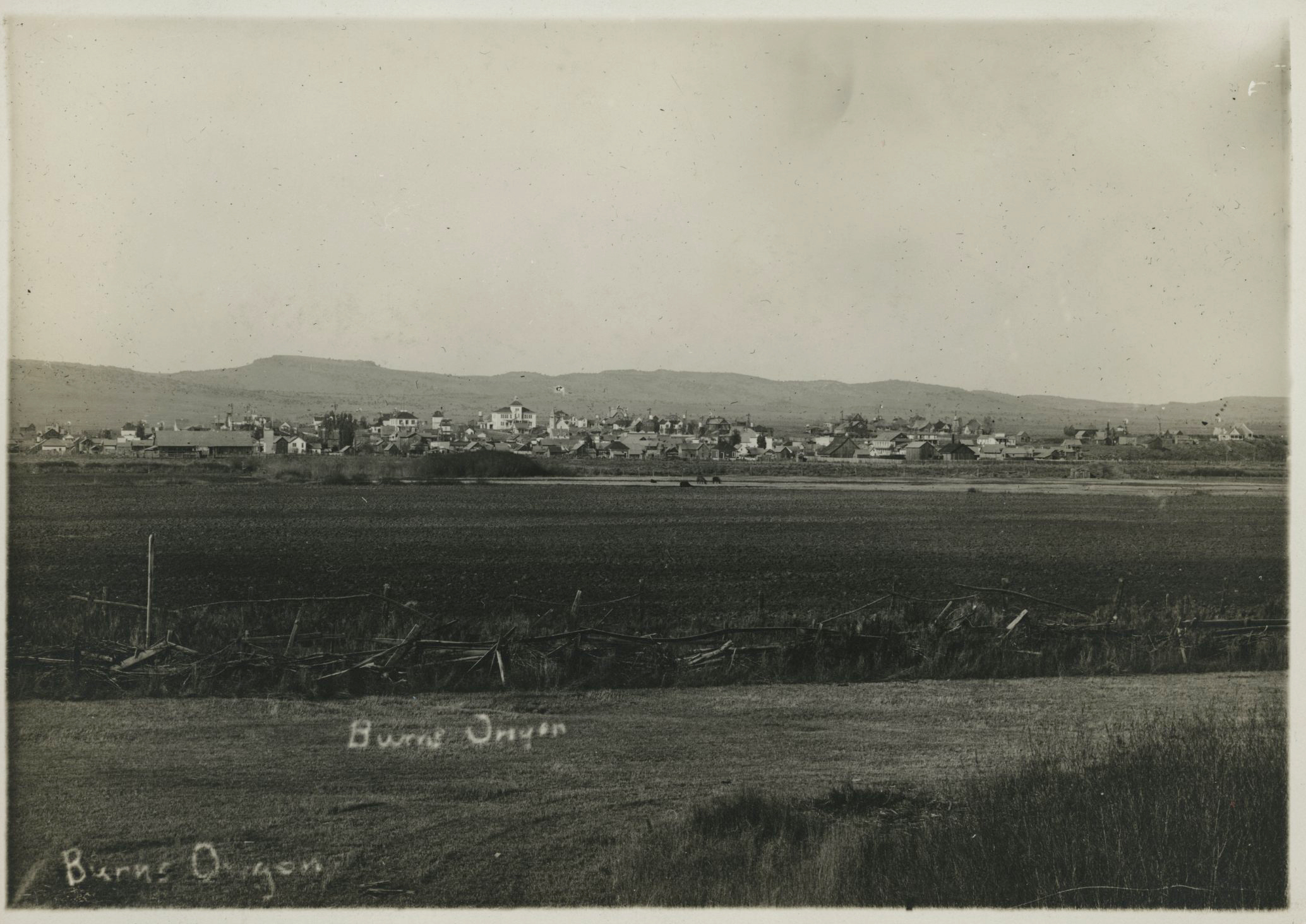
![Courtesy Oregon Hist. Soc. Research Lib., bc004891]()
Burns, Oregon.
Courtesy Oregon Hist. Soc. Research Lib., bc004891 Courtesy Oregon Hist. Soc. Research Lib., bc004891
-
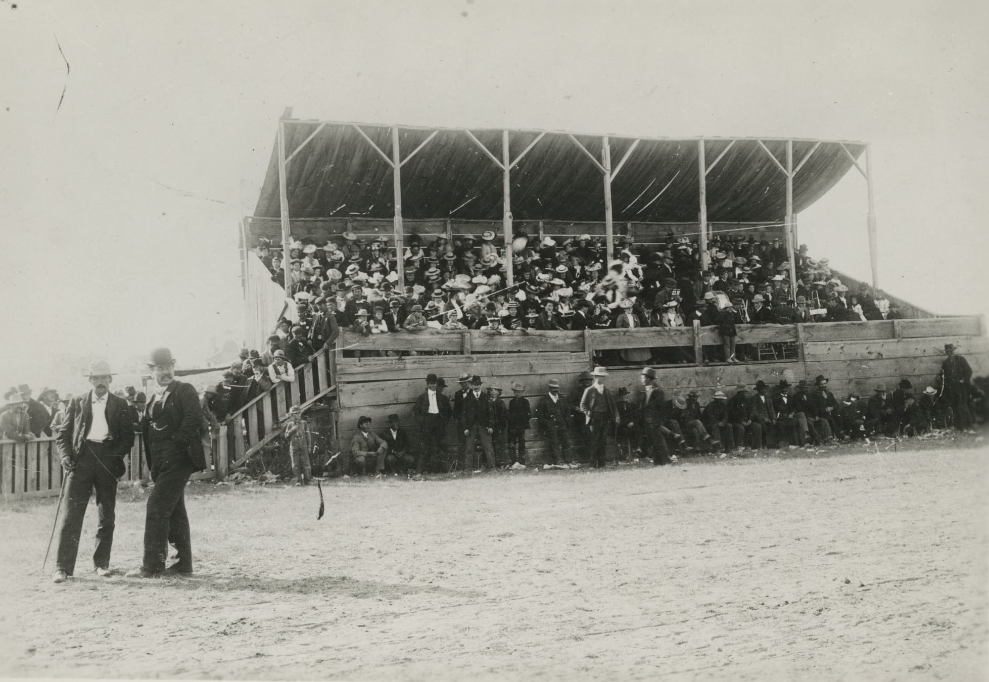
![Courtesy Oregon Hist. Soc. Research Lib., Orhi4129]()
Burns fairgrounds (man in derby is Lee Caldwell), 1910.
Courtesy Oregon Hist. Soc. Research Lib., Orhi4129 Courtesy Oregon Hist. Soc. Research Lib., Orhi4129
-
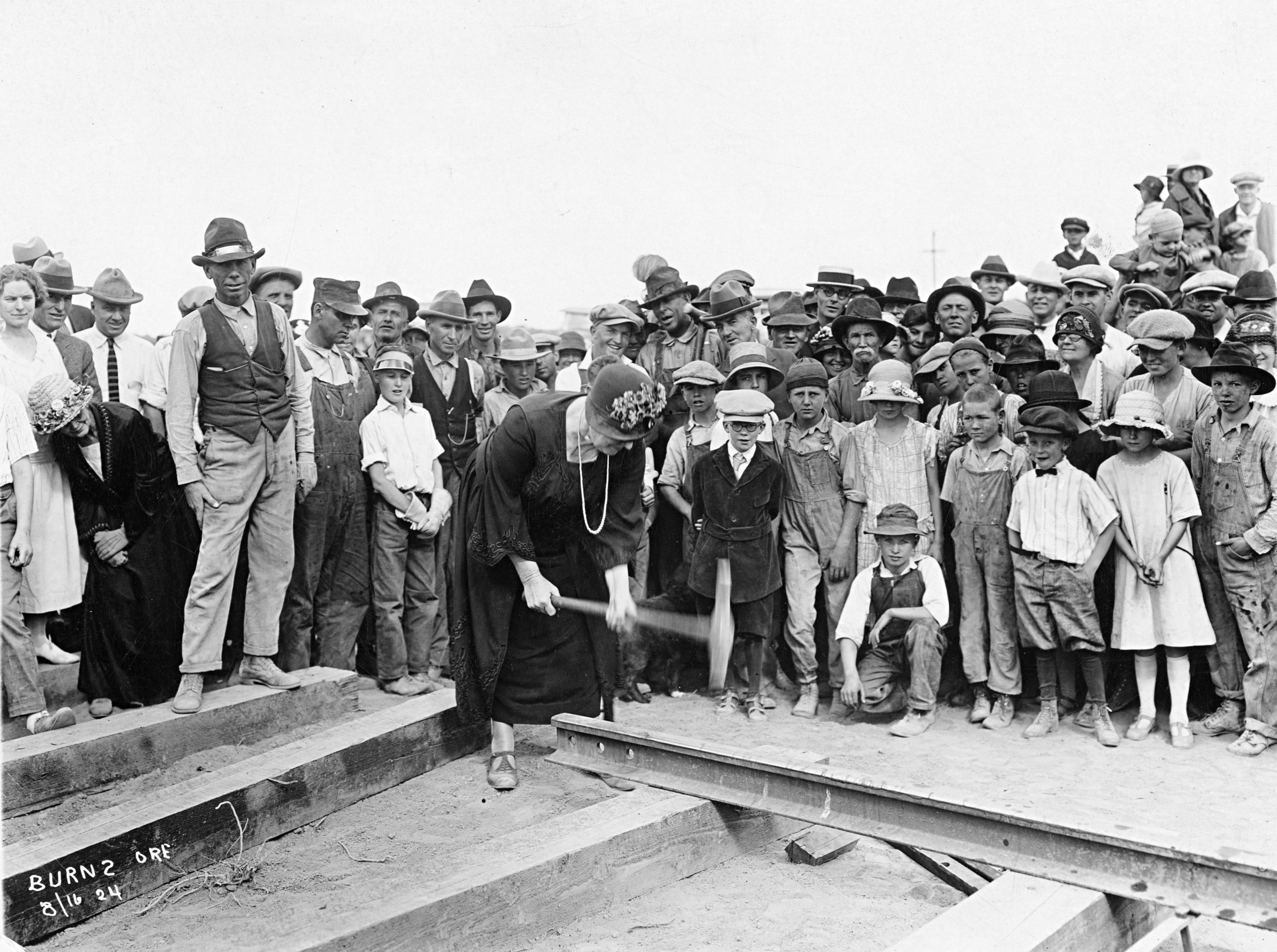
![Courtesy Oregon Hist. Soc. Research Lib., Orhi88262]()
Railroad spike ceremony for UP-Oregon Short Line, Burns, 1924.
Courtesy Oregon Hist. Soc. Research Lib., Orhi88262 Courtesy Oregon Hist. Soc. Research Lib., Orhi88262
-
![Courtesy Oregon Hist. Soc. Research Lib., bb002962]()
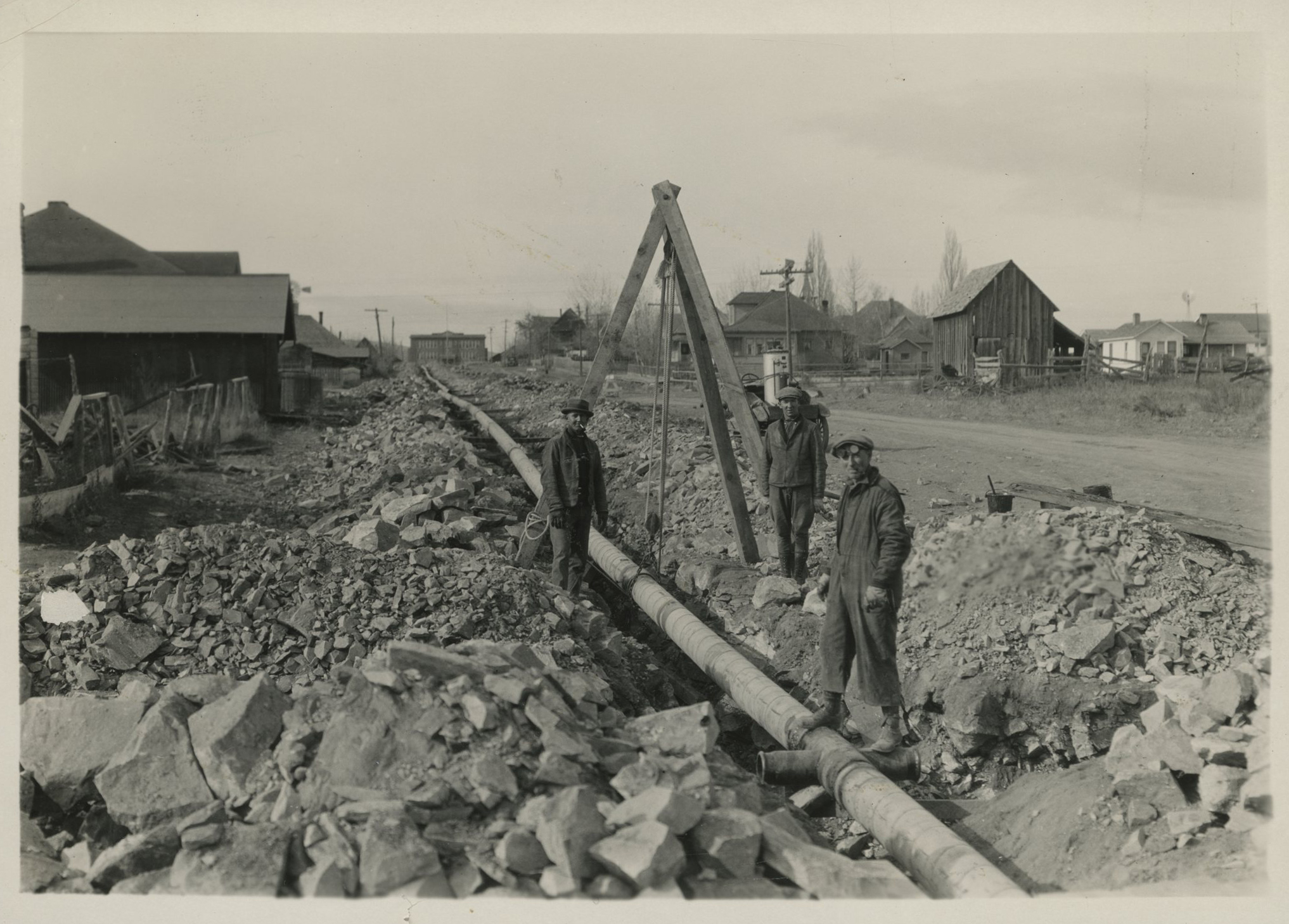
Workmen placing pipes for a new water system, Burns, c.1928.
Courtesy Oregon Hist. Soc. Research Lib., bb002962 Courtesy Oregon Hist. Soc. Research Lib., bb002962
-
![Courtesy Oregon Hist. Soc. Research Lib., bc004868]()
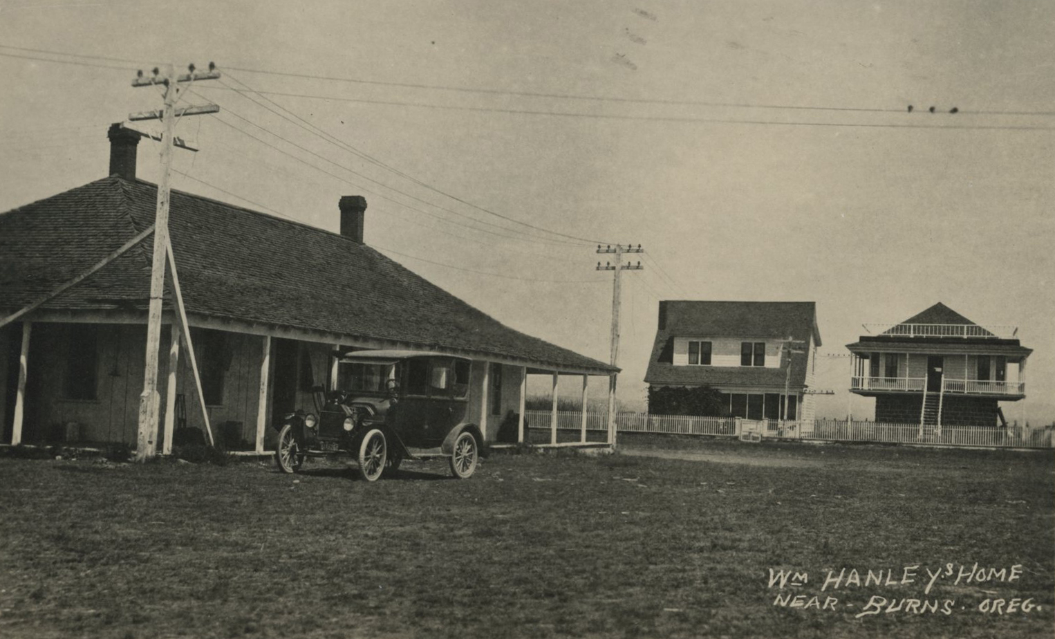
Rancher William Hanley's home, Burns.
Courtesy Oregon Hist. Soc. Research Lib., bc004868 Courtesy Oregon Hist. Soc. Research Lib., bc004868
-
![Courtesy Oregon Hist. Soc. Research Lib., Orhi084371]()
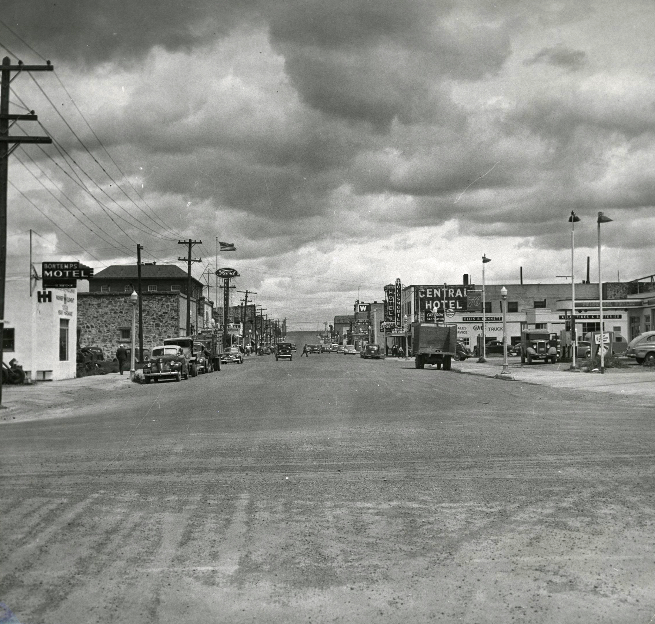
Main Street, Burns, 1950.
Courtesy Oregon Hist. Soc. Research Lib., Orhi084371 Courtesy Oregon Hist. Soc. Research Lib., Orhi084371
-
![Courtesy Oregon Hist. Soc. Research Lib., 2007.579.1]()
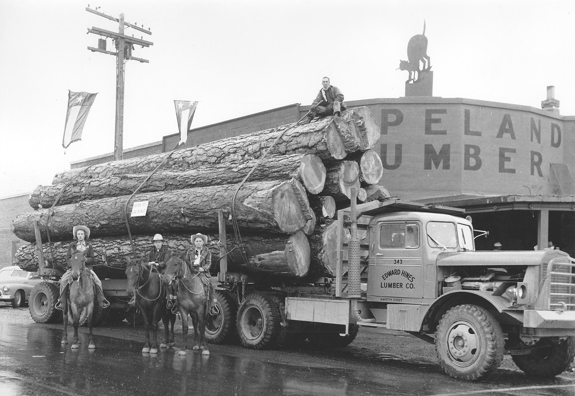
Edward Hines logging truck, Burns, 1950s.
Courtesy Oregon Hist. Soc. Research Lib., 2007.579.1 Courtesy Oregon Hist. Soc. Research Lib., 2007.579.1
Related Entries
-
![Claire Isabel McGill Luce (1923-1971)]()
Claire Isabel McGill Luce (1923-1971)
Claire Isabelle (isabel) McGill Luce was an accomplished businesswoman …
-
![Harney County Fair, Rodeo, and Race Meet]()
Harney County Fair, Rodeo, and Race Meet
The first “fair” in Harney County was a media event. On July 4, 1888, a…
-
![High Desert]()
High Desert
Oregon’s High Desert is a place apart, an inescapable reality of physic…
-
![Hines and the Edward Hines Lumber Company]()
Hines and the Edward Hines Lumber Company
In the mid-1920s, large sawmill owners in the United States found a new…
-
![John William "Pete" French (1849-1897)]()
John William "Pete" French (1849-1897)
Peter (or Pete) French was a stockman of near-legendary status who ran …
-
![Malheur National Wildlife Refuge]()
Malheur National Wildlife Refuge
Malheur National Wildlife Refuge, established in 1908 by President Theo…
-
![Norma Petersen Paulus (1933-2019)]()
Norma Petersen Paulus (1933-2019)
Norma Paulus was a forward-thinking, practical-minded Republican leader…
-
![Peter French Round Barn]()
Peter French Round Barn
Standing clear on a low rise in a sagebrush-dotted expanse of the easte…
-
![Robert Freeman Smith (1931–2020)]()
Robert Freeman Smith (1931–2020)
Bob Smith was a Republican who served in the U.S. Congress, representin…
-
![Steens Mountain]()
Steens Mountain
Rising to an elevation of 9,733 feet, Steens Mountain is the highest po…
Related Historical Records
Map This on the Oregon History WayFinder
The Oregon History Wayfinder is an interactive map that identifies significant places, people, and events in Oregon history.
Further Reading
An Illustrated History of Baker, Grant, Malheur and Harney Counties, with a Brief Outline of the Early History of the State of Oregon. Chicago (?): Western Historical Publishing Company, 1902.
Jenks, Jennifer. "Destination Harney County: 2013–14 Visitor and Relocation Information Guide." Burns Times-Herald, April 3, 2013.
Malheur Wildlife Refuge Website: http://ww.fws.gov/refuge/malheur. Accessed 8/30/17
Powell, David C. "Early Timber Harvesting in the Blue Mountains." United States Forest Service, June 2008. https://www.fs.usda.gov/Internet/FSE_DOCUMENTS/fsbdev7_015647.pdf