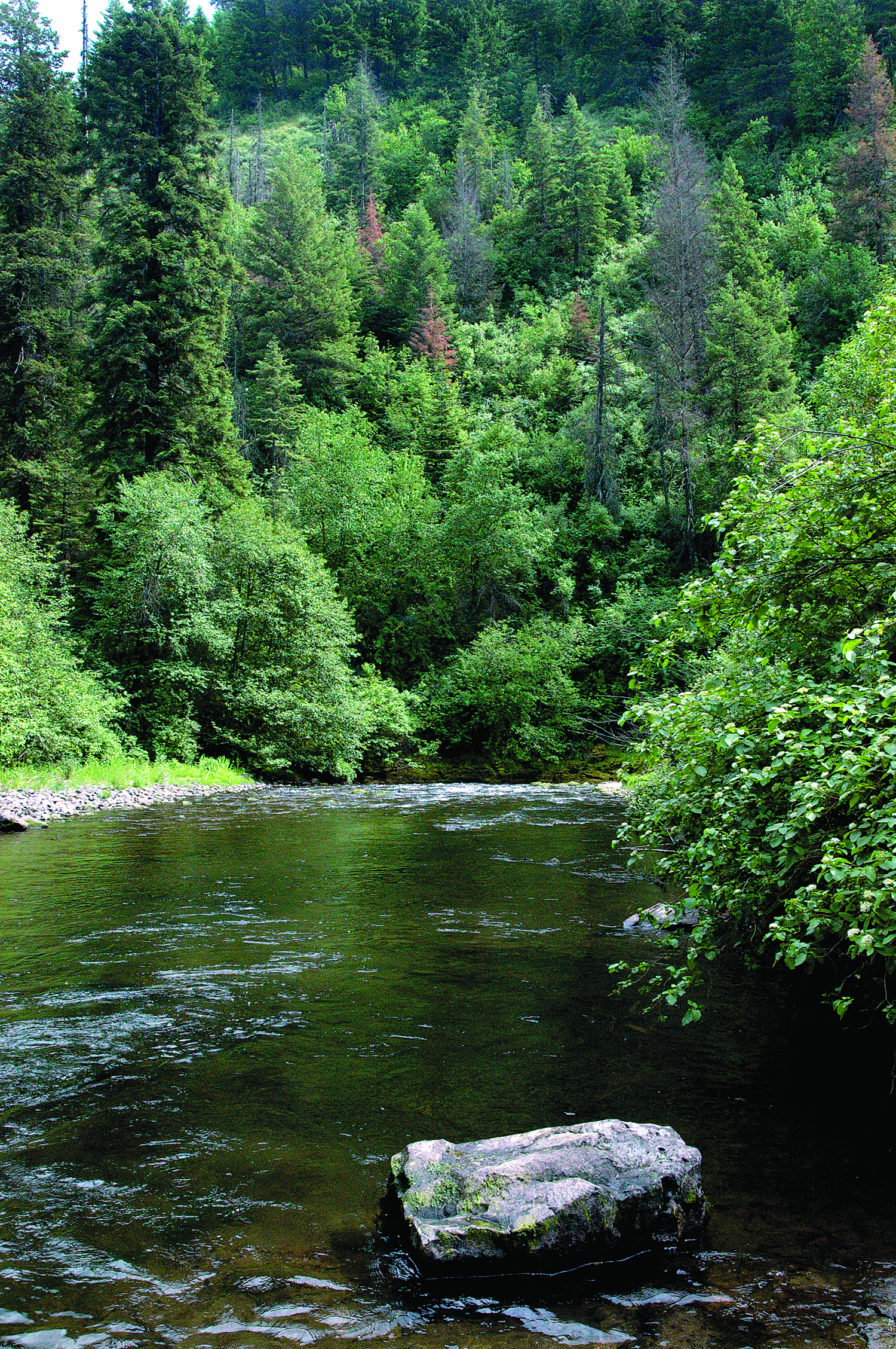
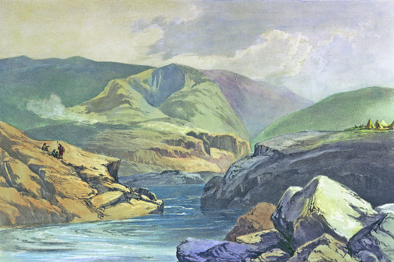
The Umatilla River flows out of the forested northwestern slopes of the Blue Mountains in northeast Oregon, then across dry plains of irrigated farmland and through the City of Pendleton before emptying into the Columbia River at the City of Umatilla. It is a river of contrasting and historically conflicting uses—heavily appropriated for irrigated agriculture and, at one time, with robust runs of anadromous fish. From the mid-1920s until the early 1990s, the lower river was drained dry by irrigation during the summer and fall, extirpating salmon and steelhead. But through the determined efforts of the Confederated Tribes of the Umatilla Indian Reservation (CTUIR), local, state, and federal agencies and governments, irrigation districts and other partners, long-dewatered stretches of the river flowed again, and the fish returned.
Size and Topography
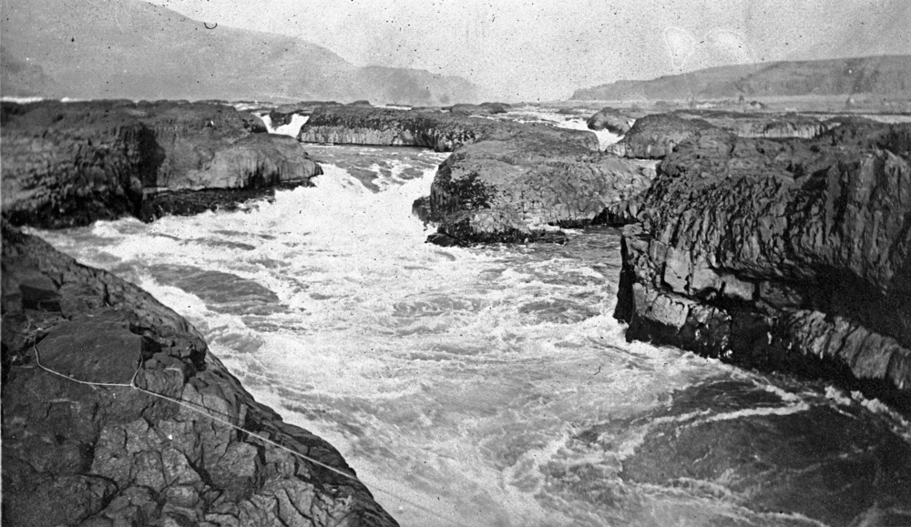
The Umatilla is not a large river. Its annual mean flow, from 1905 through 2018, was about 500 cubic feet per second measured near the mouth of the river. In comparison, the John Day River, which flows into the Columbia west of the Umatilla, has an average flow of 2,075 cubic feet per second. In all, the Umatilla is 89 miles long and drains an area of 2,290 square miles. Originating at nearly 6,000 feet in elevation, the river descends through narrow, well-defined canyons before flowing across a series of broad valleys that drain low rolling lands.
The mainstem Umatilla River has eight main tributaries: the North and South Forks and Meacham Creek in the upper subbasin; Wildhorse, Tutuilla, McKay, and Birch Creeks in the mid subbasin; and Butter Creek in the lower subbasin. Except for Wildhorse Creek, the main tributaries drain a portion of the Blue Mountains and enter the Umatilla River from the south. Wildhorse Creek drains the divide between the Umatilla River and the Walla Walla River to the north. There are also many smaller tributary creeks, some of them intermittent. Flows, which are influenced by snowmelt runoff, are highest in April and lowest in September.
The topography of the basin is quite varied. From the upper basin canyons in the Blue Mountains, the river descends to a wide expanse of plains and terraces in the lower basin. The lower basin is prime agricultural land, composed of tertiary and quaternary loess, alluvium, glacio-fluvial, and lacustrine sediment deposits that mantle the underlying Columbia River basalts. The Umatilla Basin has strong seasonal fluctuations in both temperature and precipitation, from warm and dry summers to cold and snowy winters. Precipitation changes dramatically with the seasons, with most falling in the fall, winter, and spring.
The basin is home to multiple species listed as threatened or endangered. These include two fish species—bull trout and summer steelhead—and five terrestrial species—bald eagles, Canada lynx, peregrine falcons, Washington ground squirrels, and wolverines.
Human Habitation
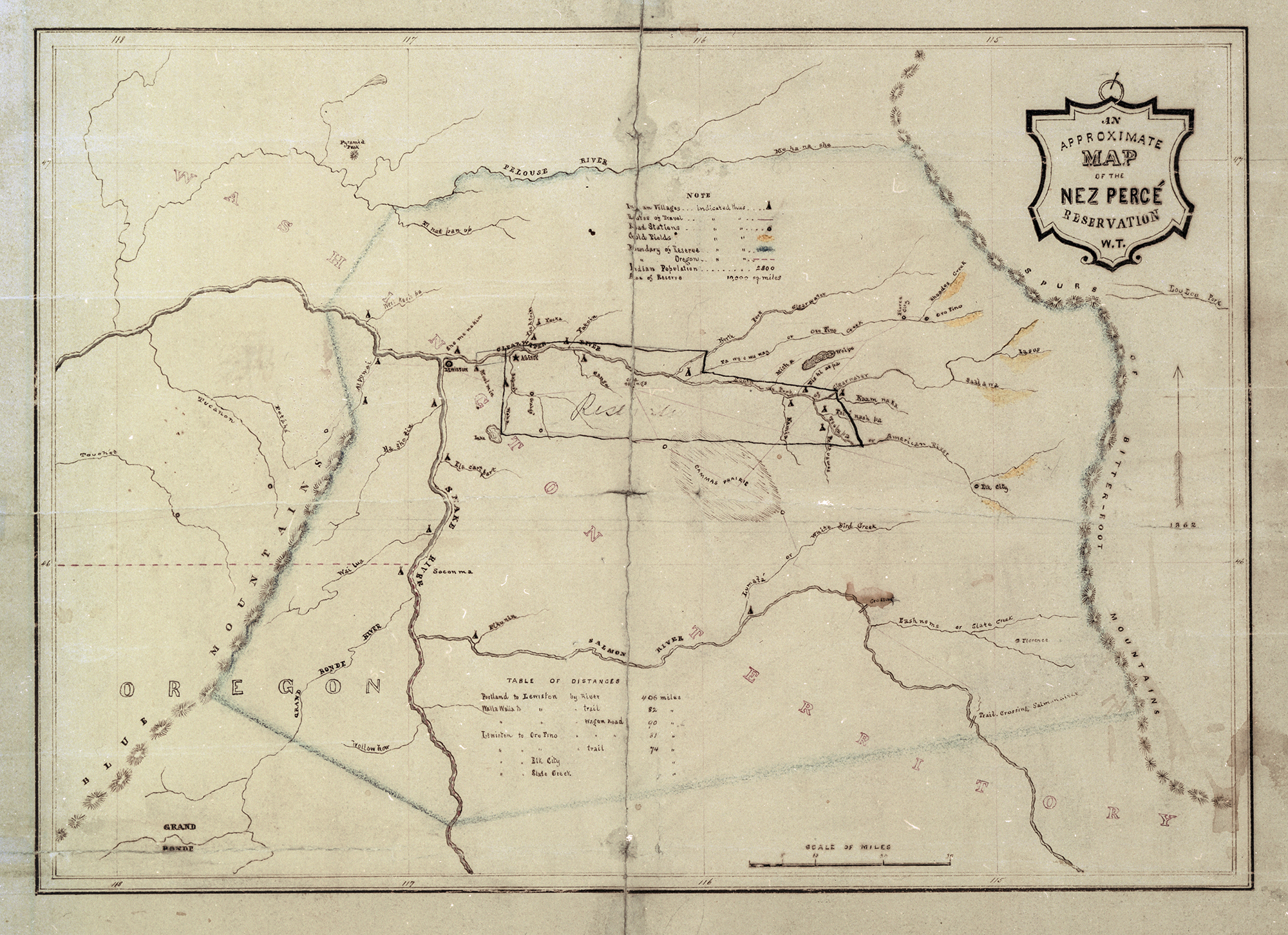
Like much of eastern Oregon, the drainage basin of the Umatilla River is sparsely populated. The census of 2016 counted 79,880 people in Umatilla County. The largest cities are Hermiston, Pendleton, and Umatilla. The river also flows through Morrow County, where the largest city is Boardman. The Umatilla flows through the Confederated Tribes of the Umatilla Indian Reservation (CTUIR), where about half of its 3,100 tribal members live. The Tribes have reserved fishing rights on the reservation and at usual and accustomed places in the region, established in an 1855 treaty with the United States government.
Farming and Irrigation
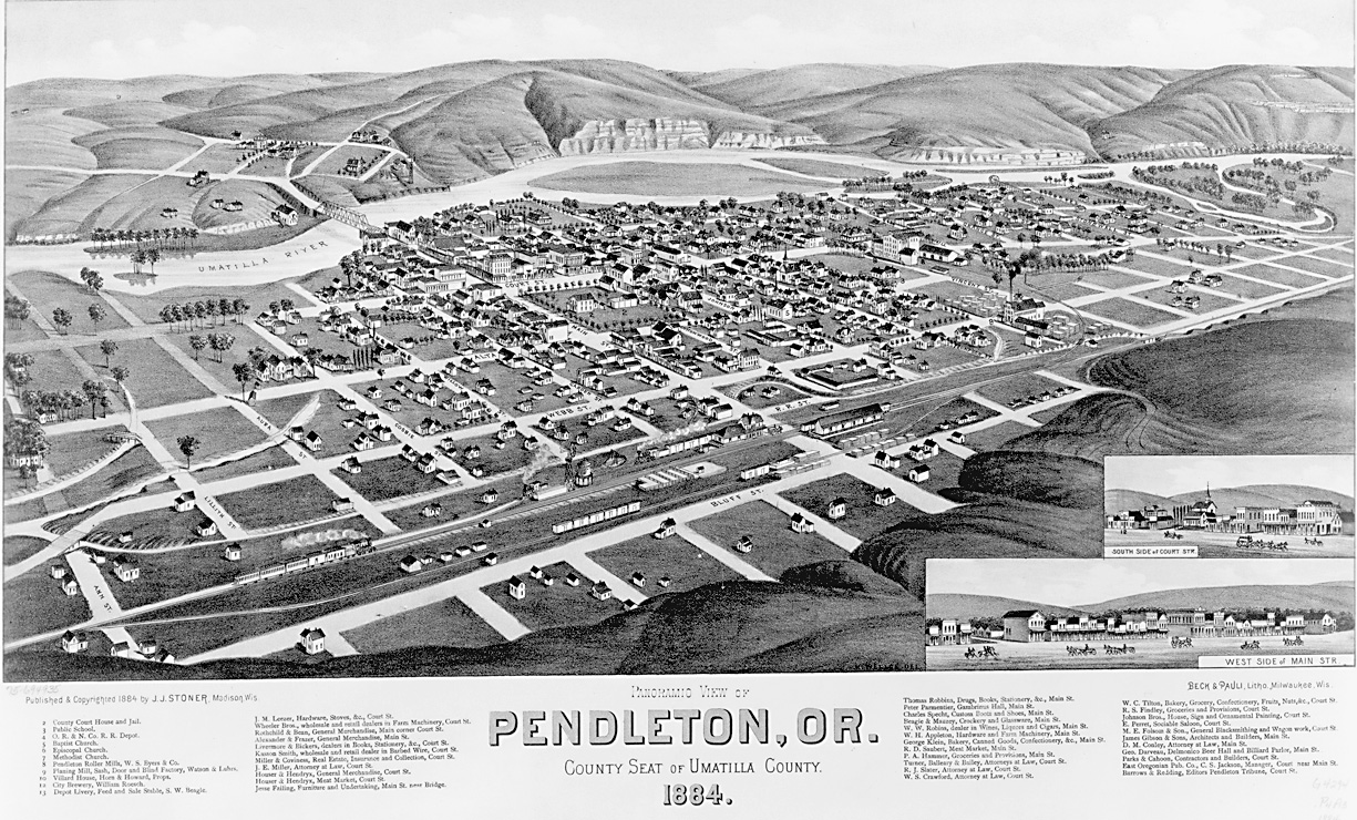
Agriculture has a long history in the basin, dating to the first non-Indian settlements that focused on ranching and dryland wheat farming. The gold rush of 1862 brought non-Indian settlers to the Umatilla Basin, where the first census, in 1870, totaled 2,916. The county grew with the arrival of the railroad in 1881. Today, fruit, grain, timber, cattle, and sheep are important agricultural products.
Intensive dryland agriculture began in the 1880s, when large amounts of native grassland were converted to dry cropland. Productivity increased with the advent of large-scale irrigation, provided by both the federal government and private water companies. In Umatilla and Morrow Counties today, 250,000 acres have been developed for irrigated crop production.
Irrigation in the Umatilla Basin began in 1893 by a private company that built a ditch from a diversion point two miles up the Umatilla River. The Baily Ditch Company went into receivership three years later, and its ditch was taken over by the Oregon Land and Water Company (OLWC) in 1904. In 1906, OLWC filed additional water rights to irrigate more land around the cities of Umatilla and Irrigon and farther west near Boardman.
In 1896, local ranchers began talking to the U.S. Reclamation Service about establishing a federal irrigation project in the basin. Private irrigation companies also formed and began supplying irrigation water from the river in 1903 and 1905. In 1903, the Reclamation Service, part of the newly created Bureau of Reclamation, began surveys of the potential to irrigate land along the lower Umatilla River with water from the Columbia and Snake Rivers. The Umatilla Project, as it was called, was initiated in 1906, the same year the Bureau began the Yakima Project in Washington State.
The first water from the Umatilla Project flowed in 1908, and the project was expanded in 1927, 1938, and 1993. Today, the Umatilla Basin Project supplies water to more than 17,000 acres and a supplemental supply to about 13,000 acres. The East Division is the Hermiston Irrigation District; the West Division is the West Extension Irrigation District. The South Division includes the Stanfield and Westland Irrigation districts.
Water comes from the river and from impoundments, including Cold Springs Dam and Reservoir, Feed Canal Diversion Dam and Canal, and Maxwell Diversion Dam and Canal in the East Division; Three Mile Falls Diversion Dam on the Umatilla and the 27-mile West Extension Main Canal in the West Division; and McKay Dam and Reservoir in the South Division. Some 3,800 acres not included in an irrigation district receive either a full or supplemental water supply from McKay Reservoir under individual storage contracts.
Fish Recovery
While irrigation made the basin productive for agriculture, the CTUIR acutely felt the loss of salmon and steelhead, which had tremendous importance to their traditional economy, culture, and nutrition. By the late 1970s, the Tribes had forged tentative agreements with federal, state, and local entities that could influence recovery of anadromous fish in the basin, but it was passage of the Pacific Northwest Electric Power Planning and Conservation Act of 1980 that set the recovery process in motion. The Power Act made the Bonneville Power Administration responsible for implementing a program developed by the Northwest Power and Conservation Council, a four-state compact authorized in the Power Act to protect and enhance fish and wildlife affected by those dams. Through the Council’s Columbia River Basin Fish and Wildlife Program, the Tribes secured Bonneville funding to study fish passage at many of the irrigation dams.
At the same time, there was widespread support in the basin for a Bureau of Reclamation study on how to bring more water to the Umatilla River. If water could be added to the Umatilla from another source, such as the Columbia River, then irrigators could continue to irrigate and there would be enough water in the river to support anadromous fish. The U.S. Fish and Wildlife Service issued a study, funded by Bonneville, describing how the existing water supply in the river might support the return of anadromous fish. The Oregon Department of Fish and Wildlife helped the Tribes establish a unique fish hatchery system, the Umatilla Fish Restoration Program.
The Power Council included the Umatilla Fish Restoration Program in its 1982 Fish and Wildlife Program, but bureaucratic inertia soon set in. The Tribes, frustrated by the slowdown, took the bold move of releasing some large Chinook salmon from the lower Columbia into the Umatilla to allow them to spawn. Then they announced that the progeny of these Umatilla tourists would return to the Umatilla as adults in four years. That got the government's attention. “If the Council, Bonneville, and the state government did not address the issues of water allocation on the Umatilla—the very issue that had killed off the Umatilla runs in the first place,” Christopher Shelley wrote in 2002, “then there would not be a river for them to ascend. A potential public relations disaster faced fish management agencies: the spectacle of huge salmon stranded at the mouth of a non-existent river."
After years of delay, the Umatilla Fish Restoration Program facilities were built, utilizing the river's existing flow, and fish were trapped and trucked thirty-two miles from the lower river to the hatchery facilities when there was not enough water in the river for them to pass. The river needed more water if the restoration program was going to work over the long term, and all parties to the restoration program understood that.
CTUIR worked with the Bureau of Reclamation and the irrigation districts in the basin to study a new water-management project for the Umatilla. While the Tribes cited their treaty-reserved rights to fish and hunt in their usual and accustomed places and while all parties understood that the Tribes also could invoke legal precedent to assert their water rights to the river, the Tribes preferred negotiation to confrontation and did not want to wreak havoc with the local economy by taking a significant amount of water away from irrigators. Neither the Tribes nor the irrigators wanted to take a dispute over water to the courts.
The Bureau study, paid for by Bonneville and completed in 1983, proposed a two-phase alternative: pump water from the Columbia to fill irrigation reservoirs during the irrigation season, leaving Umatilla water in the Umatilla for the fish to imprint on, and build a new reservoir system that the Tribes could use to keep water in the river when salmon are migrating. By the mid-1980s, the Tribes, state, and four irrigation districts supported the plan and lobbied Congress to support the proposal for construction by the Bureau of Reclamation.
While Bonneville objected to paying for the electricity to power the huge pumps in the Columbia River, that is what Congress ordered Bonneville to do in the 1988 Umatilla Basin Project Act. In 1992, the parties signed an agreement allowing the Umatilla Basin Project to be implemented. The end result was a good-news story for irrigators, the local economy, and the Tribes.
Two phases of the act have been completed (as of 2020), and a third phase has been proposed. Phase I of the project involves pumping water (up to 140 cubic feet per second) from the Columbia River into the West Extension Irrigation District system to offset diversion of Umatilla River water when flows in that river drop below target values. Phase II involves exchanging up to 240 cubic feet per second of Umatilla River and McKay Reservoir water for Columbia River water for use by the Stanfield and Hermiston Irrigation Districts.
Two pumping plants send Columbia River water to the irrigation project. The Cold Springs Pumping Plant, located at the end of the Cold Springs Canal in the City of Umatilla, delivers Columbia River water to the North Branch Furnish Canal. A 770-foot-long intake pipe extends from Columbia-Cold Springs Canal to the Cold Springs Pumping Plant. The plant consists of six units with a total pumping rate of 150 cubic feet per second. Water is conveyed through a 6,200-foot discharge line to the North Branch Furnish Canal. The total lift is 60 feet.
The Columbia River Pumping Plant is located about eight miles upstream from McNary Dam near Hat Rock State Park. Water from that plant travels through a 4,300-foot-long pipeline to the Columbia-Cold Springs Canal. The maximum pumping rate is 240 cubic feet per second, and the total lift is 320 feet. Bonneville pays between $1.1 million and $1.6 million per year to the Umatilla Electric Cooperative to supply the power for the pumps. The water exchange project also includes modifications of the river channel and construction of fish ladders, fish traps, and fish screens to improve fish passage and collection and to help restore and rebuild salmon and steelhead runs.
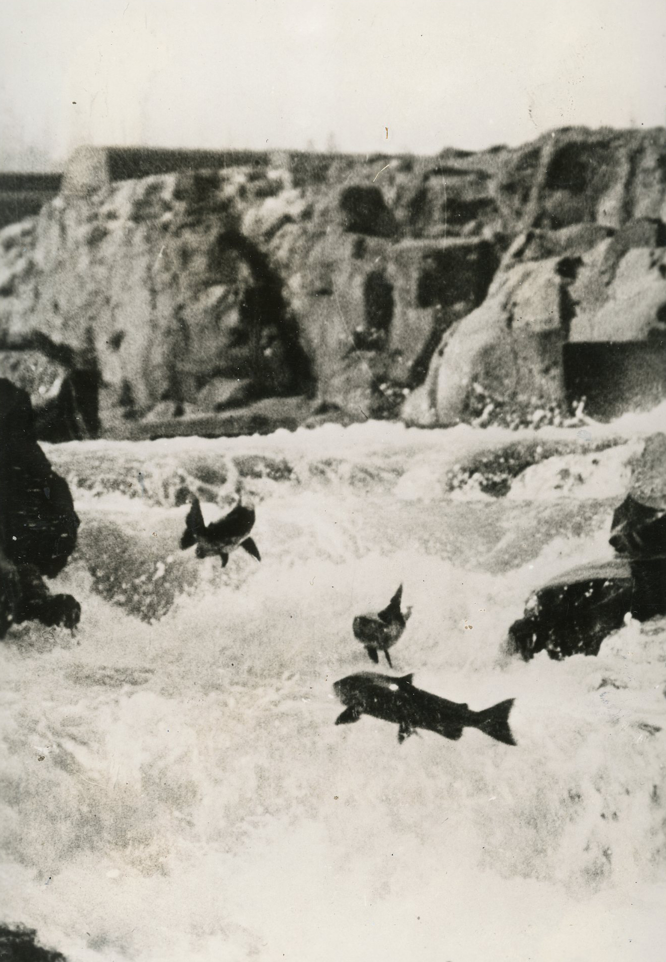
As a result of the water exchange and pumping of Columbia River water, about half the storage in McKay Reservoir is used to maintain instream flows in the Umatilla River below McKay Creek. Through the water exchange, flows increase when adult salmon and steelhead return to the river to spawn, but not all year. While the water exchange helped steelhead recovery and the reintroduction of Chinook and coho salmon, irrigation still removes approximately half the instream flows in the summer. Chinook were extirpated from the basin in the 1920s; spring Chinook were reintroduced in 1986, fall Chinook in 1982–1983. Water temperatures still can rise to harmful levels for fish, but the project has resulted in salmon and steelhead once again swimming through the middle of downtown Pendleton and a fishery in the river. "In the Umatilla River Basin,” Shelley wrote, “a combination of culture, law and policy, along with shifting alliances within resource extraction, produced an environmental success story."
-
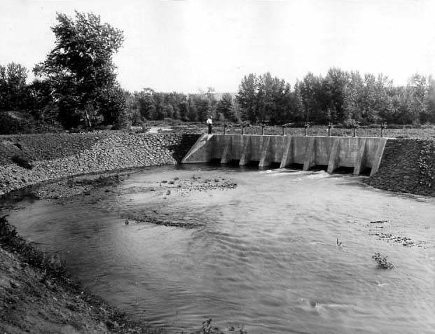
![Umatilla Project Stanfield diversion feeder canal for Cold Springs Reservoir, 1907.]()
Umatilla Proj, Stanfield diversion dam, Sep 1907.
Umatilla Project Stanfield diversion feeder canal for Cold Springs Reservoir, 1907. U.S. Bureau of Reclamation, P30-100-921
-
![]()
-
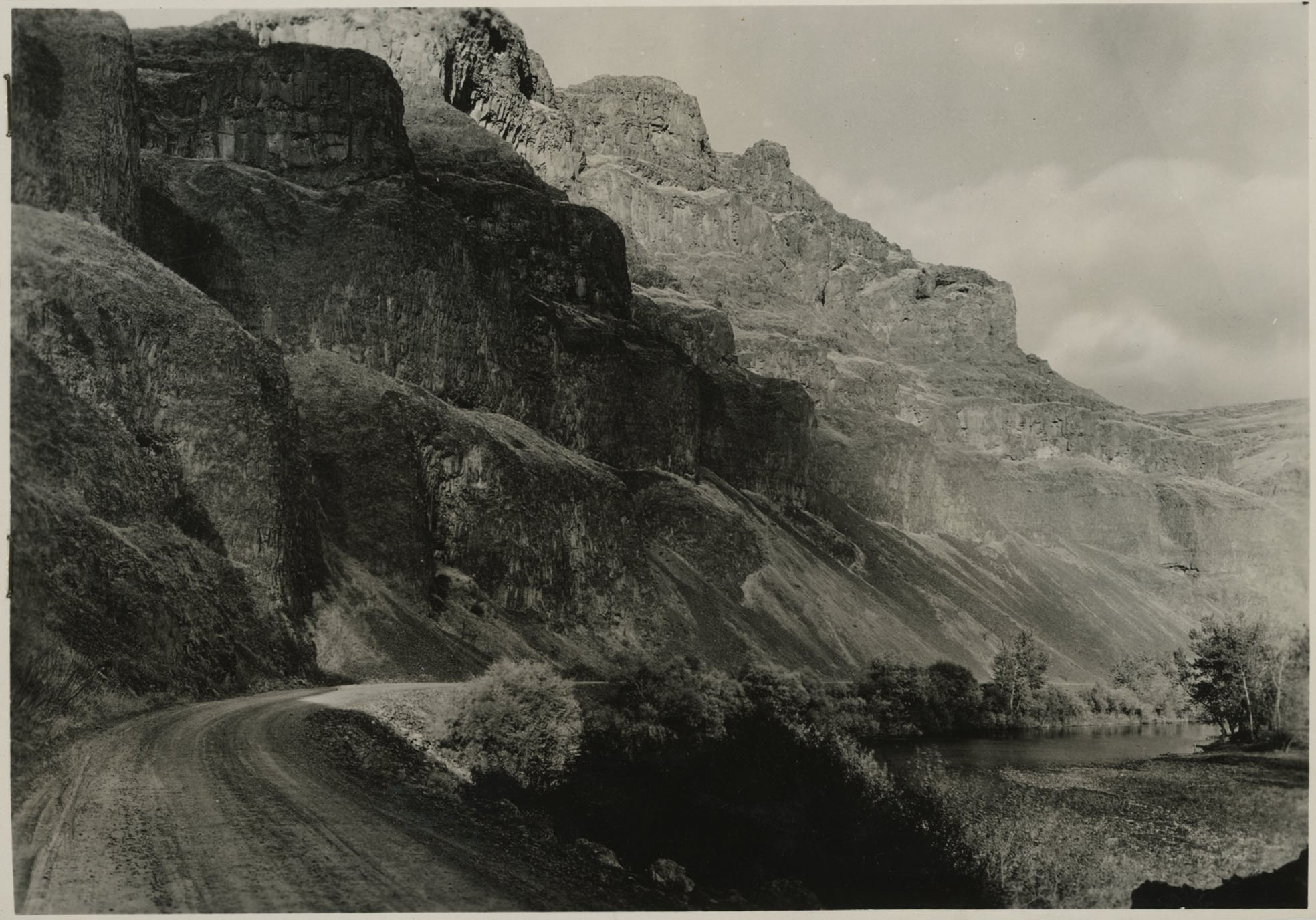
![]()
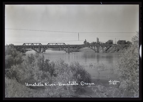
Umatilla River in Umatilla, OR, c.1940.
Oregon Historical Society Research Library, Digital Collections, OrgLot1275_B1_Christian_11-917 -
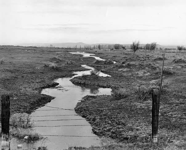
![Swamp in West Extension, Umatilla Project, March 1947.]()
Umatilla Project, swamp, Mar 1947.
Swamp in West Extension, Umatilla Project, March 1947. Photo Merritt, U.S. Bureau of Reclamation, P30-100-946
-
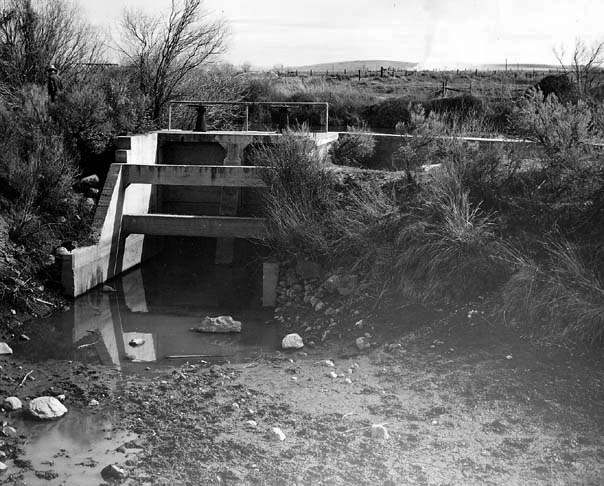
![Umatilla Project diversion dam, Maxwell Canal, Hermiston, March 1947.]()
Umatilla Proj, Maxwell Canal diversion dam, Mar 1947.
Umatilla Project diversion dam, Maxwell Canal, Hermiston, March 1947. Photo Merritt, courtesy U.S. Bureau of Reclamation, P30-100-951
-
![Stanfield diversion, Umatilla Project, about 1950.]()
Umatilla Proj, Stanfield diversion, ca 1950.
Stanfield diversion, Umatilla Project, about 1950. Photo Merritt, courtesy U.S. Bureau of Reclamation, P30-100-947;
-
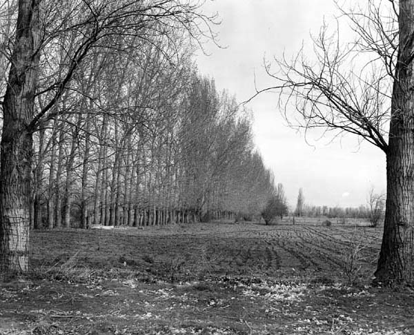
![Typical Umatilla Project wind breaks, March 1947.]()
Umatilla Proj, wind break, Mar 1947.
Typical Umatilla Project wind breaks, March 1947. Photo Merritt, courtesy U.S. Bureau of Reclamation, P30-100-945
-
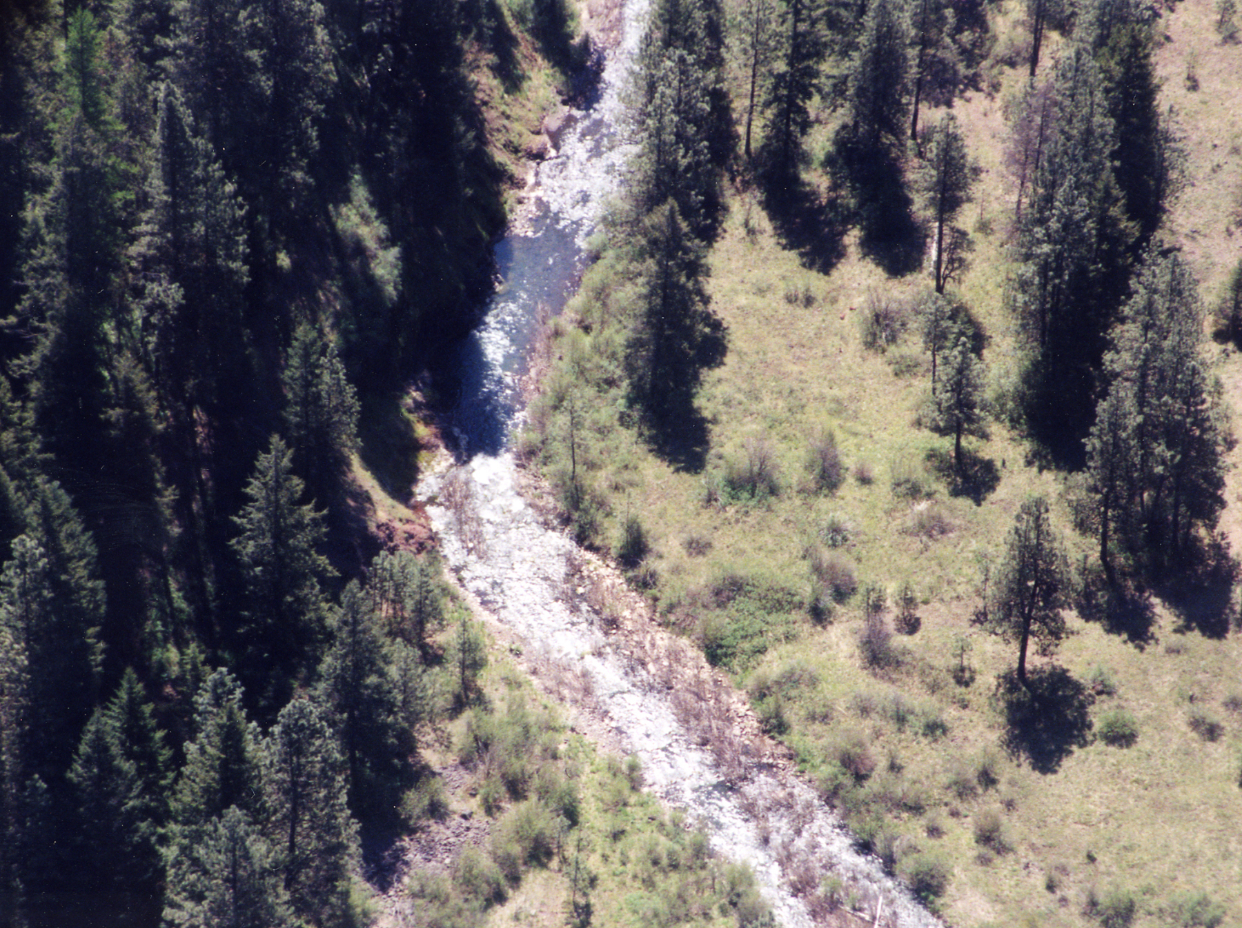
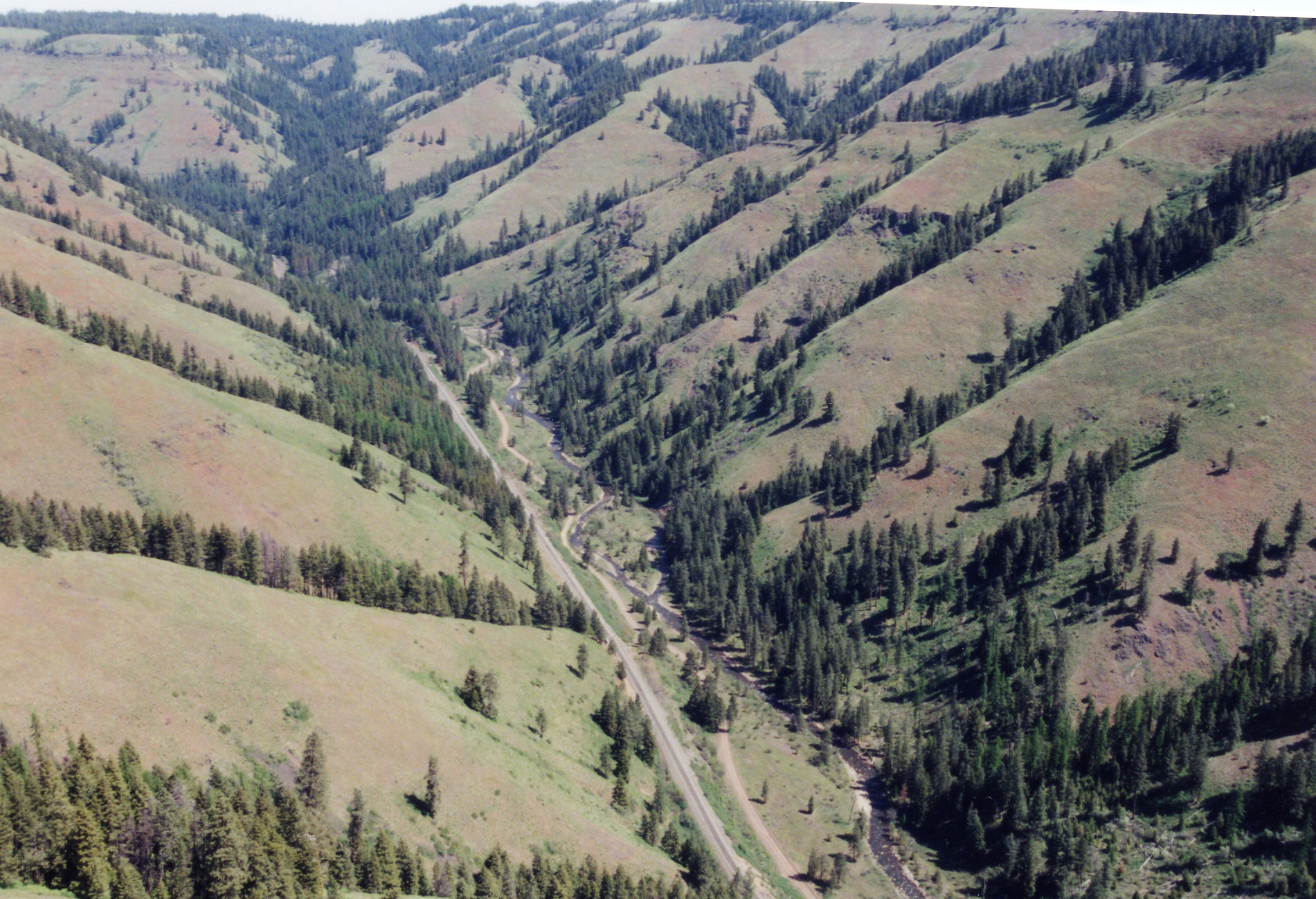
![]()
Aerial view of the Umatilla River, 1999.
Courtesy Confederated Umatilla Journal, Confederated Tribes of the Umatilla Indian Reservation -
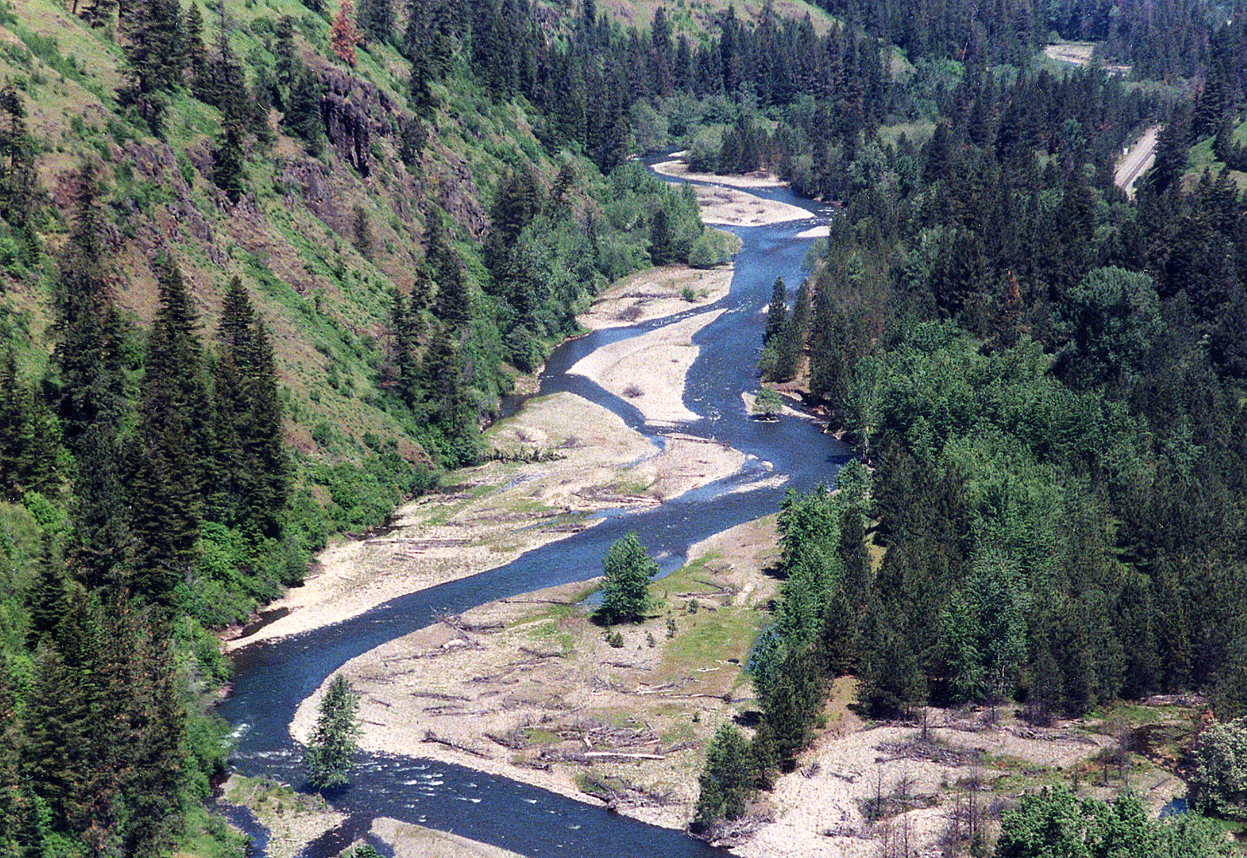
![]()
Aerial view of the Umatilla River, 1999.
Courtesy Confederated Umatilla Journal, Confederated Tribes of the Umatilla Indian Reservation -
![]()
Aerial view of the Umatilla River, 1999.
Courtesy, Confederated Umatilla Journal, Confederated Tribes of the Umatilla Indian Reservation -
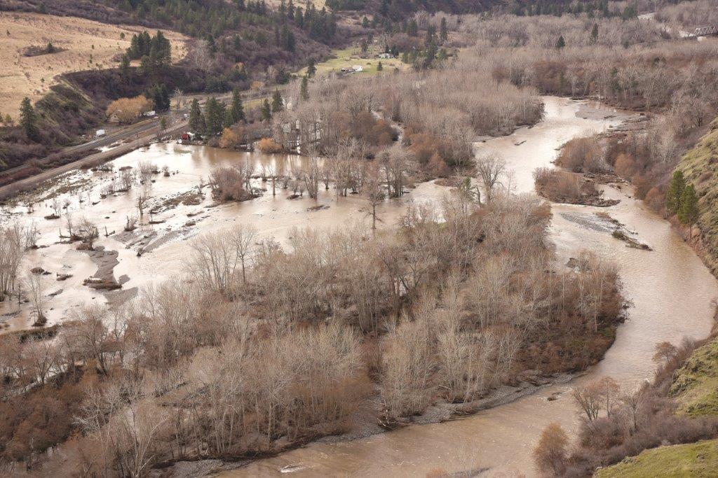
![]()
Umatilla River flooding, 2020.
Courtesy Confederated Umatilla Journal, Confederated Tribes of the Umatilla Indian Reservation

Related Entries
-
![Blue Mountains]()
Blue Mountains
The Blue Mountains, perhaps the most geologically diverse part of Orego…
-
![Bonneville Power Administration]()
Bonneville Power Administration
In 1937, the impending completion of Bonneville Dam (1938) and progress…
-
![Columbia River]()
Columbia River
The River For more than ten millennia, the Columbia River has been the…
-
![Columbia River Inter-Tribal Fish Commission]()
Columbia River Inter-Tribal Fish Commission
The Columbia River Inter-Tribal Fish Commission (CRITFC) is the fishery…
-
![Native American Treaties, Northeastern Oregon]()
Native American Treaties, Northeastern Oregon
After American immigrants arrived in the Oregon Territory in the 1840s,…
-
![Pendleton]()
Pendleton
Pendleton, a city of 17,107 in the 2020 census, sits in the foothills o…
-
![Salmon]()
Salmon
The word “salmon” originally referred to Atlantic salmon (Salmo salar),…
-
![U.S. Bureau of Reclamation]()
U.S. Bureau of Reclamation
The U.S. Bureau of Reclamation, in the Department of the Interior, has …
Related Historical Records
Map This on the Oregon History WayFinder
The Oregon History Wayfinder is an interactive map that identifies significant places, people, and events in Oregon history.
Further Reading
Northwest Power and Conservation Council. "Umatilla Subbasin Plan, May 28, 2004. https://www.nwcouncil.org/sites/default/files/1ExecSumm.pdf
Shelley, Christopher. "The Resurrection of a River: The Umatilla and its Salmon." Master of Arts Thesis, Portland State University, 2002. https://pdxscholar.library.pdx.edu/open_access_etds/3971/
U.S. Bureau of Reclamation. "Umatilla Basin Water Supply Study for the Confederated Tribes of Umatilla Indian Reservation," January 2012. https://www.usbr.gov/pn/studies/umatilla/appraisalfinal.pdf
West Extension Irrigation District. "History."
U.S. Bureau of Reclamation Projects and Facilities Reports, Umatilla Basin Project: https://www.usbr.gov/projects/index.php?id=410, accessed October 24, 2019.
Confederated Tribes of the Umatilla Indian Reservation. https://ctuir.org/