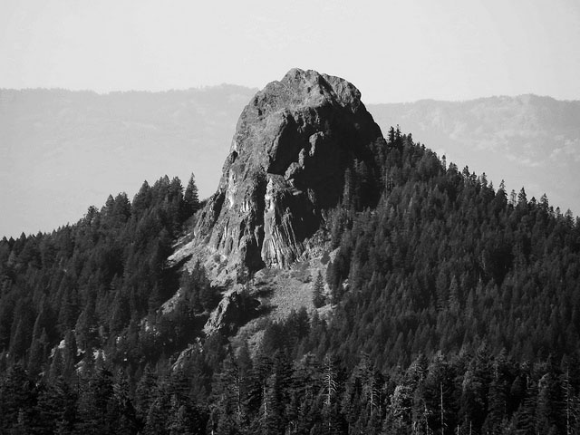
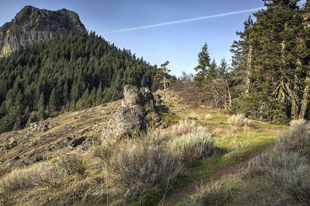
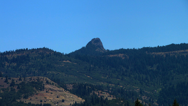
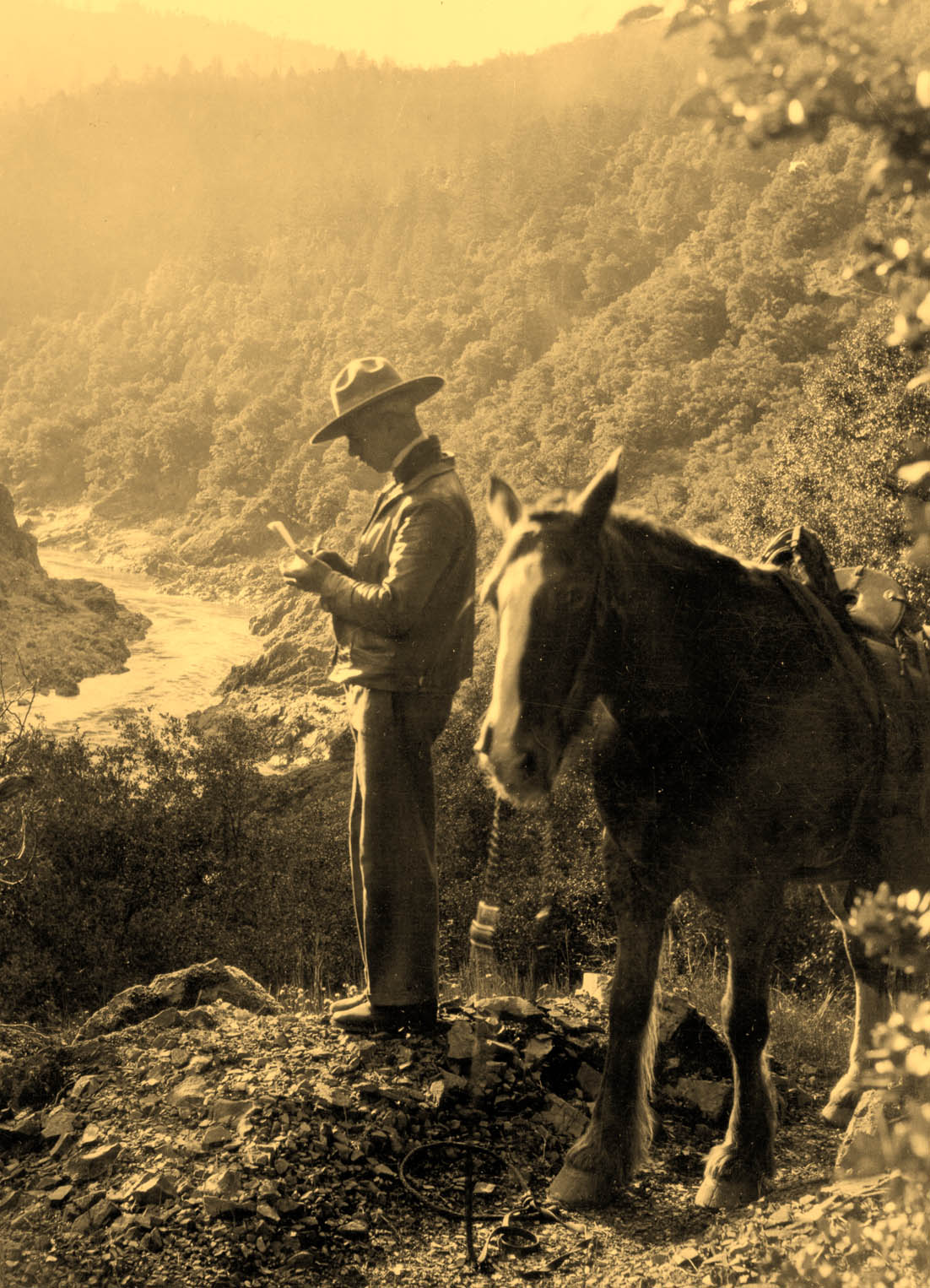
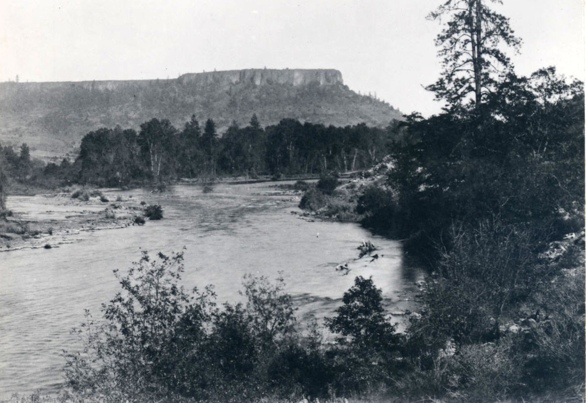
Located east of Siskiyou Pass inside the Cascade-Siskiyou National Monument, Pilot Rock is a prominent landmark in southwestern Oregon, protruding from the skyline of the Rogue-Klamath watershed divide like a hitchhiker’s thumb. The Upland Takelma people, who could see the rock rising above the horizon from their homeland on the Rogue River near the Table Rocks, knew it as Tan-ts’atseniptha (rock standing up).
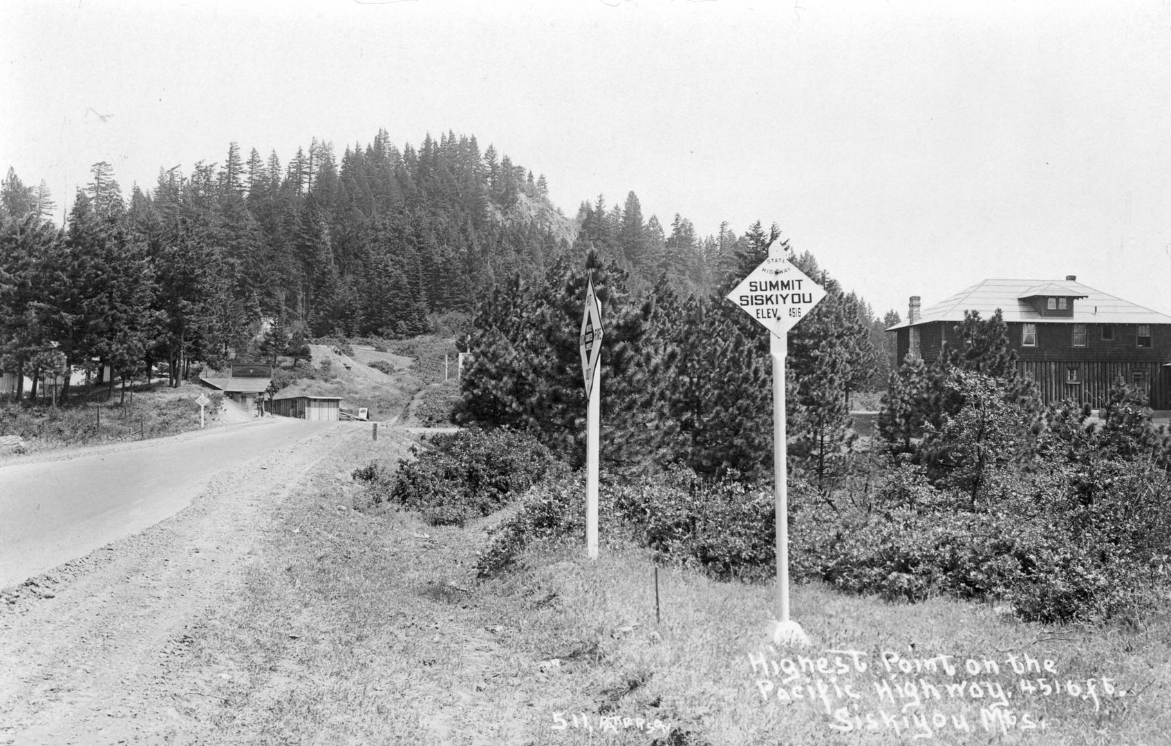
Members of the U.S. Exploring Expedition, traveling south through the Rogue River drainage in 1841, named it Emmons Peak for the party’s leader, U.S. Navy Lieutenant George Emmons. During the 1840s and 1850s, travelers used Pilot Rock, both as a marker of the approximate boundary between California and Oregon Territory and to "pilot" their way to Siskiyou Pass, which formed the main crossing of that boundary. The Pacific Crest National Scenic Trail passes along the rock's northwestern base.
More than two hundred feet high, Pilot Rock is made of andesite, a remnant of late-stage magma that cooled in the throat of a 25.6 million-year-old volcano. The bulk of the volcano formed as the magma punched through existing volcanically fragmented and chaotically deposited debris. This earlier material, resembling pebble-rich concrete, is called breccia, which was much weaker than the solidified andesitic magma that filled the throat of the volcano. The breccia eroded relatively rapidly over time, somewhat like a melting Popsicle® leaves behind the stick, creating Pilot Rock.
Pilot Rock is one of many small intrusions into the highly eroded Western Cascade volcanic series, which is to the west of the more recent volcanoes of the High Cascades. Previous to build-up of the Western Cascades, the local landscape was quite subdued, allowing great rivers to flow west unhindered by a mountainous barrier. With eruption of the Western Cascade volcanoes, which were 42 million to 19 million years old, a substantial barrier to these ancient westward-flowing rivers took form.
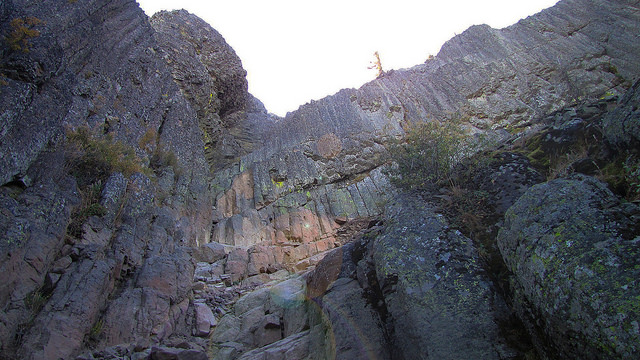
Near vertical columns (columnar joints) are noticeable on the sides of Pilot Rock. When magma cools, it contracts, resulting in cracks that propagate up and down from the cooling surfaces and join to form usually vertical, three- to eight-sided columns. Today, the columns of Pilot Rock are inclined 20 degrees to the east, having been tilted during the slow, progressive uplift of the Klamath and Siskiyou Mountains to the west. Moreover, the columns often change direction, an indication that the volcanic intrusions that resulted in Pilot Rock did not occur all at once but as closely spaced events.
Radial dikes, or radial intrusions, are visible to the east of the base of Pilot Rock. The dikes formed as the landscape bulged upward during the volcanic intrusion and split the existing rocks; magma filled the cracks that radiated out from Pilot Rock.
The name Pilot Rock was used during the early 1970s as the title of a countercultural publication based in Ashland, although its claim that the landmark was an honored “place of peace” among Native groups is without foundation. The local businesses that use the name include Pilot Rock Excavating, Pilot Rock Environmental Consultants, and Pilot Rock Productions. The name of Standing Stone Brewing Company in Ashland was inspired by the landmark, and the company uses a drawing of Pilot Rock as its logo.
-
![]()
Pilot Rock.
Courtesy Bureau of Land Management
-
![]()
Pilot Rock.
Courtesy Bureau of Land Management
-
![]()
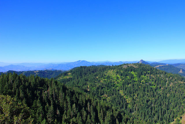
View of Pilot Rock from Boccard Point.
Courtesy Bureau of Land Management
-
![]()
Columnar joints of Pilot Rock.
Courtesy Bureau of Land Management Oregon and Washington
-
![]()
Pilot Rock.
Courtesy Bureau of Land Management Oregon and Washington
Related Entries
-
![Applegate Trail]()
Applegate Trail
The Applegate Trail, first laid out and used in 1846, was a southern al…
-
![Ashland]()
Ashland
Ashland, a city of 21,360 people in Jackson County, is situated in the …
-
![Cascade Mountain Range in Oregon]()
Cascade Mountain Range in Oregon
The Cascade mountain system extends from northern California to central…
-
![Siskiyou National Forest]()
Siskiyou National Forest
The Siskiyou Forest Reserve was created on March 2, 1907; within two da…
-
![Siskiyou Pass]()
Siskiyou Pass
Siskiyou Pass, including the 4,310-foot-high Siskiyou Summit of Interst…
-
![Smith Rock State Park]()
Smith Rock State Park
Smith Rock State Park encompasses 652 acres near Redmond and Terrebonne…
-
![Table Rocks]()
Table Rocks
The Table Rocks, two large mesas north of Medford, rise nearly 800 feet…
Map This on the Oregon History WayFinder
The Oregon History Wayfinder is an interactive map that identifies significant places, people, and events in Oregon history.
Further Reading
Knauss, Lia L., Manuel Silva, and Jad D’Allura. Pilot Rock, A Late Oligocene Western Cascades Andesite Intrusive, Southern Oregon 16 (2008) Proceedings of the Oregon Academy of Science.
LaLande, Jeff. From Abbott Butte to Zimmerman Burn: A Gazetteer of the Rogue River National Forest. Medford, Ore.: U.S. Forest Service, 2001.
Miller, Marli. Roadside Geology of Oregon. 2d ed. Missoula, Mont.: Mountain Press, 2014.