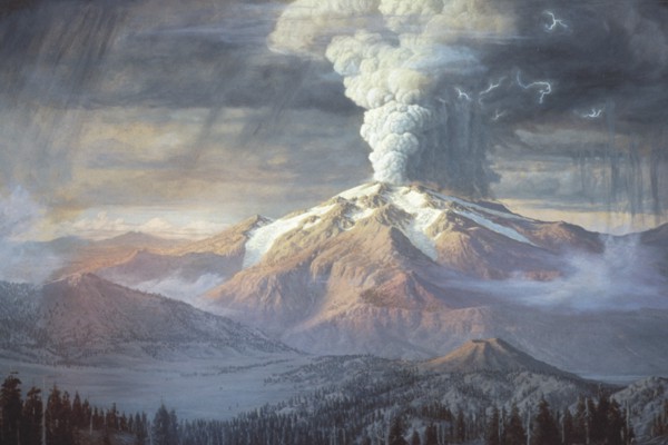
With its summit spire towering a few hundred feet above less precipitous flanks, Mount Thielsen reigns over the High Cascades along the 38-mile stretch from Crater Lake to Diamond Peak. Extinct now, the mountain was an active volcano 300,000 years ago. The seventh highest mountain in the Oregon Cascade Range, Mount Thielsen has a summit altitude of 9,182 feet. Rugged in profile and standing distinct from adjacent Cascade peaks, Thielsen is a key landmark for people living in or moving across the area. Such has always been the case. The mountain’s longstanding Klamath name is His-chok-wol-as, a word whose root, sčʼikʼwal, invokes the action of putting or carrying someone on one’s shoulders.
The EuroAmerican name of Mount Thielsen originated in about 1872. Hans Thielsen (b. 1814) was a Danish civil engineer who immigrated to the United States in 1837. He worked for midwestern railroad companies and, following a chance visit with railroad promoter Ben Holladay, moved to Oregon in 1870 to work as a chief engineer for Holladay and, ultimately, Henry Villard’s Northern Pacific Railway. The Danish surname is pronounced TEEL-sen, and should be the mountain’s appellation. It is unclear if Hans Thielsen ever approached his namesake mountain.
Time has taken its toll on Mount Thielsen, which has experienced at least two major glaciations. The precipice-laden Thielsen landform possesses only remnants of its once-smoothly ascending slopes. Erosion has laid bare its well-bedded vent deposits, forming colorfully variegated beds that range from pale yellow to olive brown, orange, and dark gray. The many hues result from the alteration of once-glassy cinder and ash to clay minerals.
Mount Thielsen’s flanks comprise lava flows of basaltic andesite composition. Chemical analyses from the lava show silica (SiO2) ranges from 53 to 58 percent. The relatively monotonous composition and the volcano’s structure led to its classification as a shield volcano. Unlike Hawaiian shield volcanoes, whose flanks are gently sloping, Cascade Range shields can range from gentle to steep. (Black Butte, west of Sisters, for example, is a classic little-eroded, steep-sided Cascade shield volcano.) Like other Cascade Range shield volcanoes, Mount Thielsen lacks the diverse compositional range and eruptive products found at the four prominent composite volcanoes of Oregon’s Cascade Range: Mount Hood, Mount Jefferson, South Sister, and Mount Mazama (Crater Lake).
Mount Thielsen’s prominent profile owes to its volcanic neck, or plug, the now-solid conduit through which magma rose to erupt as cinder and ash. The plug is about 1,600 feet across at its base (eastside exposures at 7,600 feet altitude) but bifurcates upward. As a glacial landform, the plug forms a fine example of a horn, or sharp-pointed mountain peak with flanking cirques. But there would be no pinnacle at Thielsen were it not for the lava congealing in the volcano's throat at the end of its eruptive life. Plugs stand proud because they are more resistant to erosion than adjacent rock, and similar plugs form the summits of Union Peak to the south and Mount Washington to the north.
Known as the lightning rod of the Cascades, Mount Thielsen's summit spire is mottled with fulgurite, which is created by lightning strikes (fulgur is Latin for lightning). The fulgurite, easily overlooked by climbers who ascend the summit, occurs as thin surficial splotches of slightly frothed dark-green glass, with diameter ranging from one to four inches and a thickness of from 0.1 to 0.2 inches. These form by the instantaneous melting of rock when struck by lightning.
Mount Thielsen hosts a tiny snowfield or icefield in a cirque on its north side, where cliffs of the summit spire provide shade through summer months. Known as Lathrop Glacier, this snowfield is a descendent of a larger snowfield, or possibly a glacier, of the Little Ice Age. That glacial episode began in 1300–1400 CE and ended in the late 1800s or early 1900s. Its cooler temperatures allowed brief expansions of perennial snow, and many small glaciers formed on the upper slopes of some Cascade Range peaks. Scientific opinion lacks consensus about he onset of the Little Ice Age, owing in part to the nonsynchronous nature of ice expansion across the northern hemisphere. To modify a storied analogy, it’s not a case of three blind men with differing descriptions of an elephant (trunk, body, tail). Instead, it’s an elephant that wades into different watering holes at different times.
Experts disagree on whether Lathrop Glacier is now or ever was an actual glacier, defined as a flowing mass of ice. Observers report a crevasse or two, typically the result of ice flow over irregularities in the glacier bed, but these could simply be slabs of the stagnant snowfield thinning and breaking apart. The snowfield lies upslope behind a rampart of undisturbed talus, which accumulates when rockfall from the cliffy backdrop skids across the snow to build up at the snout of the snowfield. But Lathrop, unlike most remnant Cascade Range glaciers, lacks lateral and terminal moraines that might mark the glacier’s greater extent during the Little Ice Age.
To climb Mount Thielsen by the most common route is a straightforward (and steeply upward) day’s work, ascending roughly 3,800 feet in altitude. The path begins at a trailhead (5,340 feet) on Oregon Highway 138 near Diamond Lake and passes through a mountain hemlock forest to the Pacific Crest National Scenic Trail, which wraps the volcano's west side nearly at timberline (7,200 feet or so). From there hikers slog upward through loose cinder and ash (two steps forward, one step back) to a small saddle just below the crest. This segment of the climb is a class-3 scramble. Many hikers are satisfied to pause at the saddle and then descend.
To truly summit requires scaling the remaining 50 feet on a rock pinnacle whose climb rating may be one of the more highly argued in Oregon (class 4 to 5.1). Climbers confident of themselves on secure rock will find sufficient handholds and footholds to ascend without technical aid. Those less surefooted or anxious of heights wisely use fall protection such as rope and anchors. Downclimbing the pinnacle is no more difficult than its ascent.
-
![]()
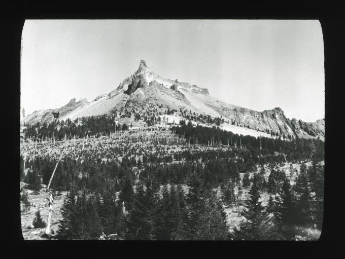
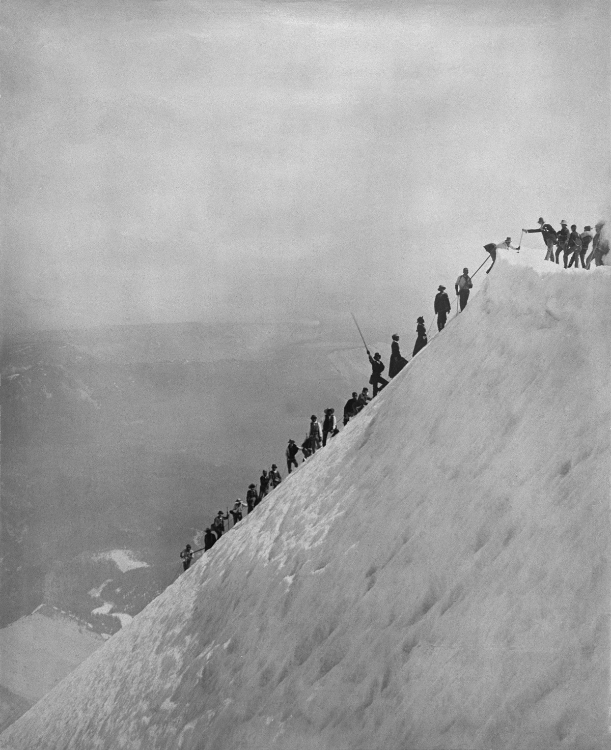
Mount Thielsen, c.1925.
Courtesy Oregon State University Libraries -
![]()
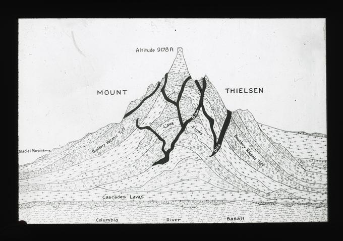
Cross-section of Mount Thielsen, c.1925.
Courtesy Oregon State University Libraries -
![]()
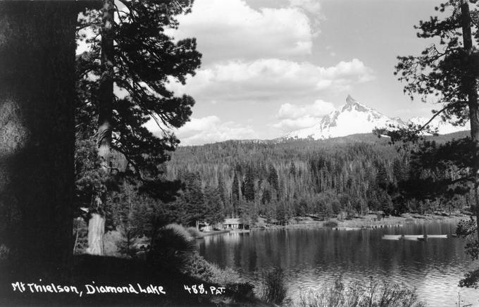
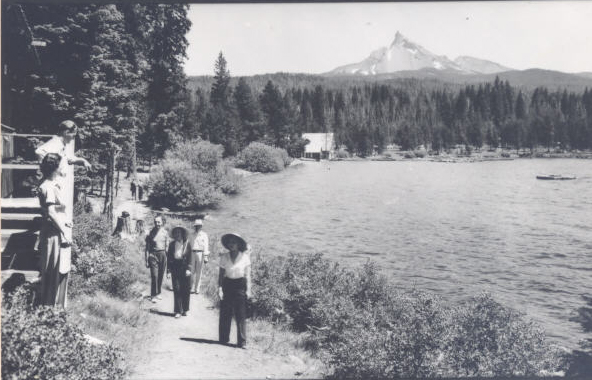
Diamond Lake, with Mount Thielsen in the background, 1932.
Courtesy Oregon State University Libraries -
![]()
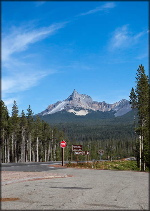
Mount Thielsen.
Courtesy U.S. Forest Service
Related Entries
-
![Cascade Mountain Range in Oregon]()
Cascade Mountain Range in Oregon
The Cascade mountain system extends from northern California to central…
-
![Diamond Lake]()
Diamond Lake
“Gem of the Cascades” is how Diamond Lake is heralded by those who trou…
-
![Henry Villard (1835-1900)]()
Henry Villard (1835-1900)
Henry Villard gained national significance as a journalist, advocate of…
-
![Mount Hood]()
Mount Hood
Mount Hood is a stratovolcano in northwest Oregon located about fifty m…
-
![Mount Mazama]()
Mount Mazama
Mount Mazama is located in the southern part of the Cascade Range, abou…
Map This on the Oregon History WayFinder
The Oregon History Wayfinder is an interactive map that identifies significant places, people, and events in Oregon history.
Further Reading
"Oregon's southernmost glacier named for hypothermia expert." Oregon Geology 43.2: 20.
Clark, R.C. History of the Willamette Valley, Oregon. Chicago, Ill.: S.J. Clarke Publishing Co., 1927.
Lafrenz, M.D. "The Neoglacial history of Mt. Thielsen, Southern Oregon Cascades." Master's thesis, Portland Sstate University, 2001.
Lathrop, T.G. "Return of the Ice Age?" Mazama 50.13 (1968): 34–36.
Porter, S.C., and G.H. Denton. "Chronology of Neoglaciation in the North American Cordillera." American Journal of Science 265.3 (1967): 177–210. doi:10.2475/ajs.265.3.177.
Purdom, W.B. "Fulgurites from Mount Thielsen, Oregon." Ore Bin 28.9 (1966): 153–159.
U.S. Geological Survey, Mount Thielsen topographic quadrangle, scale 1:24,000, 1985.
Williams, H. "Mount Thielsen, a dissected Cascade volcano: University of California Publications." Bulletin of the Department of Geological Sciences 23.6 (1933): 195–214.