The unincorporated town of Christmas Valley (population approximately 1,300) stretches for over five miles along both sides of Lake County Hwy 5-14 (Christmas Valley-Wagontire Road), yet rarely does the community's widely scattered buildings extend more than half a mile back from that road. Located within the flat, sagebrush-filled expanse of a huge Ice-Age lake bed called Christmas Lake Valley, the town began in the 1960s as a California real estate developer’s dream. That scheme, which largely failed, gives Christmas Valley a history unlike that of any other town in Oregon’s high desert.
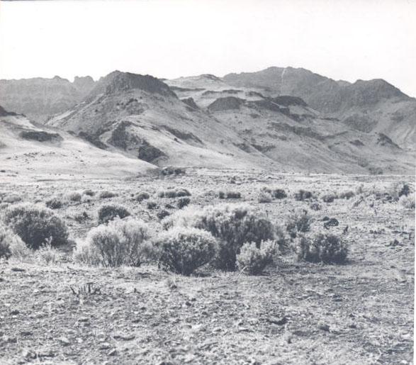
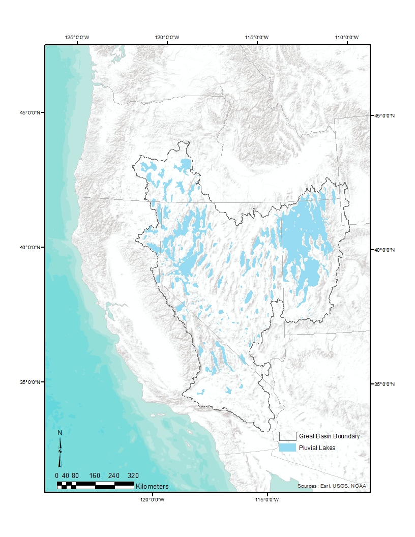
The Christmas Valley townsite is situated in northern Lake County at about 4,300 feet above sea level in the western portion of Christmas Lake Valley. Today, the region is among the most arid places in Oregon, but approximately 12,000 years ago it formed part of a huge late-Pleistocene pluvial lake called Lake Fort Rock. The origin of the place name “Christmas” may have resulted from a spelling error. In the 1870s, cattleman Peter Chrisman built a cabin about six miles northeast of the present town near a seasonal alkali lake. What was originally known as Chrisman or Christman Lake had morphed into Christmas Lake by 1877.
The region had long been home to bands of the Northern Paiute people, who seasonally gathered edible plants, hunted game, and periodically held jackrabbit drives for food, hides, and as inter-band social gatherings. With the initial arrival of White stockmen in the 1860s-1870s, livestock raising, especially cattle, became the valley’s dominant activity. Sheep were important beginning in the 1890s up to the period of the high desert's “sheep-shooting war” of 1900-1905, when vigilante cattlemen captured sheepherders and killed thousands of sheep in a conflict over rangeland.
Beginning in about 1905, hundreds of would-be farmers—encouraged by a period of unusually wet years and, after 1909, by the generous acreage provisions of the Enlarged Homestead Act—arrived in the valley as part of a dry-farming boom. They homesteaded scores of 320-acre claims on federal land, built cabins, dug wells, grubbed out sagebrush, and struggled to “make a go” by raising grain crops. Several tiny hamlets soon dotted Christmas Lake Valley to serve the newcomers. One such place, named Lake, was settled within what would become the town of Christmas Valley. The high desert’s frequent killing frosts, however, and a return to dryer years after 1915 made successful dry farming nearly impossible. Although the Lake post office did not close until 1943, by 1920 most homesteaders had abandoned the area after “proving up”—obtaining legal ownership on claims by fulfilling the land grant requirements.
The ZX Ranch, headquartered in the town of Paisley some fifty miles southeast of Lake, had acquired large tracts of state swampland in the Paisley area during the late nineteenth and early twentieth centuries and purchased abandoned homesteaded land and other properties in the Christmas Lake Valley during the 1920s-1930s, typically at very low prices. ZX cattle grazed the valley floor, often seeking shade from the summer sun in the shadows of former homestead cabins. The ranch is still among the largest in the country (approximately 1.3 million acres).
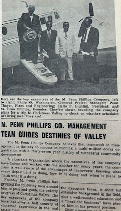
In the early 1960s, California real estate developer M. Penn Phillips forever altered the course of the area’s history. Phillips aggressively promoted new communities in remote areas of the Southern California desert, such as Hesperia and Salton City, to middle-income families. He had a reputation for misleading investors and using shoddy construction methods. In 1960, Phillips headed north to Christmas Lake Valley for his next residential project.
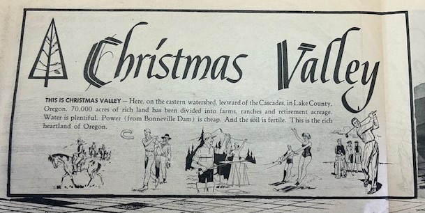
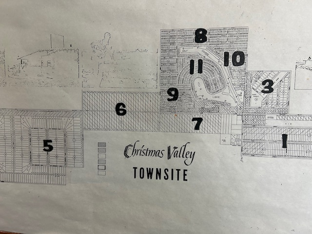
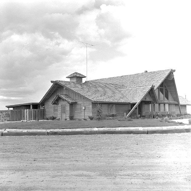
Giving his development the cheerful name of Christmas Valley, Phillips purchased thousands of acres of sagebrush from the ZX Ranch and others and surveyed a townsite for a population of 5,000. Construction began in 1961 on several model homes, a 5,000-foot airstrip, a golf course, and a Mid-Century-Modern-style lodge (said to have cost over $90,000) that fronted an artificial lake dubbed Christmas Valley Lake (now Baert Lake). Through advertisement in popular magazines and elsewhere, Phillips marketed the town as a resort with inexpensive second-homes and a place to comfortably enjoy the "rugged West.” Legal problems followed, including a state investigation of falsified property-tax evaluations and claims by buyers suing for financial fraud. Most of the lots were bought by out-of-state speculators who left the properties undeveloped. By the end of the decade, the total population of Christmas Valley was about 150 people, and Phillips was long-gone.
Still, with paved streets and some houses built, the development remained a fact on the land. Affordable lot prices and remote living attracted a trickle of newcomers. During the 1980s, scattered mobile homes and small houses appeared within and around the town. A growing number of businesses began to line the Christmas Valley Highway. In 2025, the town has two stop signs but no traffic lights, a post office, county-courthouse annex, county health clinic, credit union, church, and a small park. The K-12 North Lake School is located a few miles west of town.
Recent construction of the large Archway solar farm east of town created a few temporary local jobs, as did a now-defunct open-pit mine for diatomaceous earth used for cat litter. Recently, a proposed huge landfill operation (which, if approved, would be the largest in the Pacific Northwest) provoked both concerns and hopes among Christmas Valley residents. Ranching (both family and corporate) and growing alfalfa hay remain important to the town and the valley.
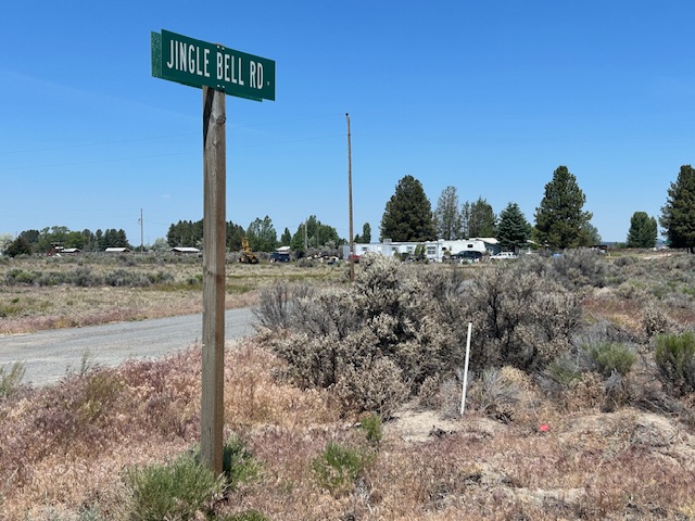
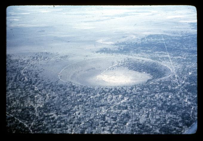
Christmas Valley is surrounded by several unusual geological formations, such as Fort Rock State Natural Area, Crack in the Ground, Hole in the Ground, the Christmas Valley Sand Dunes, and the Lost Forest. The sites are popular tourist destinations, and the Christmas Valley Back Country Byway (designated in 1989) guides a steady stream of visitors through town during the summer. As people pass through, they might see reminders of Penn Phillips’ ill-fated development scheme on Christmas Valley’s street signs: Jingle Bell Road, Snowman Road, Mistletoe Road, and Holly Street.
-
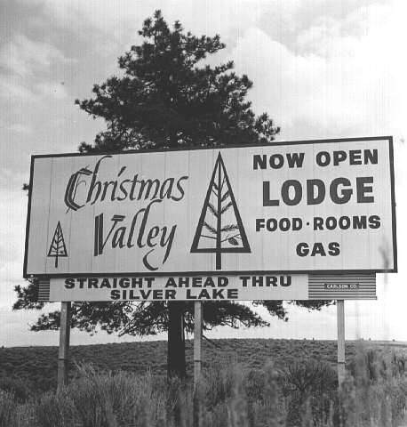
![Ben Maxwell, photographer.]()
Christmas Valley Lodge Sign, Lake County, Oregon, 1963.
Ben Maxwell, photographer. Courtesy Salem Public Library Historic Photograph Collections, Salem Public Library, Salem, Oregon, 5745 -
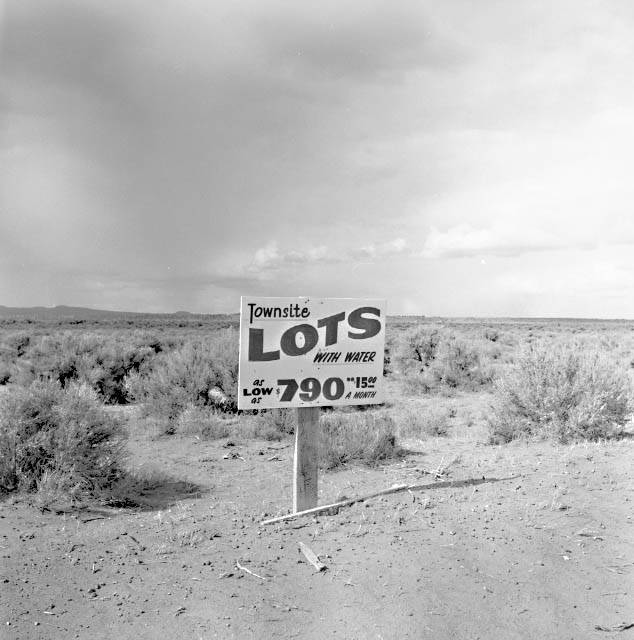
![Ben Maxwell, photographer]()
Townsite lot realtor's sign in Christmas Valley, Lake County, Oregon, 1963.
Ben Maxwell, photographer Courtesy Salem Public Library Historic Photograph Collections, Salem Public Library, Salem, Oregon, 5749 -
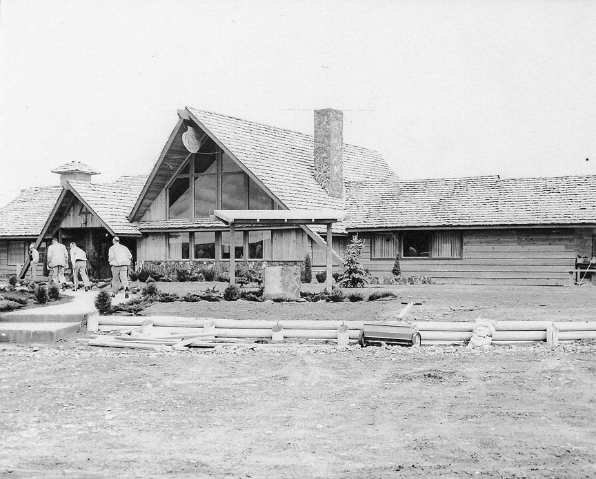
![]()
Christmas Valley Lodge, 1962.
Oregon Historical Society Research Library, Oregon Journal Collection, OrHi 007154
-
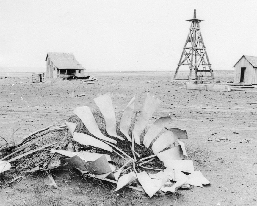
![]()
Abandoned Ranch, Christmas Valley, 1963.
Oregon Historical Society Research Library, Oregon Journal Collection, CN 007153
-
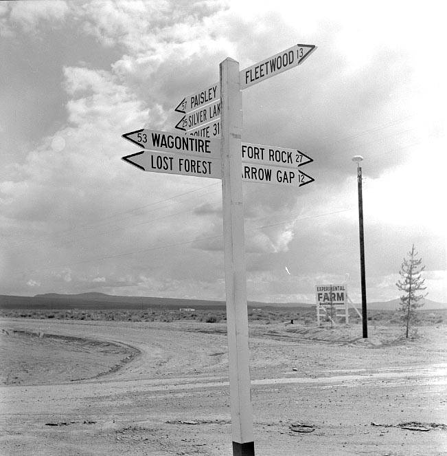
![Ben Maxwell, photographer.]()
Road sign at Christmas Valley in Lake County, Oregon, 1963.
Ben Maxwell, photographer. Courtesy Salem Public Library Historic Photograph Collections, Salem Public Library, Salem, Oregon, 5746 -
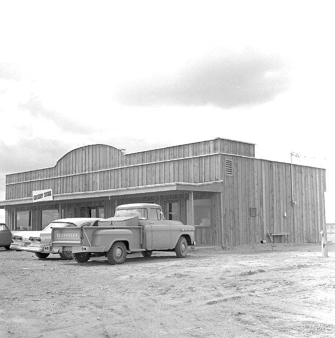
![Ben Maxwell, photographer.]()
Post Office and store in Christmas Valley, Lake County, Oregon, 1963.
Ben Maxwell, photographer. Courtesy Salem Public Library Historic Photograph Collections, Salem Public Library, Salem, Oregon, 5744 -
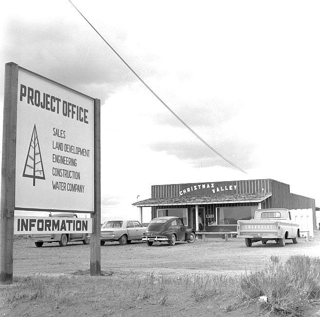
![Ben Maxwell, photographer.]()
Project development office in Christmas Valley, Lake County, Oregon, 1963.
Ben Maxwell, photographer. Courtesy Salem Public Library Historic Photograph Collections, Salem Public Library, Salem, Oregon, 5748 -
![]()
Christmas Valley Gazette, Vol.1, No.1, March 1962.
Courtesy Christmas Valley Park and Recreation District -
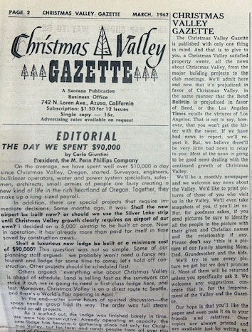
![]()
Christmas Valley Gazette, page 2, March 1962. Newspaper of the Christmas Valley Development Company.
Courtesy Jeff LaLande
-
![M. Penn Phillips is located on the far left in the photo.]()
Christmas Valley Gazette, page 2, March 1962. Newspaper of the Christmas Valley Development Company.
M. Penn Phillips is located on the far left in the photo. Courtesy Jeff LaLande
-
![]()
Christmas Valley promotional literature, 1960s.
Courtesy Jeff LaLande
-
![]()
Christmas Valley map showing surveyed lots in the early 1960s.
Courtesy Jeff LaLande
-
![Ben Maxwell, photographer.]()
Christmas Valley Lodge in Lake County, Oregon, 1963.
Ben Maxwell, photographer. Courtesy Salem Public Library Historic Photograph Collections, Salem Public Library, Salem, Oregon, 5750 -
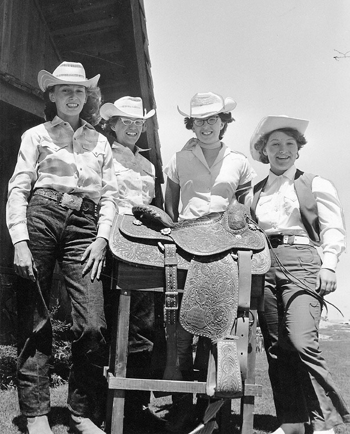
![From left are Terry Ann Foster, Janice Foster, Queen Marilyn Ward, and Velma Roper.]()
Christmas Valley Rodeo Queen and Court, July 1963.
From left are Terry Ann Foster, Janice Foster, Queen Marilyn Ward, and Velma Roper. Oregon Historical Society Research Library, Oregon Journal Collection, OrHi 105514
-
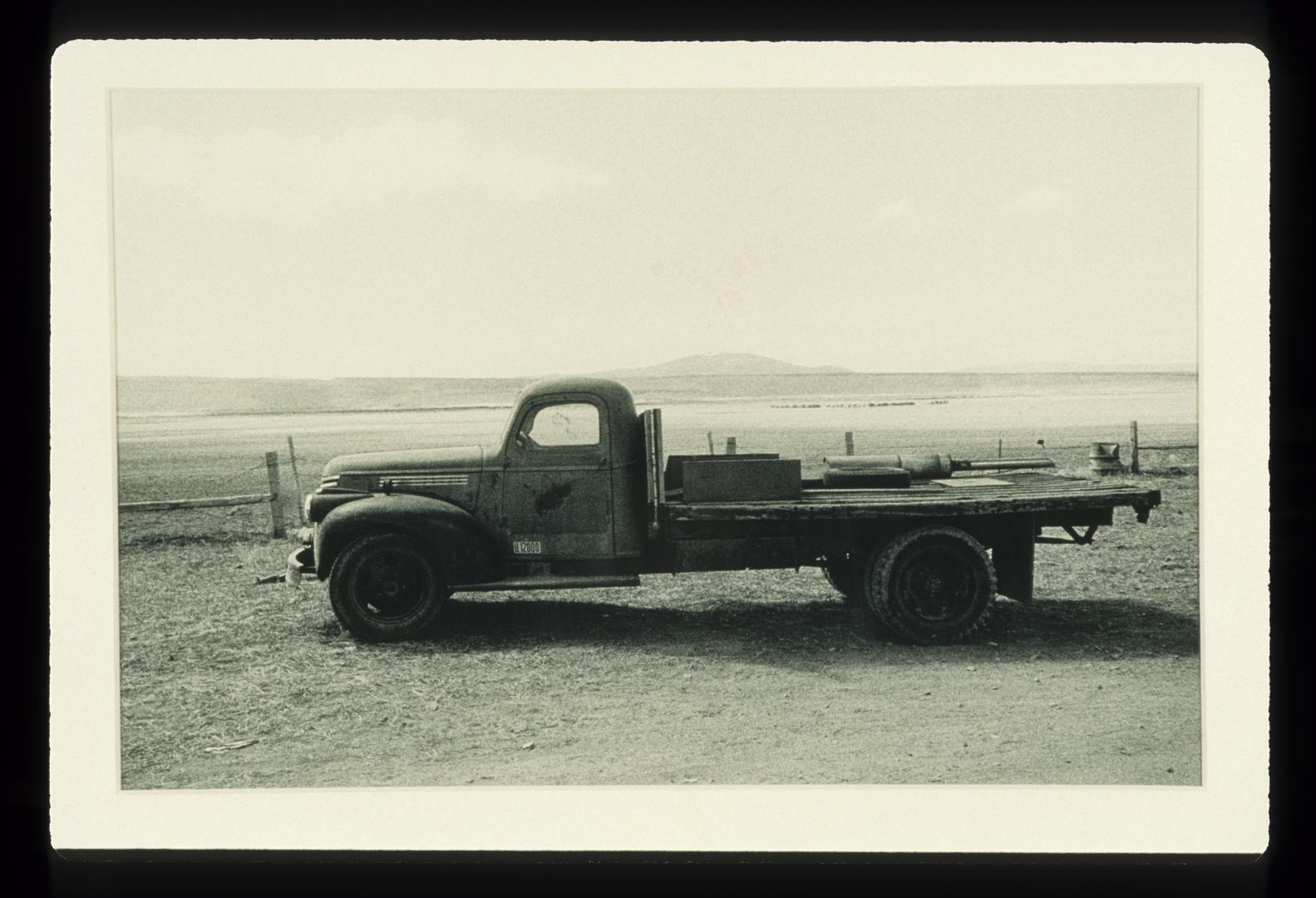
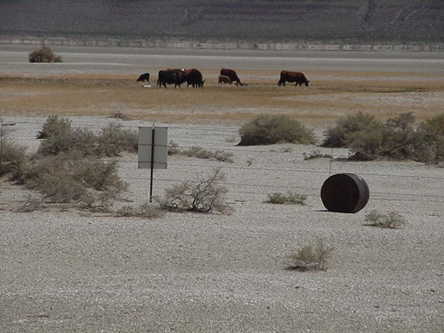
![]()
Flatbed truck near Christmas Valley, 1976.
Courtesy Oregon Percent for Art, University of Oregon. "Near Christmas Valley, Oregon" Oregon Digital -
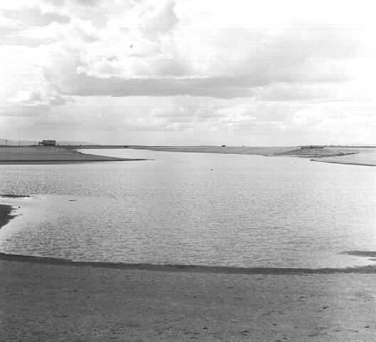
![Ben Maxwell, photographer.]()
Baert Lake in Christmas Valley, Lake County, Oregon, 1963.
Ben Maxwell, photographer. Courtesy Salem Public Library Historic Photograph Collections, Salem Public Library, Salem, Oregon, 5747 -
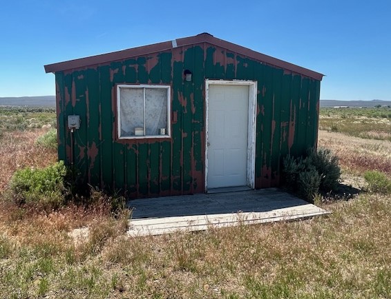
![]()
Abandoned all-metal cabin, east of Christmas Valley townsite, 2024.
Courtesy Jeff LaLande
-
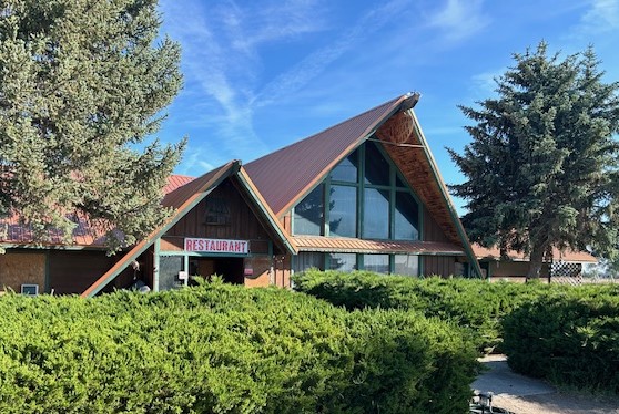
![]()
Christmas Valley Lodge, 2024.
Courtesy Jeff LaLande
-
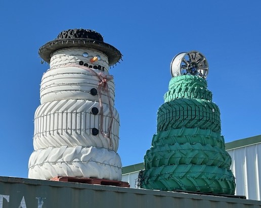
![]()
Christmas Valley Frosty the Snowman and Christmas tree made from tires at auto shop, 2024.
Courtesy Jeff LaLande
-
![]()
Jingle Bell Road, Christmas Valley, 2024.
Courtesy Jeff LaLande
-
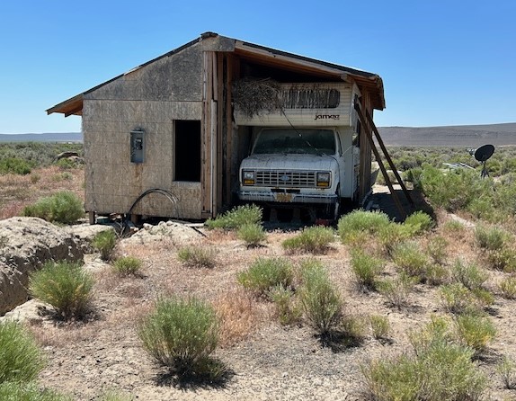
![]()
Unfinished and abandoned residence east of Christmas Valley, 2024.
Courtesy Jeff LaLande
-
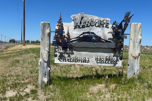
![]()
Welcome to Christmas Valley sign, 2024.
Courtesy Jeff LaLande
-
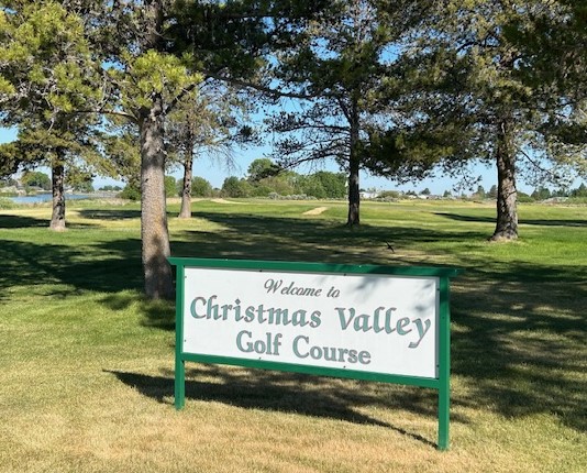
![]()
Christmas Valley Golf Course, 2024.
Courtesy Jeff LaLande
-
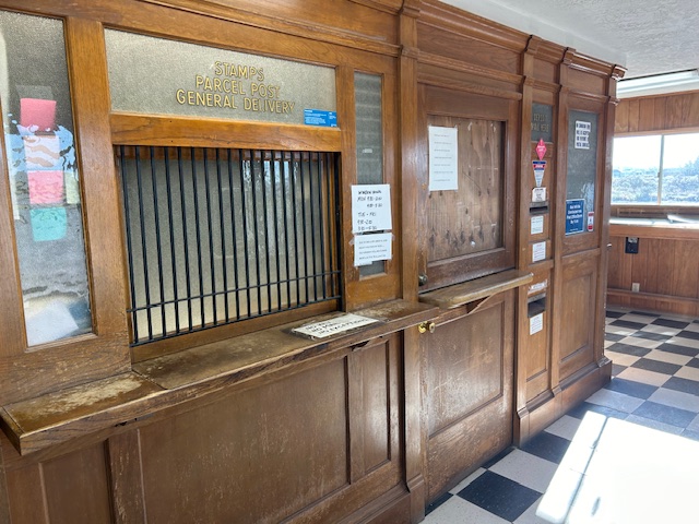
![]()
Christmas Valley post office, originally built in the early 1960s, 2024.
Courtesy Jeff LaLande

Related Entries
-
![Alkali Lake Chemical Waste Disposal Site]()
Alkali Lake Chemical Waste Disposal Site
The Alkali Lake Chemical Waste Disposal site—located thirty-five miles …
-
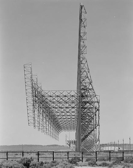
![Christmas Valley Air Force Station]()
Christmas Valley Air Force Station
The Christmas Valley Air Force Station, established in the late Cold Wa…
-
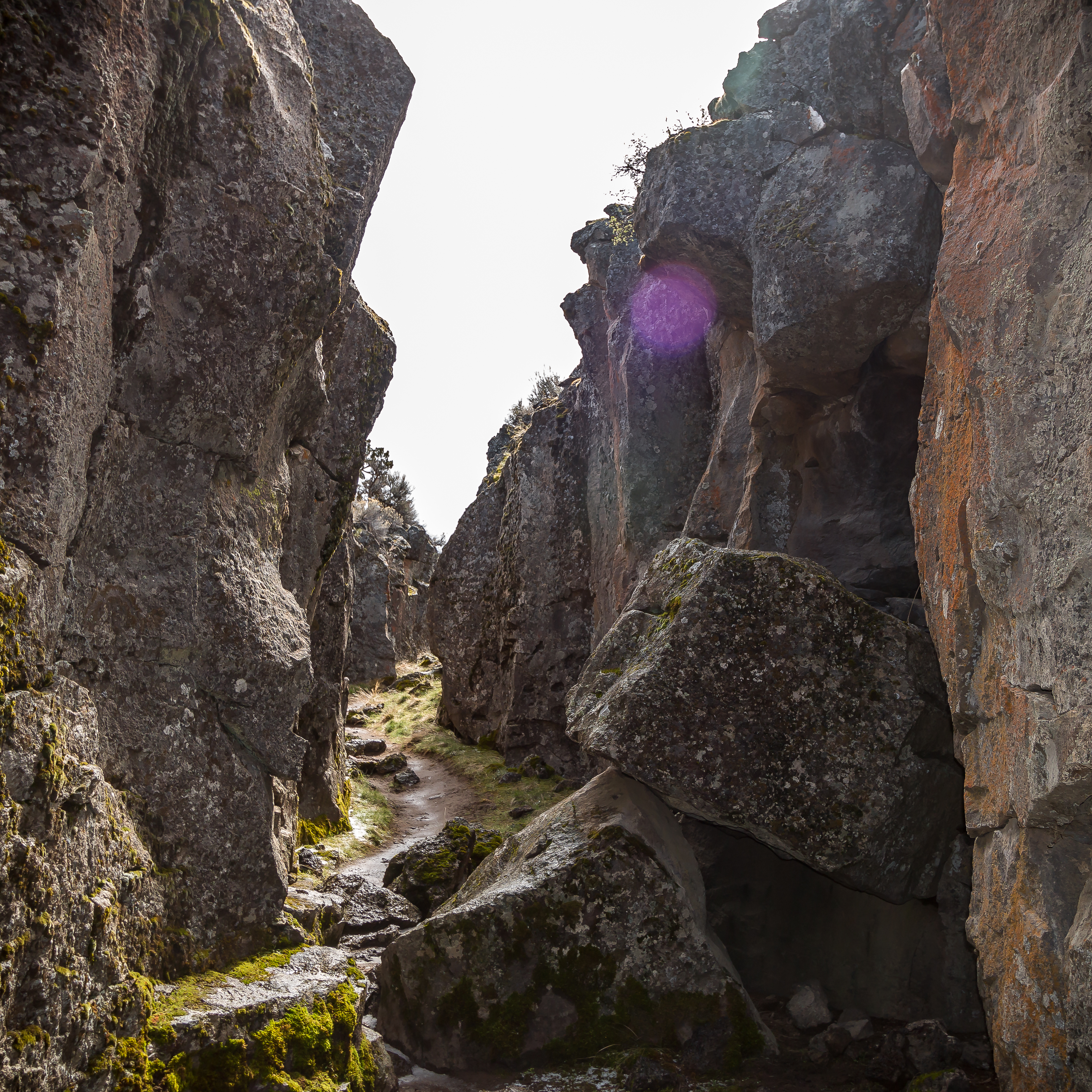
![Crack in the Ground]()
Crack in the Ground
Crack in the Ground is just that, a gaping fracture of tectonic origin …
-
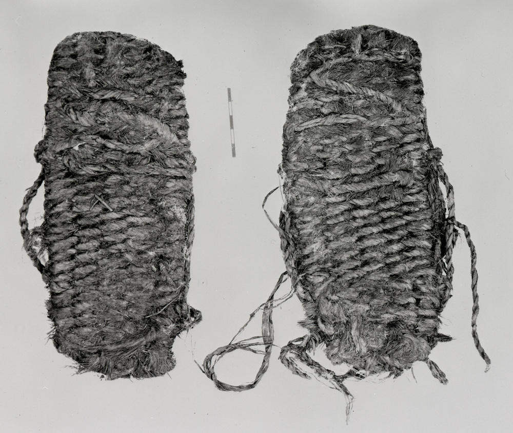
![Fort Rock Sandals]()
Fort Rock Sandals
Fort Rock sandals are a distinctive type of ancient fiber footwear foun…
-
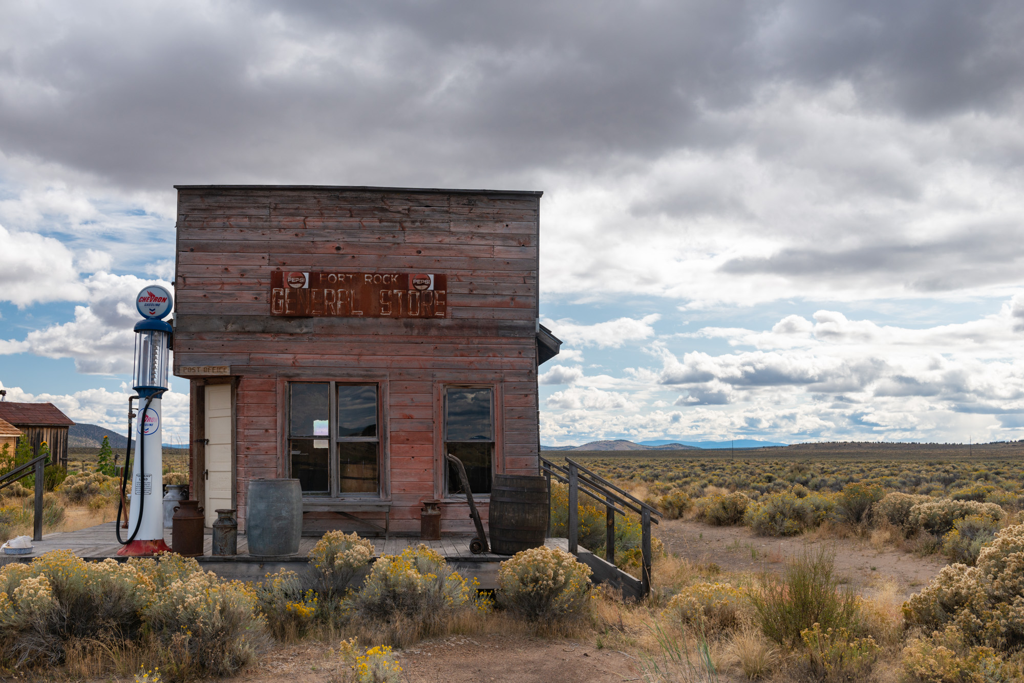
![Fort Rock (town)]()
Fort Rock (town)
The town of Fort Rock is an unincorporated community in northern Lake C…
-
![High Desert]()
High Desert
Oregon’s High Desert is a place apart, an inescapable reality of physic…
-
![Hole in the Ground]()
Hole in the Ground
Hole in the Ground is a spectacular bowl-shaped volcanic crater located…
-
![Pleistocene Pluvial Lakes]()
Pleistocene Pluvial Lakes
During the Last Glacial Maximum, from about 24,000 to about 18,000 year…
Related Historical Records
Map This on the Oregon History WayFinder
The Oregon History Wayfinder is an interactive map that identifies significant places, people, and events in Oregon history.
Further Reading
Bogart, Barbara Allen. Homesteading the High Desert. Salt Lake City, UT: University of Utah Press, 1987.
Gutgulek, Mark. “Penn Phillips: Developer, Government Official, Charlatan.” San Bernadino Sentinel, August 25, 2015.
Shaver, Frederic Ambrose. An Illustrated History of Central Oregon: Embracing Wasco, Sherman, Gilliam, Wheeler, Crook, Lake, and Klamath Counties, State of Oregon. Spokane, Wash.: Western Historical Publishing Company, 1905.
Tupper, Melany. "Early History of Christmas Valley, Oregon." Christmas Valley Property.