The Wilson River Highway (Oregon Route 6) begins in Tillamook near the north Oregon Coast and winds east along the Wilson River through the Tillamook State Forest and over the Coast Range. The fifty-two-mile-long highway ends at the Sunset Highway (US 26) near Banks. The highway, completed as OR 6 in 1941, provides an important commercial interchange and access for businesses and residents of rural and coastal towns in Washington, Tillamook, and Multnomah Counties.
Tillamook Indians circumvented the rugged north Coast Range to reach the Willamette Valley by canoe on the Pacific Ocean and Columbia River or by taking a trail south from Tillamook Bay, southeast up the Nestucca River, across the lower-elevation central Coast Range, and northeast down the Yamhill River. EuroAmericans followed the same route and depended on ships to transport produce and obtain supplies from Astoria and Portland. But erratic schedules, unfavorable weather, and hazardous conditions in Tillamook Bay and on the Columbia River led to a search for an easier route across the mountains.
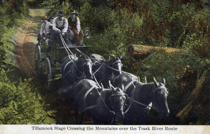
By 1874, the Trask Toll Road—a narrow, steep, and sometimes harrowing track over the Coast Range to the Willamette Valley—had been completed with financial support from the Oregon legislature. Travelers could take the forty-five-mile road along the Trask River southeast from Tillamook to climb the Coast Range before descending into the Yamhill Valley, where they would ride another forty miles (or so) to Portland. The trip usually took two days.
In 1876, Tillamook farmers William Baxter, Jacob Elliott, and William Doughty sought a more direct route—up the Wilson River and down Gales Creek—but they got lost and nearly starved before returning home. In 1890, a group led by W. S. Runyan began building an eight-foot-wide, forty-five-mile-long dirt toll road that began east of Tillamook and followed the Wilson River and its South Fork before climbing to the 1,743-foot summit and dropping a thousand feet to Gales City. When the road was completed in 1893, travelers could cross the Coast Range in a day.
The Wilson River Toll Road improved intercity commerce and also provided scenic views and recreational opportunities that made it popular with vacationers. But the company was bankrupt by 1900, and stagecoach driver John McNamer assumed ownership of the road in 1901. But because of McNamer’s insistence that travelers often clear the road themselves and pay tolls for commercial loads, people tore the gates down in 1907. Tillamook County soon took ownership of the road and eliminated the tolls.
In 1906, real estate developer E. F. Cannon and fellow Portland Automobile Club member O. W. Olsen claimed to be the first to drive an automobile from Tillamook to Portland on the Wilson River Road. It took them six days in a steam-powered Locomobile. The road was “full of muck holes and lined with rickety bridges,” the August 18 Oregon Journal reported, and Cannon said he was “not in a hurry to do it again.” Most Portland autoists took a longer, southern loop using forerunners of OR 99 W, OR 18, OR 22, and U.S. 101. The 112-mile trip took at least five hours and forty-five minutes.
The Pacific Railway & Navigation Company rail line, completed in 1911, became the preferred mode of freight and passenger transport between Tillamook and Portland and spurred a booming tourism industry on the coast. The winding train journey was uncomfortable and cars had become more popular, so Tillamook and Washington Counties looked to the Wilson River Road to attract visitors with a faster, easier route over the Coast Range. In 1921, the counties paid a surveyor to lay out the road. The survey lay dormant for ten years before the Oregon State Highway Commission revisited it and dedicated Wilson River Road as a state highway (Oregon 6) in answer to an “insistent demand” by travelers for “fast routes from Portland to the northern beaches,” as explained in the 1939-1940 Oregon Blue Book.
After reviewing the route surveyed in 1921, state surveyors laid out an entirely new route east along Devils Lake Fork to a lower summit of 1,586 feet and a more gradual drop to Glenwood. After years of false starts and funding woes, construction began in 1934 with federal assistance to improve the eighteen miles between Tillamook and Jordan Creek so loggers could haul trees killed by the 1933 Tillamook Burn. In 1936, the Works Progress Administration (WPA) provided the funds to finish the highway.
Contractors, with assistance from WPA workers, spent five years digging and dynamiting their way through the Coast Range, laying culverts, graveling surfaces, and covering them with asphalt. They also built a 606-foot-long, 130-foot-high steel bridge over Devils Lake Fork. Twenty years after the initial road survey, the new Wilson River Highway opened to the public on October 15, 1941, cutting the travel time between Tillamook and Portland by 50 percent.
Two months later, the United States entered World War II, and chose Tillamook as the site for a Naval Air Station to store blimps. During 1942, trucks hauling construction material, logs, dairy, fish, and seafood products shared the Wilson River Highway with construction workers, Navy personnel, and Portland recreationists. Tillamook saw its population double that year.
In 1956, the Oregon Department of Transportation rerouted OR 6 near Dorman Pond to the Sunset Highway, saving drivers only two miles but cutting travel time by a half hour. Landslides blocked the highway in 1965 and 1991, a hazard that threatens as of 2025 to be repeated near milepost 35. Seven traffic deaths in 2021 prompted state legislators to fund the Wilson River Highway Corridor Study. Though completed in August 2023, none of its primary recommendations have been implemented due to lack of funding. Most of the highway is currently unserved by cell towers, which increases emergency service response time. Fiber optic cable laid in 2025 gives hope that might change in the future.
In 2018, Oregon designated the Wilson River Highway as the Trees to Sea Scenic Byway in recognition of the landscape shifts along the route, from the farms and vineyards of Banks, through the Tillamook State Forest.
-
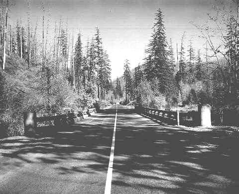
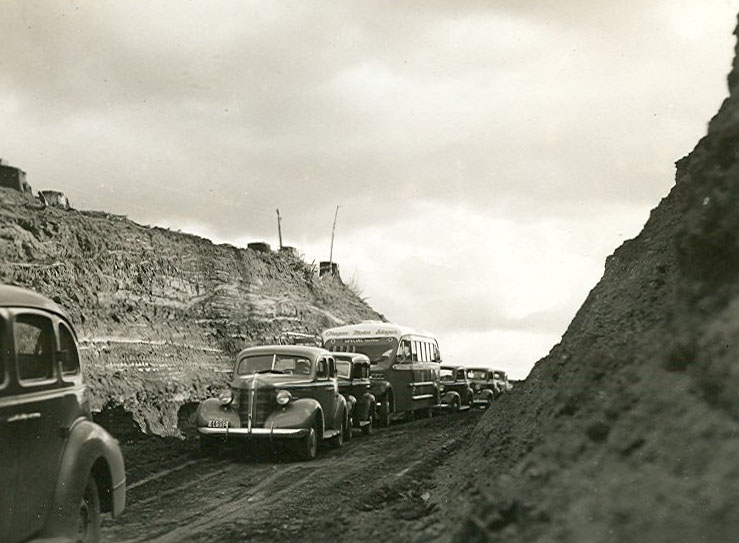
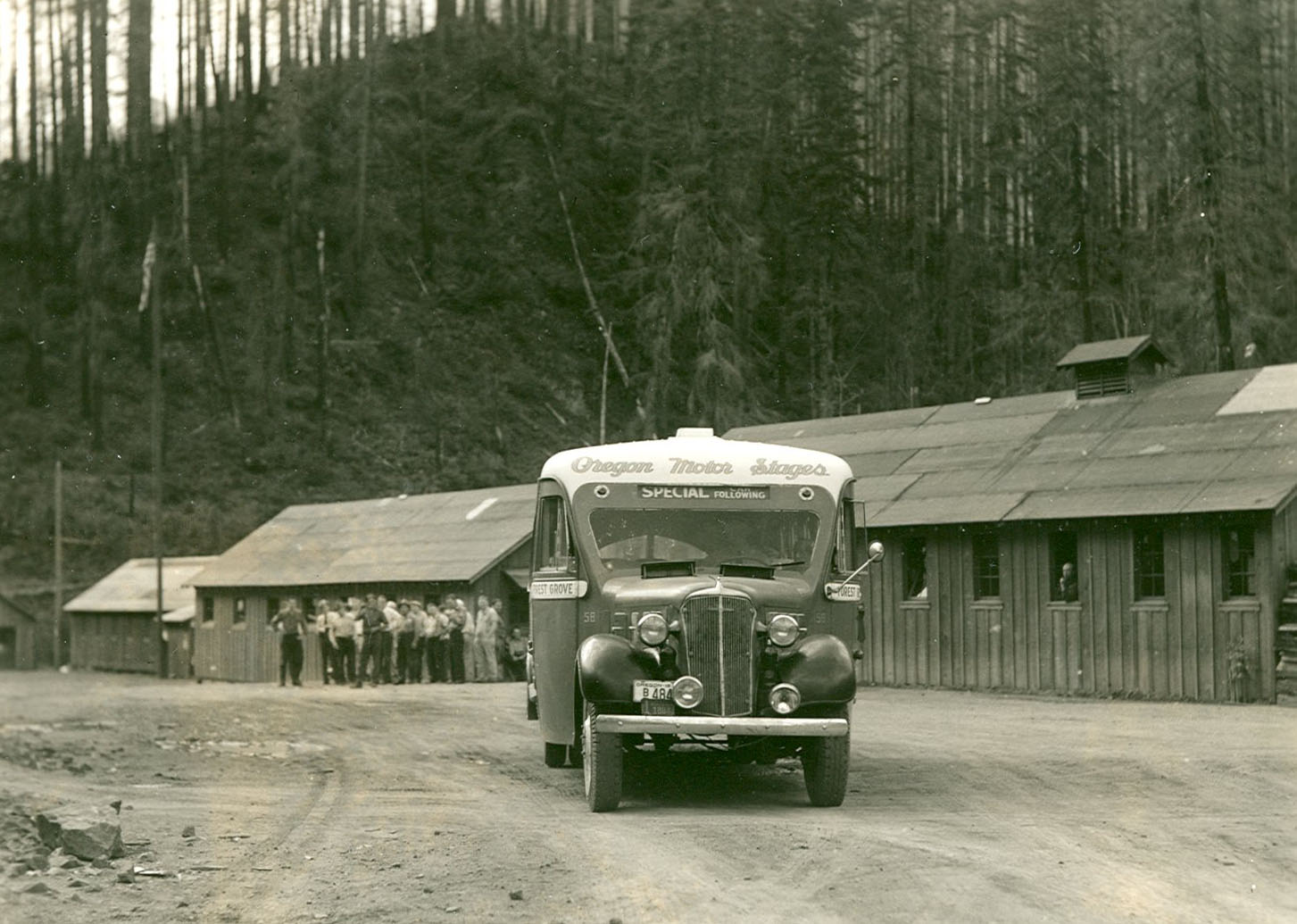
![]()
Wilson River Highway in Tillamook County, Oregon, October 23, 1941.
Courtesy Oregon State Archives, Oregon State Highway Division, OHD1605 -
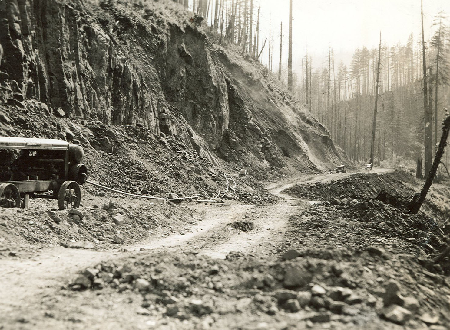
![Number 17 from Series 1939, from “Wilson River and Wolf Creek” album, WPA Writers Project Series 4.]()
Five miles from McNamers Camp on Wilson River Road, 1939.
Number 17 from Series 1939, from “Wilson River and Wolf Creek” album, WPA Writers Project Series 4. Courtesy State Library of Oregon -
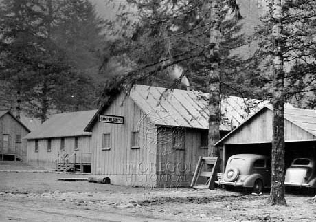
![]()
Camp Wilson No.1, 12 miles east of Tillamook, a WPA camp for workers on the Wilson River Highway project, March 15, 1936.
Oregon Historical Society Research Library, ORHI 66694
-
![Number 35 from Series 1938, from “Wilson River and Wolf Creek” album, WPA Writers Project Series 4.]()
Wilson River Highway looking West from summit, 1938.
Number 35 from Series 1938, from “Wilson River and Wolf Creek” album, WPA Writers Project Series 4. Courtesy State Library of Oregon -
![Number 37 from Series 1938, from “Wilson River and Wolf Creek” album, WPA Writers Project Series 4.]()
Summit on Wilson River Highway, 1938.
Number 37 from Series 1938, from “Wilson River and Wolf Creek” album, WPA Writers Project Series 4. Courtesy State Library of Oregon -
![Number 31 from Series 1938, from “Wilson River and Wolf Creek” album, WPA Writers Project Series 4.]()
Wilson River Highway road construction, 1938.
Number 31 from Series 1938, from “Wilson River and Wolf Creek” album, WPA Writers Project Series 4. Courtesy State Library of Oregon -
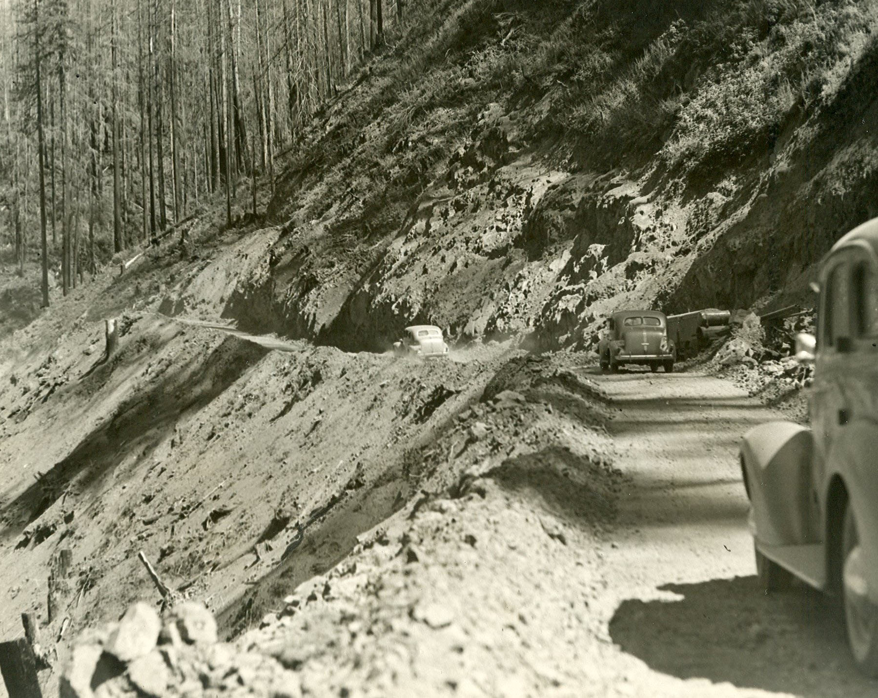
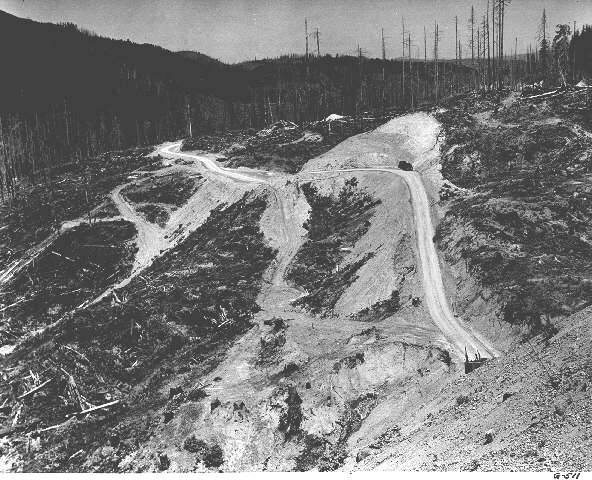
![Road construction at the Wilson River cutoff in Tillamook County. The view is east from a railroad trestle and shows an area of forest burned in the Tillamook Burns, a series of devastating forest fires in Tillamook County in 1933 and 1939.]()
Road construction at the Wilson River cutoff in Tillamook County, 1938.
Road construction at the Wilson River cutoff in Tillamook County. The view is east from a railroad trestle and shows an area of forest burned in the Tillamook Burns, a series of devastating forest fires in Tillamook County in 1933 and 1939. Courtesy Oregon State Archives, OHDG511 -
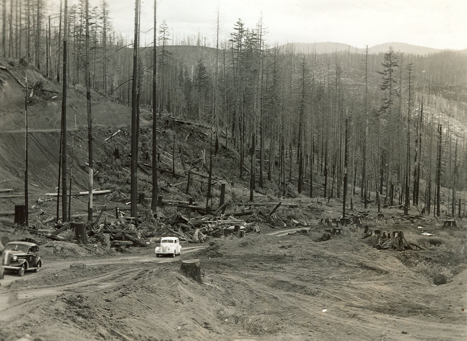
![Number 25 from Series 1938, from “Wilson River and Wolf Creek” album, WPA Writers Project Series 4.]()
-
![WPA Writers Project Series 4.]()
McNamer's Camp, Oregon Coast Range, 1938.
WPA Writers Project Series 4. Courtesy State Library of Oregon -
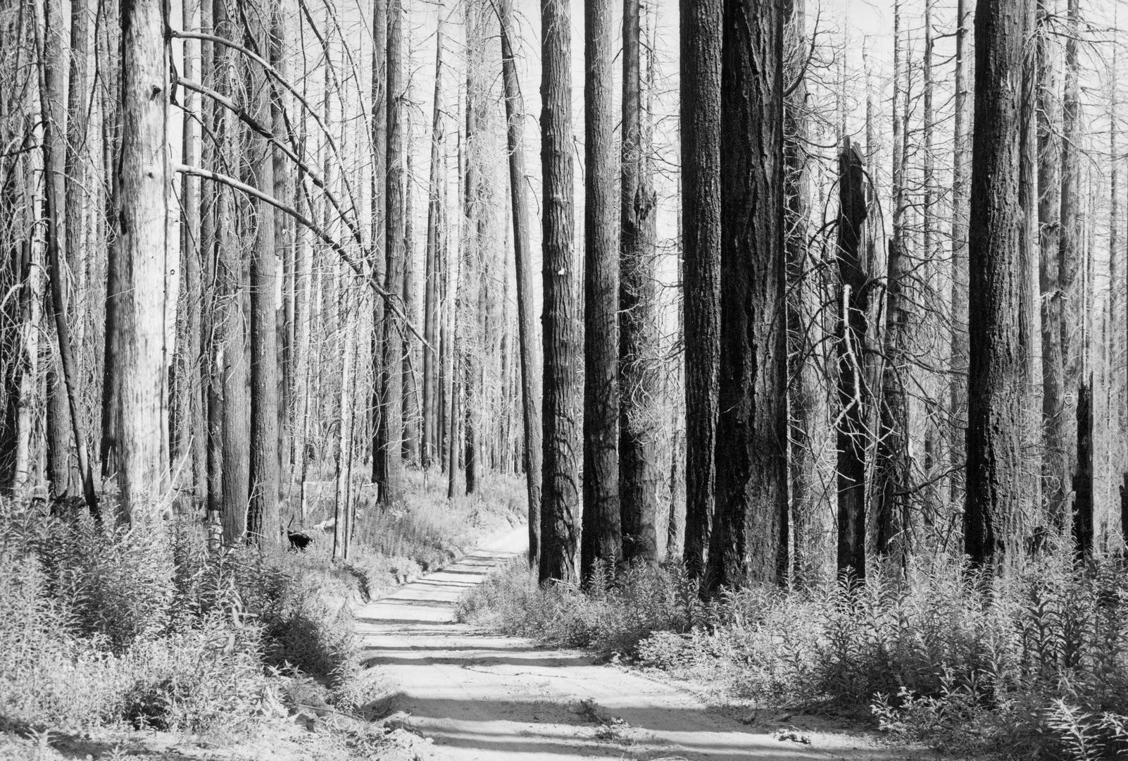
![]()
Old Trask Road in the Tillamook Burn area, 1940.
Courtesy Oregon Explorer, Oregon State University. "Old Trask Road in the Tillamook Burn area" Oregon Digital -
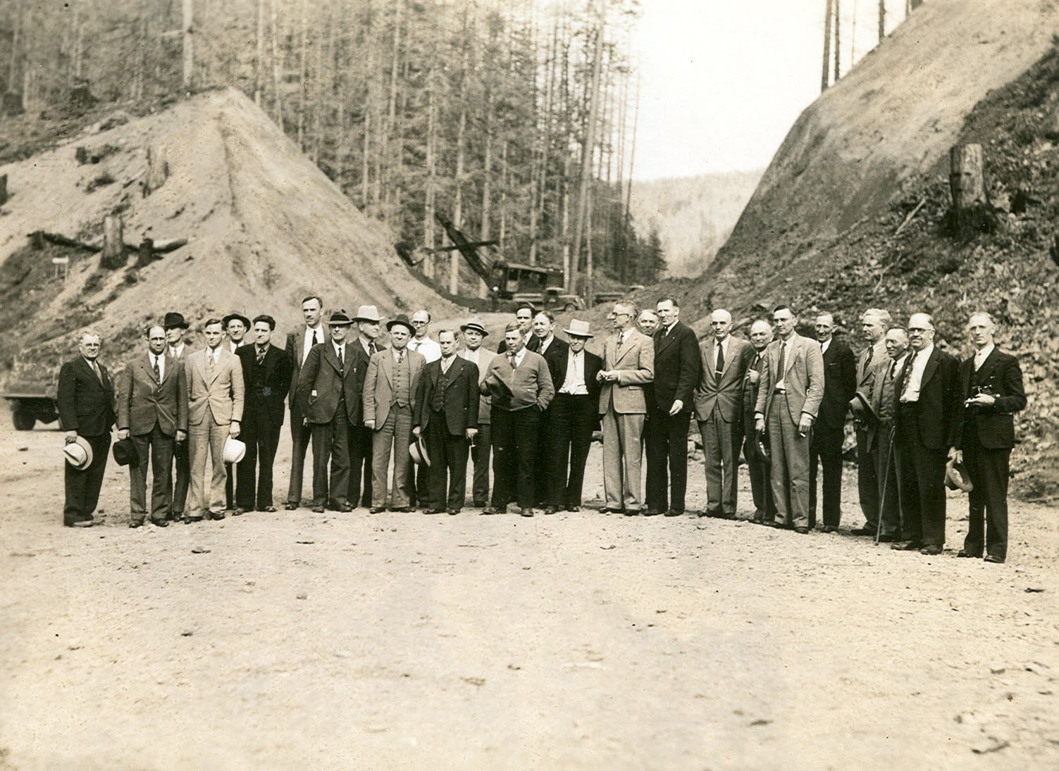
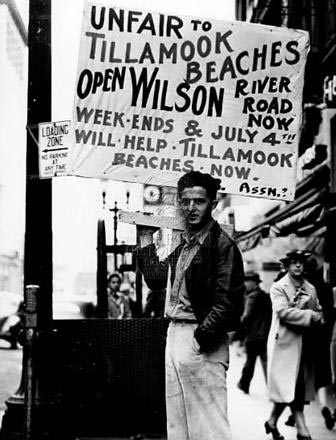
![]()
Tillamook Beach Boosters Association picket at state WPA office in Bedell building to open Wilson River Road, June 1941.
Oregon Historical Society Research Library, Oregon Journal Collection, 005575
-
![]()
Wilson River Road construction, October 8, 1941.
Oregon Historical Society Research Library, Digital Collections, Al Monner news negatives; Org. Lot 1284; Box 14; 393-6 -
![]()
Wilson River Road Construction, October 8, 1941.
Oregon Historical Society Research Library, Digital Collections, Al Monner news negatives; Org. Lot 1284; Box 14; 393-5 -
![]()
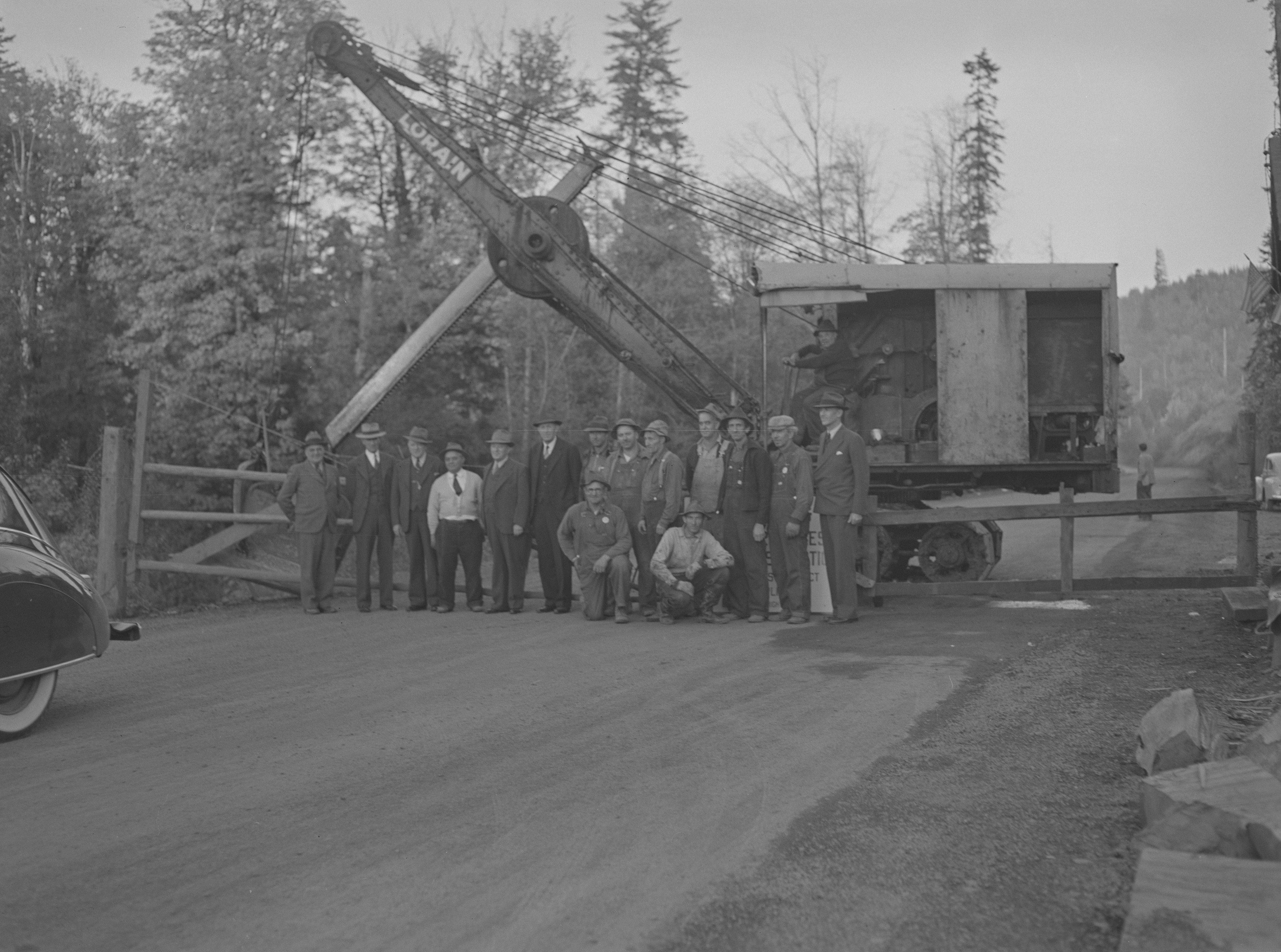
Wilson River Road opening, October 14, 1941.
Oregon Historical Society Research Library, Digital Collections, Al Monner news negatives; Org. Lot 1284; Box 14; 399-4 -
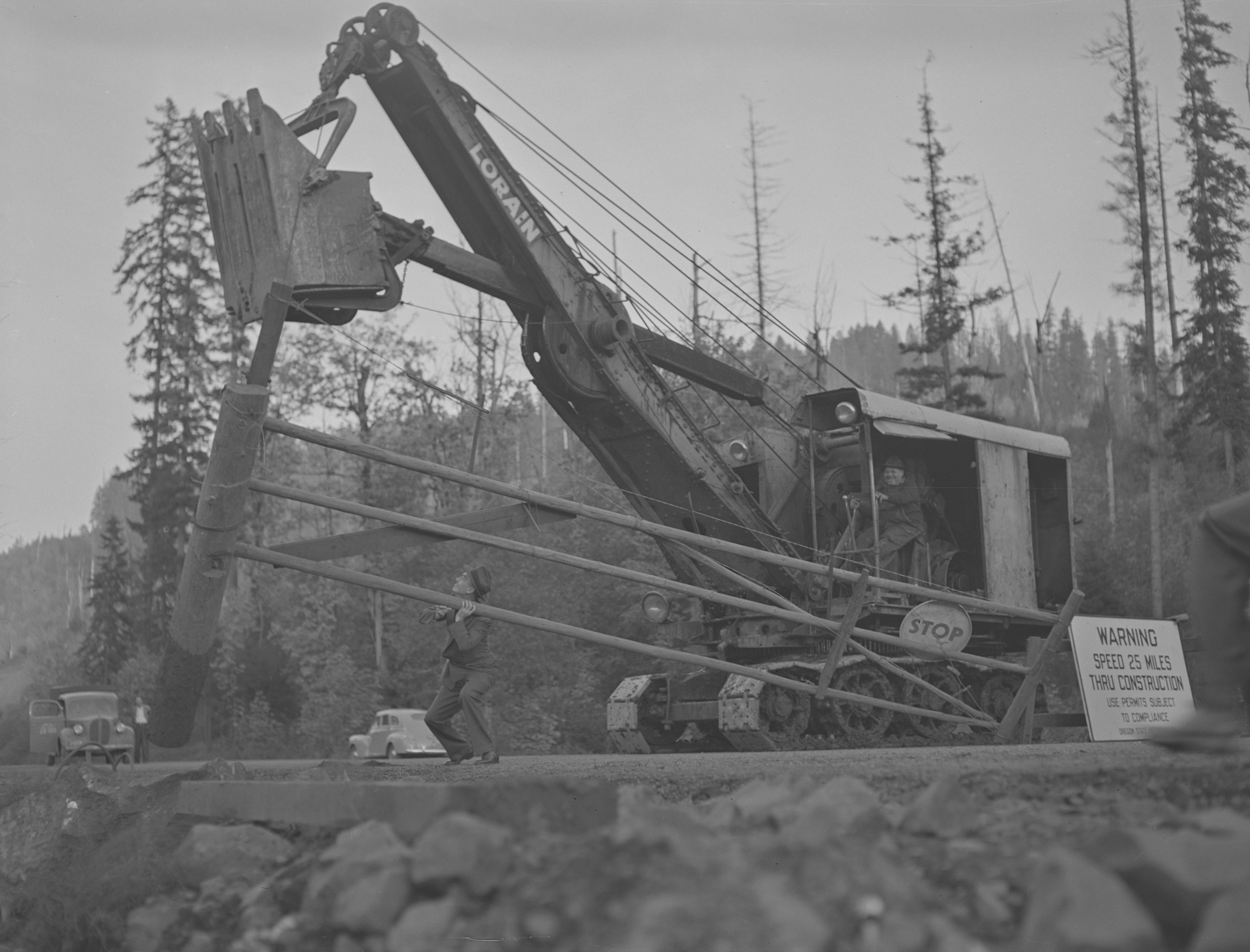
![Photograph showing a gate on the newly opened Wilson River Road, being removed by a crane.]()
-
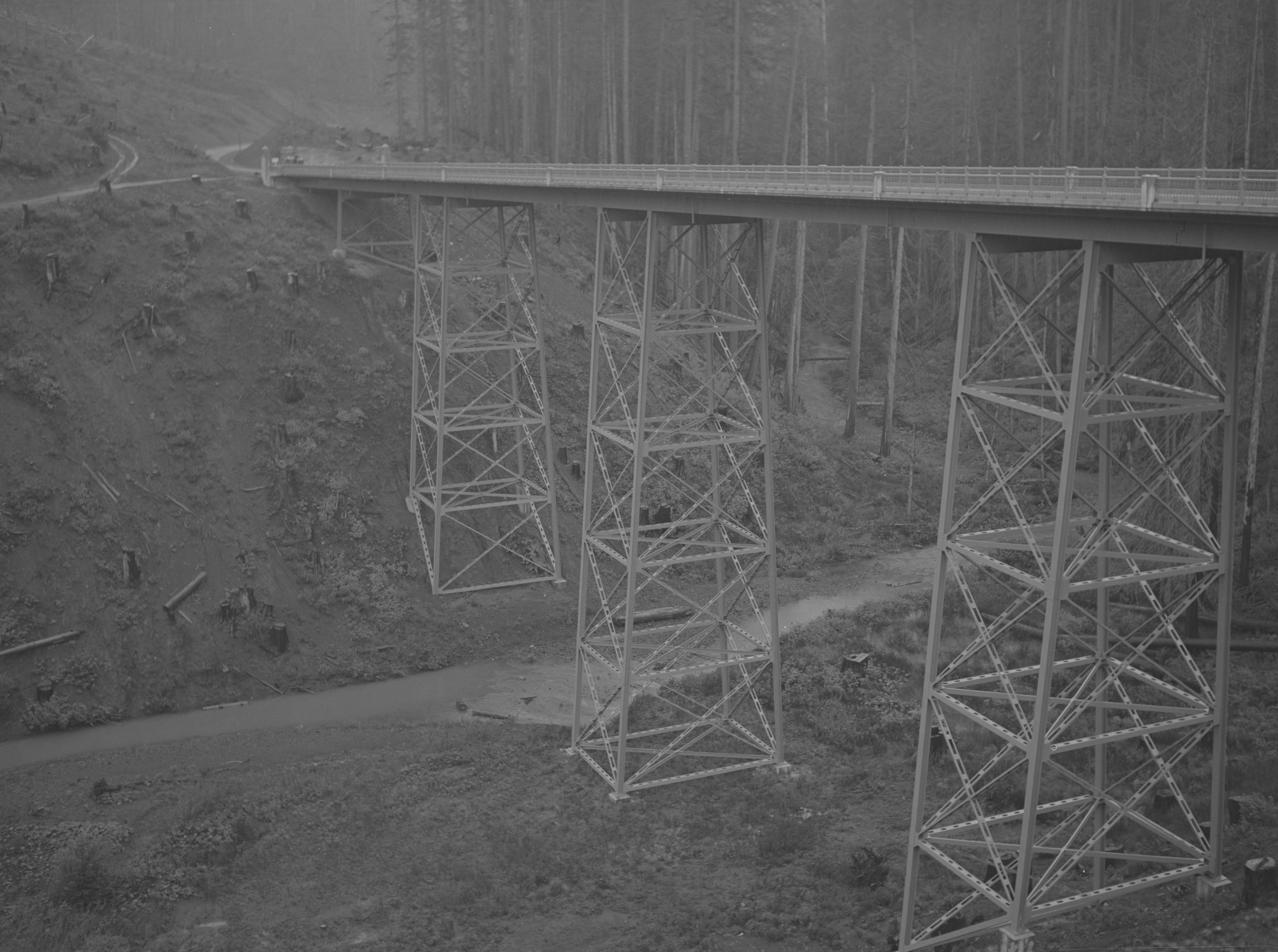
![Ben Maxwell, photographer.]()
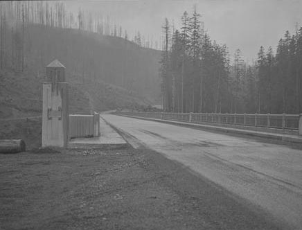
Devils Lake Fork Bridge on State Hwy. 6 in Tillamook County, Oregon, 1957.
Ben Maxwell, photographer. Courtesy Salem Public Library Historic Photograph Collections, Salem Public Library, Salem, Oregon, 5521 -
![Ben Maxwell, photographer.]()
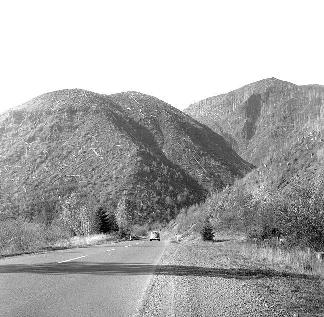
Tillamook Burn as viewed from the Wilson River route in Oregon, 1960.
Ben Maxwell, photographer. Courtesy Salem Public Library Historic Photograph Collections, Salem Public Library, Salem, Oregon, 8287 -
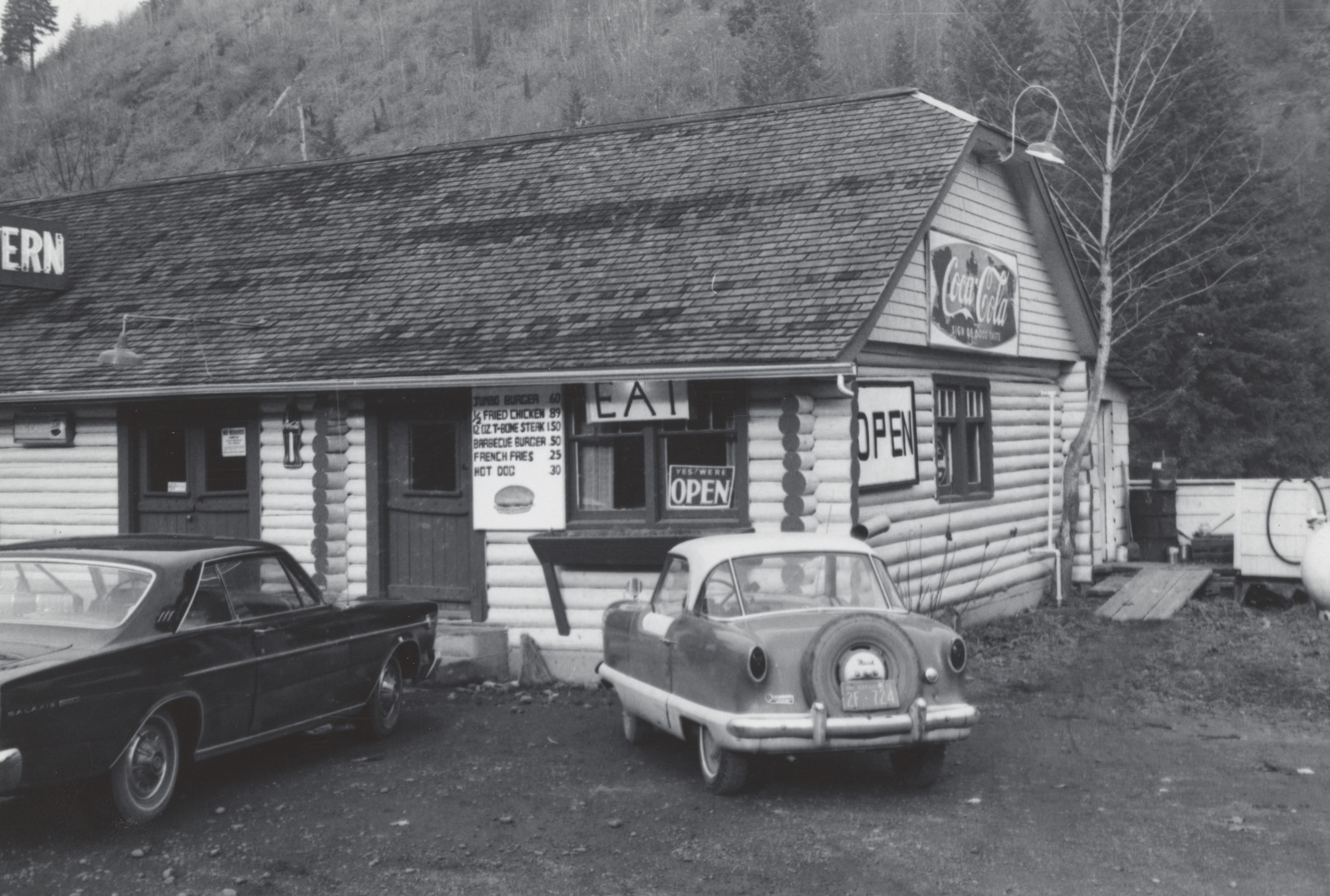
![Two cars are parked outside of the Log Cabin Cafe, located between the communities of Glenwood and Gales Creek on Highway 6.]()
Log Cabin Cafe on Highway 6, Oregon, c.1965.
Two cars are parked outside of the Log Cabin Cafe, located between the communities of Glenwood and Gales Creek on Highway 6. Oregon Historical Society Research Library, Digital Collections, Valley Migrant League photographs, Org. Lot 74, Box 2, Folder 1, 004 -
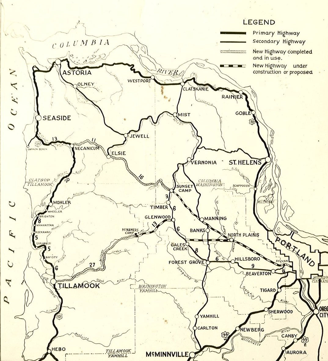
![WPA album of maps and photographs associated with the Wolf Creek-Wilson River Highway, Oregon.]()
Map in WPA Wolf Creek-Wilson River Highway album, c.1937.
WPA album of maps and photographs associated with the Wolf Creek-Wilson River Highway, Oregon. Courtesy State Library of Oregon -
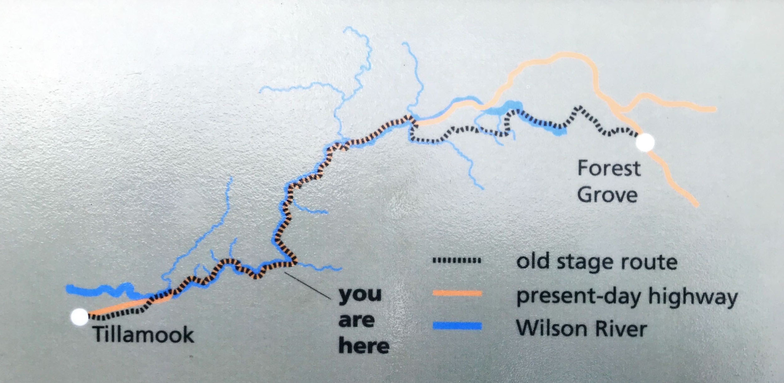
![]()
Map from Charles Sprague Memorial Wayside placard.
Courtesy Jerry Sutherland
Related Entries
-
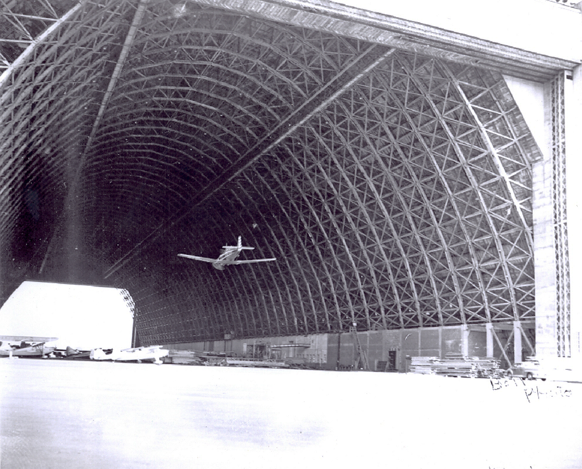
![Naval Air Station Tillamook / Tillamook Air Museum]()
Naval Air Station Tillamook / Tillamook Air Museum
Tillamook is home to the largest free-standing, clear-span wooden struc…
-
![Tillamook]()
Tillamook
Tillamook, the county seat of Tillamook County and its largest city, is…
-
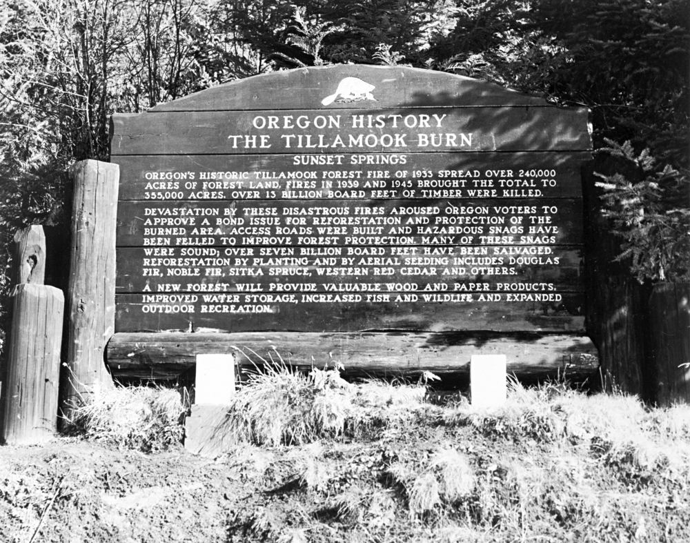
![Tillamook Burn]()
Tillamook Burn
The Tillamook Burn was a catastrophic series of large forest fires in t…
-
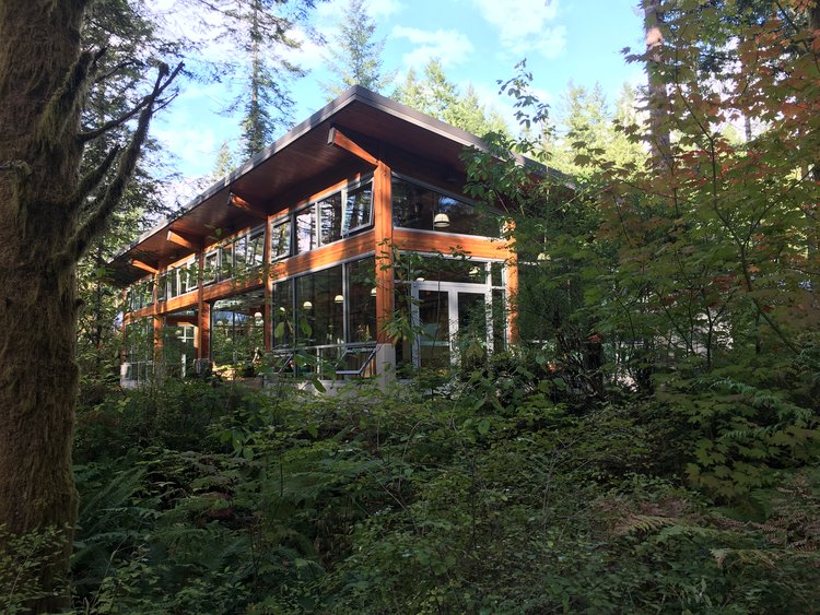
![Tillamook Forest Center]()
Tillamook Forest Center
The Tillamook Forest Center, located twenty-two miles east of Tillamook…
-
![Trask Toll Road]()
Trask Toll Road
The Trask River Wagon Toll Road may have given travelers “the most awfu…
-
![US 101 (Oregon Coast Highway)]()
US 101 (Oregon Coast Highway)
Many places on the Oregon coast were virtually inaccessible in the earl…
Related Historical Records
Map This on the Oregon History WayFinder
The Oregon History Wayfinder is an interactive map that identifies significant places, people, and events in Oregon history.
Further Reading
Dana, Marshall N. “Wilson River Opened at Brief Ceremony.” Portland Oregon Journal, October 15, 1941, 1, 3.
Dicken, Samuel N. Pioneer Trails of the Oregon Coast. Portland: Oregon Historical Society, 1978.
“Declares Toll Roads Should Be Condemned by the State.” Portland Oregon Journal, August 19, 1906, 7.
“Wilson River Highway Victory Feted: 76-Year Road Battle Told.” Portland Oregon Journal, November 10, 1941, 4.
“Wilson River Road Bill Is Vetoed By Governor Patterson.” Tillamook Headlight-Herald, February 17, 1927, 1.
“Short Road to Coast Gets Board’s O.K.” Portland Oregon Journal, October 9, 1931, 12.
“Survey Crews at Work.” Portland Oregonian, June 16, 1926, 17.
“Major Road Jobs Dropped by Commission.” Portland Oregon Journal, December 28, 1932, 5.
“Tillamook Eagerly Working for Shortcut; Wilson River Highway Being Pushed.” Portland Oregon Journal, May 19, 1935, 9.
“Road Shorter to Tillamook.” Portland Oregonian, November 17, 1956, 1.
Steyn, Hermanus, et al. “OR 6 Wilson River Highway Corridor Study (HB 4053).” Salem, Ore.: Oregon Department of Transporation, August 2023.
Chappell, Will. "Fournier pushes for Highway 6 fix." Tillamook Headlight Herald 137.20 ( May, 20, 2025).
"Massive Earth Slide Blocks Wilson River." Portland Oregonian, February 1, 1965, p.1.
"Crews Reopen Road to Tillamook After Seven Weeks." Portland Oregonian, May 24, 1991, D4.