Many places on the Oregon coast were virtually inaccessible in the early twentieth century. Small fishing villages existed as remote outposts, separated by rocky headlands and timber-covered hills. The Roosevelt Coast Military Highway, named in honor of President Theodore Roosevelt, was a result of a renewed national sense of isolationism and the perceived need for emergency preparedness following World War I. In 1919, Oregon voters approved the sale of $2.5 million in bond obligations for the project, but matching federal funds failed to materialize.
By the early 1920s, however, a pleasure-seeking public asked for coastal highway construction. Work on the new coast road, designed by the state’s highway department, began in earnest in 1921. Throughout the 1920s, crews graded and paved section after section of the 400-mile route. In 1926, the road became U.S. 101; in 1931, the state renamed it the Oregon Coast Highway.
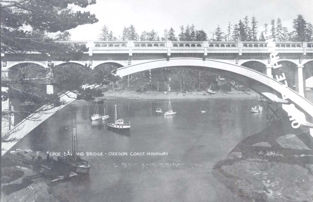
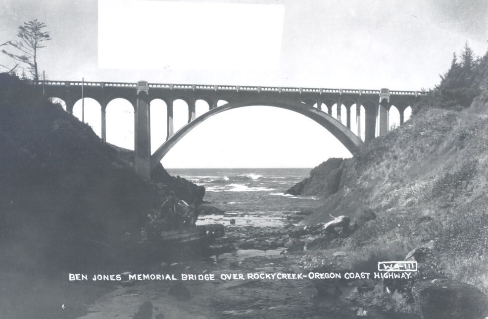
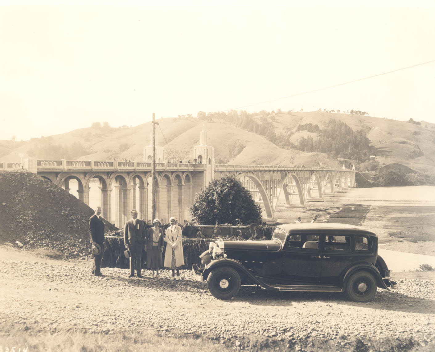
The new road needed bridges and tunnels. In the 1920s, the state bridge engineer, Conde B. McCullough, oversaw the design and construction of numerous short-span and a few larger reinforced-concrete bridges along the highway. Most notable are three reinforced-concrete deck arches: one across the mouth of Depoe Bay; a second across Rocky Creek in Lincoln County, named the Ben Jones Bridge after the "Father of the Coast Highway" (state representative Ben Jones drafted important legislation to support the highway project); and a third across Soapstone Creek in Clatsop County. All exhibited characteristic McCullough features: open spandrels with arched curtain walls, paired arch ribs, and pre-cast decorative railings and brackets. They were embellished with the Classical and Gothic architectural details that were signature elements for his structures.
Among the bridges on the Coast Highway none challenged McCullough more than the identical 120-foot reinforced-concrete tied arches that he designed for the stream crossings over the Wilson River, Big Creek, and Ten Mile Creek. Opened in 1931, they were some of the first bridges of this type in the United States.
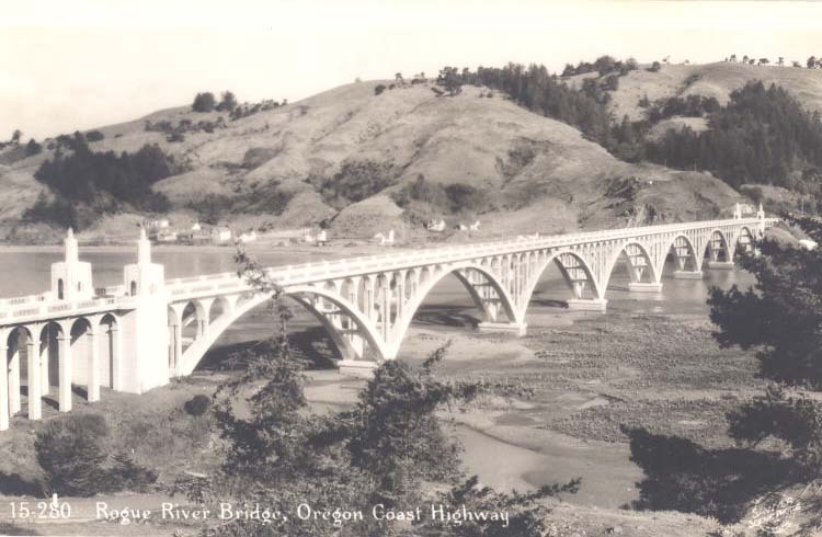
Ferries had crossed two bays and four estuaries along the coast since the nineteenth century. In the 1920s, they became a traffic impediment, and the highway commission branded them a barrier to growth and development. McCullough’s bridges would replace the ferries in the 1930s. For the mouth of the Rogue River at Gold Beach, he created the Isaac Lee Patterson Bridge, named after the Oregon governor who promoted its construction. It was the first pre-stressed reinforced-concrete arch bridge in the United States.
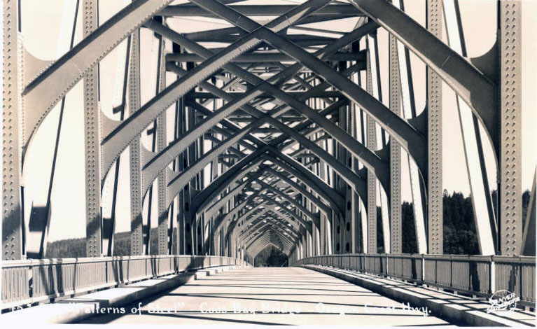
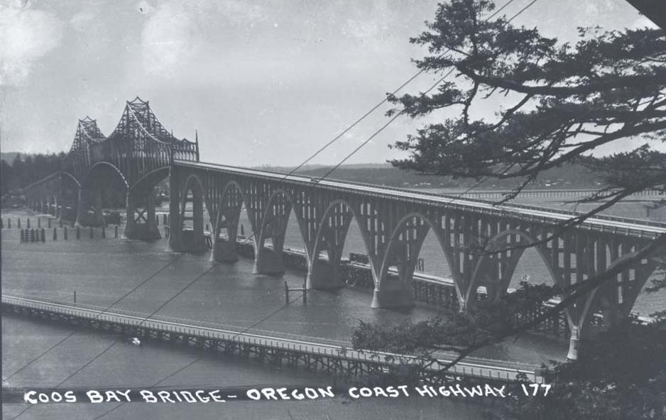
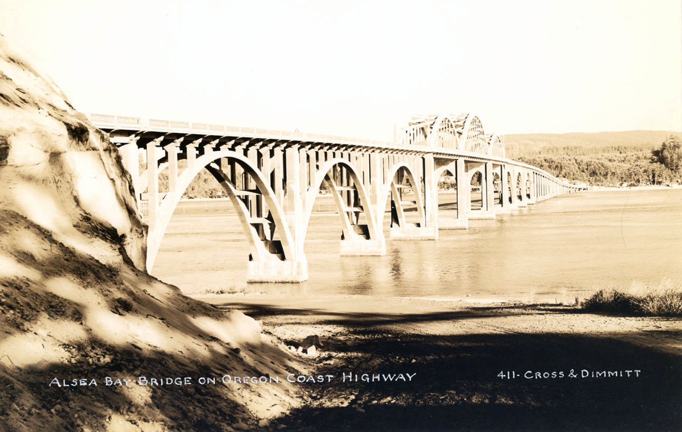
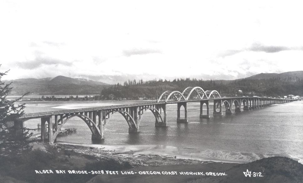
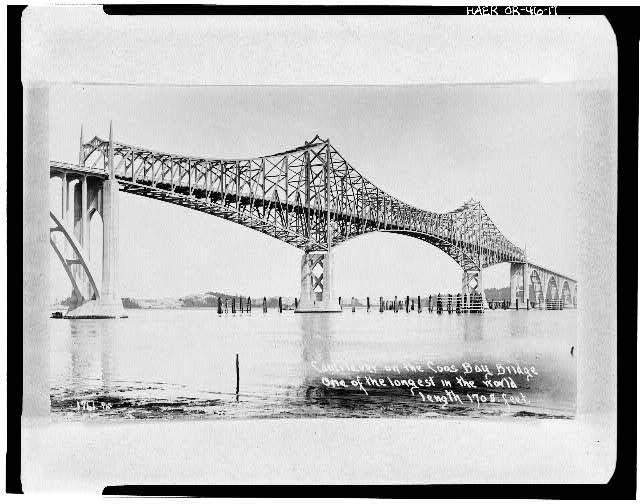
The other five bridges opened in 1936 through a cooperative financial arrangement between Oregon and the federal government, brokered by U.S. Senator Charles McNary. At Yaquina Bay in Newport, McCullough created a 600-foot steel through-arch flanked by a pair of steel deck arches. At Alsea Bay in Waldport, he designed three reinforced-concrete tied arches. For the deep narrow channel of the Siuslaw River in Florence, he created a bridge with a central section of reinforced-concrete tied arches on either side of a double-leaf bascule drawbridge. For the wide, shallow Umpqua River in Reedsport, he designed pairs of the 154-foot reinforced-concrete tied arches flanking a 430-foot steel tied-arch center swing span. Finally, at Coos Bay, McCullough created a 1,700-foot cantilevered steel-trussed midsection with two large tower piers. All of the bridges featured multiple-span, reinforced-concrete approaches. Landscaped waysides, with grand staircases, united their architectural spaces with the nearby sandy shores and timbered hills. The repetitive arch form made the bridges appear as continuations of the coastal mountains.
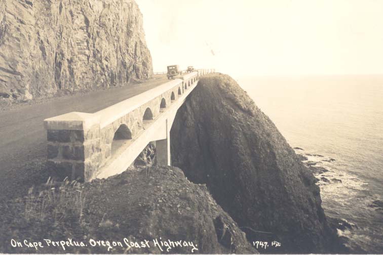
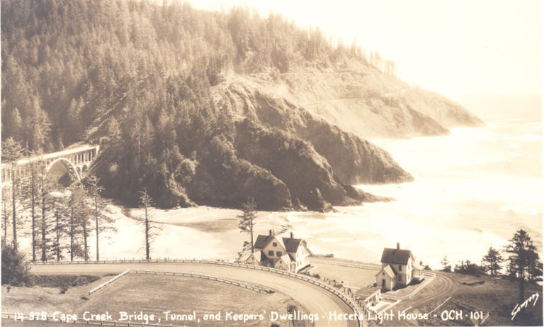
Throughout the 1930s, the Oregon Department of Transportation and the U.S. Bureau of Public Roads worked to realign some sections of the highway. One was a picturesque five-mile section through rugged terrain north of Florence. It involved constructing a two-tiered reinforced-concrete viaduct and arch bridge over Cape Creek, boring a 714-foot tunnel through Devil’s Elbow (Cape Creek Tunnel) and excavating a roadway from the cliffs high above the surf.
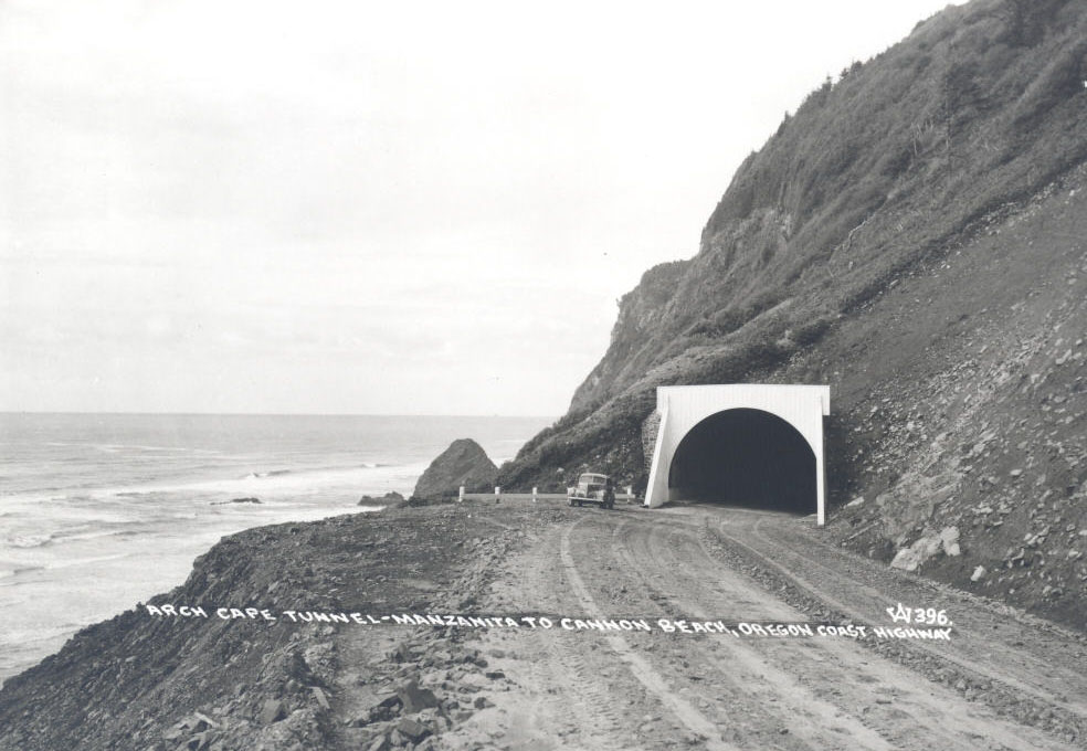
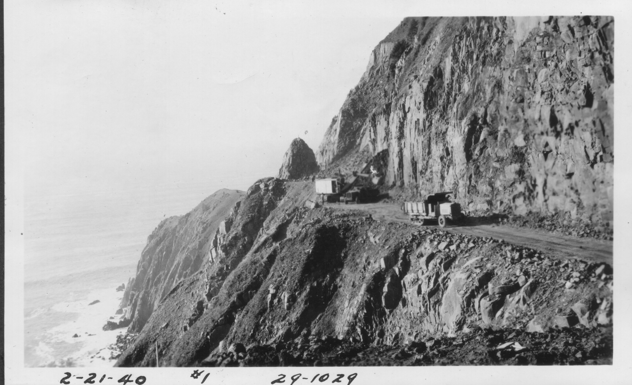
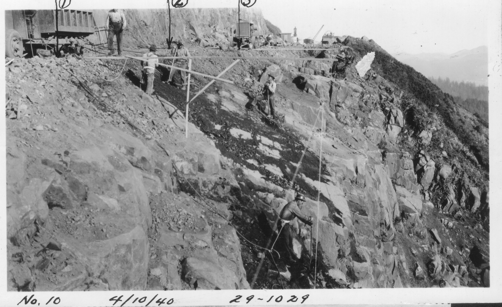
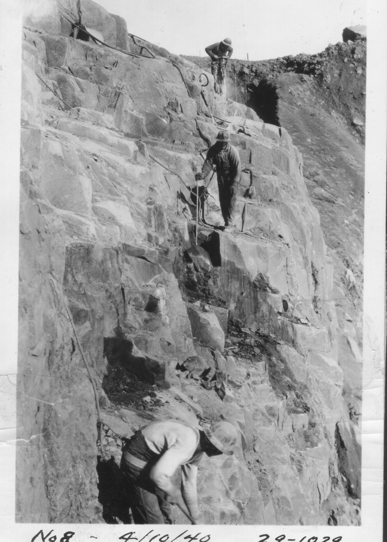
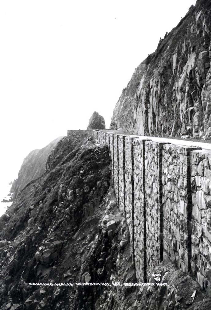
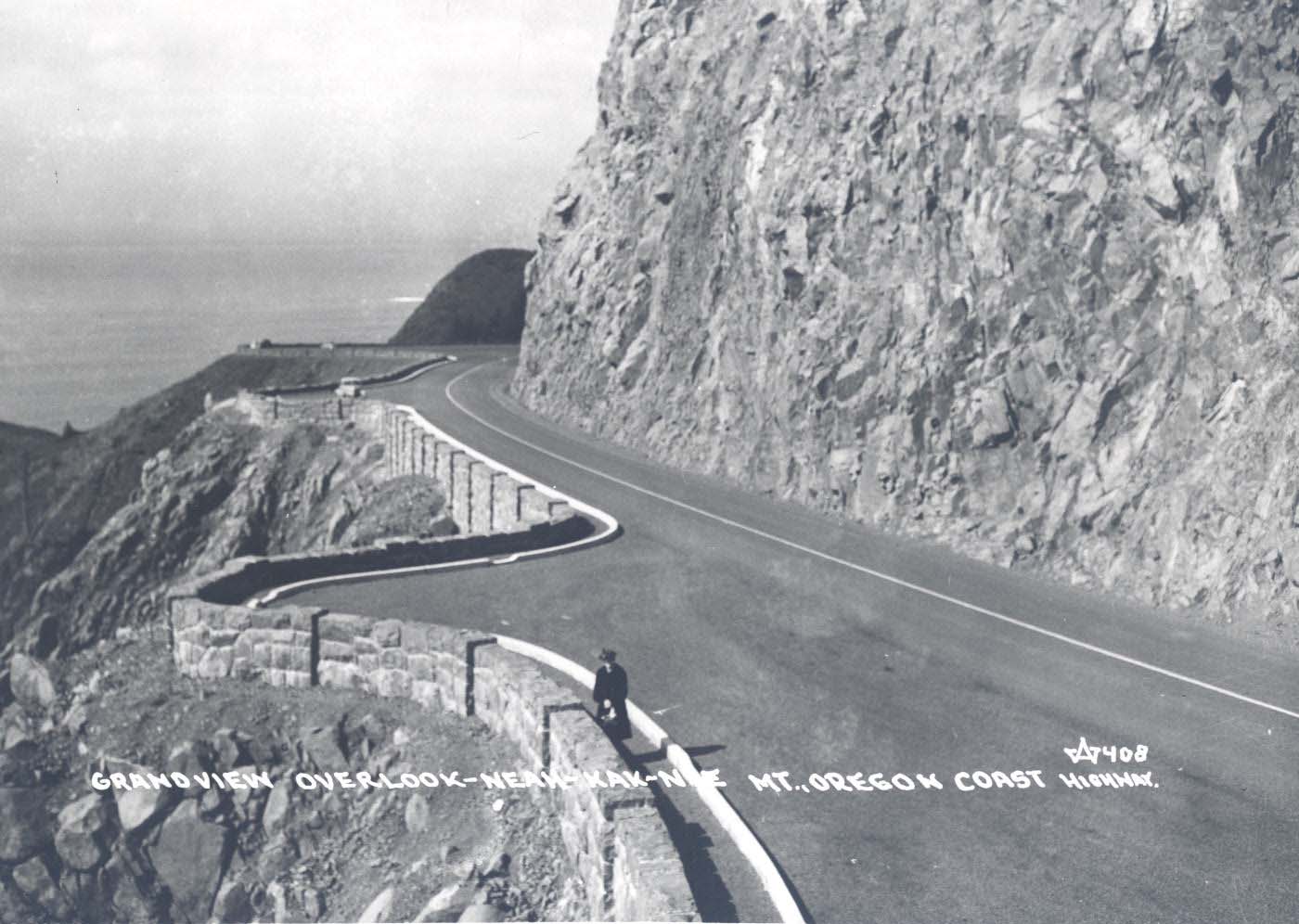
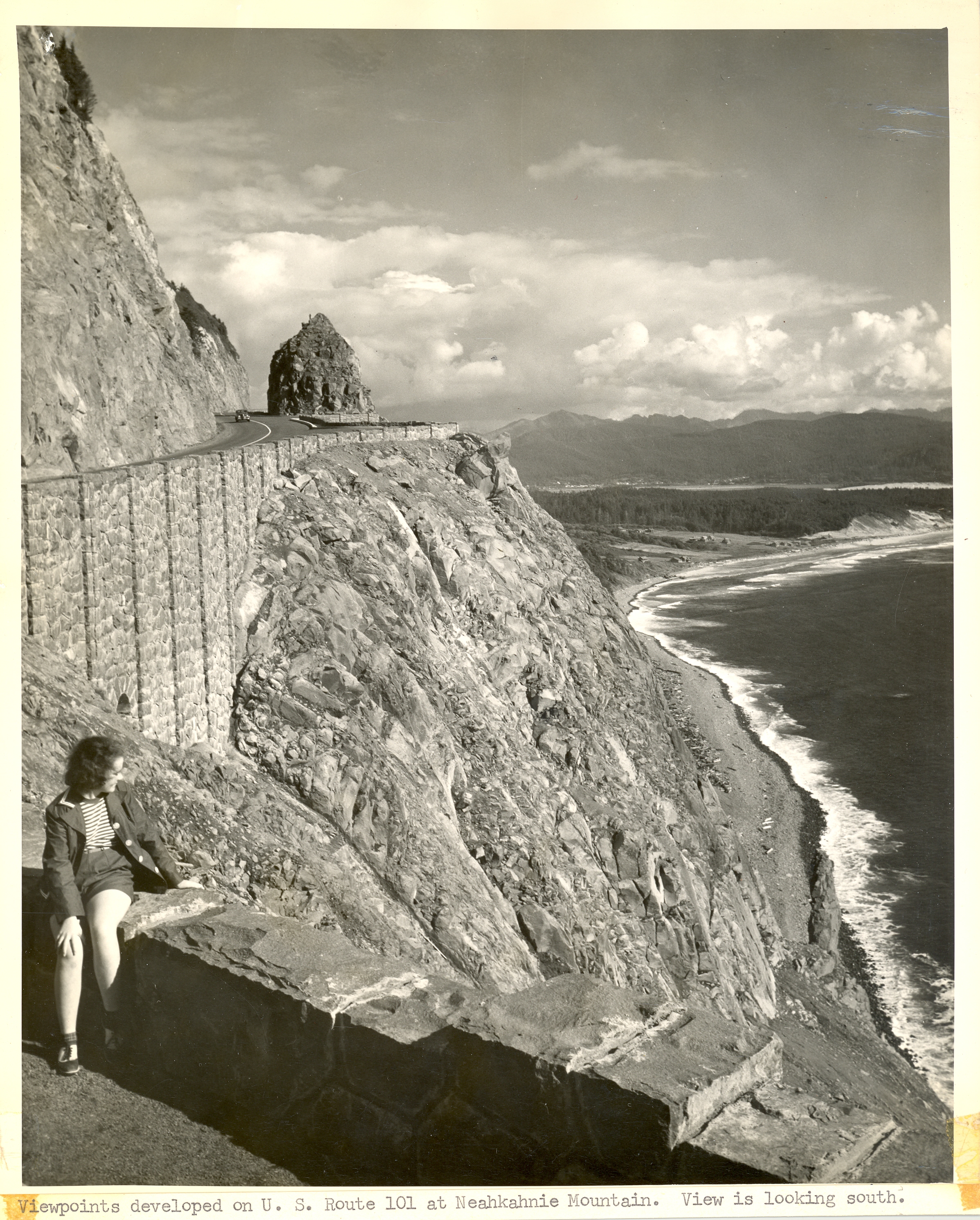
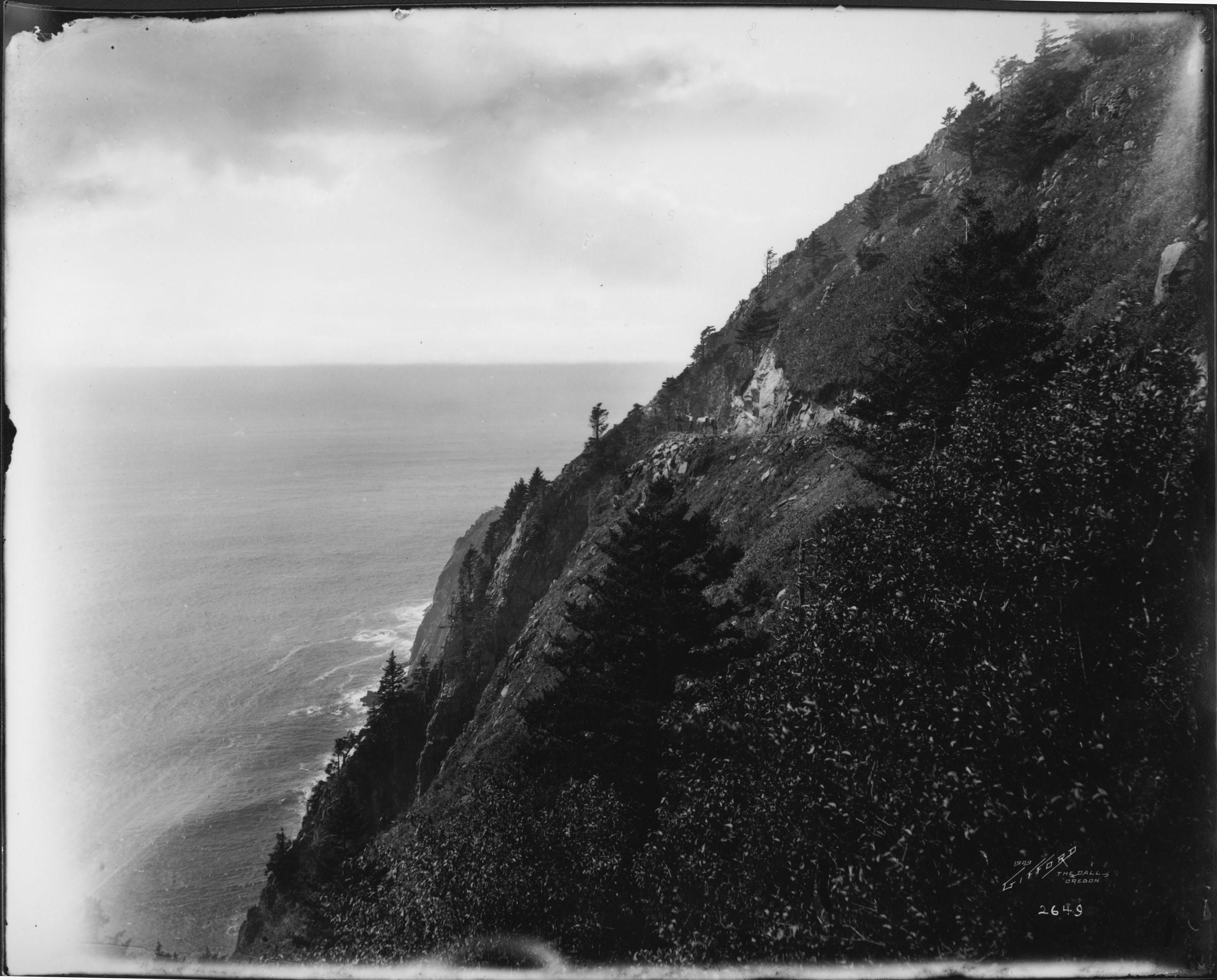
A section of highway from Heceta Head Lighthouse to the Sea Lion Caves became known as the “half-million-dollar mile,” the most expensive mile of road construction in the nation that involved Bureau of Public Roads participation. Later, the Oregon State Highway Department bored a 427-foot tunnel thorough Arch Cape, a rugged and steep basaltic formation, and carved a road around Neahkahnie Mountain, where it hugged nearly perpendicular cliffs some 600 feet above the sea.
The Oregon Coast Highway has always adapted to changing traffic needs. Yet, it maintains the timelessness that it possessed when it opened in the 1920s. The road became a National Scenic Byway–All American Road in 2002. In 2005, eleven of the McCullough bridges were listed on the National Register of Historic Places.
-
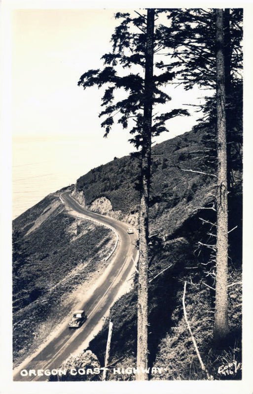
![Highway 101 (Oregon Coast Highway)]()
Highway 101 (Oregon Coast Highway).
Highway 101 (Oregon Coast Highway) Courtesy Oreg. Hist. Soc. Research Lib.
-
![Highway 101 on Cape Perpetua, 1938]()
Highway 101 on Cape Perpetua, 1938.
Highway 101 on Cape Perpetua, 1938 Courtesy Oreg. Hist. Soc. Research Lib., 991D070
-
![Coos Bay Bridge]()
Coos Bay Bridge.
Coos Bay Bridge Courtesy Oreg. Hist. Soc. Research Lib., Acc97204
-
![Rogue River Bridge]()
Rogue River Bridge.
Rogue River Bridge Courtesy Oreg. Hist. Soc. Research Lib., Acc97204
-
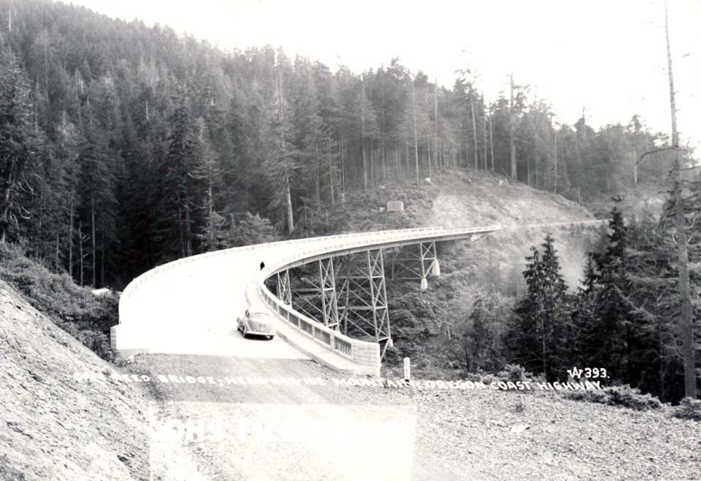
![Samuel Reed Bridge]()
Samuel Reed Bridge.
Samuel Reed Bridge Courtesy Oreg. Hist. Soc. Research Lib., 19388
-
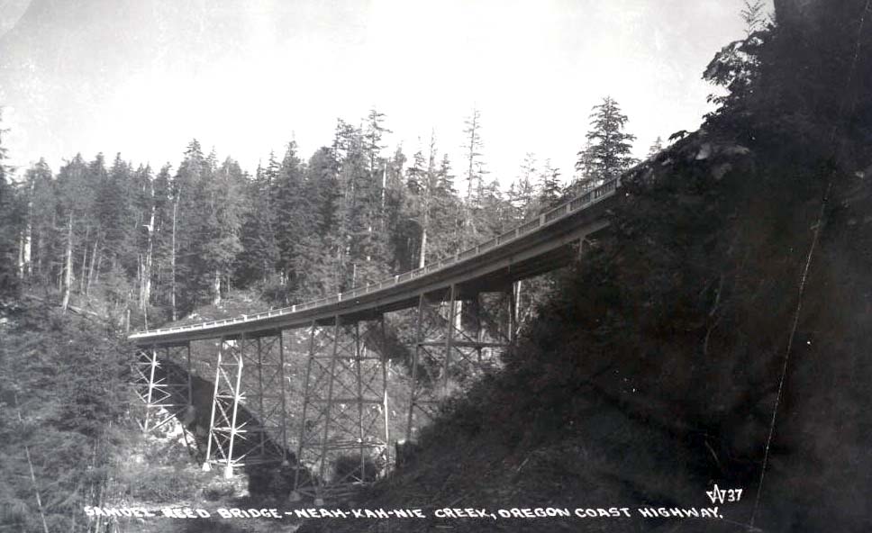
![Samuel Reed Bridge]()
Samuel Reed Bridge.
Samuel Reed Bridge Courtesy Oreg. Hist. Soc. Research Lib., 16325
-
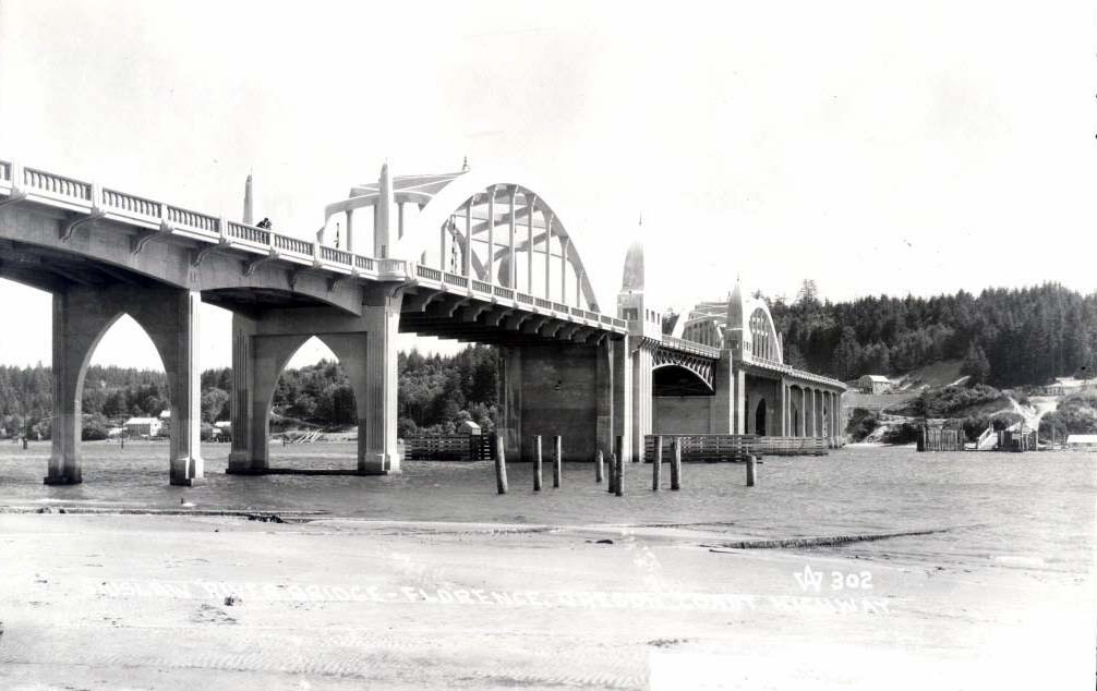
![Siuslaw River Bridge]()
Siuslaw River Bridge.
Siuslaw River Bridge Courtesy Oreg. Hist. Soc. Research Lib., 19300
-
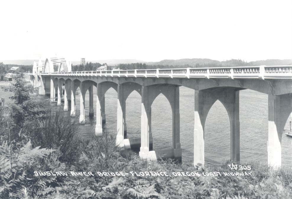
![Siuslaw River Bridge]()
Siuslaw River Bridge.
Siuslaw River Bridge Courtesy Oreg. Hist. Soc. Research Lib., 19303
-
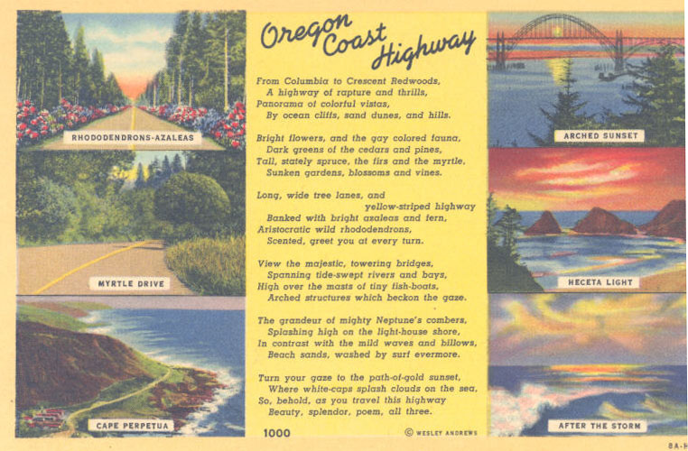
![Postcard with poem by Wesley Andrews]()
Postcard with poem by Wesley Andrews.
Postcard with poem by Wesley Andrews Courtesy Oreg. Hist. Soc. Research Lib.
-
![Depoe Bay and Bridge]()
Depoe Bay and Bridge.
Depoe Bay and Bridge Courtesy Oreg. Hist. Soc. Research Lib., 19233
-
![Coos Bay Bridge]()
Coos Bay Bridge.
Coos Bay Bridge Courtesy Oreg. Hist. Soc. Research Lib., 19181
-
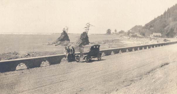
![Old Coast Highway]()
Old Coast Highway.
Old Coast Highway Courtesy Oreg. Hist. Soc. Research Lib., 16555
-
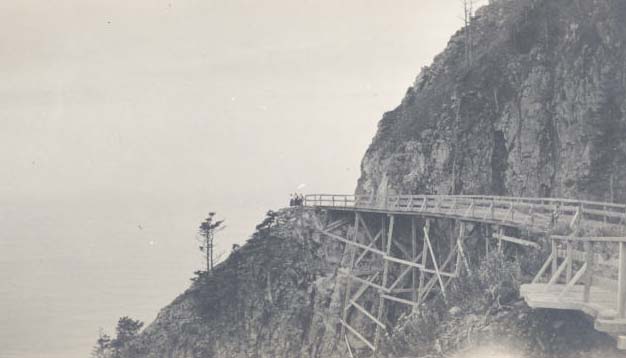
![Trestle on new road to Short Sands Beach, c. 1911]()
Trestle on new road to Short Sands Beach, c. 1911.
Trestle on new road to Short Sands Beach, c. 1911 Courtesy Oreg. Hist. Soc. Research Lib., OrHi103004
-
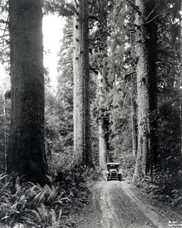
![Highway 101 between Seaside and Tillamook]()
Highway 101 between Seaside and Tillamook.
Highway 101 between Seaside and Tillamook Courtesy Oreg. Hist. Soc. Research Lib., photo by A.M. Prentiss, OrHi2562C
-
![Arch Cape Tunnel]()
Arch Cape Tunnel.
Arch Cape Tunnel Courtesy Oreg. Hist. Soc. Research Lib.
-
![Cape Creek Bridge, Tunnel, and Heceta Head Lighthouse]()
Cape Creek Bridge, Tunnel, and Heceta Head Lighthouse.
Cape Creek Bridge, Tunnel, and Heceta Head Lighthouse Courtesy Oreg. Hist. Soc. Research Lib., Acc77204
-
![Alsea Bay Bridge]()
Alsea Bay Bridge.
Alsea Bay Bridge Courtesy Oreg. Hist. Soc. Research Lib.
-
![Alsea Bay Bridge]()
Alsea Bay Bridge.
Alsea Bay Bridge Courtesy Oreg. Hist. Soc. Research Lib., 19310
-
![Ben Jones Memorial Bridge]()
Ben Jones Memorial Bridge.
Ben Jones Memorial Bridge Courtesy Oreg. Hist. Soc. Research Lib., 19123
-
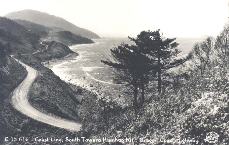
![Highway 101, south to Humbug Mountain]()
Highway 101, south to Humbug Mountain.
Highway 101, south to Humbug Mountain Courtesy Oreg. Hist. Soc. Research Lib., Acc27945
-
![]()
Construction of Oregon Coast Highway (101) at Neahkahnie Mountain, February 1940.
Courtesy Oregon Department of Transportation
-
![]()
Construction of Oregon Coast Highway (101) at Neahkahnie Mountain, April 1940.
Courtesy Oregon Department of Transportation
-
![]()
Construction of Oregon Coast Highway (101) at Neahkahnie Mountain, April 1940.
Courtesy Oregon Department of Transportation
-
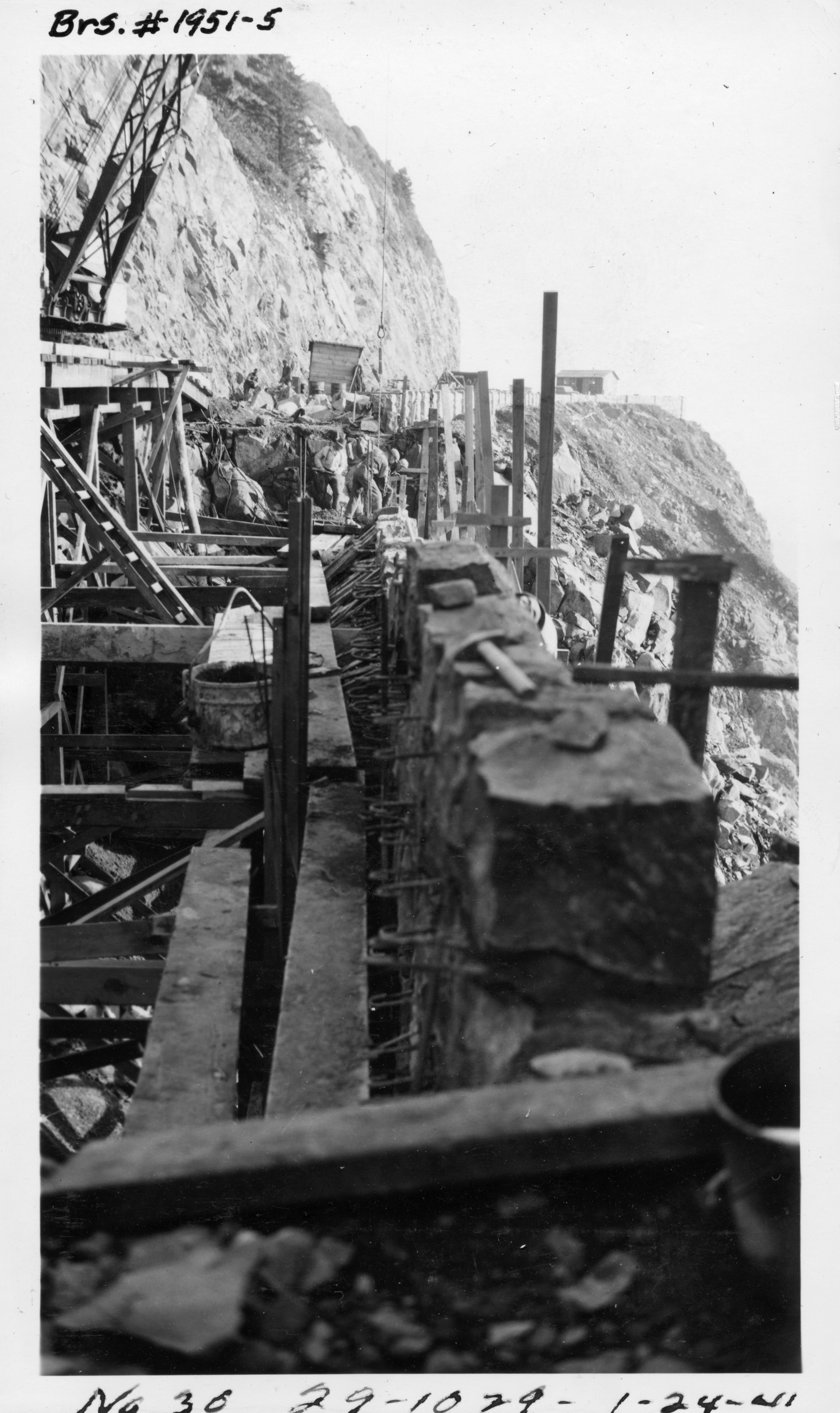
![]()
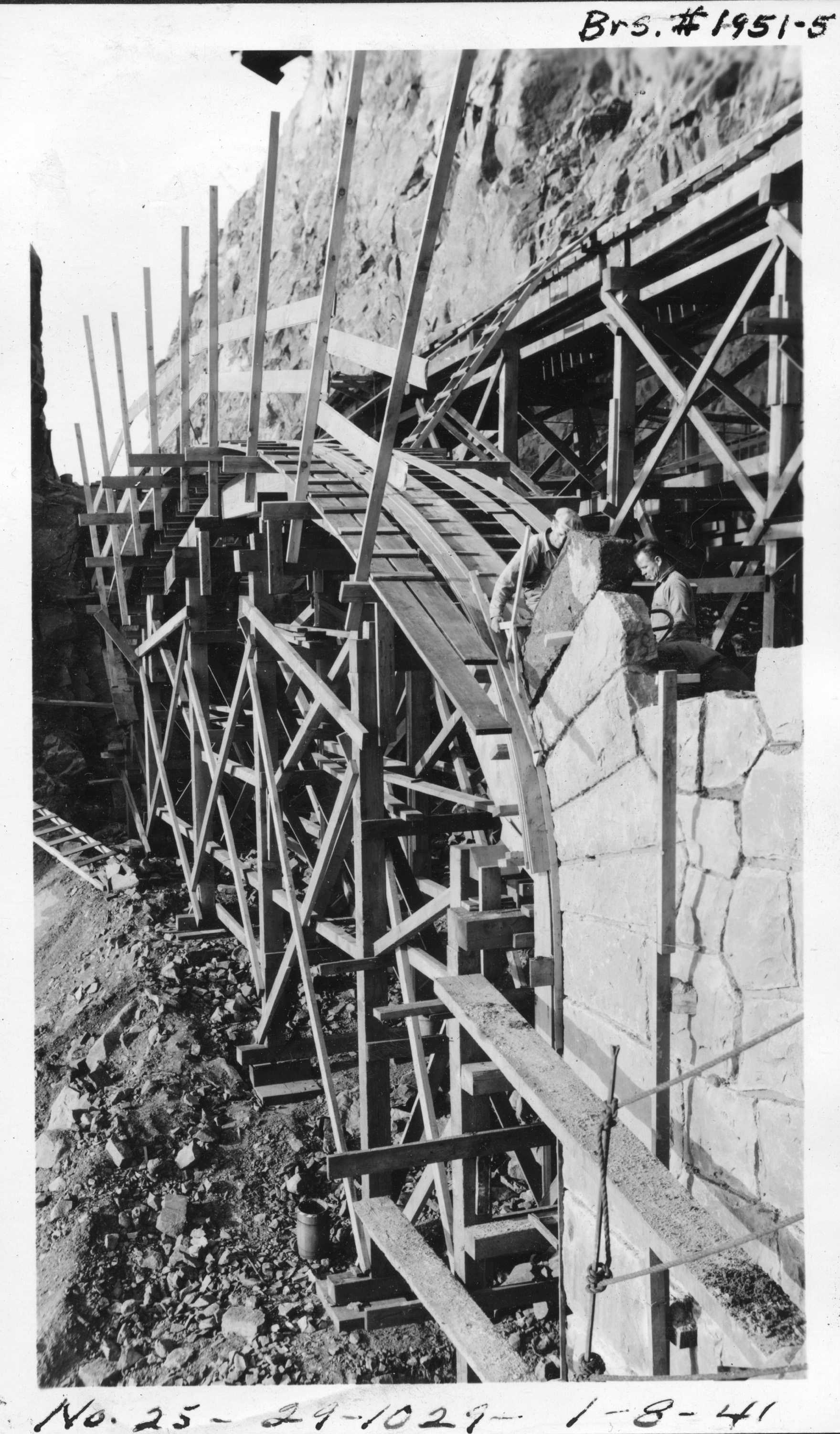
Construction of Neahkahnie Mountain Chasm Bridge, 1941.
Courtesy ODOT, Bridge Engineering Section
-
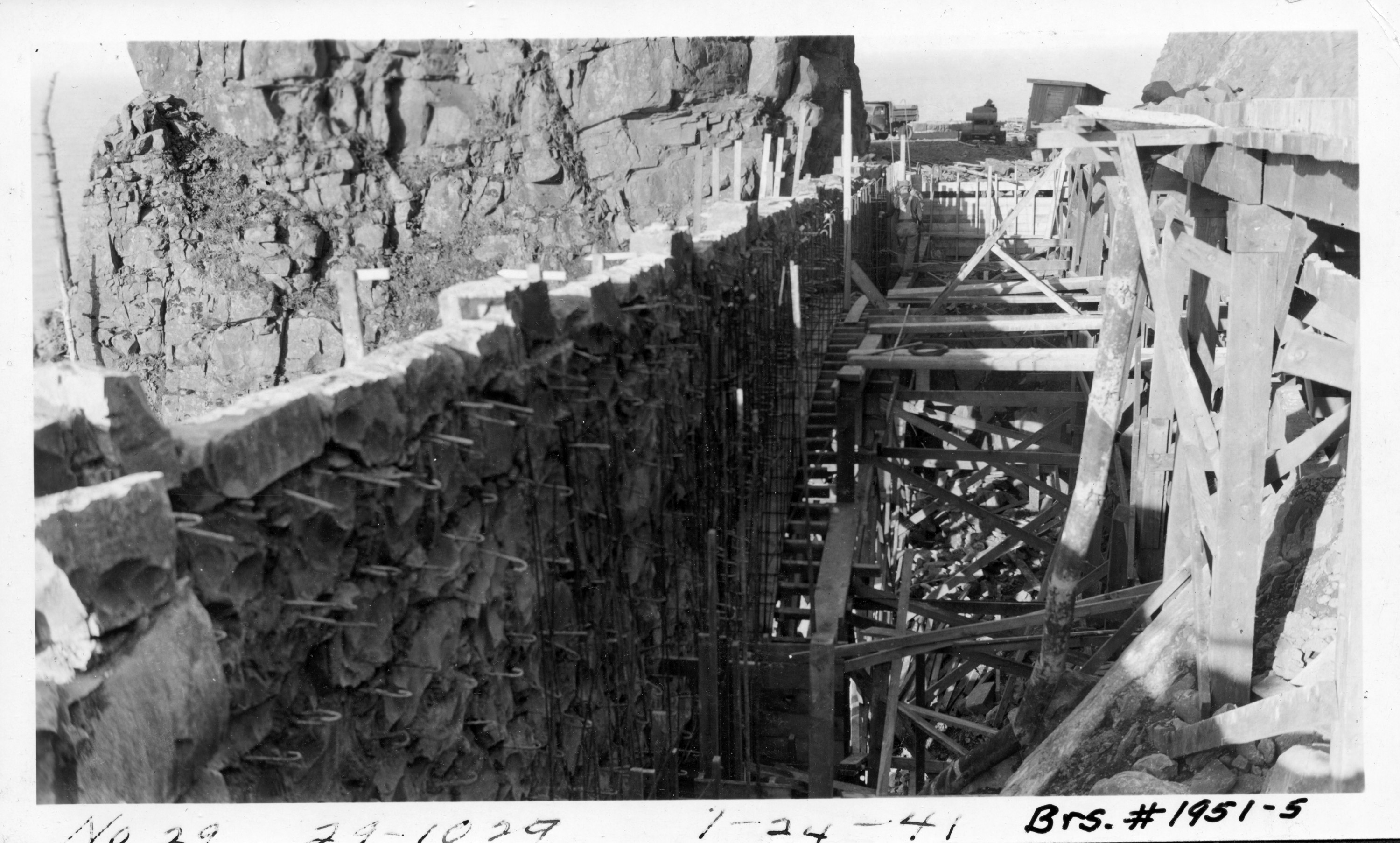
![]()
Construction of Neahkahnie Mountain Chasm Bridge, 1941.
Courtesy ODOT, Bridge Engineering Section
-
![]()
Construction of Neahkahnie Mountain Chasm Bridge, 1941.
Courtesy ODOT, Bridge Engineering Section
-
![Hanging Walls, Neahkahnie]()
Hanging Walls, Neahkahnie.
Hanging Walls, Neahkahnie Courtesy Oreg. Hist. Soc. Research Lib.
-
![Grandview overlook, Neahkahnie Mountain]()
Grandview overlook, Neahkahnie Mountain.
Grandview overlook, Neahkahnie Mountain Courtesy Oreg. Hist. Soc. Research Lib., 16555
-
![]()
Scenic view along the Oregon Coast Highway (101) at Neahkahnie Mountain.
Courtesy Oregon Department of Transportation
Related Entries
-
![Conde Balcom McCullough (1887-1946)]()
Conde Balcom McCullough (1887-1946)
Conde B. McCullough, born in Dakota Territory in 1887, was raised and e…
-
![Conde B. McCullough Memorial Bridge]()
Conde B. McCullough Memorial Bridge
Of all the bridges engineer Conde B. McCullough designed, the one on Hi…
-
![Neahkahnie Mountain]()
Neahkahnie Mountain
Neahkahnie Mountain, about twenty miles south of Seaside, is a prominen…
-
![Rogue River Bridge]()
Rogue River Bridge
The Rogue River Bridge spans the mouth of the Rogue River between Gold …
Related Historical Records
Map This on the Oregon History WayFinder
The Oregon History Wayfinder is an interactive map that identifies significant places, people, and events in Oregon history.
Further Reading
Hadlow, Robert W. Elegant Arches, Soaring Spans: C. B. McCullough, Oregon's Master Bridge Builder. Corvallis: Oregon State University Press, 2001.