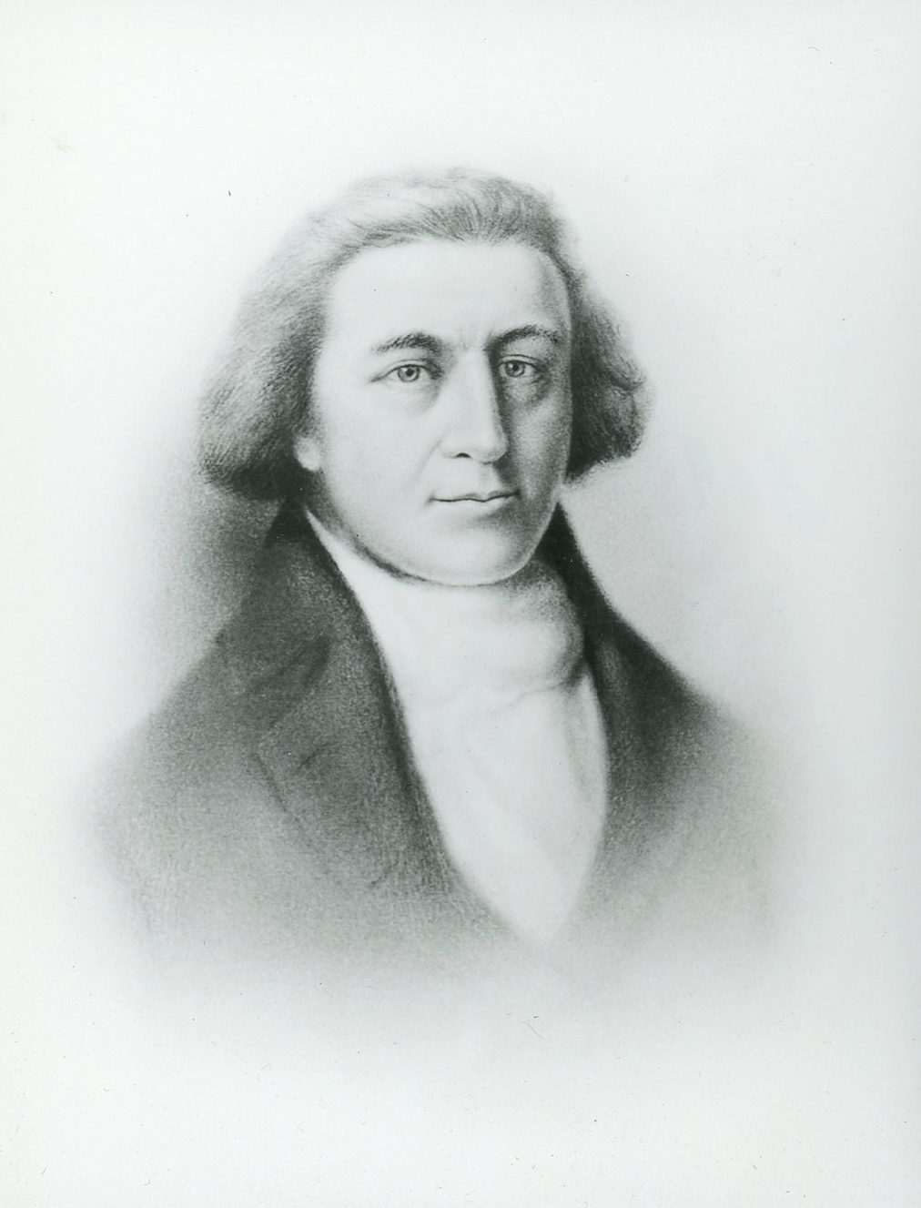
The role George Vancouver played in Oregon history is tangential, yet it is foundational to the developments that radically changed the region during the early nineteenth century. In 1791-1795, Vancouver led the most thorough scientific maritime exploration of the Northwest Coast of North America, which included the creation and publication of detailed maps of the coastlines of present-day Oregon and Washington and the complex waterways of Puget Sound. Vancouver and his officers laid down dozens of place-names in the region, including Mount Rainier, for British Rear Admiral Peter Rainier, and Mount Hood, for Lord Samuel Hood of the British Admiralty Board. Most important, in October 1792, Vancouver sent two longboats under Lt. William Broughton one hundred miles up the Columbia River, an expedition that produced a detailed map of the lower river. When published in 1798 in Vancouver’s A Voyage of Discovery, Broughton’s map became the first to accurately represent the lower Columbia River. Meriwether Lewis and William Clark used the map to orient themselves on the river in 1805.
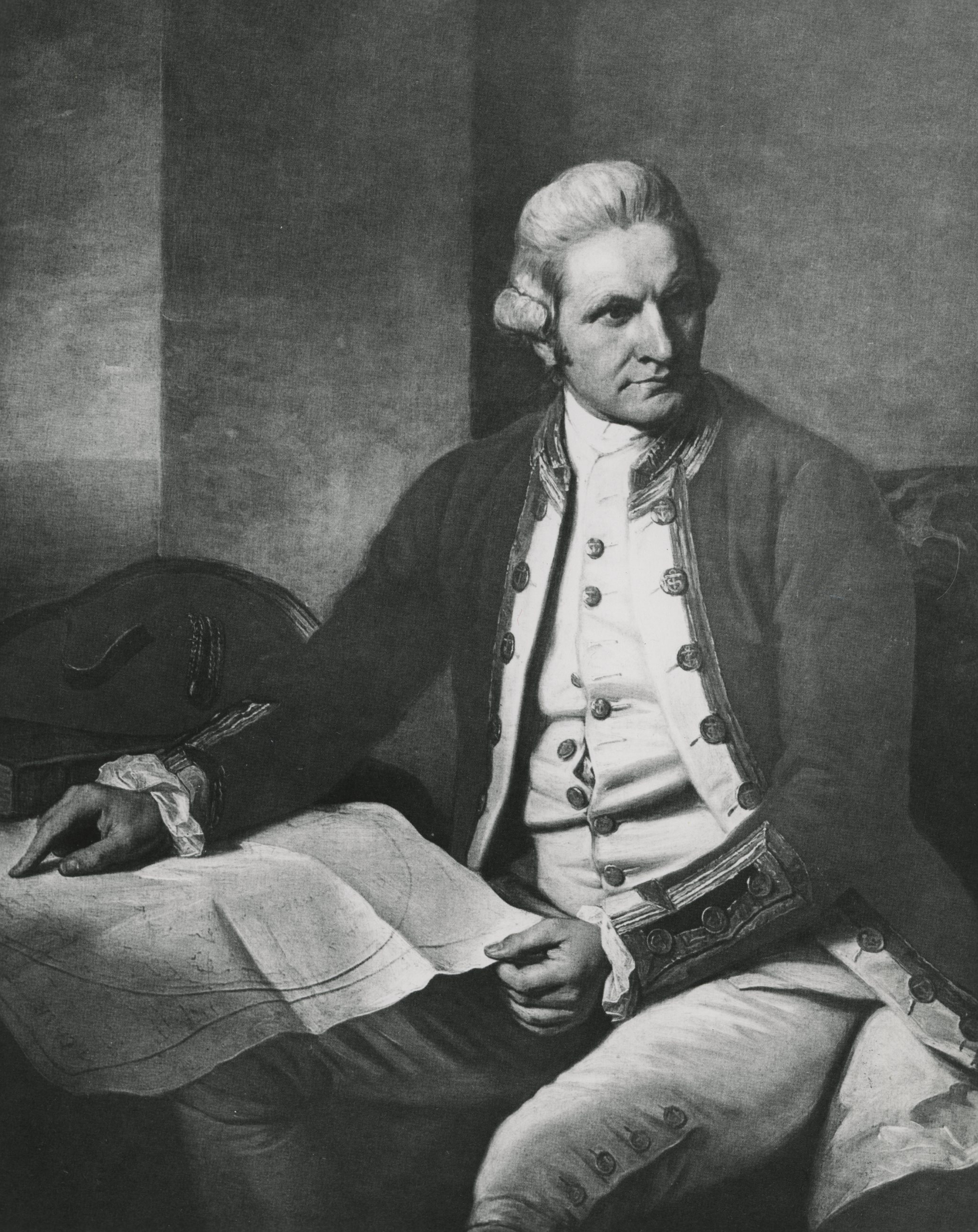
Vancouver grew up in King’s Lynn on England’s east coast, where he was born on June 22, 1757. Through his father’s influence as collector of customs in King’s Lynn, fourteen-year-old Vancouver joined James Cook on his second voyage to the Pacific Ocean in January 1772. On board, he learned navigation from expert mariners, and he did well enough to be promoted to senior midshipman on Cook’s third voyage in 1776. Vancouver was on hand when Hawaiians killed Cook at Kealakekua Bay in February 1779, and he played an important role in continuing the expedition and bringing Cook’s ships, the Resolution and the Discovery, back to England in 1780.
In 1790, Britain became embroiled in a dispute with Spain over control of Nootka Sound on the coast of present-day Vancouver Island. The next year, Vancouver was named the leader of a scientific and diplomatic expedition to the Northwest Coast. His instructions required Vancouver to represent Britain in negotiations with Spain’s emissary, Francisco de la Bodega y Quadra, at Nootka Sound, where he sought restitution for damages to British ships and materials. The two men resolved the main issues, which left both nations free to sail international waters on the Northwest Coast.
Afterward, with Vancouver commanding the 330-ton Discovery and William Broughton captaining the 131-ton Chatham brig, the expedition sailed 65,000 miles around the world. It was the longest deep-water sailing voyage on record and produced the world’s most detailed maps and charts of the Northwest Coast. Those maps were used by all nineteenth-century mariners sailing from present-day Oregon to the Aleutians, and they were consulted during the Oregon Treaty negotiations in 1846.
After the voyage and what he hoped would be a hero’s welcome in Britain, Vancouver came under political attack by disgruntled crew members who claimed he had abused them on the voyage. Archibald Menzies, the physician and naturalist on the Discovery, claimed that Vancouver was "indiscreet...in exceeding his powers in the matter of discipline," and the Chatham’s master mate Thomas Manby called Vancouver "Haughty Proud Mean and Insolent.”
Because of Vancouver’s middle-class background, he had little success defending himself against the vitriolic challenges of an aristocratic crew member, Thomas Pitt, who was Lord Camelford and nephew of Prime Minister William Pitt. Pitt confronted Vancouver on a public street in September 1796, brutally caning him for avoiding a duel. A cartoon of the attack, published in London newspapers and distributed as prints on October 1, 1796, further humiliated Vancouver, whose health had been failing since his return from sea.
Vancouver’s ailments, likely from malaria contracted in the West Indies twenty years earlier, led to death in May 1798 when he was only forty years old. While Vancouver died with little acclaim, today he is recognized as one of Britain’s greatest mariners.
-
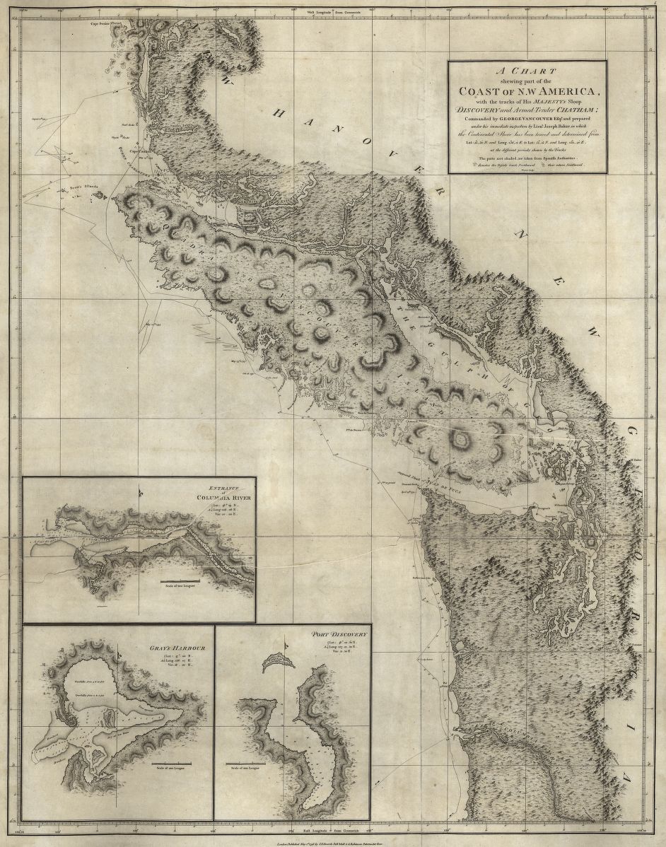
![From the voyages of the Discovery and the Chatham]()
A chart shewing [sic] part of the coast of NW America, 1798.
From the voyages of the Discovery and the Chatham Courtesy Library of Congress, G420.V22 -
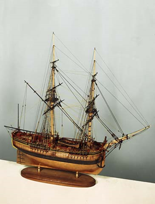
![]()
Ship model of the H.M.S. Chatham, 1972.
Oregon Historical Society Museum Collection, 72-202
Related Entries
-
![Cartography of Oregon, 1507–1848]()
Cartography of Oregon, 1507–1848
The cartographic history of Oregon as a place in the Pacific Northwest …
-
![Columbia River]()
Columbia River
The River For more than ten millennia, the Columbia River has been the…
-
![James Cook (1728-1779)]()
James Cook (1728-1779)
In the lower right-hand corner of his magnificent Chart of the NW Coast…
-
![John Box Hoskins (1768–1824)]()
John Box Hoskins (1768–1824)
John Box Hoskins served as a clerk on the Columbia Rediviva, captained …
-
![Lewis and Clark Expedition]()
Lewis and Clark Expedition
The Expedition No exploration of the Oregon Country has greater histor…
-
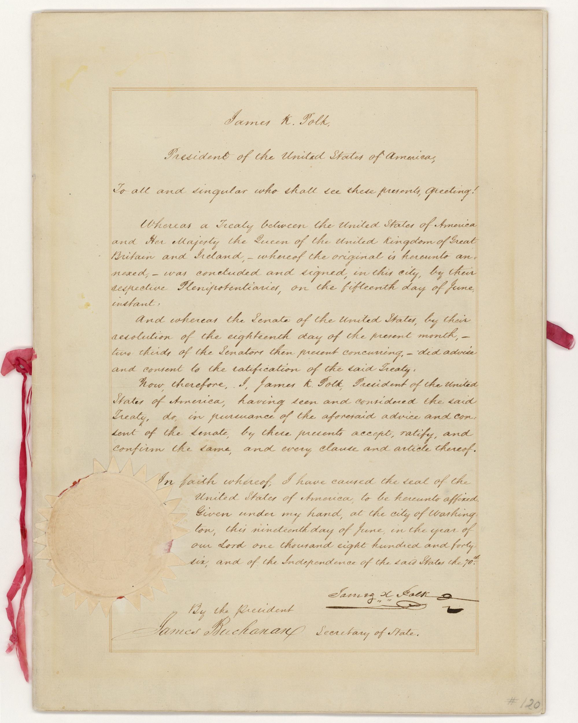
![Oregon Treaty, 1846]()
Oregon Treaty, 1846
On November 12, 1846, the Oregon Spectator announced that Captain Natha…
-
![Robert Gray (1755–1806)]()
Robert Gray (1755–1806)
On May 11, 1792, Robert Gray, the first American to circumnavigate the …
Related Historical Records
Map This on the Oregon History WayFinder
The Oregon History Wayfinder is an interactive map that identifies significant places, people, and events in Oregon history.
Further Reading
Clayton, Daniel W. Islands of Truth: the Imperial Fashioning of Vancouver Island. Vancouver: UBC Press, 2000.
Fireman, Janet. "The Seduction of George Vancouver: A Nootka Affair." Pacific Historical Review (August 1987): 427-443.
Tovell, Freeman. “The Other Side of the Coin: The Viceroy, Vancouver, Bodega y Quadra and the Nootka Crisis.” BC Studies 93 (Spring 1992): 3-29.
David, Andrew. “Vancouver’s Survey Methods and Surveys.” In Robin Fisher and Hugh Johnson, eds., From Maps to Metaphors: The Pacific World of George Vancouver. Vancouver: UBC Press, 1993).
Watt, Sir James. “The Voyage of Captain GeorgeVancouver 1791-95: The Interplay of Physical and Psychological Pressures.” Canadian Bulletin of Mental Health ( 1987 ): 48.
Brown, Stephen. Madness, Betrayal and the Lash: The Epic Voyage of Captain George Vancouver Vancouver, B.C.: Douglas & McIntyre, 2008.