The United States Army Corps of Engineers constructed The Dalles Dam between 1952 and 1957. The dam was a significant part of the federal government's effort during the twentieth century to develop the hydropower and navigation potential of the Columbia River. Located 192 miles upstream from the mouth of the Columbia, the dam is two miles east of the City of The Dalles.
The Corps of Engineers first proposed the dam in the early 1930s as part of the ten-dam comprehensive plan to develop the water resources potential of the Columbia River. In 1927, Congress had ordered the Corps to survey the river and its tributaries for the combined development of hydropower, flood control, navigation, and irrigation.
Based on the Corps' report, completed in 1931, Congress approved construction of Grand Coulee Dam by the Bureau of Reclamation and Bonneville Dam by the Corps of Engineers but deferred action on the other recommended dams until after World War II. Grand Coulee Dam is on the upper Columbia River in eastern Washington, and Bonneville Dam is on the lower Columbia about 145 miles upstream from the Pacific Ocean. Following further studies by the Corps, Congress authorized a dam at Umatilla (later named McNary Dam) in 1945. In 1950, after the original Columbia River report was updated, Congress gave the go-ahead for the construction of The Dalles Dam, primarily for hydropower and navigation.
The Corps' studies for the multiple purpose development of the Columbia River in the late 1940s noted that power loads had tripled between 1937 and 1946 and that they were projected to make a similar increase by 1960. The Dalles Dam would help meet that electrical power demand. In addition, a modern navigation lock would replace the Corps' small, outmoded Dalles–Celilo Canal. The size of barge tows had increased over the years, and tugs pushing up to five large barges each were already using the locks and slackwater pools at Bonneville and McNary Dams to carry petroleum products upstream and agricultural and wood products downstream. The Corps' planning for the new dam also took into account the recreational use of the waters that the dam would impound and the environmental concerns related to its effects on anadromous fish.
The Dalles Dam was originally proposed as a high dam, but concerns about its costs and the impact on fish runs led the Corps to shift to a plan for a low dam. The Portland District of the Corps of Engineers, under Colonel Ralph Tudor, had responsibility for building the new dam, using the design and techniques pioneered in the construction of Bonneville and McNary Dams.
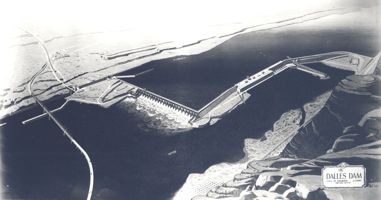
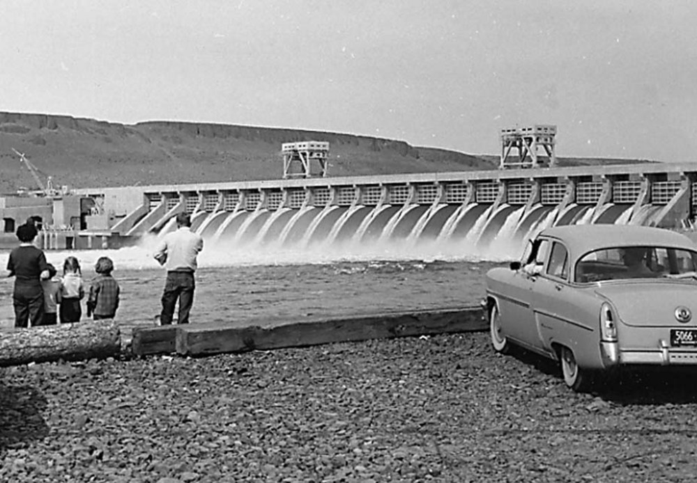
Sitting astride the Columbia River on the eastern approach to The Dalles, the massive, L-shaped concrete structure has an imposing presence on the landscape. As constructed, the main portion of the dam consists of a 1,380-foot concrete spillway section containing 23 radial steel gates, each 50 feet wide and 43 feet high. The powerhouse, expanded in 1973, ultimately has an installed generating capacity of 1.8 million kilowatts of power produced by 22 units. The 86-by-675-foot navigation lock on the north side of the spillway section provides a maximum lift of 87.5 feet for barge traffic.
To accommodate the anadromous fish runs passing up and down the Columbia each year, the project contained fish passage facilities, which cost $27 million. These fishways only partially mitigated the losses to Native Americans from the drowning of the fishery at Celilo Falls, behind the dam. The total cost of construction for The Dalles Dam came to approximately $286 million.
The Dalles Dam had both supporters and detractors. Powerful economic and conservation groups argued over the advisability of constructing a dam at The Dalles. Business, shipping, and agricultural interests lobbied Congress for a dam that would generate power for regional industrial growth and enhance inland navigation to inexpensively transport agricultural produce from eastern Washington and northeastern Oregon, a region known as the Inland Empire.
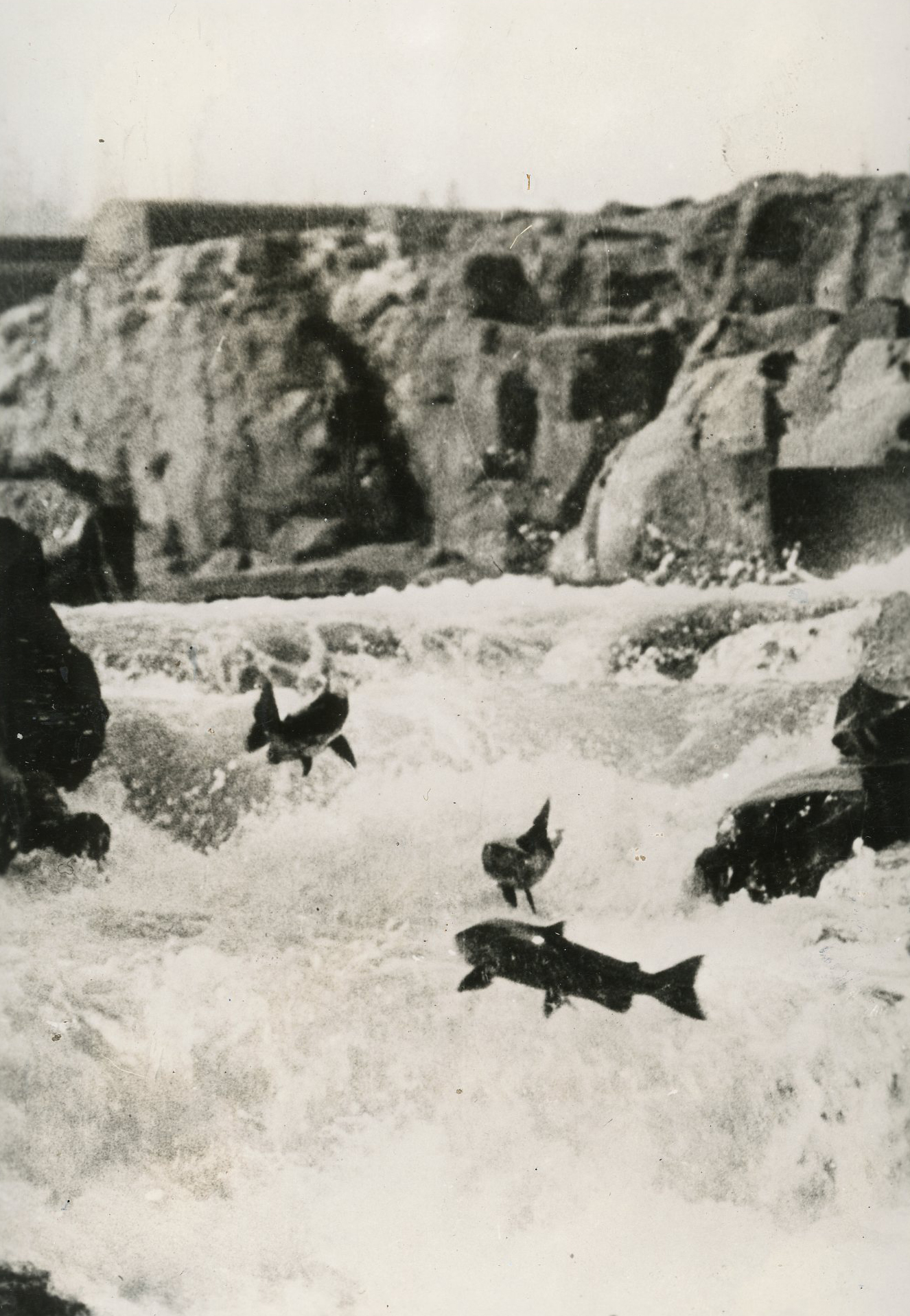
At the same time, the region's commercial and recreational salmon fishery interests and Native American tribes fought the project, fearing the impact of the dam on fish runs. In particular, The Dalles Dam would drown out Celilo Village and the fishery at Celilo Falls. Both places had been continually occupied by Native fishers and traders for thousands of years; at the time of the damming, fishers annually caught 2.5 million pounds of fish for subsistence and commercial purposes.
The drowning of the Celilo Falls fishery was an irreplaceable loss to the cultural, spiritual, and economic wellbeing of Native people whose families had used the site for at least 9000 years. The U.S. government paid those tribes whose people had traditionally fished at Celilo $23.5 million to extinguish their treaty fishing rights. It also pledged to increase scientific research to achieve better conservation of the fish runs in the future. The federal government built a new village near the Celilo site and relocated the residents. In the mid-2000s, as part of the agreement to compensate residents for the loss of Celilo Village, Congress allocated funds to rebuild the new village to address, among other issues, structural problems with the houses and inadequate water and sewage systems.
Recreational facilities were developed behind The Dalles Dam to create opportunities for picnicking, fishing, swimming, and boating. On the Oregon side, the Corps operates Seufert and Celilo Parks, while the State of Oregon developed Deschutes State Park. On the Washington shore, the Corp built Hess, Spearfish, and Avery Parks, and Washington State Parks operates Maryhill and Horsethief Parks.
The Dalles Dam has periodic maintenance and upgrades to its equipment and systems, including rewinding generators and refurbishing turbines. Perhaps the most important upgrades have involved the long-term efforts by the Corps to improve fish passage at The Dalles Dam and other Corps dams on the Columbia. Through extensive studies and testing, the Corps has sought to design and install better surface bypass systems for downstream migrating juvenile salmon and fish-friendly turbines. The Columbia River Fish Mitigation Program continues to be a work in progress, with emphasis at The Dalles Dam on the design of the juvenile bypass system and the testing of the prototype submerged extended fish screens.
-
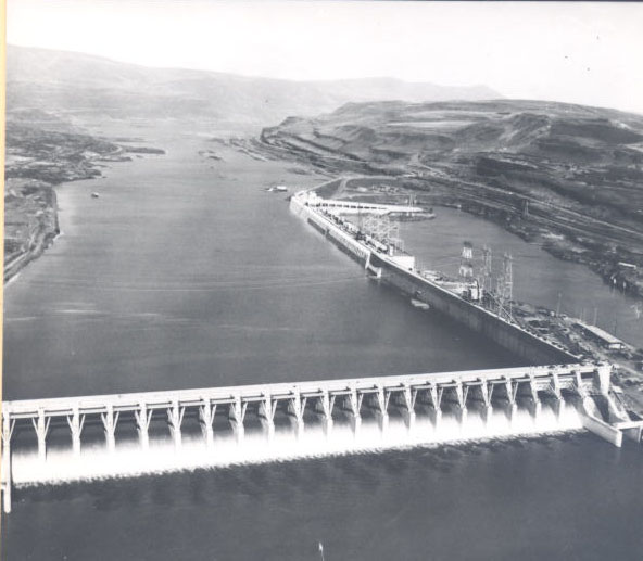
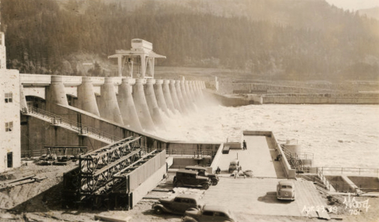
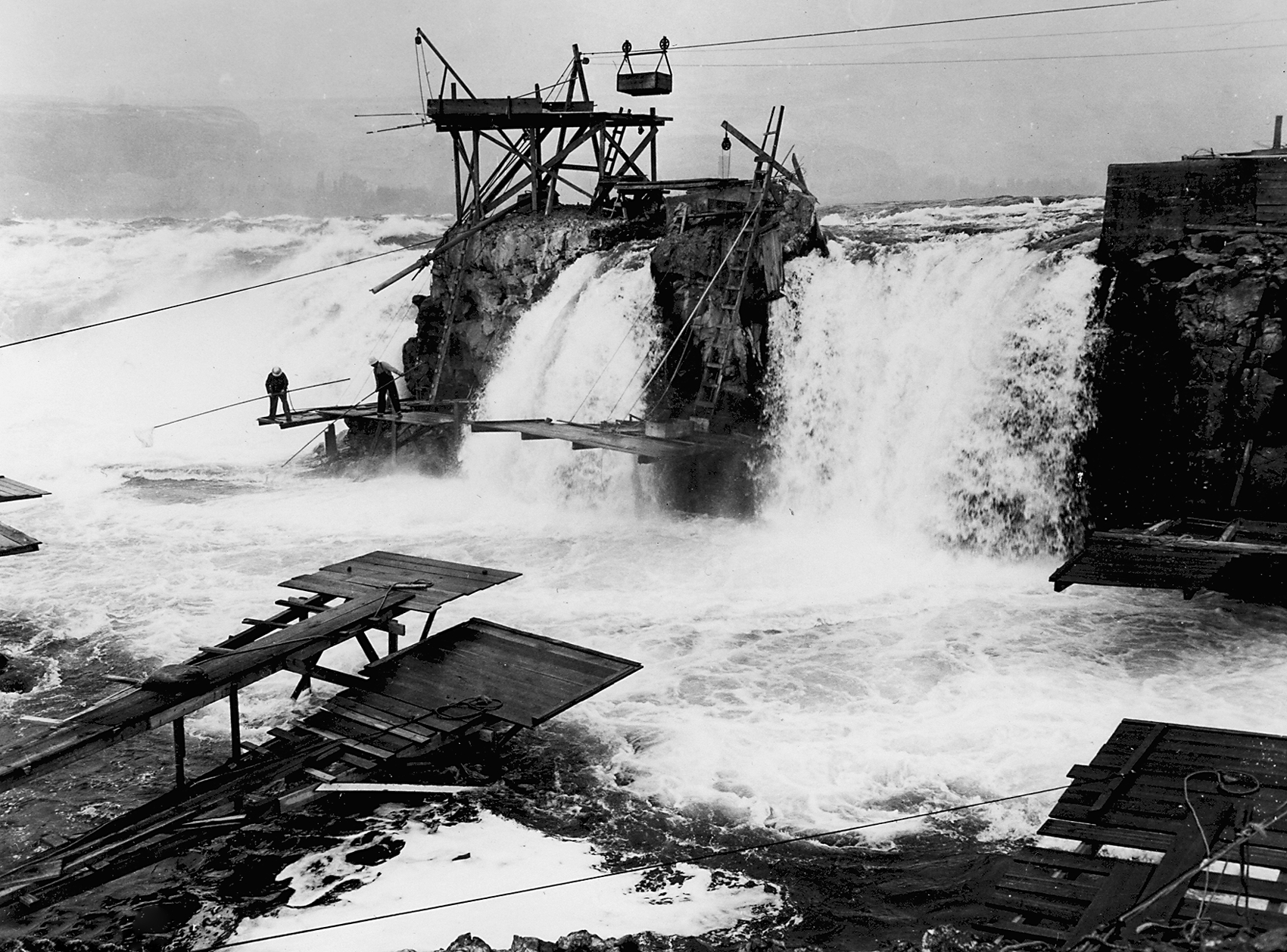
![The Dalles Dam spillway, 1957]()
The Dalles Dam spillway, 1957.
The Dalles Dam spillway, 1957 Courtesy Oreg. Hist. Soc. Research Lib., neg. no.015349
-
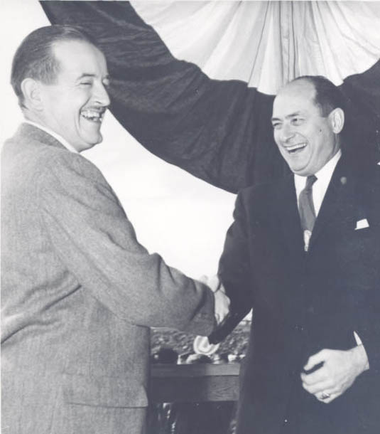
![Gov. Holmes (OR) and Gov. Rosellini (WA), at locks opening, 1957]()
Gov. Holmes (OR) and Gov. Rosellini (WA), at locks opening, 1957.
Gov. Holmes (OR) and Gov. Rosellini (WA), at locks opening, 1957 Courtesy Oreg. Hist. Soc. Research Lib., neg. no.010881
-
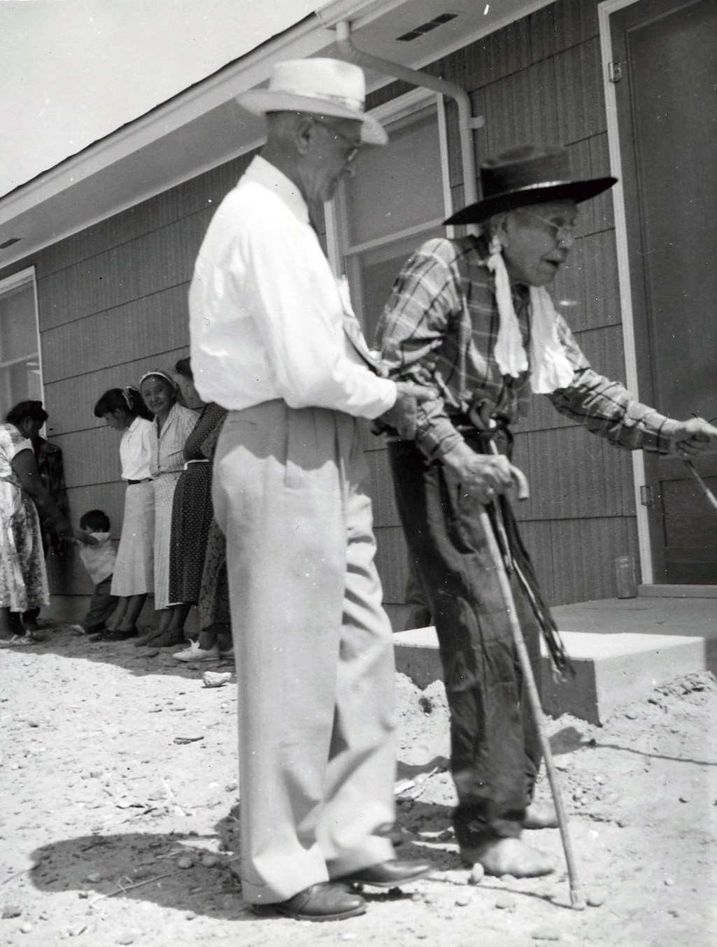
![]()
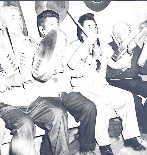
Chief Tommy Thompson relocating to new Celilo Village, c. 1956.
Courtesy Oreg. Hist. Soc. Research Lib., OrHi73669
-
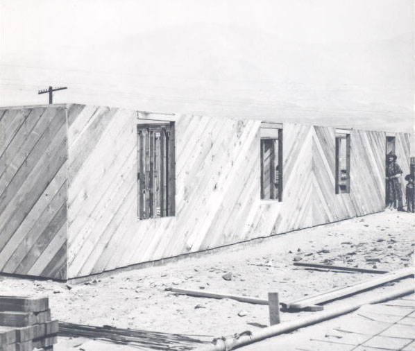
![New housing, relocated Celilo Village, 1949]()
New housing, relocated Celilo Village, 1949.
New housing, relocated Celilo Village, 1949 Courtesy Oreg. Hist. Soc. Research Lib., neg. no.007250
-
![Yakima, Umatilla, Wyam Tribe members, farewell ceremony to Celilo Falls, 1956]()
Farewell ceremony to Celilo Falls, 1956.
Yakima, Umatilla, Wyam Tribe members, farewell ceremony to Celilo Falls, 1956 Courtesy Oreg. Hist. Soc. Research Lib., neg. no.001579
-
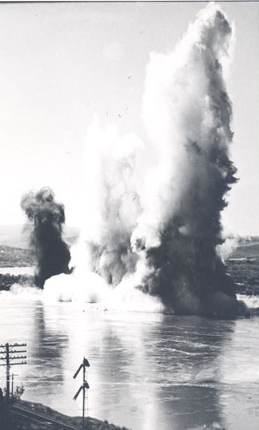
![Final large blast, removing 60 thousand cubic yards, 1956]()
Final large blast, 1956.
Final large blast, removing 60 thousand cubic yards, 1956 Courtesy Oreg. Hist. Soc. Research Lib., neg. no.015320
-
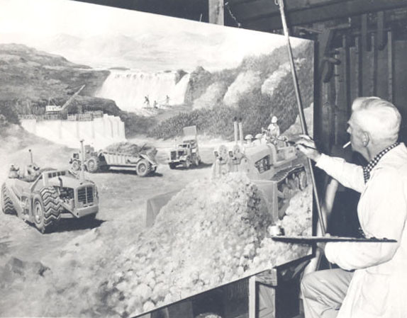
![Mural of The Dalles Dam construction and fishery, Ed Quigley, 1959]()
Mural of The Dalles Dam construction, Ed Quigley, 1959.
Mural of The Dalles Dam construction and fishery, Ed Quigley, 1959 Courtesy Oreg. Hist. Soc. Research Lib., OrHi 85012
-
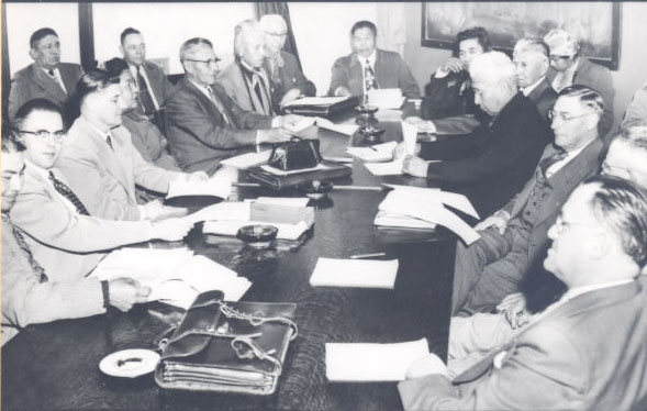
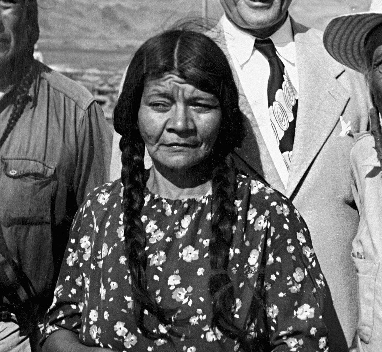
![Yakima Indians and Corps negotiate settlement, loss of fisheries, 1954]()
Yakima Indians and Corps negotiate settlement, 1954.
Yakima Indians and Corps negotiate settlement, loss of fisheries, 1954 Courtesy Oreg. Hist. Soc. Research Lib., neg. no.007247
-
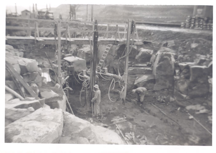
![Construction, The Dalles Dam]()
Construction, The Dalles Dam.
Construction, The Dalles Dam Courtesy Oreg. Hist. Soc. Research Lib., acc27622
-
![Early blast, The Dalles Dam construction, 1952]()
Early blast, The Dalles Dam construction, 1952.
Early blast, The Dalles Dam construction, 1952 Courtesy Oreg. Hist. Soc. Research Lib., neg. no.018212
-
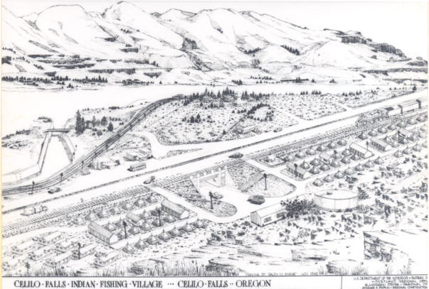
![Drawing, Celilo Village plan, 1948]()
Drawing, Celilo Village plan, 1948.
Drawing, Celilo Village plan, 1948 Courtesy Oreg. Hist. Soc. Research Lib., neg. no.007249
-
![Corps drawing of The Dalles Dam (Eric Michelson), 1952]()
Corps drawing of The Dalles Dam (Eric Michelson), 1952.
Corps drawing of The Dalles Dam (Eric Michelson), 1952 Courtesy Oreg. Hist. Soc. Research Lib., neg. no.982D177
-
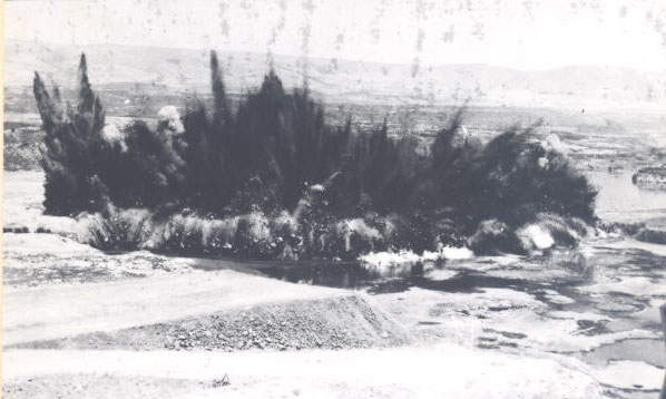
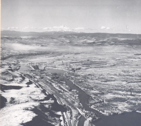
![The Dalles Dam site, 1956]()
The Dalles Dam site, 1956.
The Dalles Dam site, 1956 Courtesy Oreg. Hist. Soc. Research Lib., neg. no.005835
-
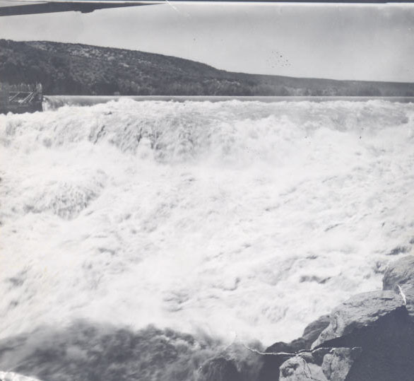
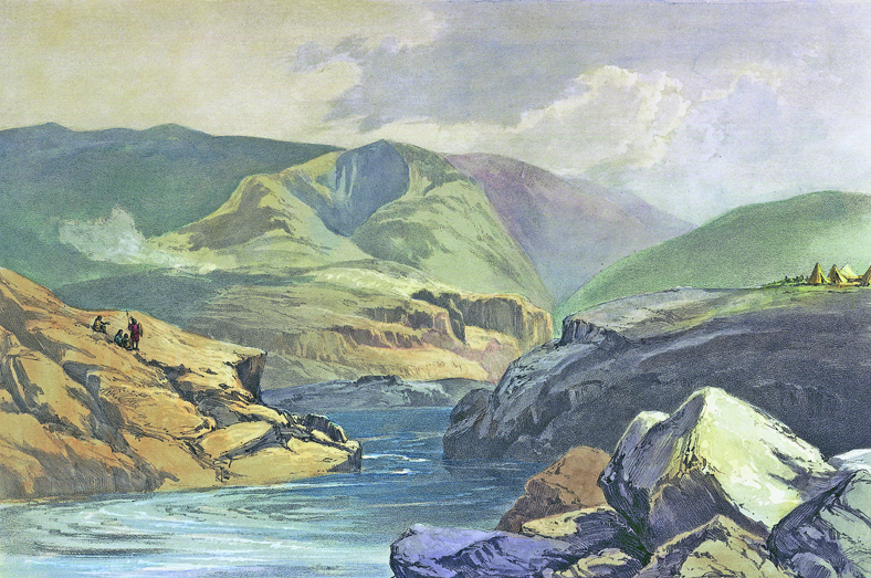
![Celilo Falls, by L. Moorhouse]()
Celilo Falls, by L. Moorhouse.
Celilo Falls, by L. Moorhouse Courtesy Oreg. Hist. Soc. Research Lib., neg. no.008377
-
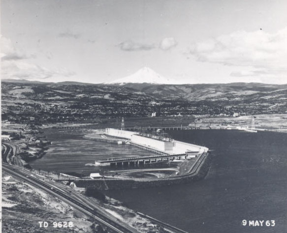
![The Dalles Dam, 1963]()
The Dalles Dam, 1963.
The Dalles Dam, 1963 Courtesy Oreg. Hist. Soc. Research Lib., neg. no.019498
-
![The Dalles Dam, 435-ton generator, 1957]()
The Dalles Dam, 435-ton generator, 1957.
The Dalles Dam, 435-ton generator, 1957 Courtesy Oreg. Hist. Soc. Research Lib., neg. no.015345

Related Entries
-
![Bonneville Dam]()
Bonneville Dam
The U.S. Army Corps of Engineers built and operated Bonneville Lock and…
-
![Celilo Falls]()
Celilo Falls
Celilo Falls (also known as Horseshoe Falls) was located on the mid-Col…
-
![Columbia River]()
Columbia River
The River For more than ten millennia, the Columbia River has been the…
-
![Flora Cushinway Thompson (1898–1978)]()
Flora Cushinway Thompson (1898–1978)
Flora Cushinway Thompson (enrolled Warm Springs) was a spiritual and co…
-
![Salmon]()
Salmon
The word “salmon” originally referred to Atlantic salmon (Salmo salar),…
-
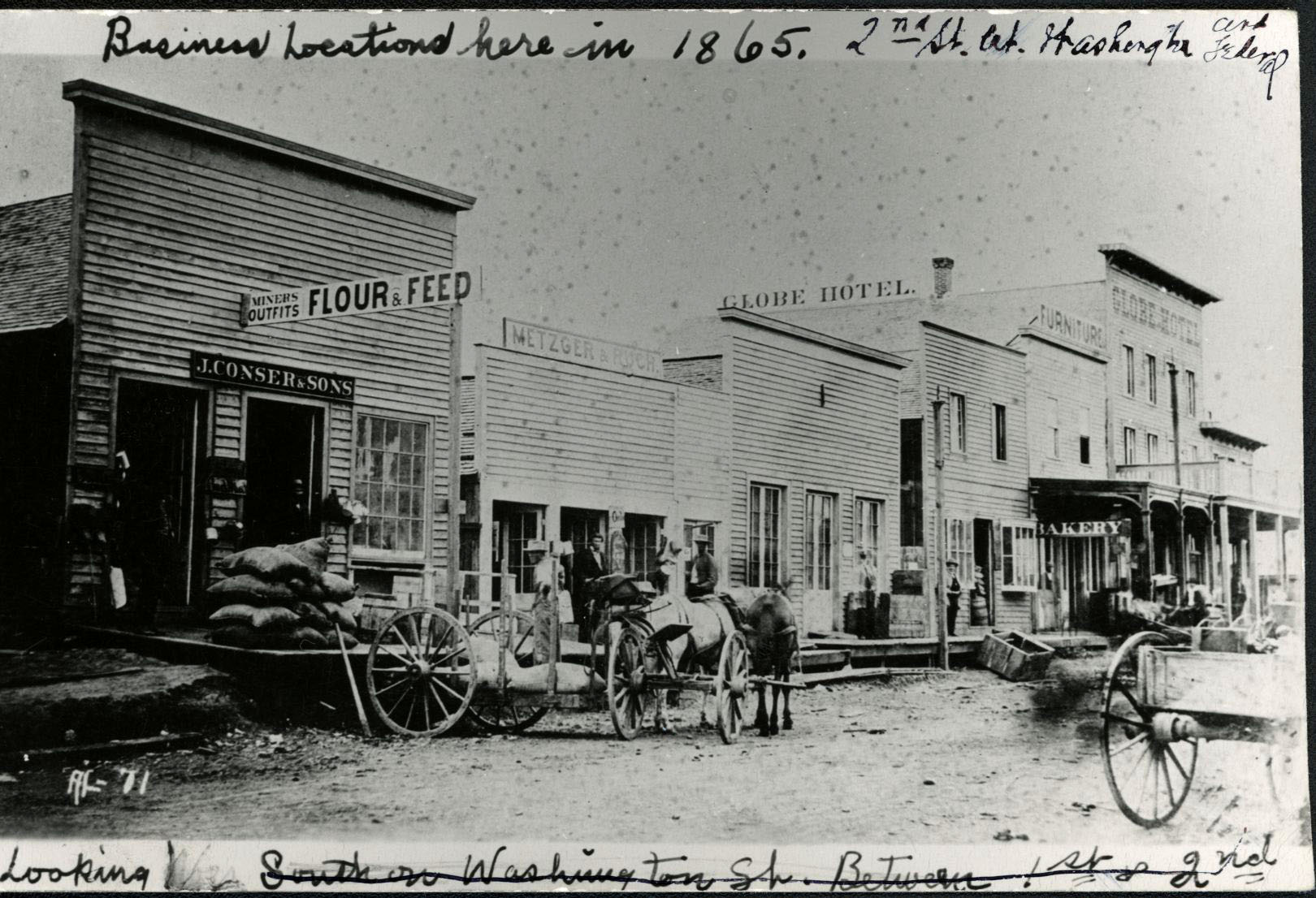
![The Dalles]()
The Dalles
The Dalles is one of the oldest permanently occupied places in Oregon, …
-
![Tommy Thompson (1864?–1959)]()
Tommy Thompson (1864?–1959)
Tommy Kuni Thompson served as the headman of Wyam (an Ichiskiin Sinwit …
-
![U.S. Army Corps of Engineers]()
U.S. Army Corps of Engineers
The U.S. Army Corps of Engineers, a hybrid military and civilian federa…
-
![U.S. Bureau of Reclamation]()
U.S. Bureau of Reclamation
The U.S. Bureau of Reclamation, in the Department of the Interior, has …
Related Historical Records
Map This on the Oregon History WayFinder
The Oregon History Wayfinder is an interactive map that identifies significant places, people, and events in Oregon history.
Further Reading
Barber, Katrine. Death of Celilo Falls. Seattle, Wash.: University of Washington Press, 2005.
Billington, David P. and Donald C. Jackson. Big Dams of the New Deal Era. Norman: University of Oklahoma Press, 2006.
Special Issue: Remembering Celilo Falls. Oregon Historical Quarterly 108:4 (Winter 2007).
U. S. Army Corps of Engineers. Water Resources Development in Oregon 2000. Portland, Ore.: U.S. Army Engineer District Portland, 2000.
Willingham, William F. Army Engineers and the Development of Oregon: A History of the Portland District U. S. Army Corps of Engineers. Washington, D.C.: U.S. Government Printing Office, 1983.