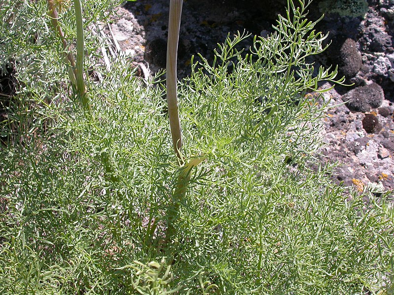
The Minam River Basin on the west side of the Wallowa Mountains is one of the most visited wilderness regions in Oregon, with 239 square miles of forested canyons, creeks, and mountains largely within the Eagle Cap Wilderness Area. The name comes from the Nez Perce word eminamah, which refers to a medicinal plant Lomatium dissectum, or fernleaf biscuitroot, commonly found on the lower canyon terraces.
The fifty-one-mile-long river runs wild for all but eight miles, where it joins the Wallowa River, a tributary of the Grande Ronde River, at the town of Minam. From the lower canyon’s Douglas-fir and sweet-smelling Ponderosa pine to the subalpine fir, mountain hemlock, and white-bark pine that whisker the ridge tops, over forty miles of the river are in the National Wild and Scenic River system. The Minam watershed falls under the management of the Eagle Cap Ranger District in the Wallowa–Whitman National Forest.
The Minam has its headwaters at Blue Lake, at altitude 7,703 feet, and from limited outflow on the south end of Minam Lake. In the early twentieth century, Minam Lake was impounded for release of summer irrigation water, which led to a reduced volume of water feeding the river. Over thirty named creeks feed the main stem of the river and its two largest tributaries, the Little Minam and the North Minam. The upper twenty miles of the river flow through a glacial U-shaped valley carved mostly in granodiorite, while the lower river’s reach lies primarily in the basaltic rock of a V-shaped valley.
The river is roughly 6 percent of the Grande Ronde River drainage area but contributes nearly 15 percent of the basin’s water. This percentage is attributable to the area’s deep winter snowpack. The highest elevation in the watershed exceeds 9,100 feet on the western flank of Elkhorn Peak, at the head of the North Minam River. (Elkhorn Peak, at 9,233 feet, is primarily in the Lostine watershed.) Discharge of the Minam has high seasonal variation owing to spring and summer meltwater. May and June are peak months for runoff, with stream flow in the range of 1,500 to 2,500 cubic feet per second.
The Cayuse, Nez Perce, Walla Walla, and Umatilla people hunted and fished this country. At Téekin Páaĺa (Sand Camp), Mayáxpa (Meadow Camp), and Tikéempe (Falls Camp), fishers used spears, gaffs, and hooks to catch salmon, steelhead, and trout. The ridgeline on the west side of the drainage became a line of demarcation in 1863 when Tuekakas, also known as Old Joseph, a chief of the Wallowa Nez Perce, placed rock and pole monuments there, warning non-Native settlers in the Grande Ronde Valley not to encroach on his people’s land. While a few of the rock mounds have endured, the Nez Perce control of the Minam-Wallowa country did not. By 1877, the Wallowa Band had been forced into Idaho, and white ranchers, graziers, and others were using the Minam River Basin. Placenames in the basin commemorate those men, who included horse thieves (Vaughan Creek), shepherds (Dobbin Creek), trappers (Lowry Gulch), and miners (Frazier Pass).
In the early twentieth century, the Minam was subject to logging. From 1917 to 1924, about two thousand acres of primarily Ponderosa pine were harvested from the lower half of the drainage. Because this roadless logging was done during the winter, using draft horses to pull logs over snow, natural processes had largely restored the forest by the 1960s. When a growing demand for lumber compelled Wallowa-Whitman forest officials to propose cutting over 400 million board feet of lumber and building fifty-one miles of road in the canyon, wilderness advocates objected and formed Save the Minam, Inc. in 1961.
Supreme Court Justice William O. Douglas, a Pacific Northwest outdoorsman, vigorously advocated wilderness protection for the entire canyon. Will Brown, regional supervisor for the Oregon Department of Fish and Wildlife Northeast Region, added his voice in favor of protection, and the Oregon Wilderness Coalition and the Grande Ronde Resource Council pushed these efforts. In 1984, with the support of Senator Mark O. Hatfield, the Minam drainage to the national forest boundary was added to the Eagle Cap Wilderness Area.
The Minam River Basin is some of Oregon’s premier wildlife habitat. Rocky Mountain bighorn sheep and mountain goats roam the highest ridges, and Rocky Mountain elk, mule deer, and white-tailed deer populate the basin. Shiras moose have moved into northeast Oregon and have been seen in the Minam drainage. Predators include black bear, mountain lion, bobcat, coyote, red fox, pine marten, and wolves. Wolverine sightings in the western Wallowas have been confirmed. Game warden Howard Fisk reported two grizzly bears along the Bear Creek–Minam Divide in 1937–1938, the last reliable report of grizzlies in Oregon. Wild stocks of spring Chinook and steelhead use the river, but their numbers have declined. Bull trout, a threatened species in Oregon, also inhabit the Minam and Little Minam Rivers. And after an absence of over fifty years, the Minam and Catherine wolf packs are resident in the basin.
-
![]()
USGS map of the Minam River Basin.
Courtesy U.S. Geological Survey
-
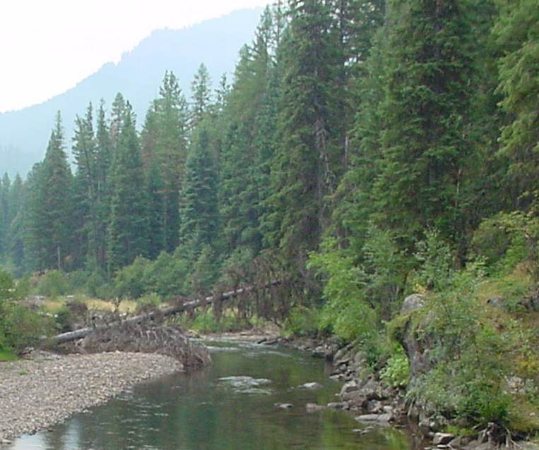
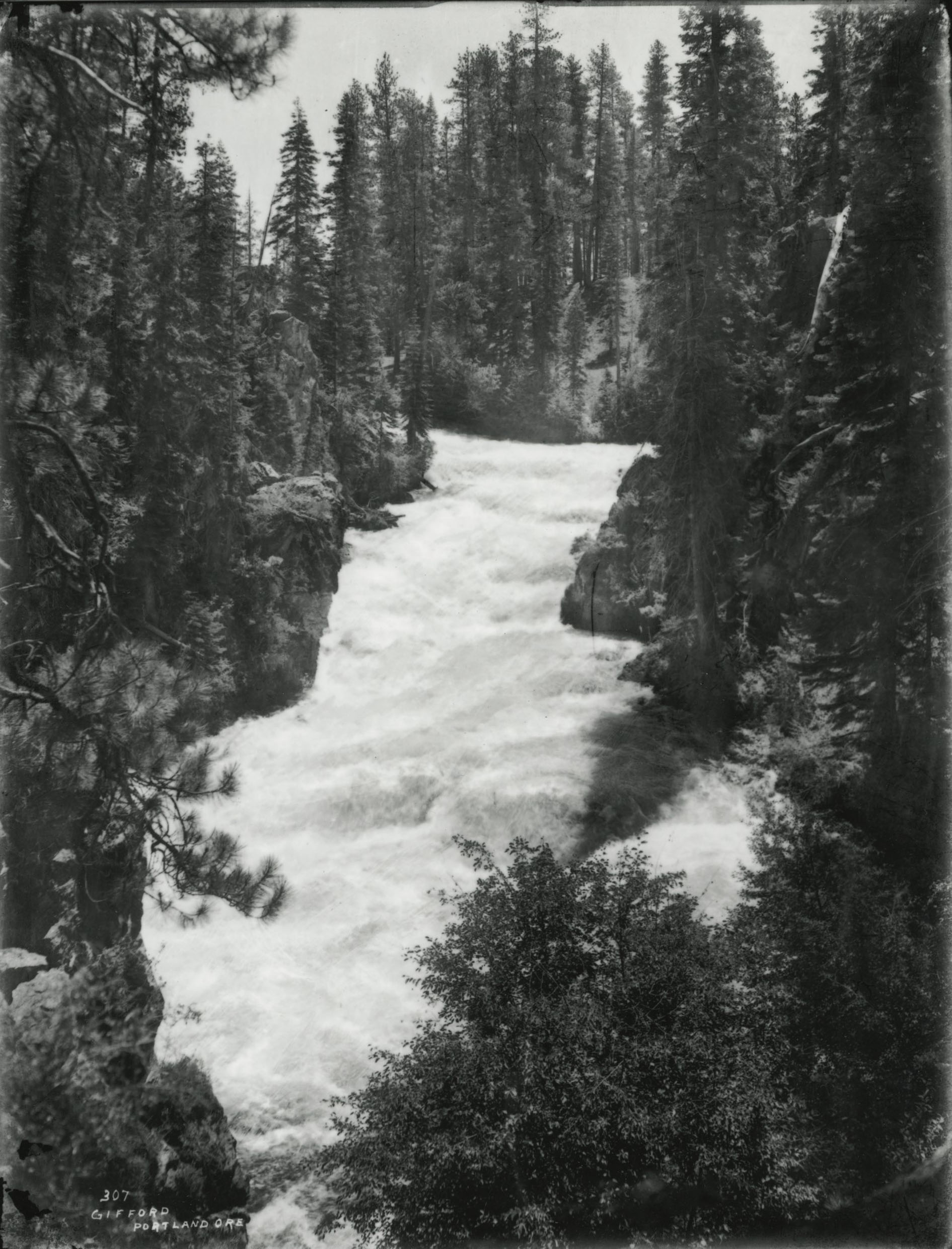
![]()
Minam River.
Courtesy U.S. Forest Service
-
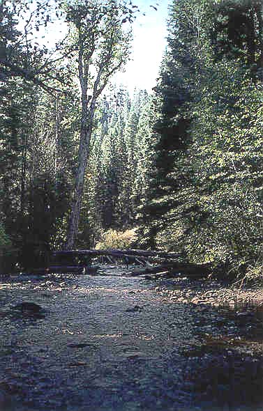
![]()
Minam River.
Courtesy U.S. Geological Survey
-
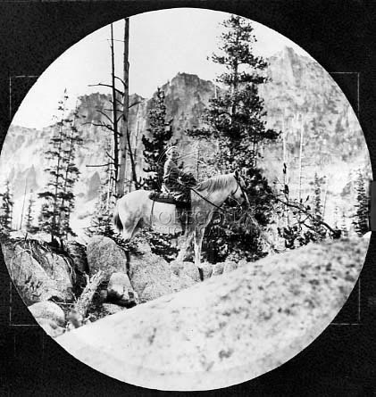
![]()
Woman riding through the Eagle Cap Wilderness, 1937.
Oregon Historical Society Research Library, 018063

Related Entries
-
![Fernleaf biscuitroot]()
Fernleaf biscuitroot
Native Americans were the first to recognize the substantial benefits o…
-
![Mark O. Hatfield (1922-2011)]()
Mark O. Hatfield (1922-2011)
As an Oregon legislator, secretary of state, governor, and United State…
-
![National Wild and Scenic Rivers in Oregon]()
National Wild and Scenic Rivers in Oregon
The world's first and most extensive system of protected rivers began w…
-
![William O. Douglas (1898-1980)]()
William O. Douglas (1898-1980)
Although he hailed from the State of Washington, William O. Douglas rep…

Related Historical Records
Map This on the Oregon History WayFinder
The Oregon History Wayfinder is an interactive map that identifies significant places, people, and events in Oregon history.
Further Reading
Hunn, Eugene S., E. Thomas Morning Owl, Philip E Cash Cash, Jennifer Karson Engum. Cáw Pawá Láakani—They Are Not Forgotten: Sahaptian Place Names Atlas of the Cayuse, Umatilla, and Walla Walla. Tamastslikt Culture Institute and Eco Trust. Seattle: University of Washington Press, 2015.
Josephy, Alvin M., Jr. The Nez Perce Indians and the Opening of the Northwest, Abridged Edition. Lincoln: University of Nebraska Press, 1971.
"Ecology." Mount Pisgah Arboretum. https://mountpisgaharboretum.com/learn/ecology/
“Specific Wolves in Oregon and Wolf Packs." Oregon Department of Fish and Wildlife. https://dfw.state.or.us/Wolves/Packs/index.asp
Palmer, Tim. Field Guide to Oregon Rivers. Corvallis: Oregon State University Press, 2014.
Skovlin, Jon M., and Donna McDaniel Skovlin. Into the Minam: The History of A River And Its People. Reflections Publishing Company. 2011.
“Minam River: Wild and Scenic River Management Plan.” Wallowa-Whitman National Forest. United States Department of Agriculture, 1994.