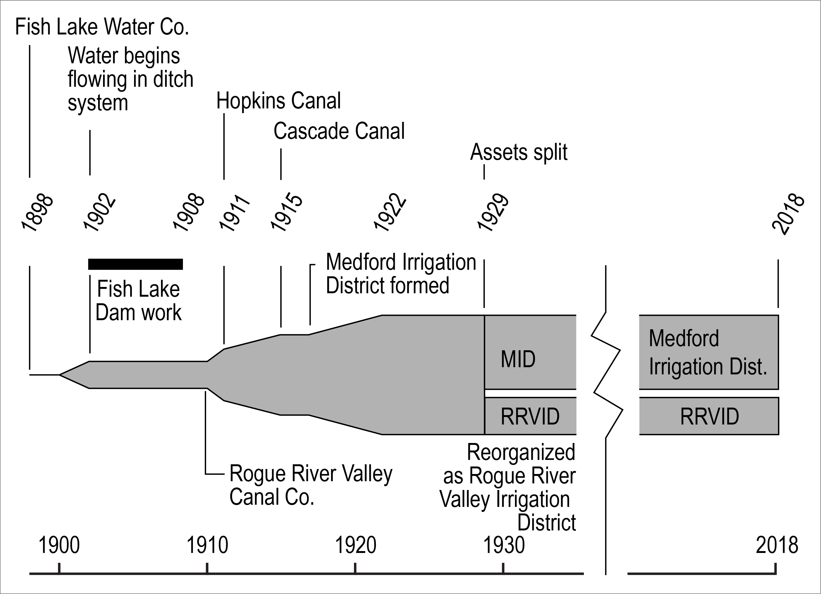
The Fish Lake Water Company was organized in Medford in 1898 to create a plan for the irrigation of more than 50,000 acres of land that it would develop in the fertile Rogue Valley, which has hot summers and long growing seasons. The company proposed to enlarge Fish Lake, about thirty-five miles east of Medford, by building a dam that would impound and store water to ensure adequate flow into Little Butte Creek. The Fish Lake Canal proved the benefits of irrigation and led to other irrigation projects that supported the rapid growth in agriculture in southern Oregon.
In 1900, the Fish Lake Ditch Company, a successor firm, began to plan for the Fish Lake Canal, the first large-scale irrigation system in the Rogue Valley. V.T. McCray, a California irrigation engineer, was in charge of the design and oversaw construction. A temporary dam was built between 1902 and 1908 to expand Fish Lake, the headwaters of the North Fork of Little Butte Creek. The canal was to be over fifty miles in length, with water entering the company’s main canal after being diverted from the North Fork at altitude 1,720 feet.
Water began to flow through the first eighteen miles of the canal by spring 1902, and by 1906 plans were announced to extend the canal to the town of Central Point. Completion of the Fish Lake Canal spurred a period of rapid agricultural development and population growth in Jackson County, known as the Orchard Boom.
In 1909, ownership of the Fish Lake Ditch Company passed to a group of investors and local irrigators headed by Fred N. Cummings and Patrick Welch, who planned a significant expansion of the system. The company spent about $10,000 a month on survey and construction. By September 1910, the new owners, generally called the “Welch Interests,” had reorganized the company and renamed it the Rogue River Valley Canal Company (RRVCC).
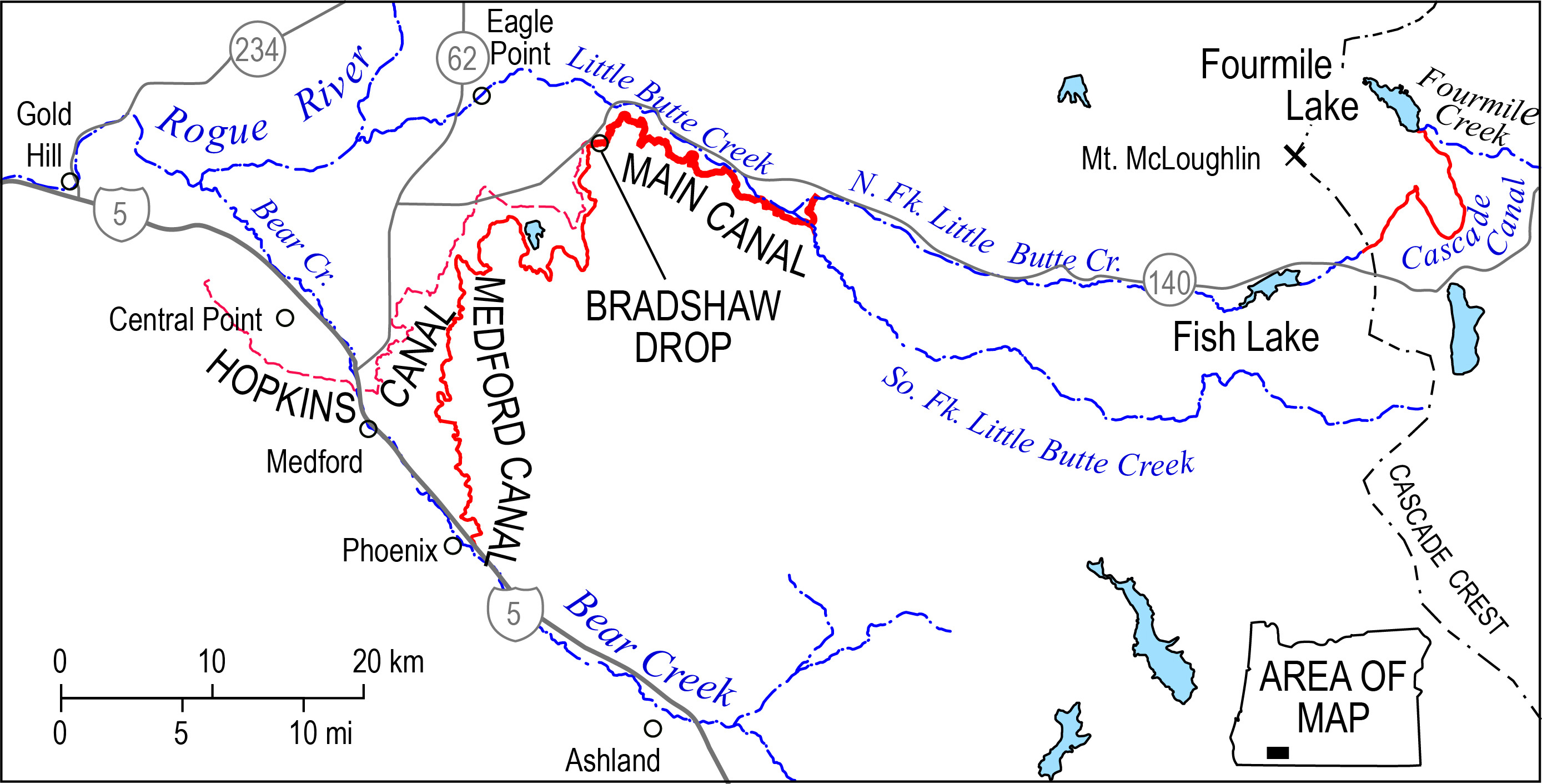
In late 1911, the enlarged Fish Lake Canal, which now extended to the Hopkins Orchard in Central Point, added 3,000 acres to the company's service area. The portion of the canal below the Bradshaw Drop, at the terminus of the main canal, was informally renamed the Hopkins Canal. In 1915, Fish Lake and Fourmile Lake were connected by the 8.8-mile-long Cascade Canal, diverting water across the Cascade Range crest from the Klamath River basin into the Rogue River basin and irrigation systems there.
In 1917, Medford voters approved the creation of the Medford Irrigation District (MID), which contracted with the RRVCC for water and enabled additional construction and expansion. The modified temporary dams at Fish Lake were replaced in 1922 with a larger permanent structure, which has since been enlarged and modified. Contract disputes and service problems led to an agreement in March 1929 whereby MID purchased two-thirds of the water rights and property of the RRVCC, which retained ownership of the remaining third of the water and the Hopkins Canal. In September 1929, property owners along the Hopkins Canal voted, 130 to 32, to form the Rogue River Valley Irrigation District (RRVID), which purchased the remaining assets of the RRVCC.
The Rogue River Valley Irrigation District operates and maintains the twenty-five-mile-long upgraded Hopkins Canal as part of its system, which now irrigates 8,813 acres. Headgates at the terminus of the main canal mark the division of the original Fish Lake project in 1929 and the creation of the Medford Irrigation District and the RRVID, both reliant on the main canal, above Bradshaw Drop. Two gates feed MID’s Medford Canal, and a third sends water to the RRVID Hopkins Canal.
-
![]()
Map of Fish Lake Canal System.
Courtesy Oregon Encyclopedia
-
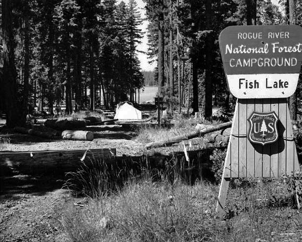
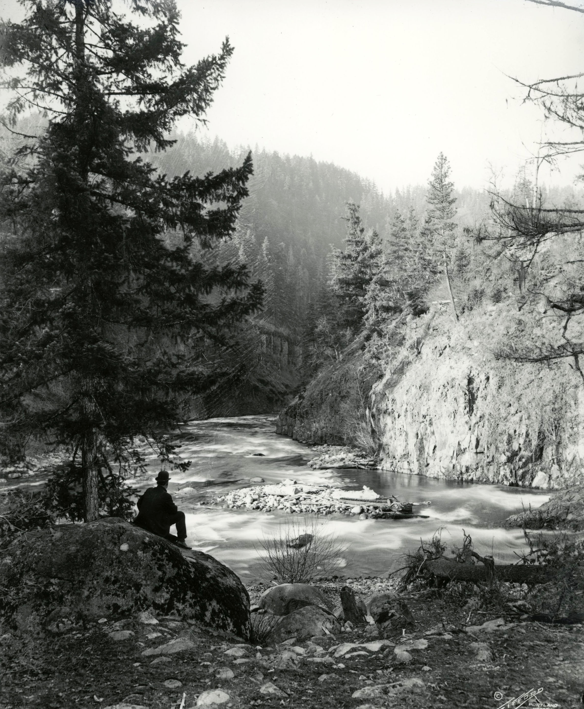
![Rogue River National Forest Campground at Fish Lake, July 1970.]()
RRNF Campground, Fish Lake, Jul 1970.
Rogue River National Forest Campground at Fish Lake, July 1970. Photo J.D. Roderick, U.S. Bureau of Reclamation, P448-100-269
-
![]()
Fish Lake Canal Timeline.
Courtesy Oregon Encyclopedia
-
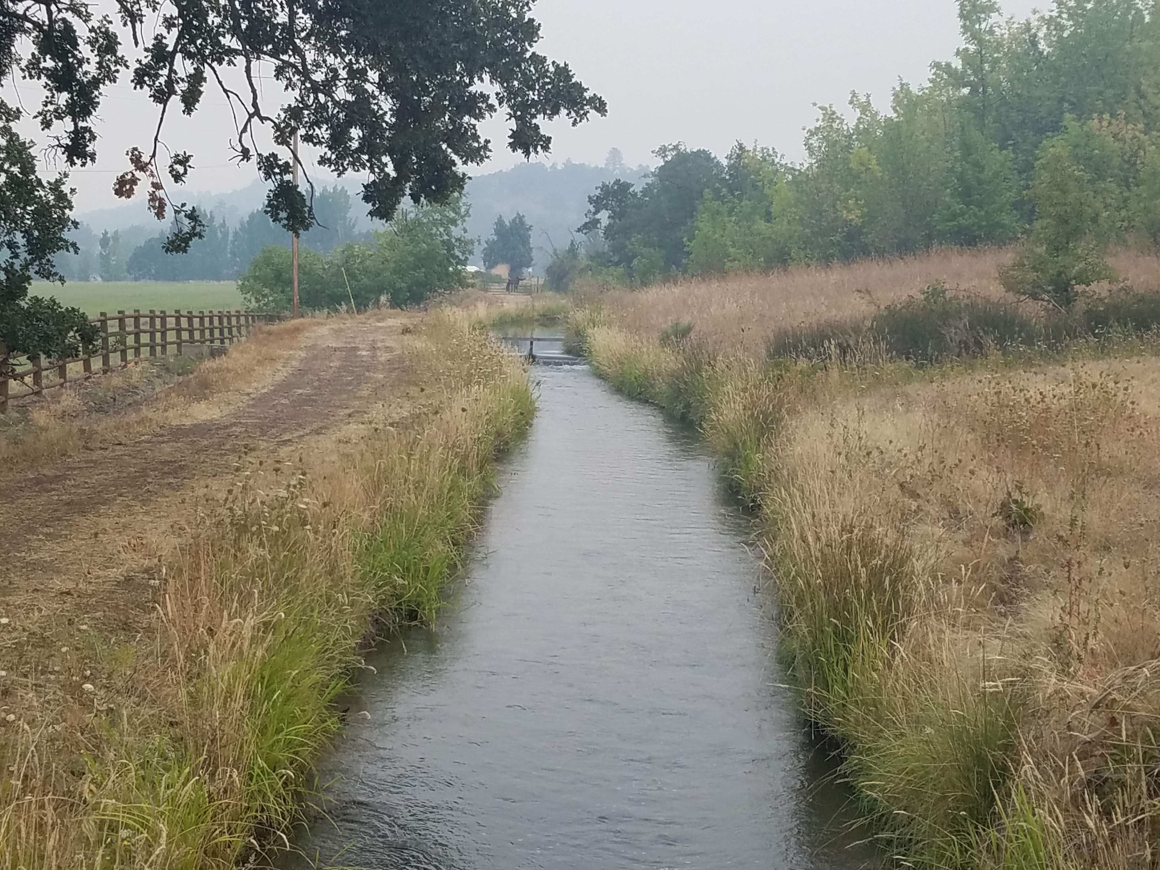
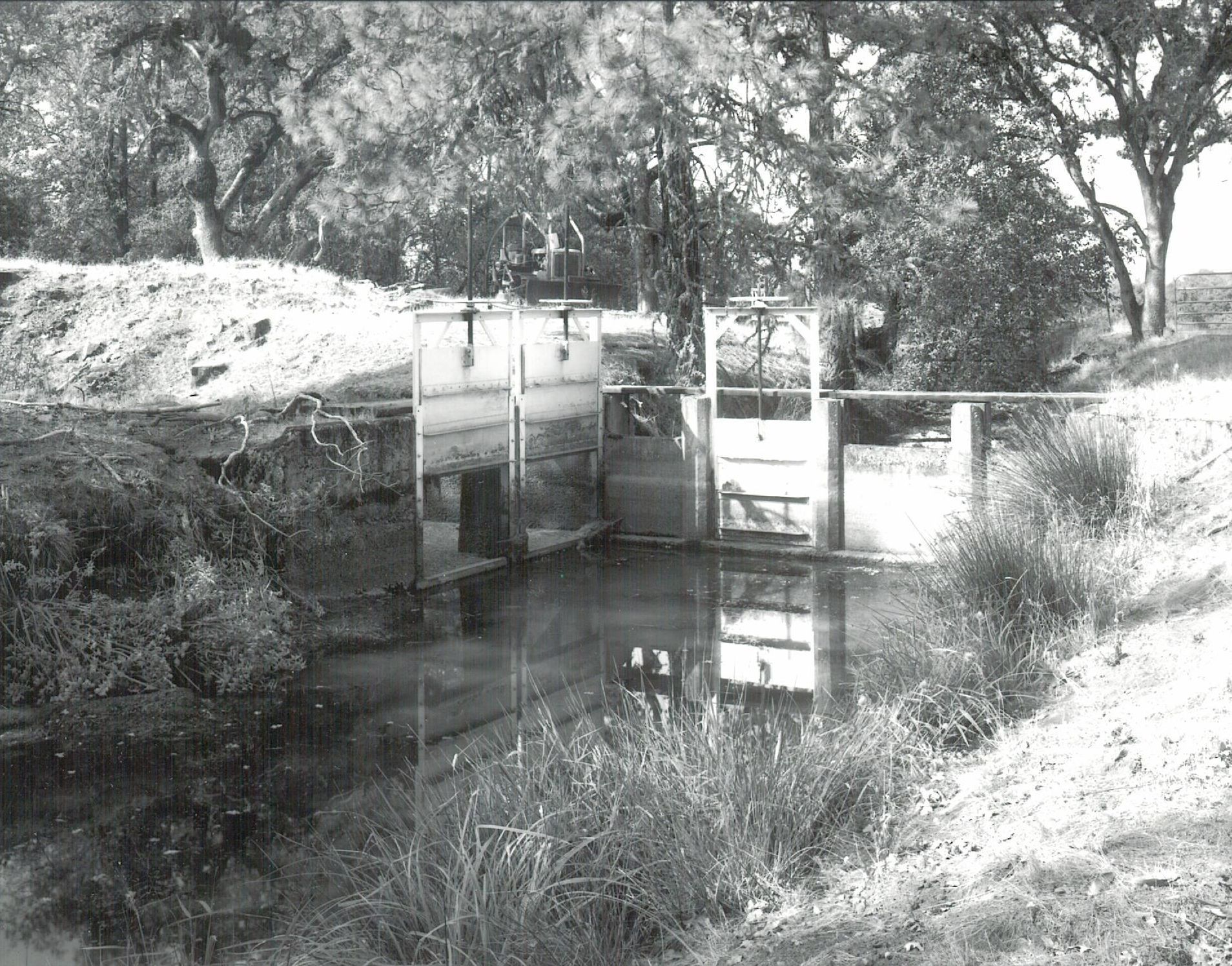
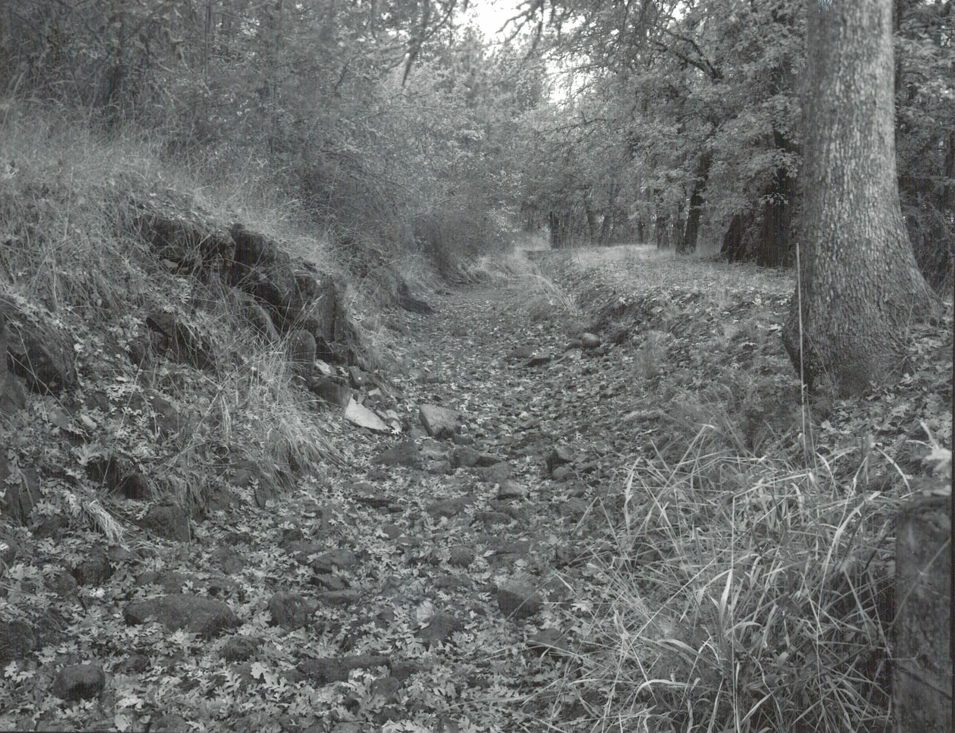
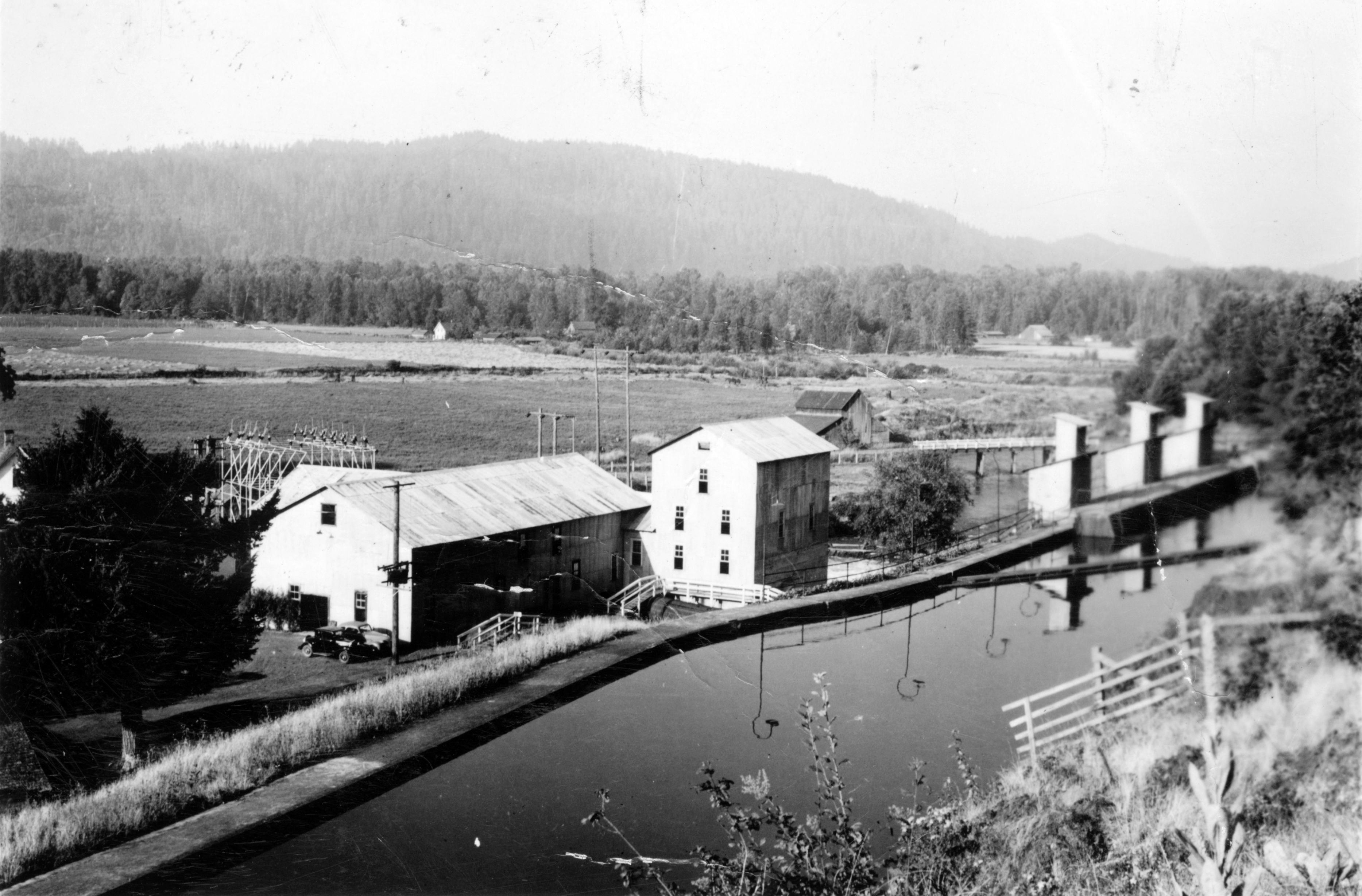
![]()
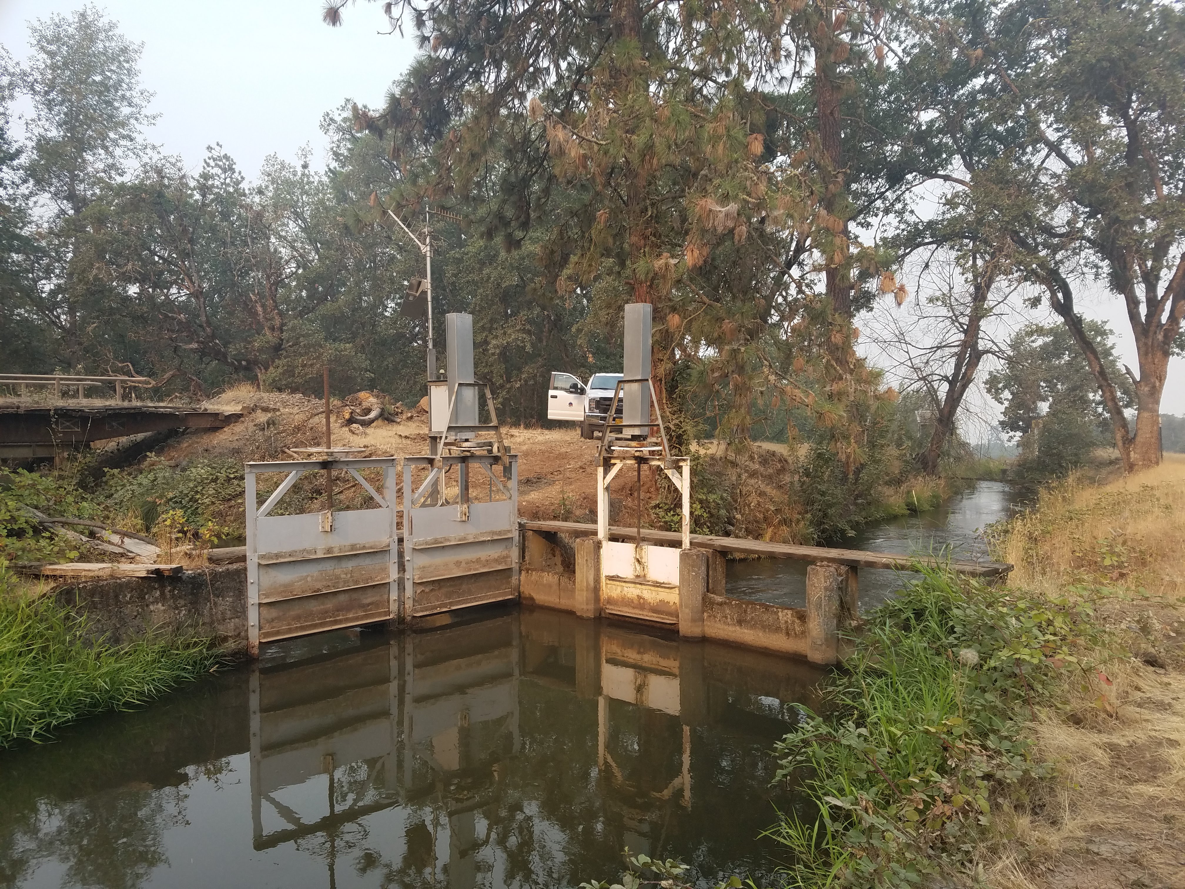
Hopkins Canal, 2018.
Courtesy Rogue River Valley Irrigation District
-
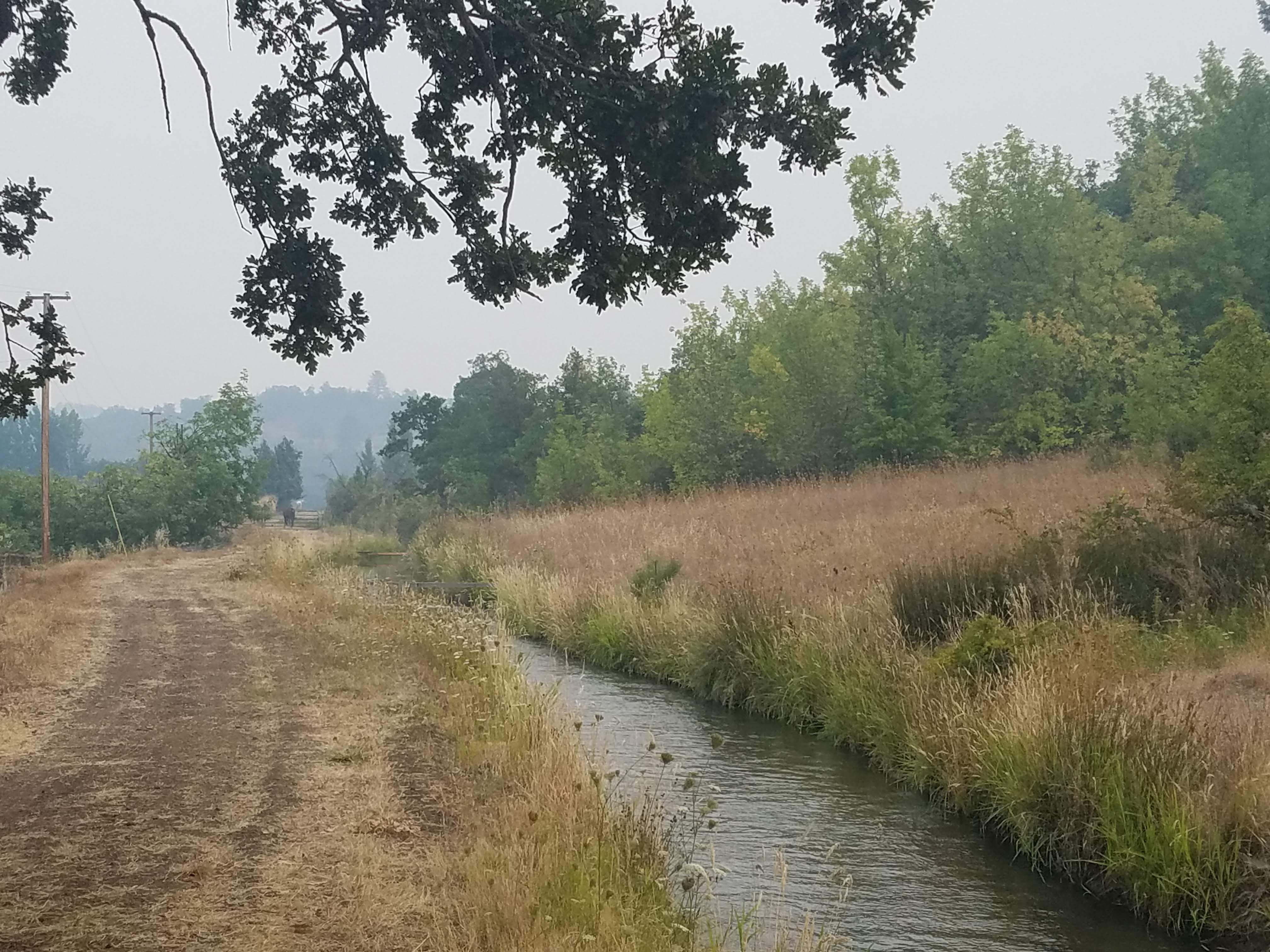
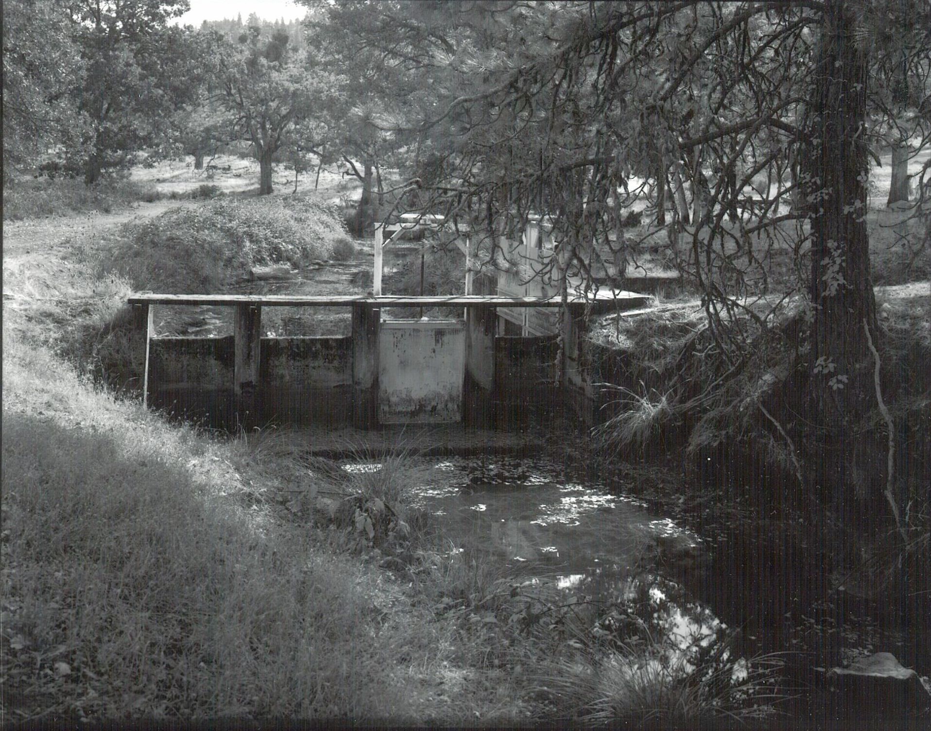
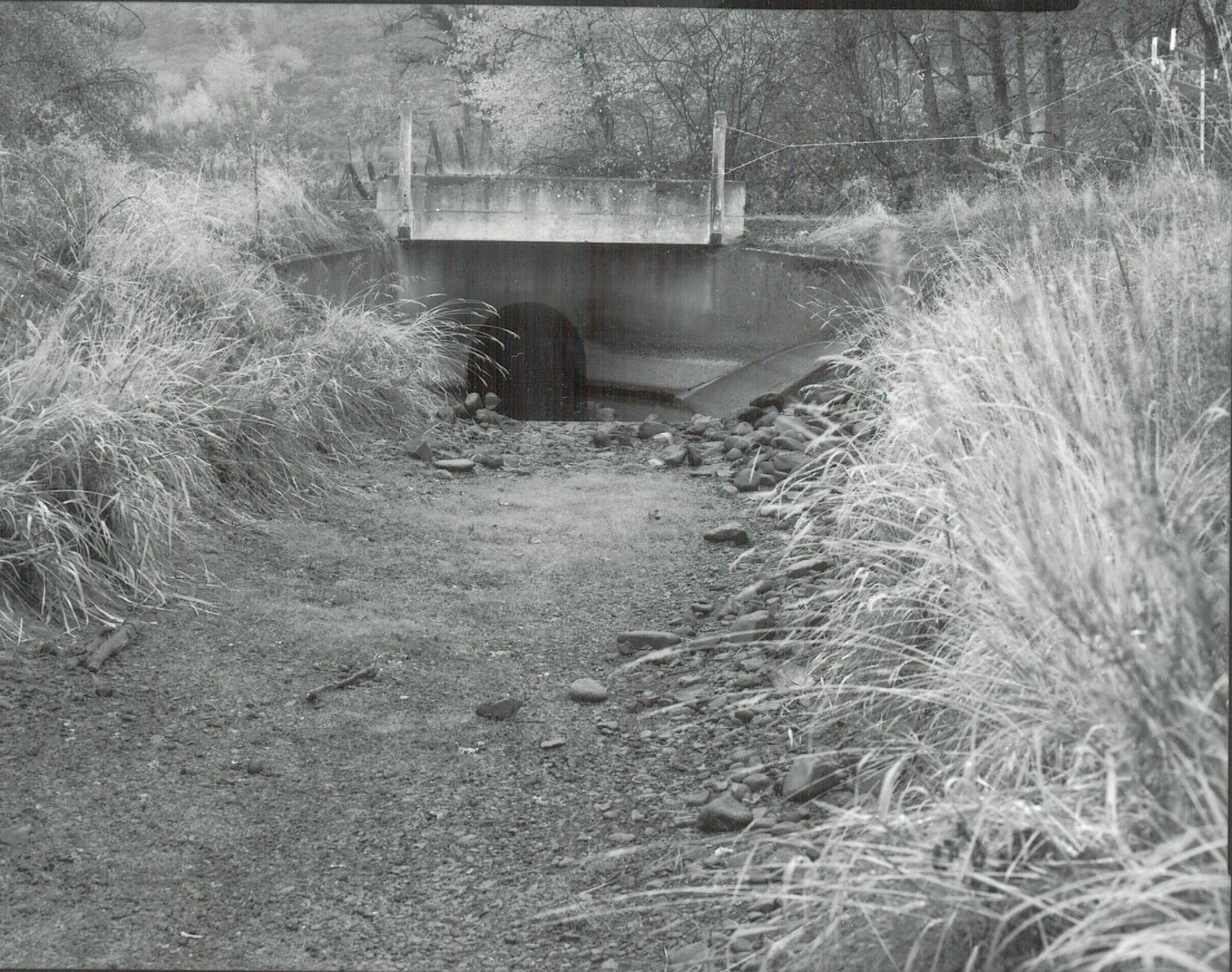
![]()
Hopkins Canal, 2018.
Courtesy Rogue River Valley Irrigation District
-
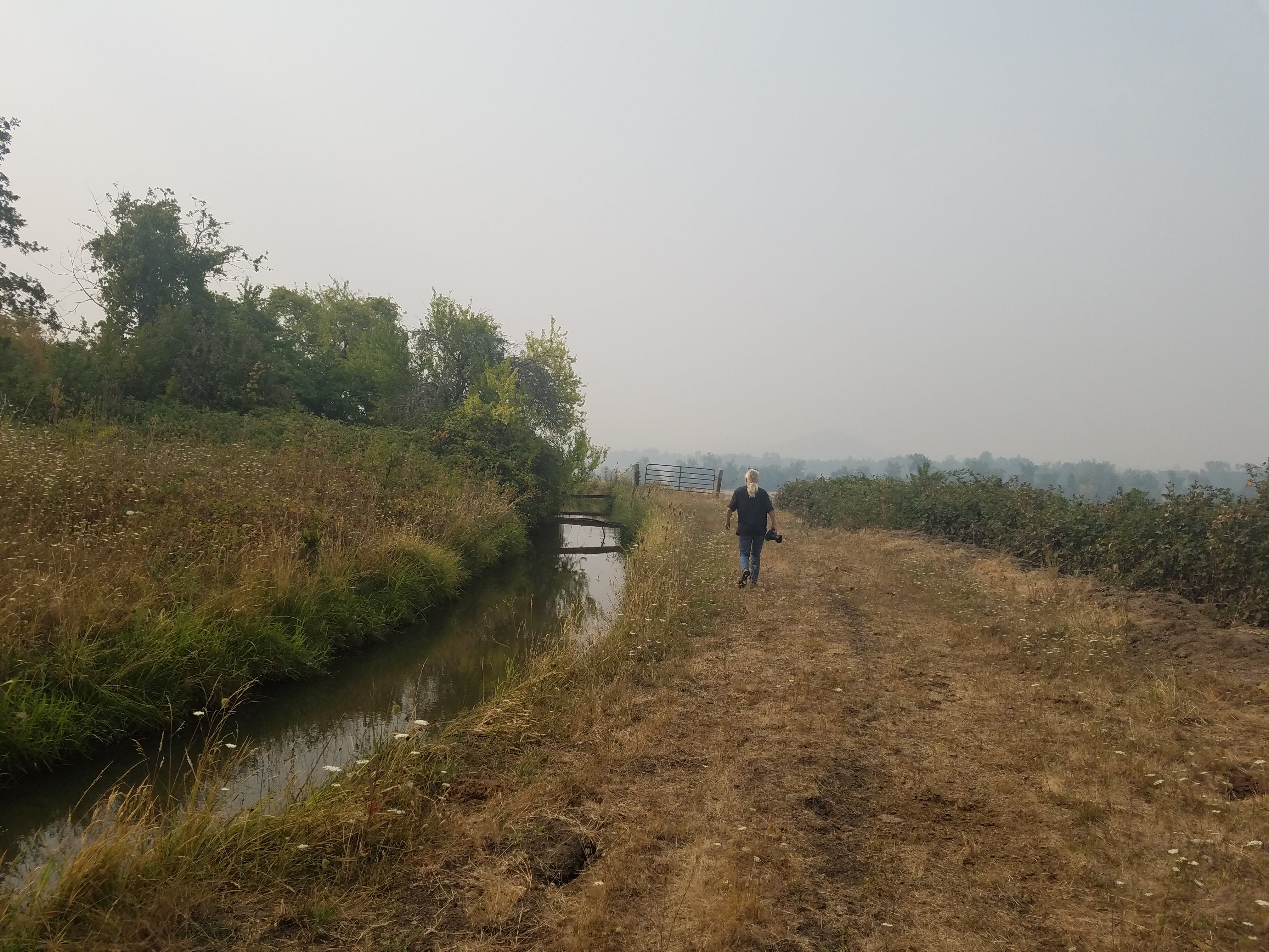
![]()
Hopkins Canal, 2018.
Courtesy Rogue River Valley Irrigation District
-
![]()
Hopkins Canal, 2018.
Courtesy Rogue River Valley Irrigation District
-
![]()
Hopkins Canal, 2018.
Courtesy Rogue River Valley Irrigation District
-
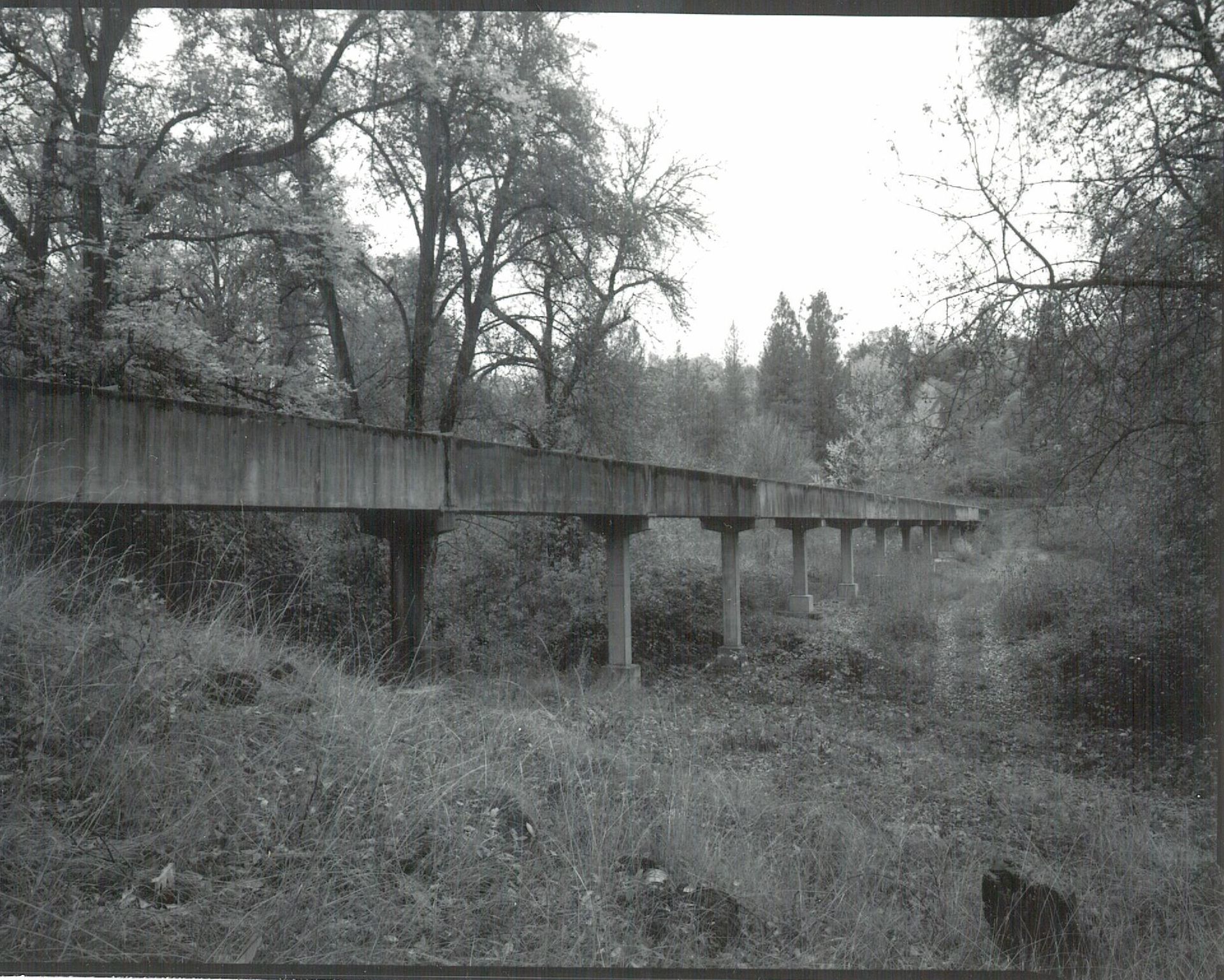
![Photo was taken as a part of the Historic American Engineering Record.]()
Hopkins Canal.
Photo was taken as a part of the Historic American Engineering Record. Courtesy U.S. Bureau of Reclamation
-
![Photo was taken as part of the Historic American Engineering Record.]()
Hopkins Canal.
Photo was taken as part of the Historic American Engineering Record. Courtesy U.S. Bureau of Reclamation
-
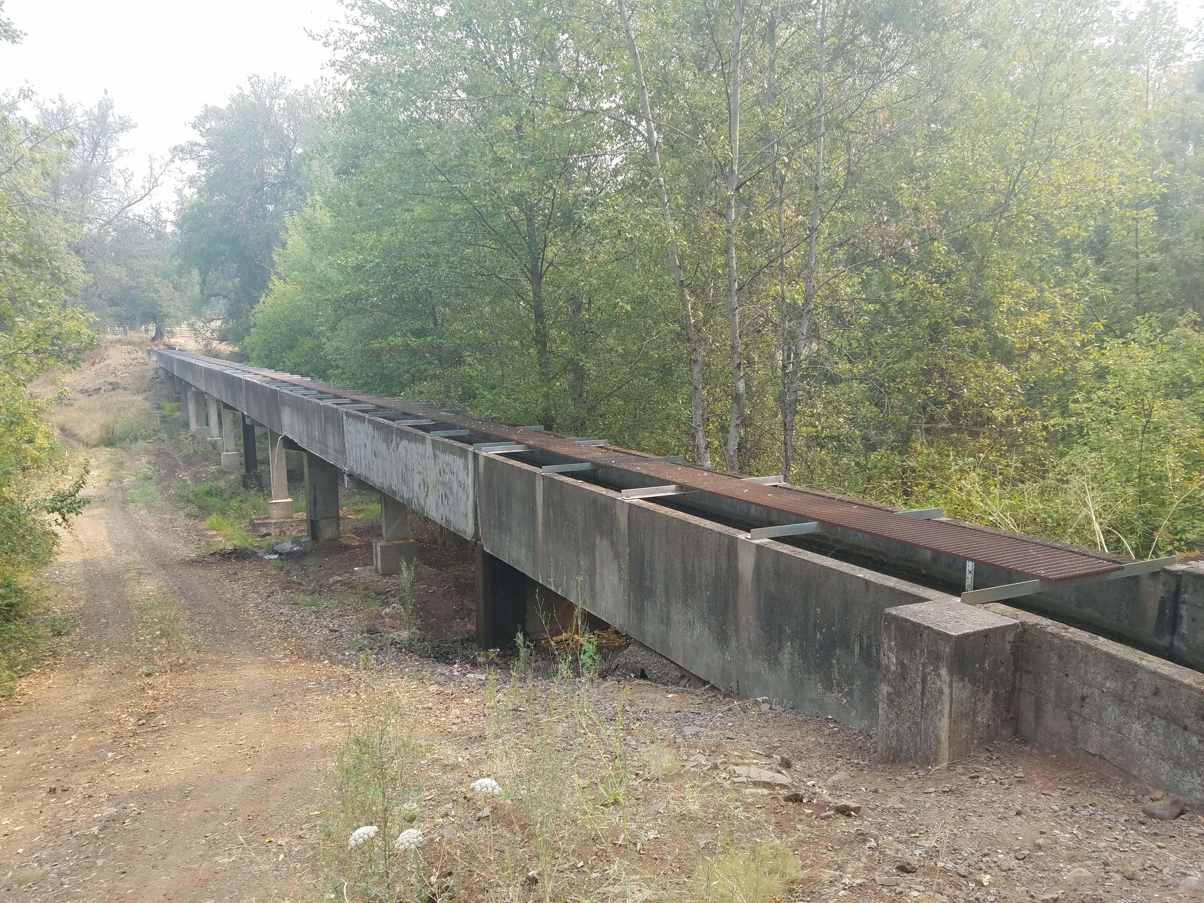
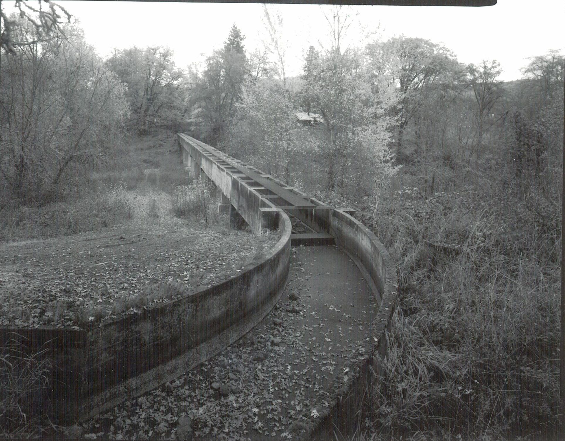
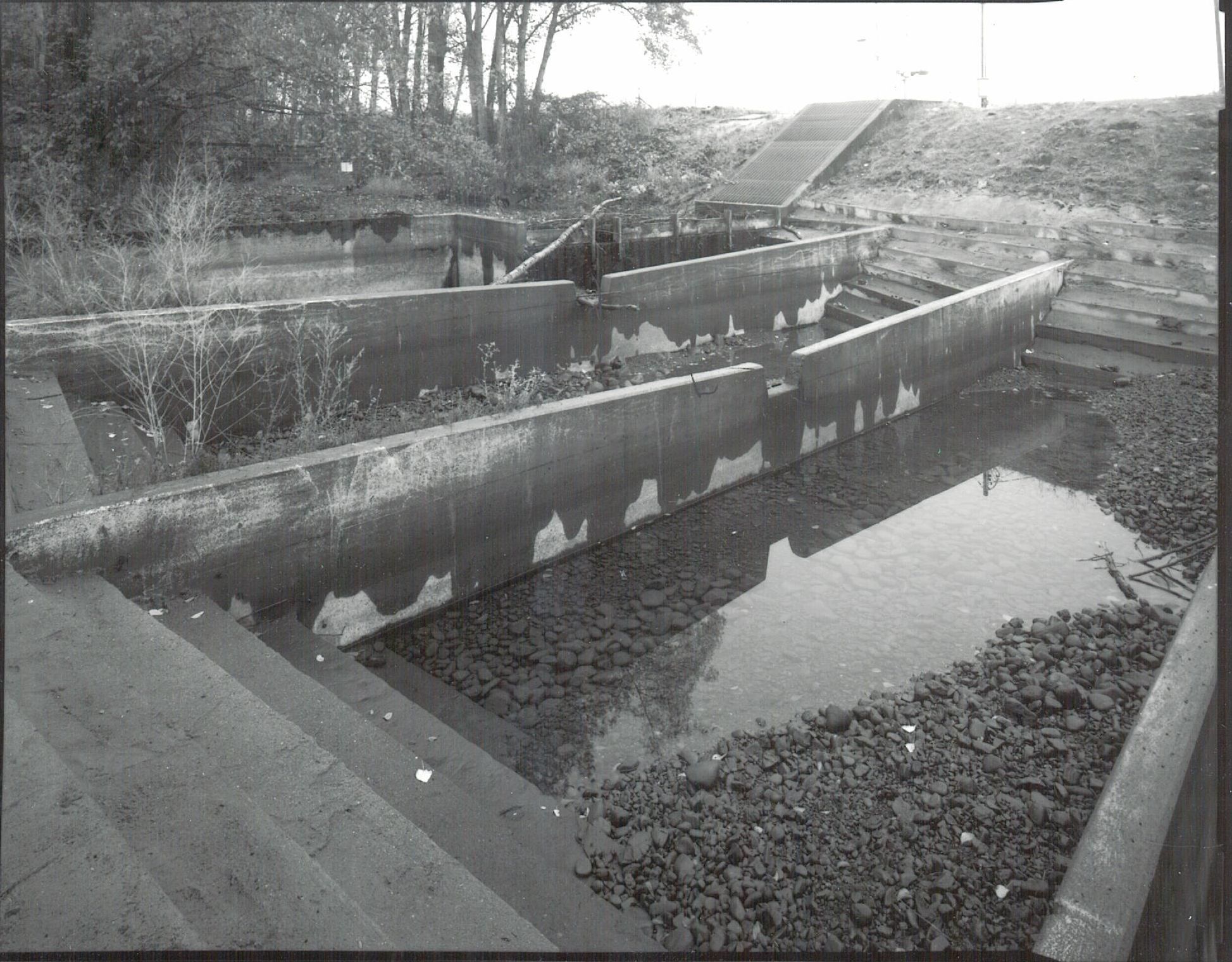
![Photo was taken as part of the Historic American Engineering Record.]()
Hopkins Canal Flume.
Photo was taken as part of the Historic American Engineering Record. Courtesy Bureau of Reclamation
-
![Photo was taken as part of the Historic American Engineering Record.]()
Hopkins Canal Flume.
Photo was taken as part of the Historic American Engineering Record. Courtesy U.S. Bureau of Reclamation
-
![Photo was taken as part of the Historic American Engineering Record.]()
Hopkins Canal.
Photo was taken as part of the Historic American Engineering Record. Courtesy U.S. Bureau of Reclamation
-
![Photo was taken as part of the Historic American Engineering Record.]()
Hopkins Canal.
Photo was taken as part of the Historic American Engineering Record. Courtesy U.S. Bureau of Reclamation
-
![Photo was taken as part of the Historic American Engineering Record.]()
Hopkins Canal.
Photo was taken as part of the Historic American Engineering Record. Courtesy U.S. Bureau of Reclamation
-
![]()
Hopkins Canal, Bradshaw Drop..
Courtesy Rogue River Valley Irrigation District
-
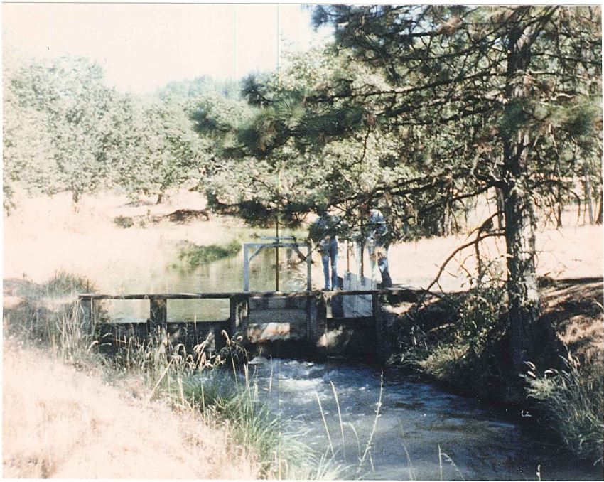
![]()
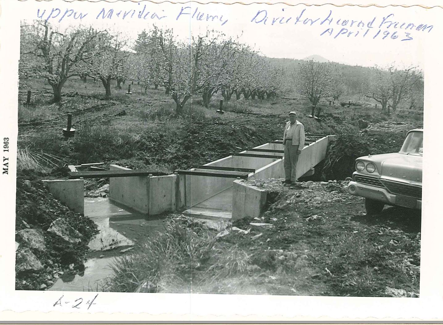
Hopkins Canal, Upper Meridian Flume, 1963..
Courtesy Rogue River Valley Irrigation District
-
![]()
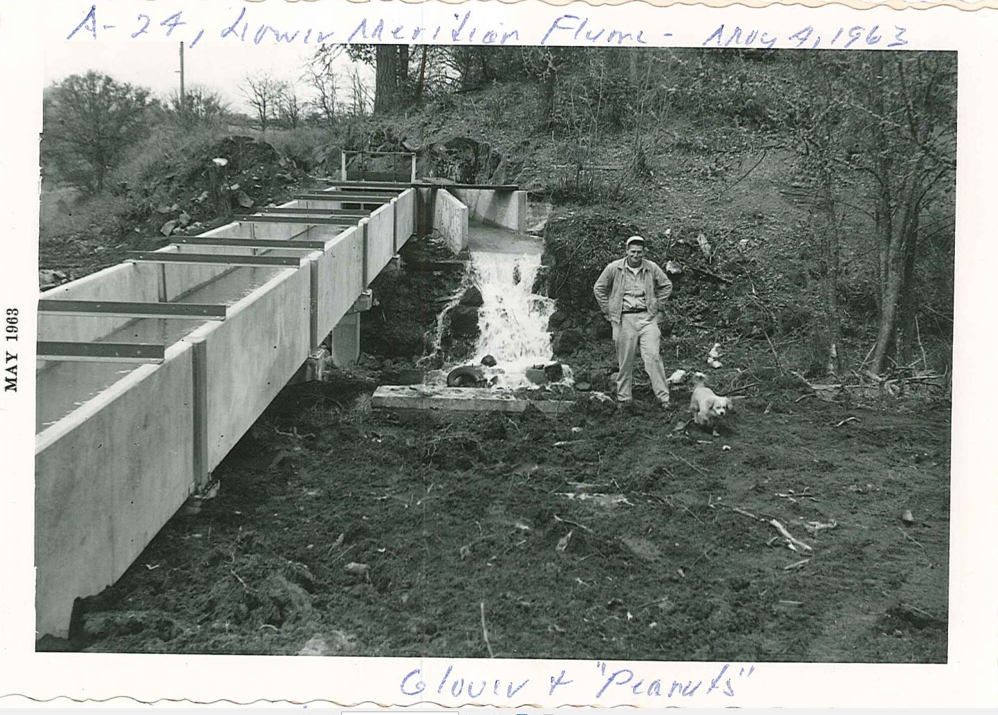
Hopkins Canal, Lower Meridian Flume, 1963..
Courtesy Rogue River Valley Irrigation District
Related Entries
-
![Central Point]()
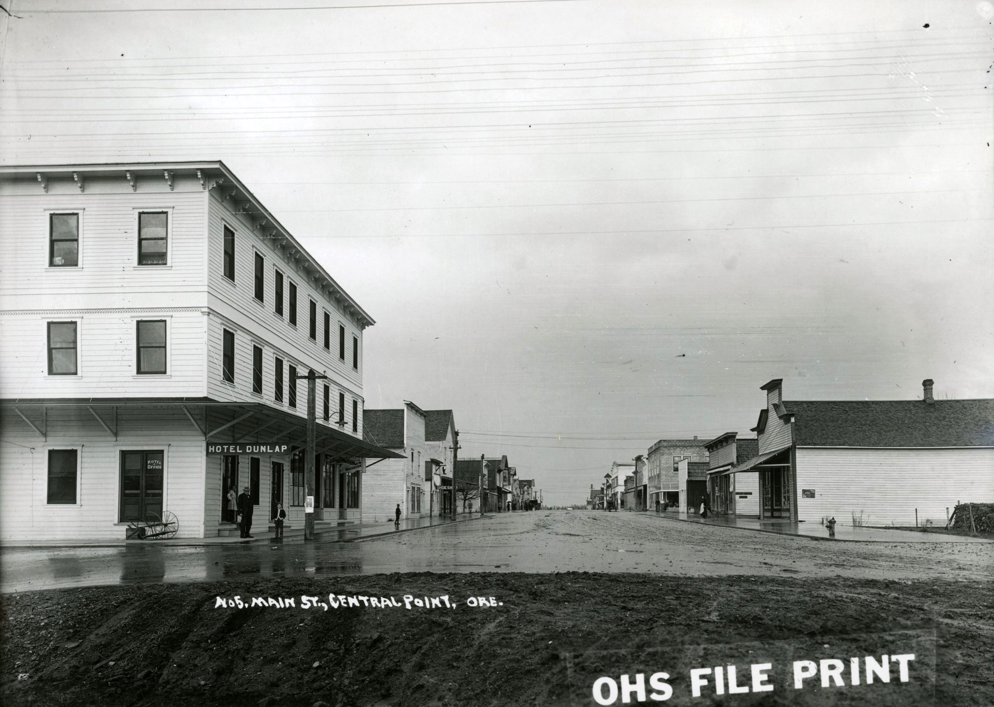
Central Point
Central Point is located about thirteen miles south of Table Rocks in t…
-
![Medford]()
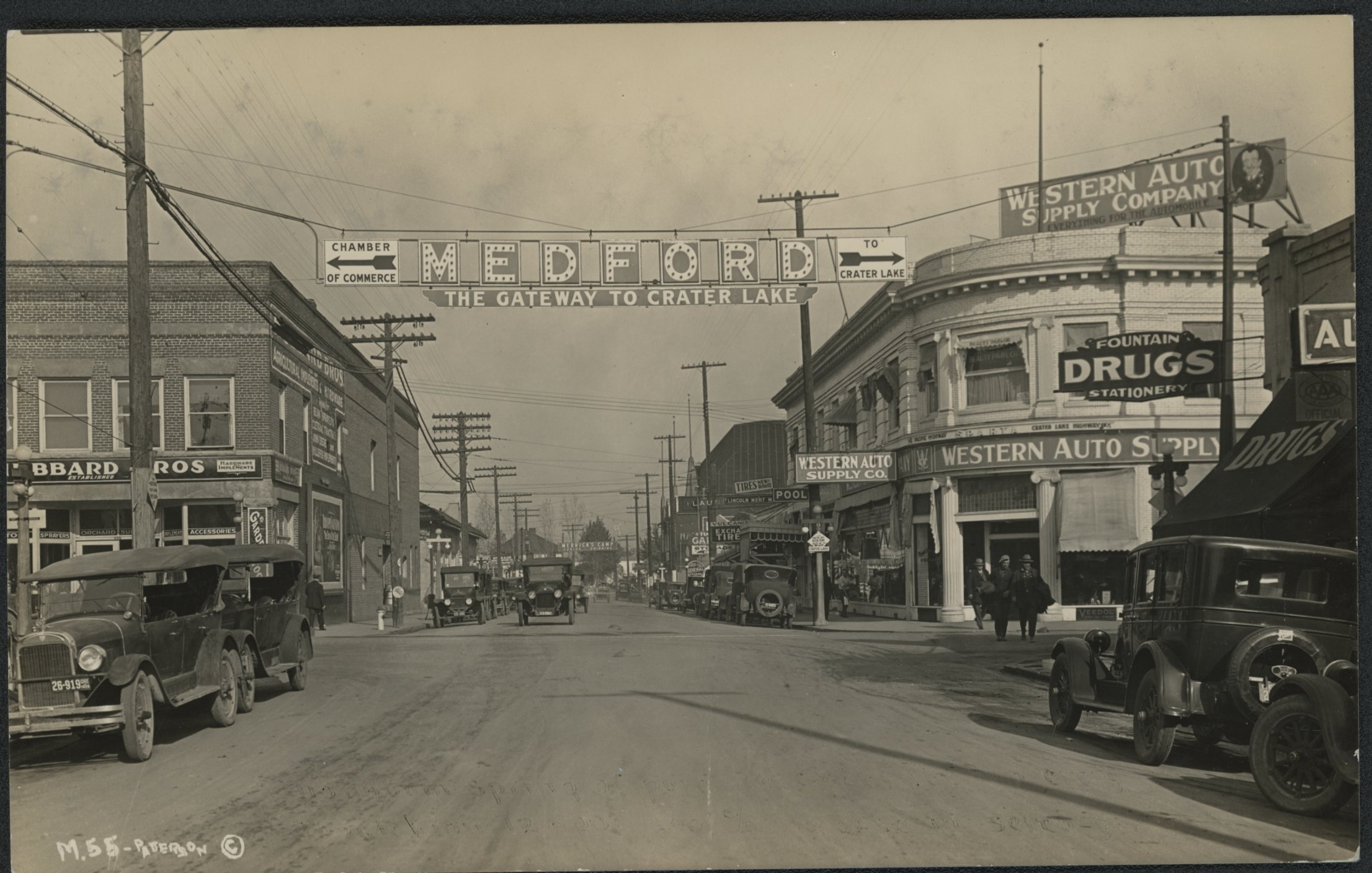
Medford
Medford, the county seat of Jackson County, was platted in 1883 in the …
-
![Rogue Basin Coordinating Council]()
Rogue Basin Coordinating Council
In 1995, the Oregon legislature passed HB 3441, which provided guidance…
-
![Rogue River]()
Rogue River
The Rogue River, Oregon’s third-longest river (after the Columbia and W…
-
![Tumalo Irrigation District]()
Tumalo Irrigation District
The Tumalo Irrigation District delivers water from Tumalo Creek, supple…
-
![Walterville Canal & Powerhouse]()
Walterville Canal & Powerhouse
The Walterville Canal and Powerhouse is owned and operated by the Eugen…
Related Historical Records
Map This on the Oregon History WayFinder
The Oregon History Wayfinder is an interactive map that identifies significant places, people, and events in Oregon history.
Further Reading
Kramer, George. State Level Documentation: Hopkins Canal-Bradshaw Drop to Antelope Siphon Segment. Prepared for Bureau of Reclamation/Rogue River Valley Irrigation District by Heritage Research Associates, Eugene, OR, 2018.
Linenberger, Toni Rae. Rogue River Basin Project. U.S. Bureau of Reclamation, 1999.
Medford Mail Tribune, July 15, 1910.
Daily Capitol Journal, September 5, 1929.
https://www.rrvid.org/district-info/ (visited August 2018).