James Walker
James Walker is a retired physician, a thirty-one-year resident of Eugene, and a longtime collector of pre- and post-exploration maps of North America and the Pacific Northwest. He has contributed articles and book reviews to Mercator's World, The Portolan, Terrae Incognitae, Imago Mundi and the the Oregon Historical Quarterly. He is interested in both the traditional and the more recent literature on the ways of understanding maps.
Author's Entries
-
Bruno de Hezeta y Dudagoitia (1744-1807)
Bruno de Hezeta y Dudagoitia, a Spanish naval officer, commanded an expedition in March 1775 whose mission was to explore and extend Spanish hegemony to the Pacific Northwest. On August 17, 1775, Hezeta became the first to map and record a written description of the entrance to the Columbia River …
Oregon Encyclopedia
-
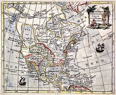
Cartography of Oregon, 1507–1848
The cartographic history of Oregon as a place in the Pacific Northwest began long before European visitation to the region. Mapmakers initially conceptualized the presence of a separate North American continent in 1507, some 234 years before the first recorded sighting of a landmark on the Pacific Northwest coast in …
Oregon Encyclopedia
-
David Imus (1957–)
Oregon native David Imus is a master mapmaker who started his mapmaking company in Eugene more than twenty-five years ago. His work has attracted international attention and has brought him critical acclaim as a cartographer, but Imus prefers to think of himself as a “geographic illustrator.” His self-described obsessive approach …
Oregon Encyclopedia
-
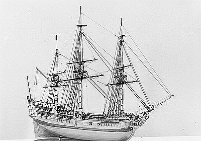
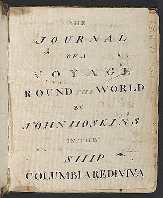
John Box Hoskins (1768–1824)
John Box Hoskins served as a clerk on the Columbia Rediviva, captained by Robert Gray, during a voyage to the Pacific Northwest from 1790 to 1793. He created the earliest known American-made map of the region, and his incomplete manuscript, Narrative, is one of four surviving accounts of that …
Oregon Encyclopedia
-
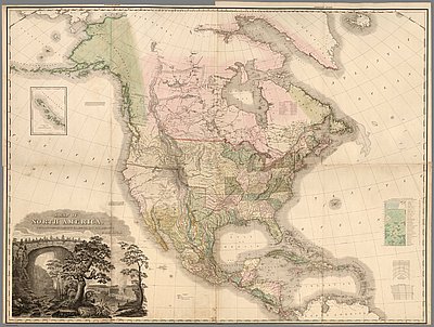
Tanner Map of 1822
Henry Schenck Tanner’s “A Map of North America” represents a significant placeholder in the early American literature on continental expansion of the republic to the West. The map was included in the fourth folio of Tanner’s New American Atlas, published in late 1822. A masterful summary of information derived from …
Oregon Encyclopedia
-
United States Exploring Expedition (1838-1842)
The United States Exploring Expedition (1838-1842), also known as the Wilkes Expedition, was shaped by both commercial and scientific concerns and a desire to expand American influence and interests in the Pacific Northwest. Maritime merchants, sealers, and whalers needed accurate charts of islands and navigational hazards in the Pacific Ocean. …
Oregon Encyclopedia