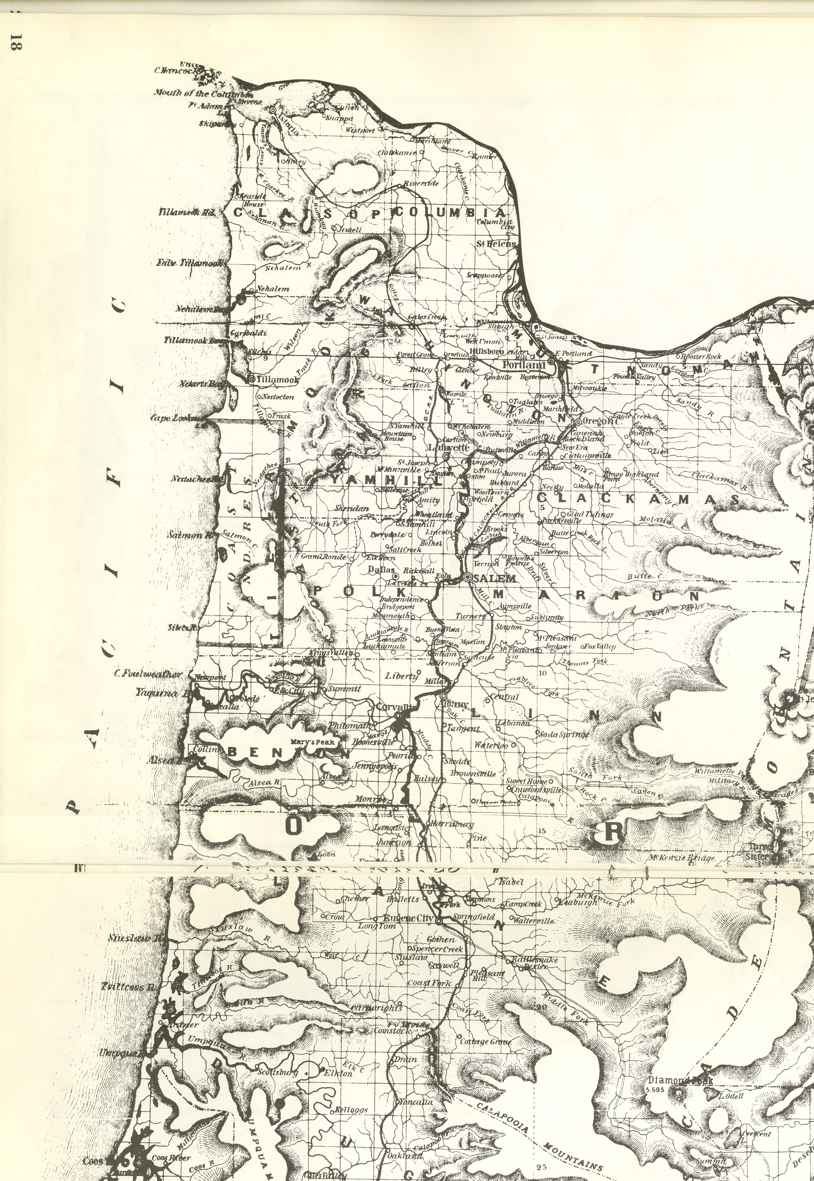
The Willamette River, in its natural state, was subject to annual flooding. Draining an area of over 11,200 square miles, the river supplied water for agricultural, industrial, municipal, and domestic uses in the Willamette Valley. But between November and February, heavy rains falling on deep snow at higher elevations, accompanied by a temperature rise and heavy precipitation in the valley, often produced major flooding along the river. The flood of 1964 was one of the worst such floods in the twentieth century.
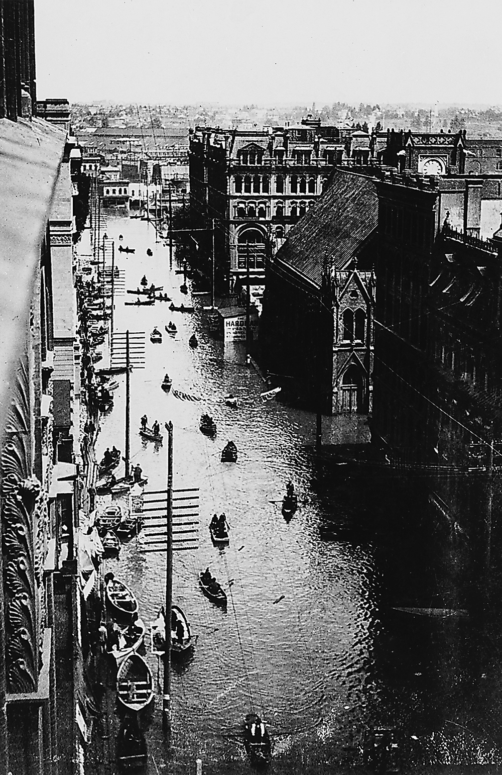
This 100-year flood event caused an estimated $71 million in damages, with especially heavy agricultural losses to crops, livestock, and soil erosion. The high water destroyed municipal sewage plants and flooded out 300 houses in north Salem. The rampaging river completely submerged Willamette Falls and inundated the paper mills there. In Portland, industrial, commercial, and harbor facilities suffered heavy losses.
In spite of the damages, the Army Corps of Engineers' flood-control projects prevented more serious losses. Before the Corps developed comprehensive plans for federal flood protection in the 1930s, flood-control efforts chiefly sought to keep high water in the river. In the 1920s, for example, the City of Portland had built a seawall, intercepting sewers, and a pumping plant to protect the business area on the west bank of the Willamette. In the Willamette Valley, spur dikes, revetments, and channel improvements provided some local protection against high water.
The Corps’ comprehensive plan included storage dams on tributaries of the Willamette and other river improvements intended to greatly reduce property damage from high water. The stored water also benefited navigation, irrigation, water quality, and power generation. Congress approved the Willamette Basin Project in 1937; and over the next thirty years, after some revisions, the Corps constructed eleven storage and two re-regulating dams to carry out the plan. In 1964, the Corps’ projects prevented an estimated $514 million losses in the Willamette Valley and protected urban areas on the river, including downtown Portland and Salem, from major damage.
-
![]()
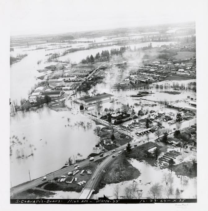
Willamette River flood, Corvallis, 1964.
Courtesy Oregon State University Libraries
-
![]()
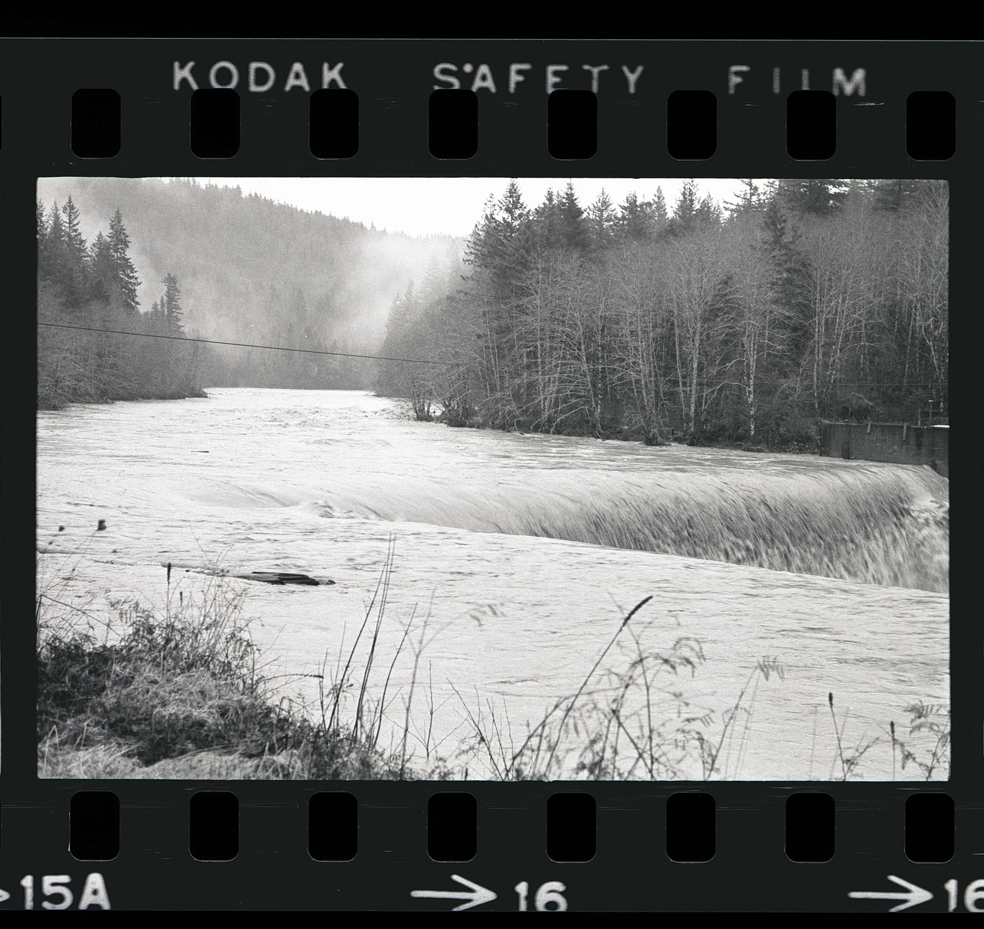
Willamette River flood, Corvallis, 1964.
Courtesy Oregon State University Libraries
-
![]()
Willamette River flood, 1964, Water Ave., Portland.
Oregon Historical Society Research Library, 971D001
-
![]()
Willamette River flood, 1964.
Oregon Historical Society Research Library, PGE, Org. Lot 151


Related Entries
-
![Willamette Falls]()
Willamette Falls
The largest falls in Oregon and the second in the United States by volu…
-
![Willamette River]()
Willamette River
The Willamette River and its extensive drainage basin lie in the greate…
-
![Willamette River flood of 1894]()
Willamette River flood of 1894
The Willamette River, in its natural state, has been subject to annual …
-
![Willamette River flood of 1996]()
Willamette River flood of 1996
In 1996, as part of a larger pattern of winter flooding in the Pacific …
-
![Willamette Valley]()
Willamette Valley
The Willamette Valley, bounded on the west by the Coast Range and on th…
Related Historical Records
Map This on the Oregon History WayFinder
The Oregon History Wayfinder is an interactive map that identifies significant places, people, and events in Oregon history.
Further Reading
Robbins, William G. Landscapes of Promise. Seattle: University of Washington Press, 1997.
Willingham, William F. Army Engineers and the Development of Oregon. Washington, D.C.: Government Printing Office, 1983.