Roseburg, the county seat of Douglas County, is located in the Hundred Valleys of the Umpqua, a region that enjoys a Mediterranean climate with rare extremes of heat and cold. A timber town for much of the twentieth century, Roseburg calls itself the “Timber Capital of the Nation.” While timber remains a part of the culture and economy, the city has reinvented itself to become a regional center for healthcare, tourism, and viticulture. With a 2020 population of about 24,000 people, the city encompasses ten-and-a-half square miles, making it the largest city in the county.
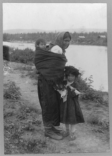
Several Indigenous groups—including the Upper Umpqua (Athapaskan speakers) and Cow Creek (Takelma speakers)—lived in the area for millennia. The arrival of whites in the mid-nineteenth century devastated their way of life, economy, and culture. As the Donation Land Claim Act and the Oregon gold rush brought people to the area, conflicts between whites and Indigenous people prompted the federal government to negotiate with tribes and force an agreement. On September 19, 1853, Superintendent of Indian Affairs Joel Palmer signed a treaty with Quin-ti-oo-san (known as Bighead); My-n-e-letta (known as Jackson); Tom, Quin-ti-oo-san’s son; and Ta-sal-pe-er (also known as Tom). The treaty ceded the Cow Creek’s 720-square-mile homeland for $12,000, or 2.3 cents per acre, and removed tribal members to temporary reservations. Congress ratified the treaty on April 12, 1854.
The City of Roseburg was named for Aaron Rose, who established a homestead along Deer Creek (the South Umpqua River) on September 23, 1851. Rose later donated three acres and $1,000 for a county courthouse, and the settlement, known as Deer Creek, adopted the name Roseburgh in 1857. By 1860, the town had a population of about 800. A ferry across the South Umpqua River was operating by 1854, the Roseburgh Express published its first paper in 1859, and a brewery opened in 1864. In the 1870s, the Oregon and California Railroad built a line from Portland to Roseburgh.
In 1894, Roseburg (the “h” was dropped that year) acquired the Oregon State Soldiers Home, a veterans retirement facility designed by William C. Knighton. The Soldiers Home operated for thirty-nine years until it was replaced in 1933 by the Roseburg Veterans Administration Hospital, which included a domiciliary. In 1937, the Veterans Administration designated it a neuropsychiatric veterans hospital. The hospital grew into what is now the Veterans Administration Roseburg Healthcare System, a 114-acre campus that offers primary care and hospital services for veterans in Oregon and Northern California.
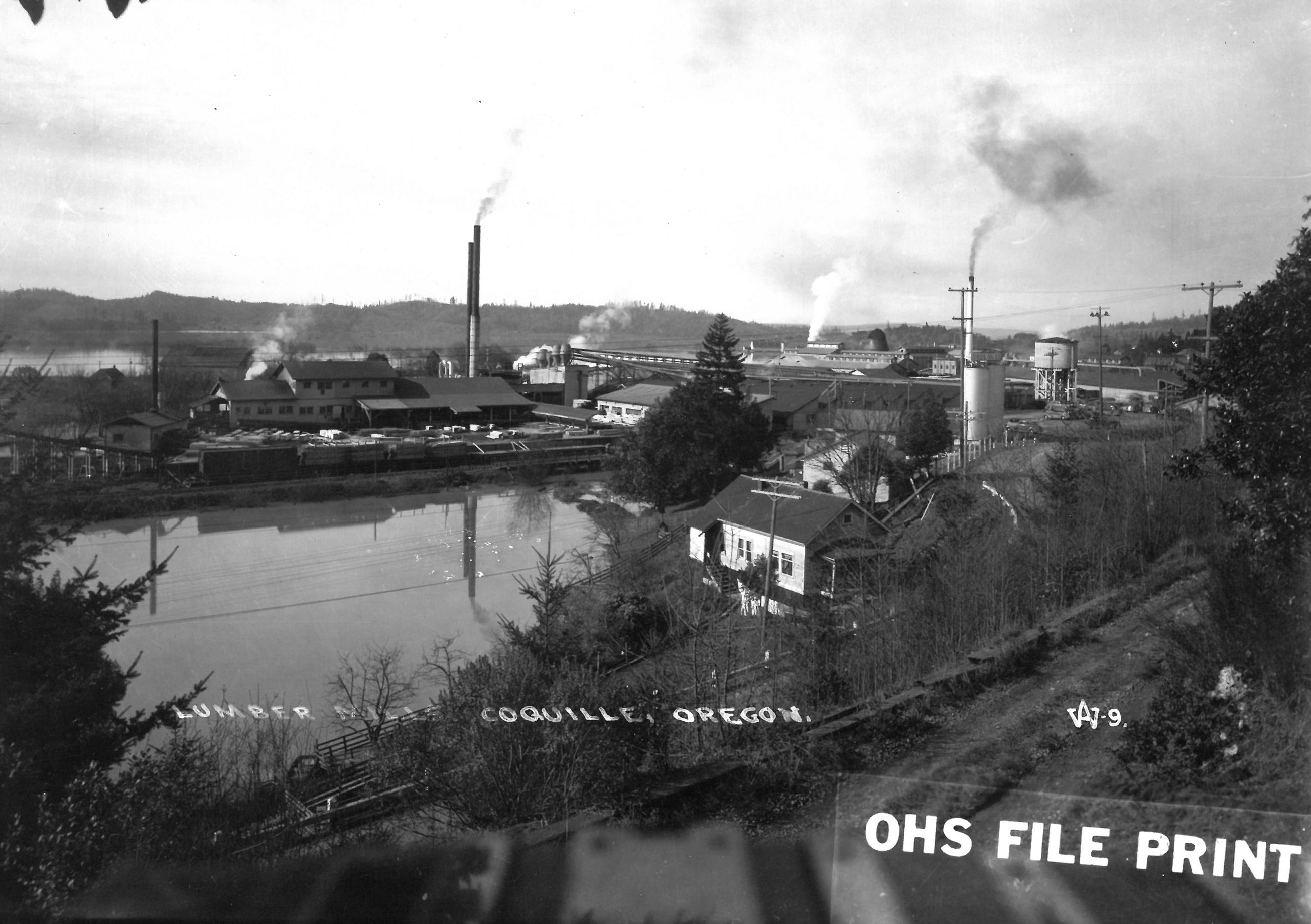
Farming was a key part of Roseburg’s early economy; prunes, turkeys, and hops were signature products. While agriculture remains important in the area, especially the cultivation of blueberries and grapes, the mid-twentieth century economy was largely based on logging. The town’s largest employer is Roseburg Forest Products, a privately owned wood products company founded by Kenneth Ford in 1936 as Roseburg Lumber. Other mills, including St. Helen’s Wood Products, which made broom handles, and the Saar Pencil Factory helped make the city a major lumber center. Roseburg thrived when World War II production and post-war growth called for significant amounts of spruce, fir, and plywood.
Beginning with the 1980s recession, the Northwest timber industry faced market challenges, including competition from the American South and British Columbia, and federal restrictions on logging in the 1990s continued the industry’s downward trajectory. With the loss of timber jobs, Roseburg suffered from unemployment and lower-than-average wages. A 2009 report by Oregon Business reported Douglas County unemployment at 16 percent, with a per capita income of about $20,000. By 2021, healthcare and healthcare support services were the largest employment sector, and Mercy Medical Center was the city’s second largest employer. A growing tourism industry depends on the region’s natural resources to promote fishing, kayaking, whitewater rafting, hiking, cycling, and mountain biking.
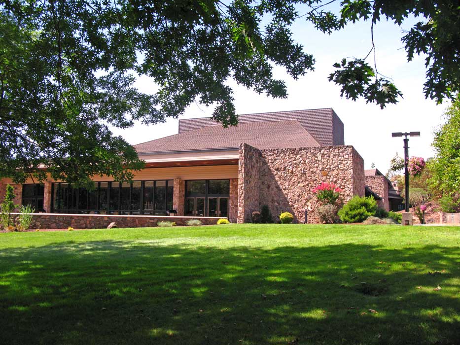
Roseburg benefits from being in the Umpqua Valley viticulture region, which is home to numerous wineries and vineyards, including HillCrest Winery, Oregon’s oldest estate winery. Umpqua Community College, established in 1964, offers career and technical programs in fire science, forestry, viticulture, and enology.
During the 1980s, the Cow Creek Band of the Umpqua Tribe regained tribal status and reached a court settlement for its 1855 homeland, receiving $1.5 million, or $1.25 for each acre. The tribe established an endowment with the settlement. The tribal government is located in Roseburg, and the Cow Creek Band is a major economic partner in Douglas County through the Umpqua Indian Development Corporation, which operates the Seven Feathers Resort and other businesses.
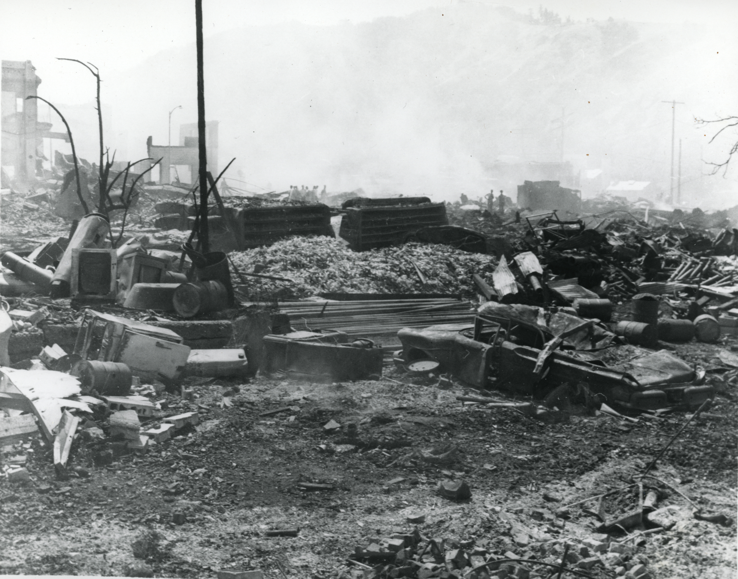
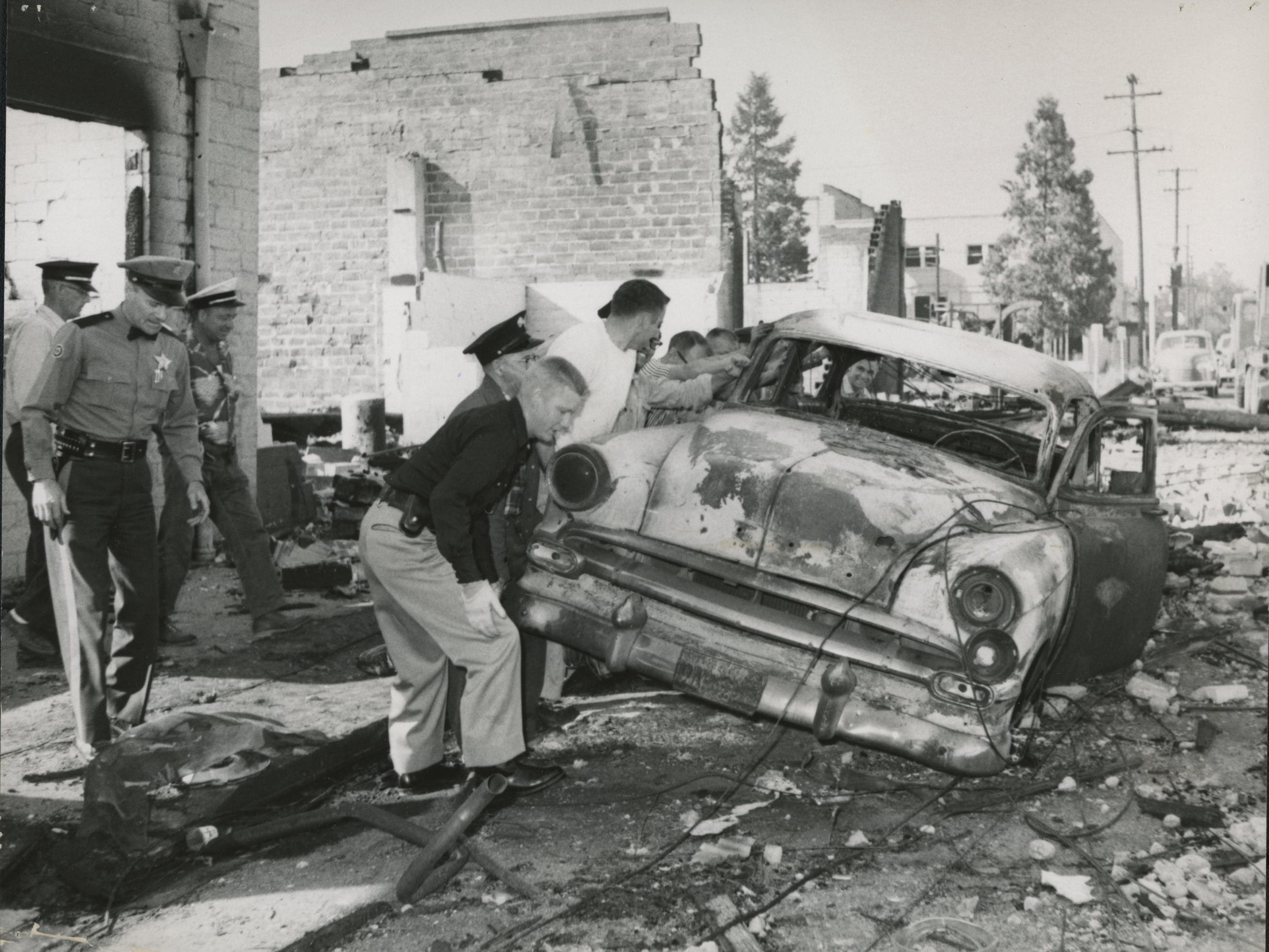
Roseburg has experienced tragedy, including a 2015 mass shooting in which a student fatally shot a faculty member and eight students at Umpqua Community College. In 2021, fires near Roseburg burned over 100,000 acres, and floods periodically damage the city, sometimes sweeping away homes and bridges. Perhaps most dramatically, in 1959 a truck loaded with two tons of dynamite and four-and-a-half tons of carbon ammonium nitrate exploded in what is known as the Roseburg Blast.
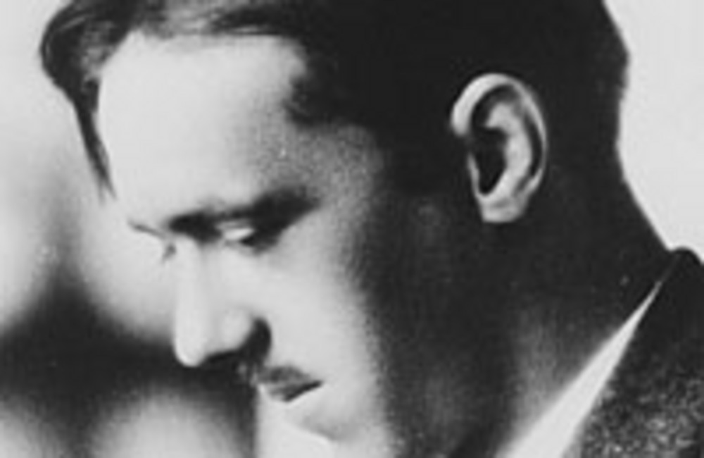
Notable people from Roseburg include retired U.S. Navy vice admiral Nancy Ann Norton, journalist Barry Serafin, presidential photographer and 1972 Pulitzer Prize winner in Photojournalism for Feature Photography, David Hume Kennerly, Pulitzer Prize-winning writer H. L. Davis, screenwriter Julien Josephson, and suffragist and spiritualist Lucy A. Mallory.
-
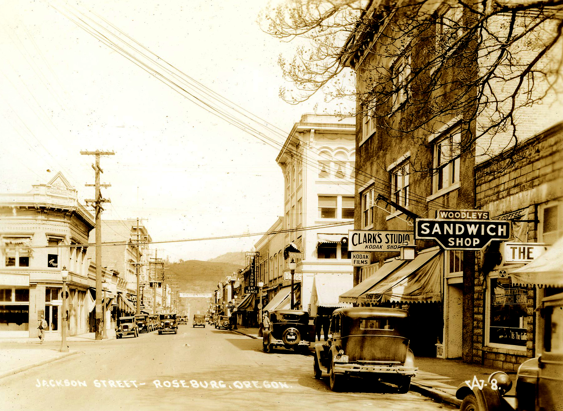
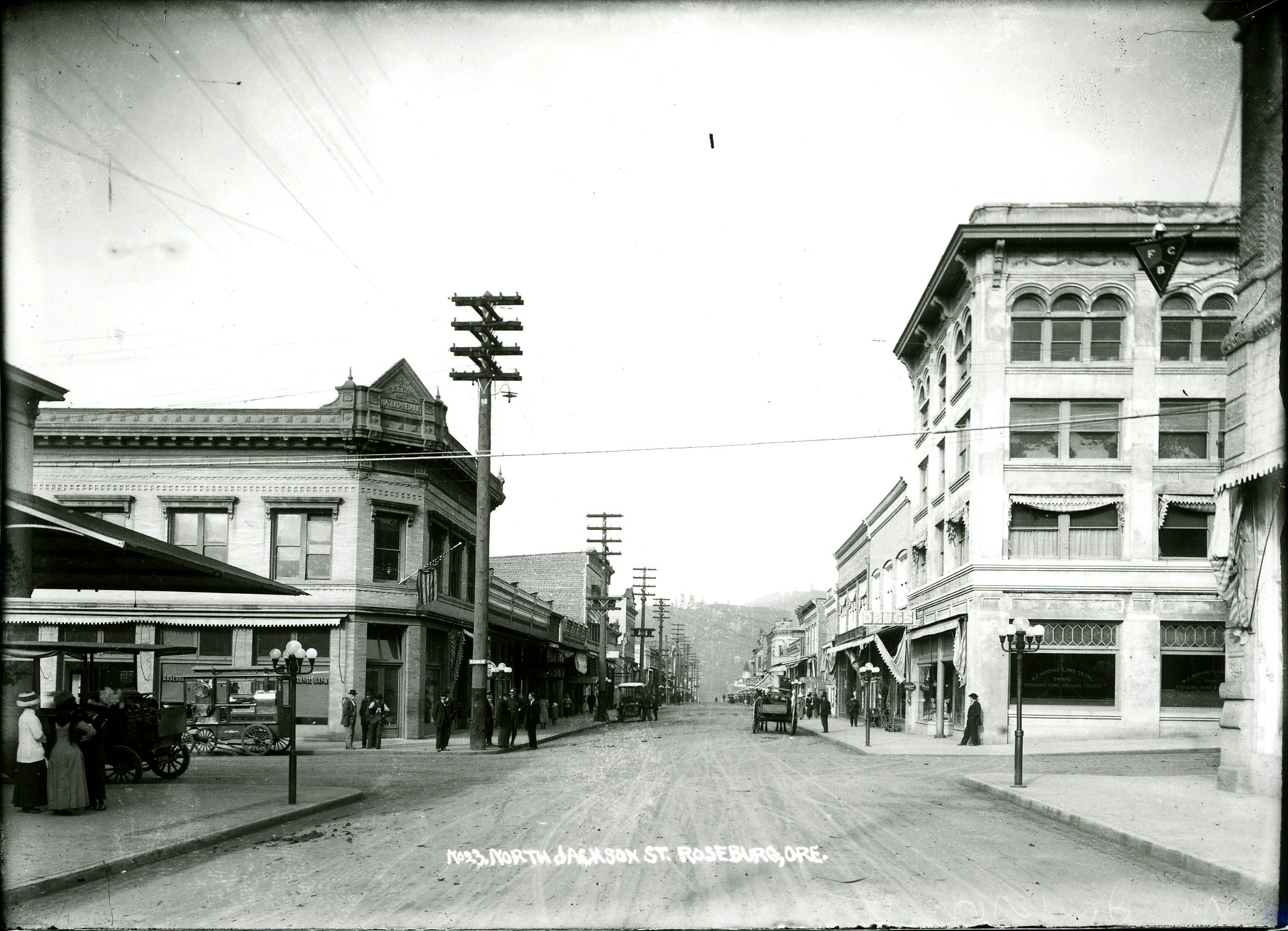
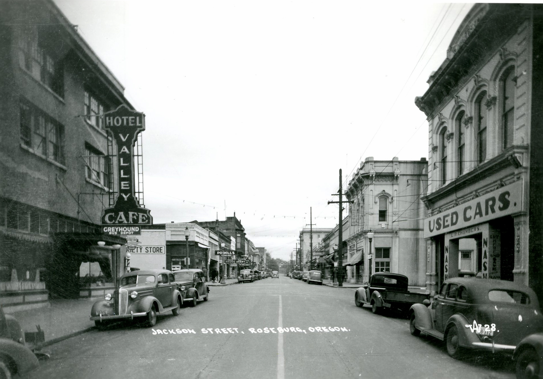
![]()
Jackson Street, Roseburg.
Oregon Historical Society Research Library, ba015516, photo file 919
-
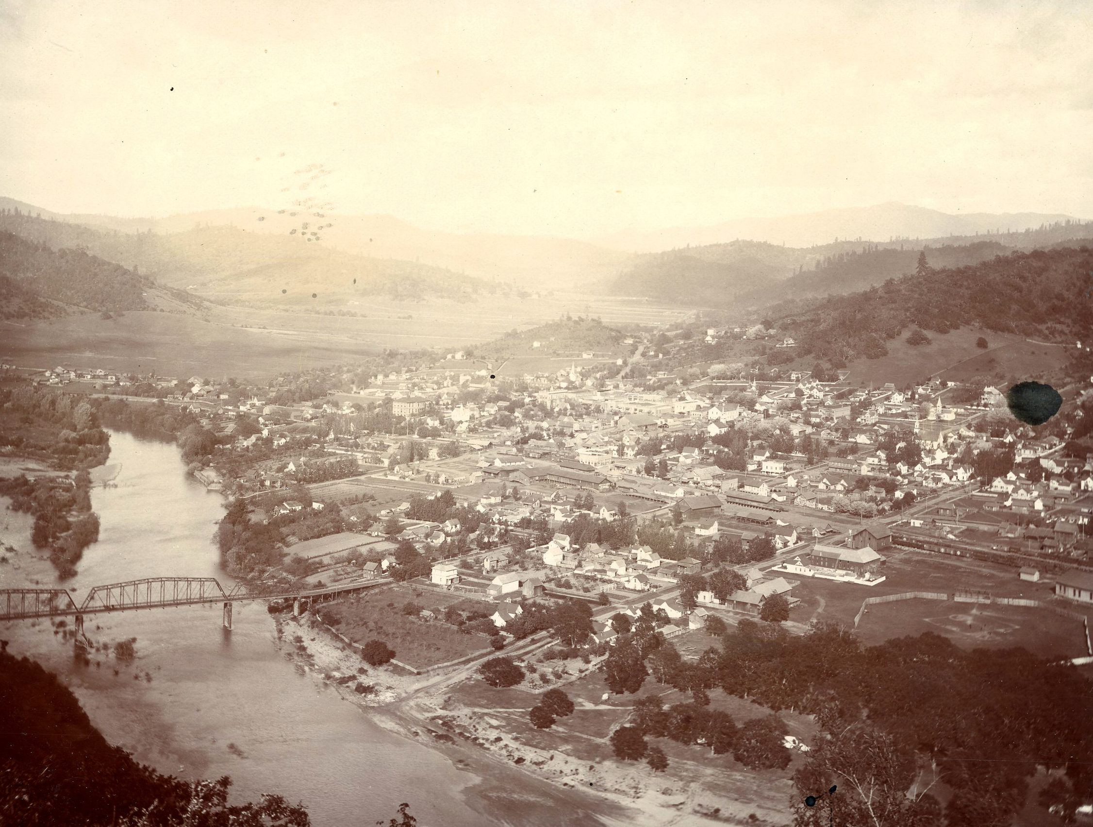
![]()
Roseburg, Oregon, 1899.
Oregon Historical Society Research Library, orhi94245, photo file 919
-
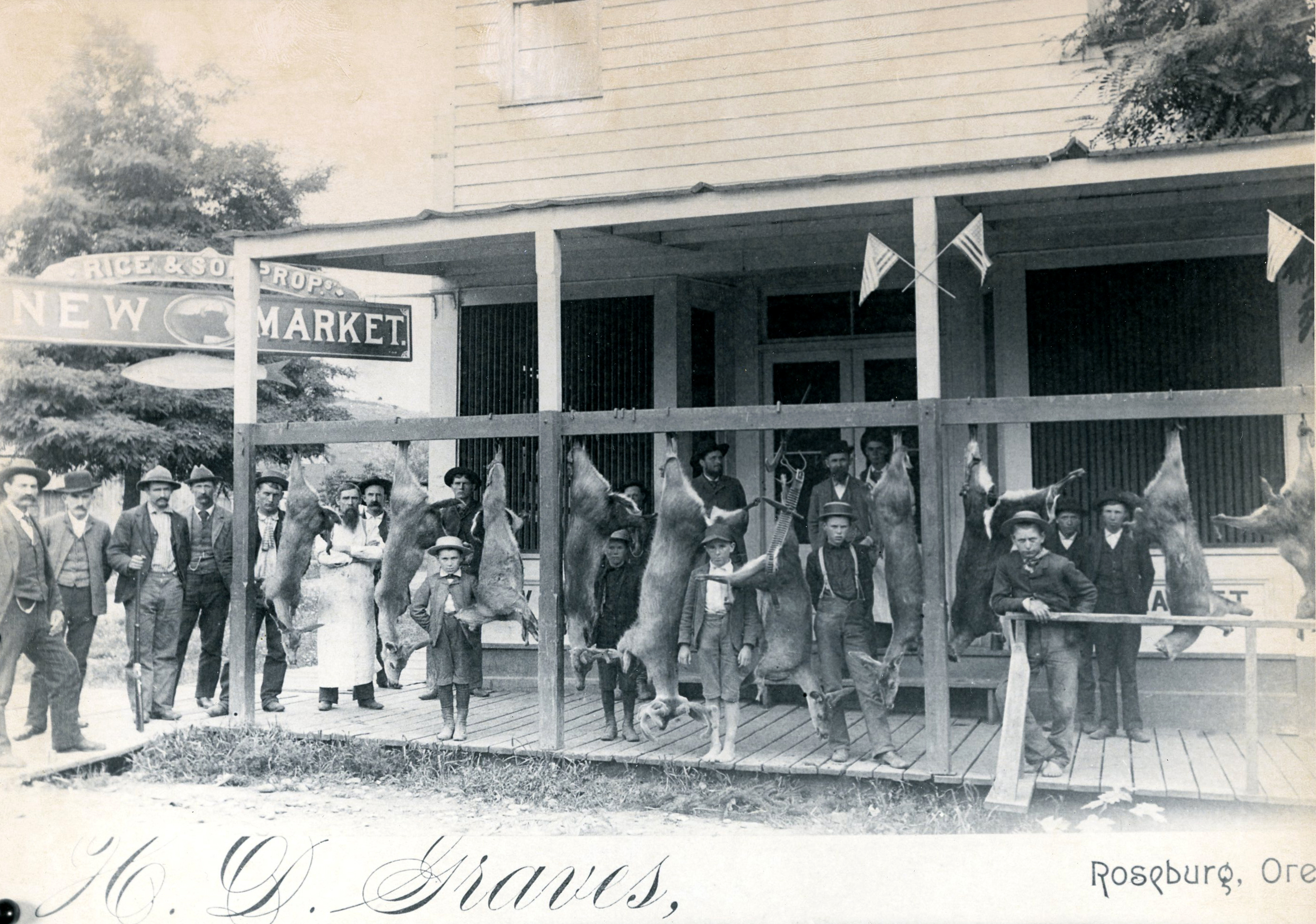
![]()
Roseburg.
-
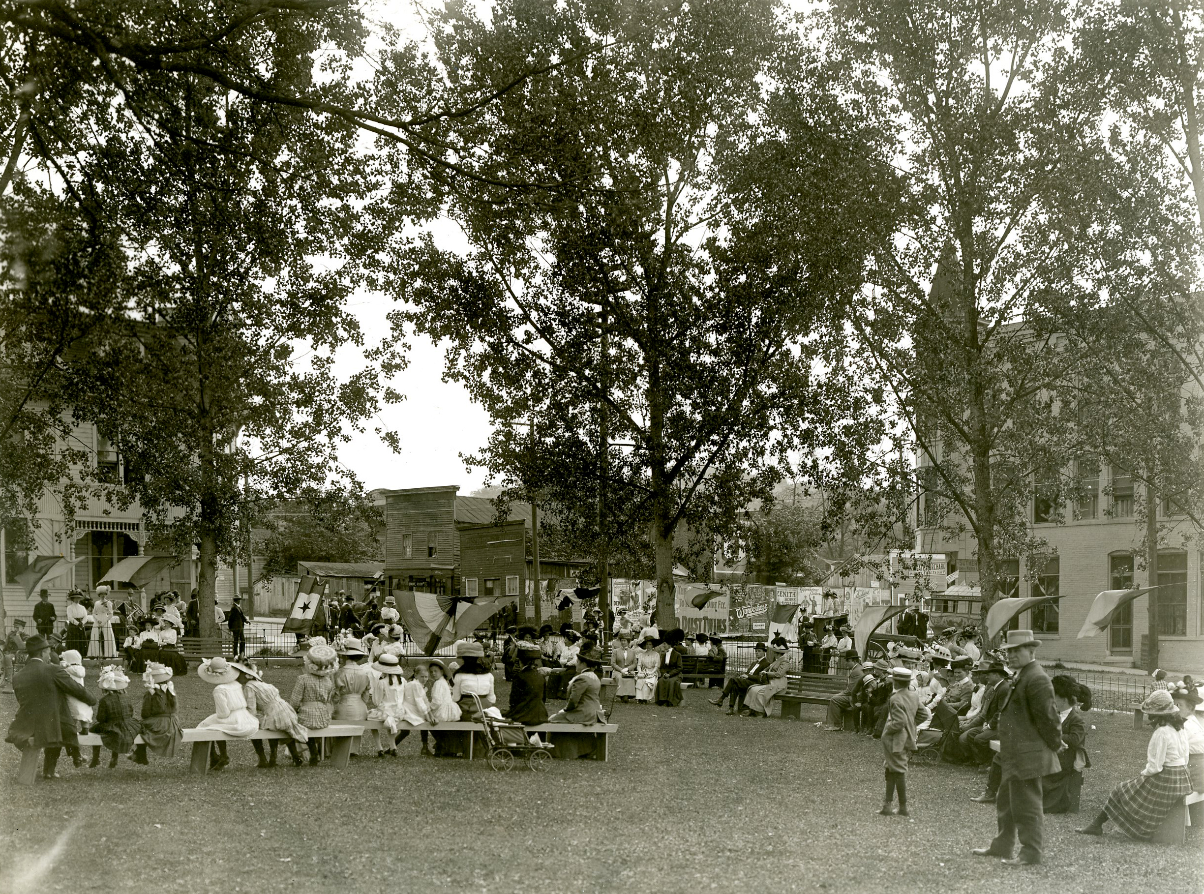
![]()
Roseburg Strawberry festival, Roseburg Courthouse.
Oregon Historical Society Research Library, 36091, photo file 919
-
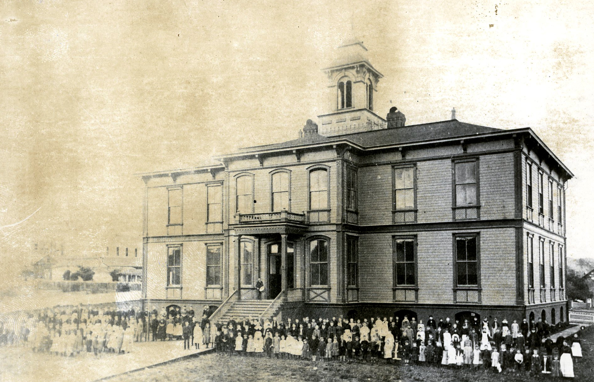
![]()
Lane School, Roseburg, c.1888.
Oregon Historical Society Research Library, ba015304, photo file 919a
-
![]()
Jackson Street, Roseburg.
Oregon Historical Society Research Library, ba015219, photo file 919
-
![]()
Early Roseburg, Oregon.
Oregon Historical Society Research Library, ba015312, photo file 919a
-
![]()
Early Roseburg, Oregon.
Oregon Historical Society Research Library, ba015233, photo file 919
-
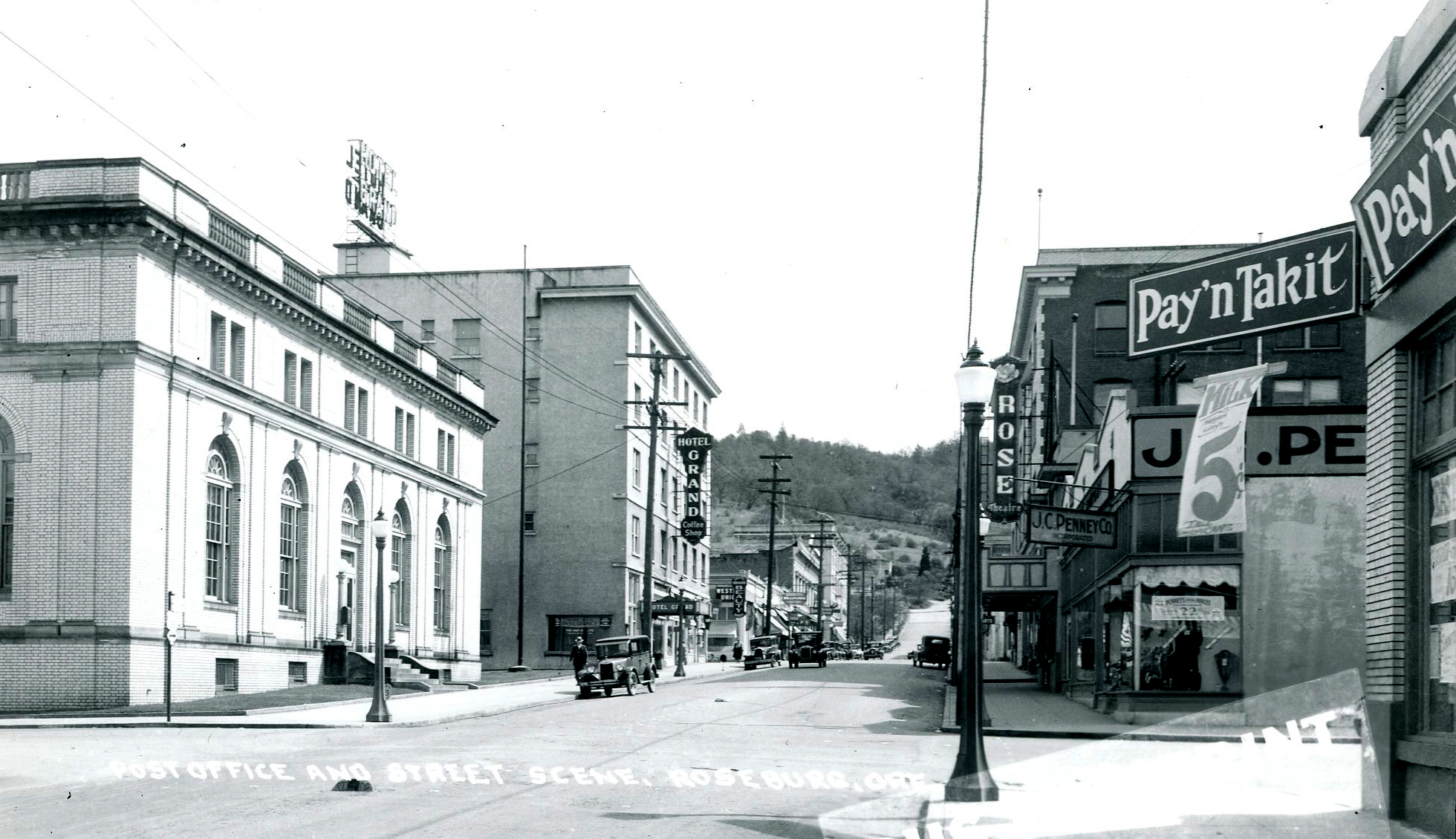
![]()
Cass Street, looking east, post office on the left, Roseburg.
Oregon Historical Society Research Library, ba015231, photo file 919
-
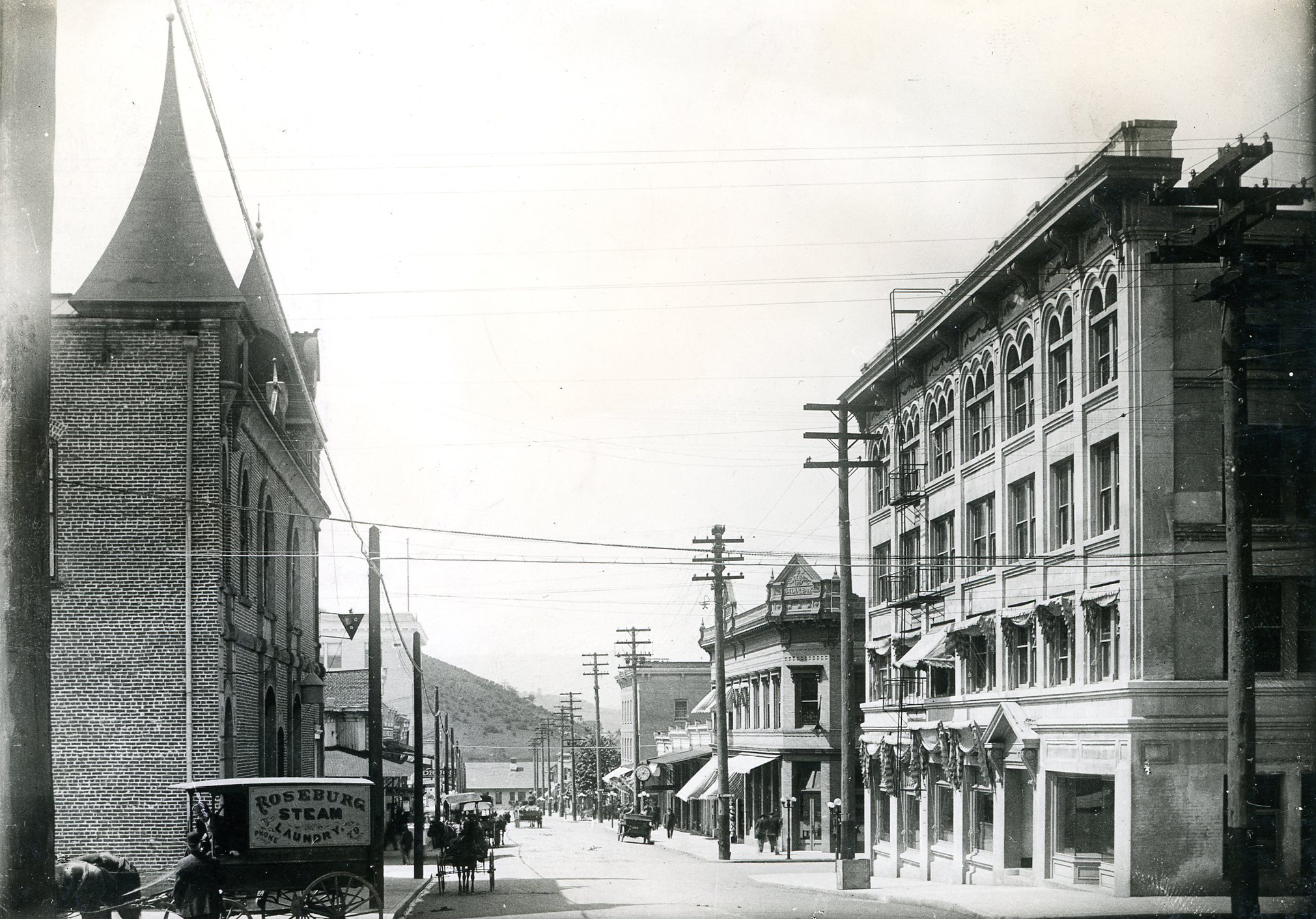
![]()
Jackson St., Roseburg.
Oregon Historical Society Research Library, ba17890, photo file 919
-
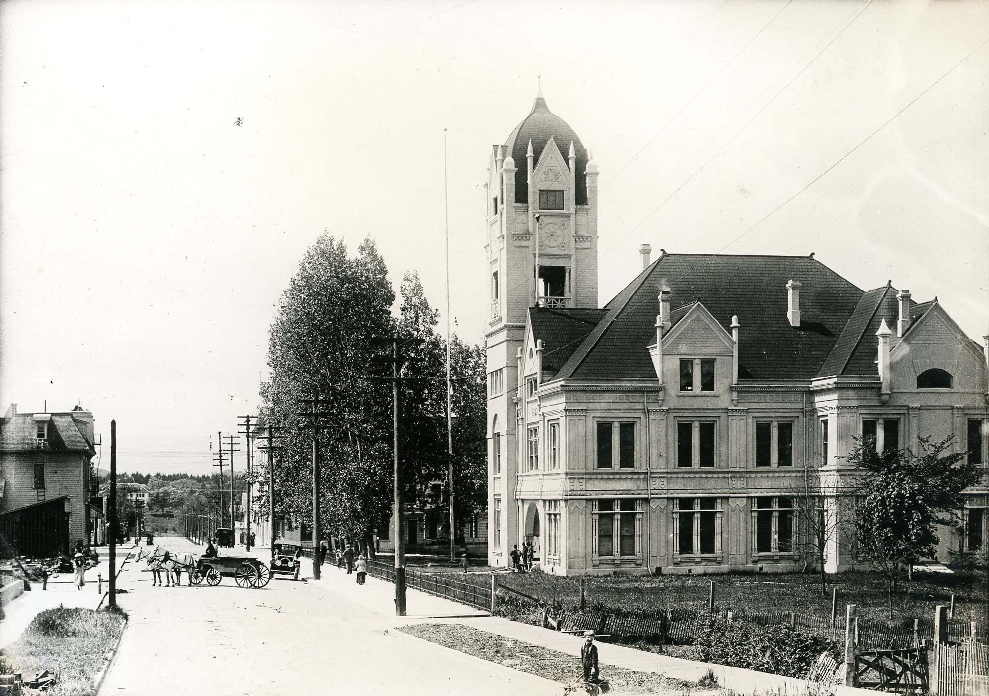
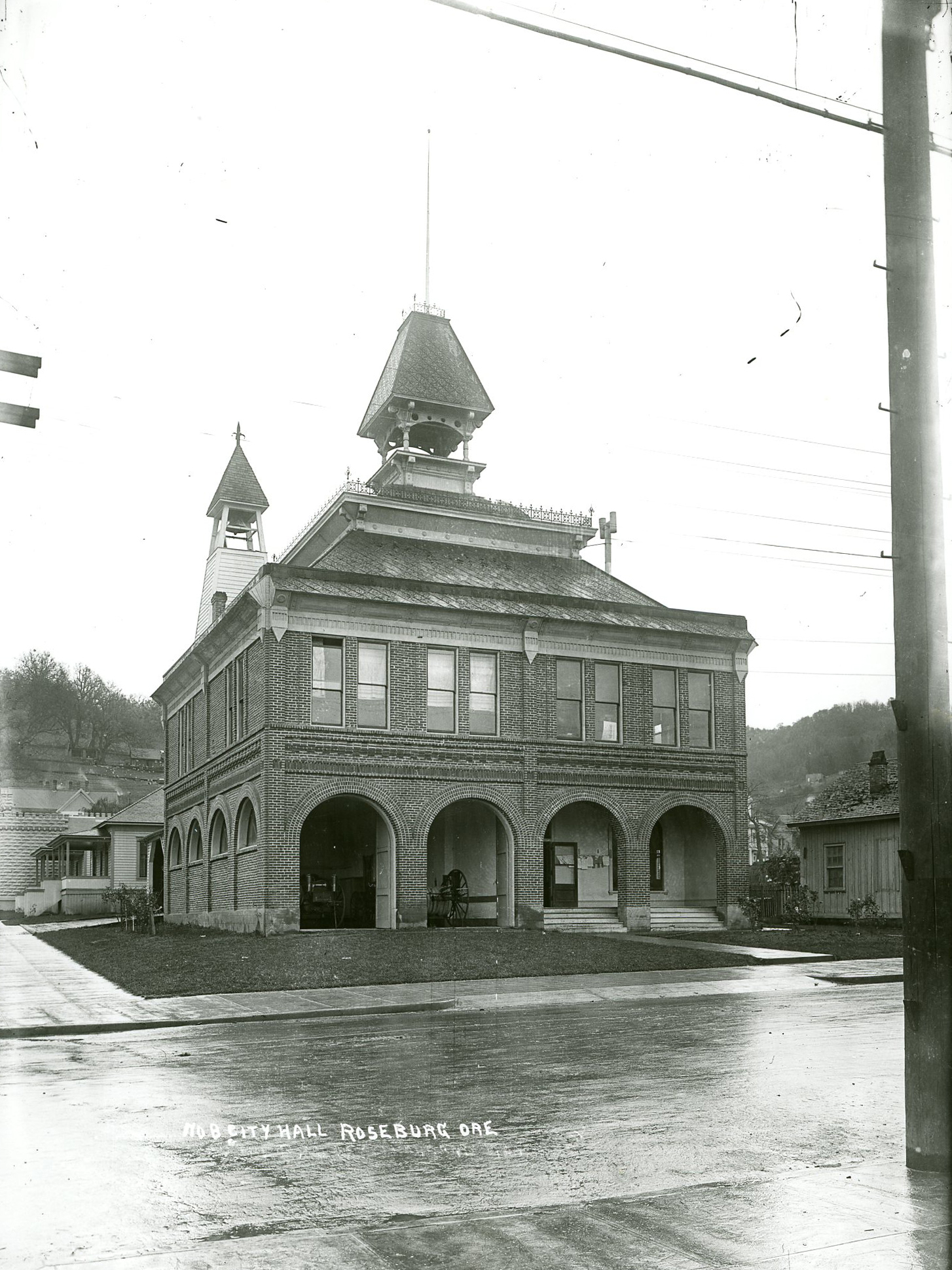
![]()
Former City Hall, Roseburg, c.1910.
Oregon Historical Society Research Library, orhi7967, photo file 919a
-
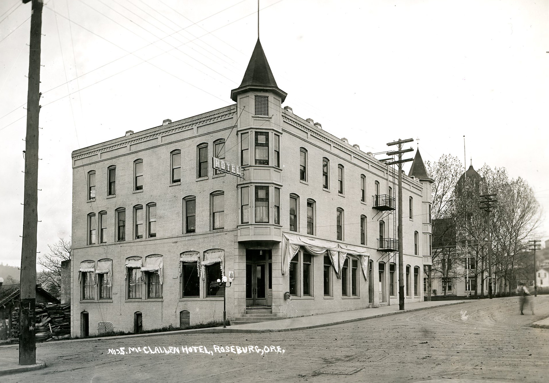
![]()
McClallen Hotel, Roseburg.
Oregon Historical Society Research Library, ba015323, photo file 919a
-
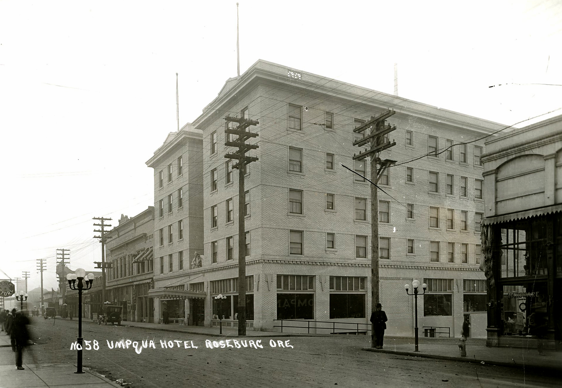
![]()
Umpqua Hotel, Roseburg.
Oregon Historical Society Research Library, ba015326, photo file 919a
-
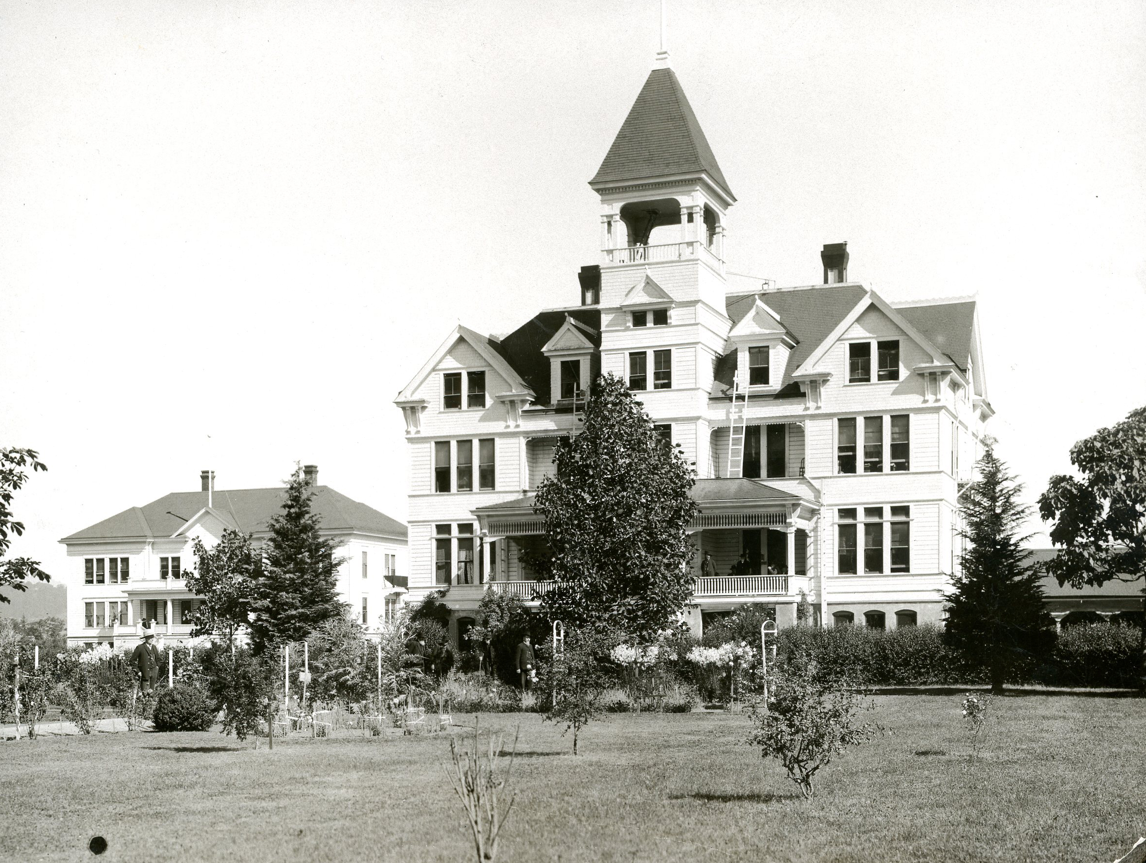
![Now the Umpqua Arts Center,]()
Oregon State Soldiers' Home, Roseburg.
Now the Umpqua Arts Center, Oregon Historical Society Research Library, ba015333, photo file 919
-
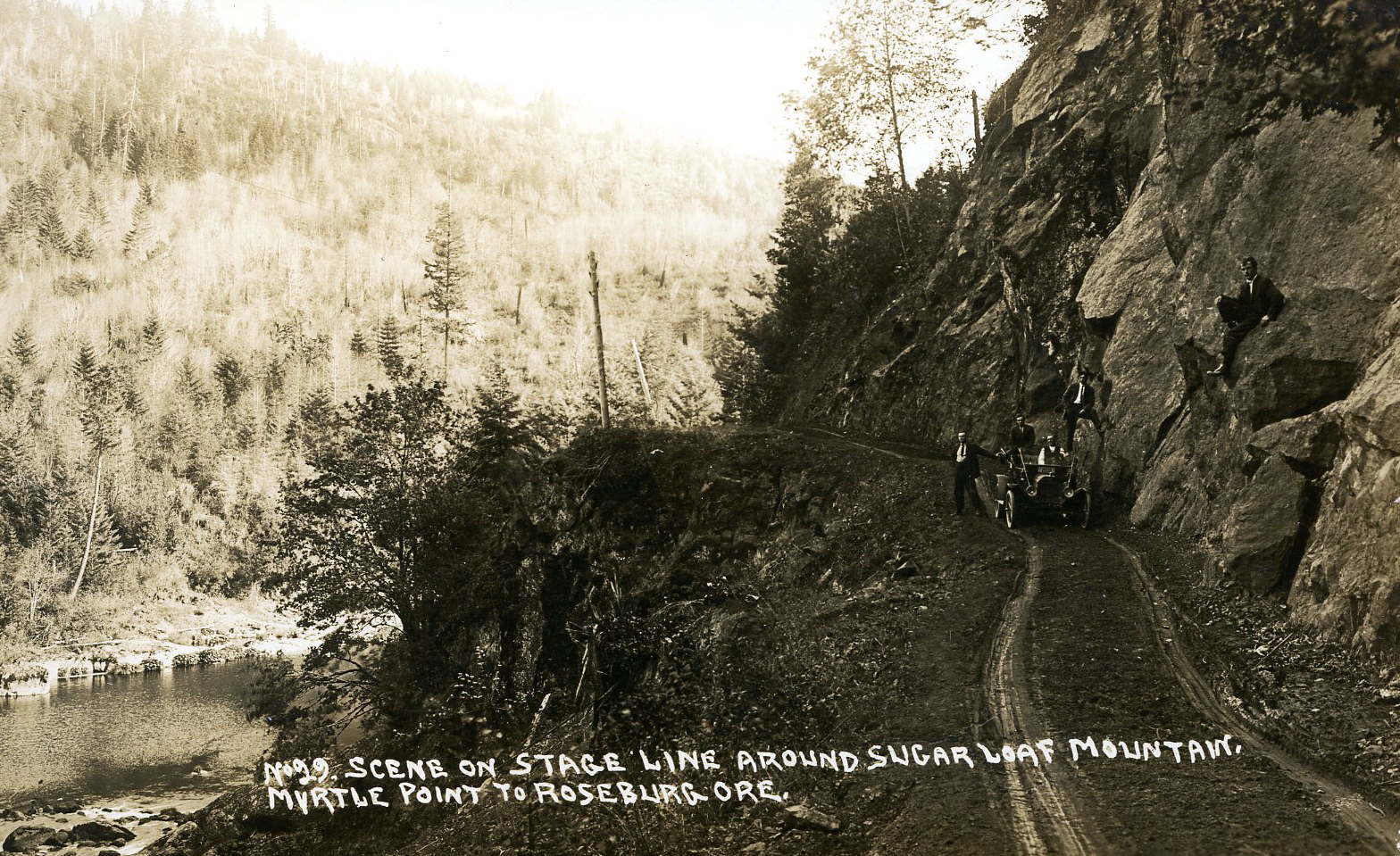
![]()
Stage line from Myrtle Point to Roseburg, around Sugar Loaf Mountain (Coos County), 1913.
Oregon Historical Society Research Library, ba015165, photo file 919
-
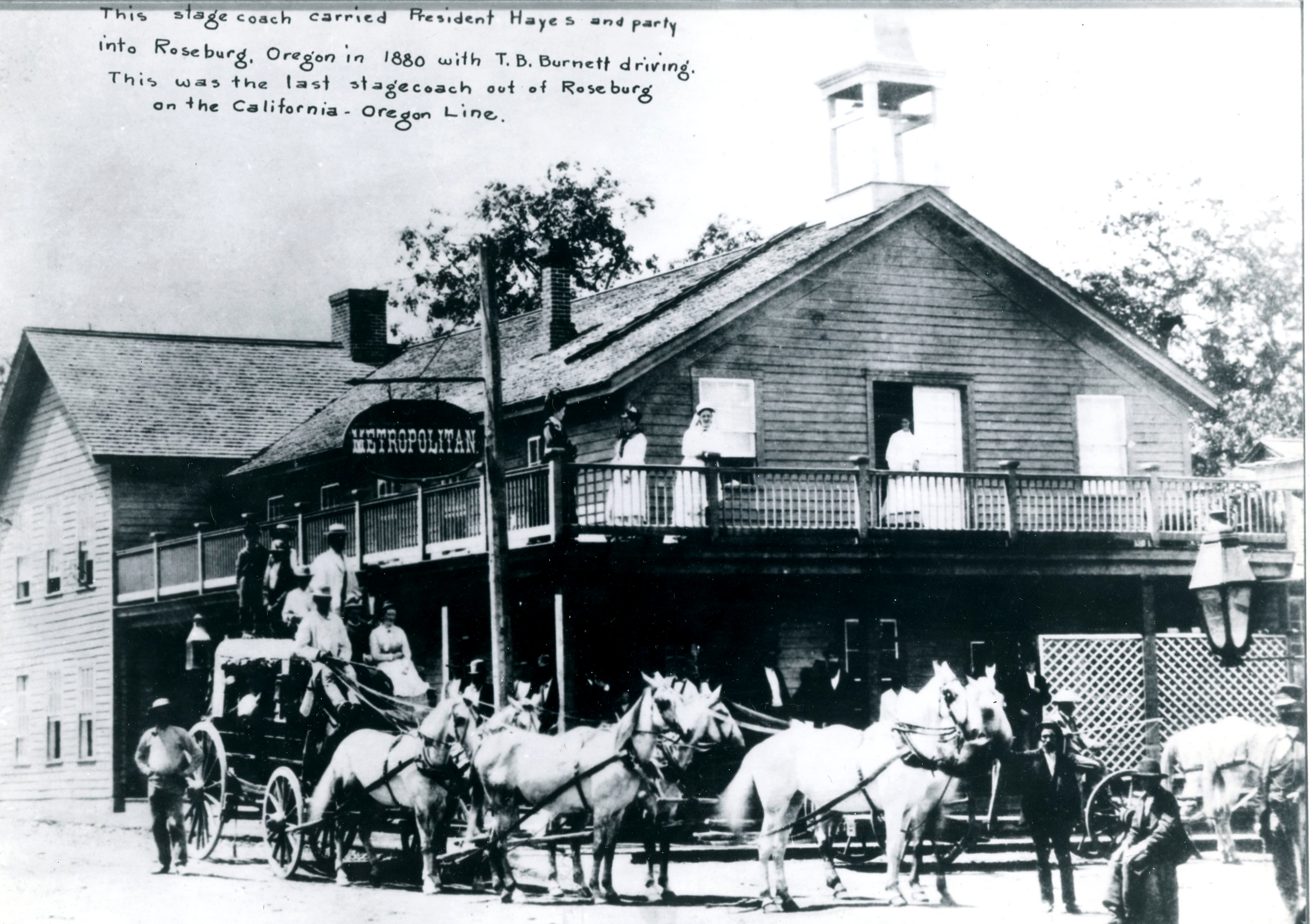
![Note on image claims to include stagecoach President Hayes used in his trip to Oregon, 1880.]()
Metropolitan Hotel, Roseburg.
Note on image claims to include stagecoach President Hayes used in his trip to Oregon, 1880. Oregon Historical Society Research Library, acc27267, photo file 919a
-
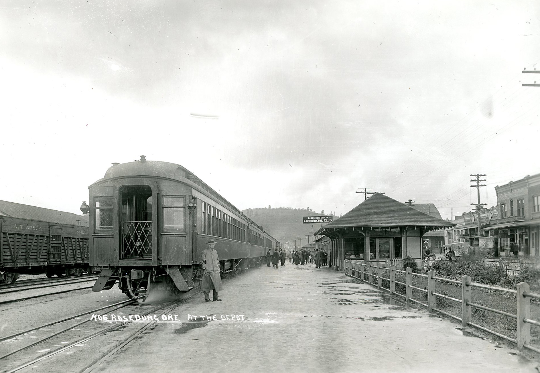
![]()
Roseburg railroad depot.
Oregon Historical Society Research Library, orhi6264, photo file 919
-
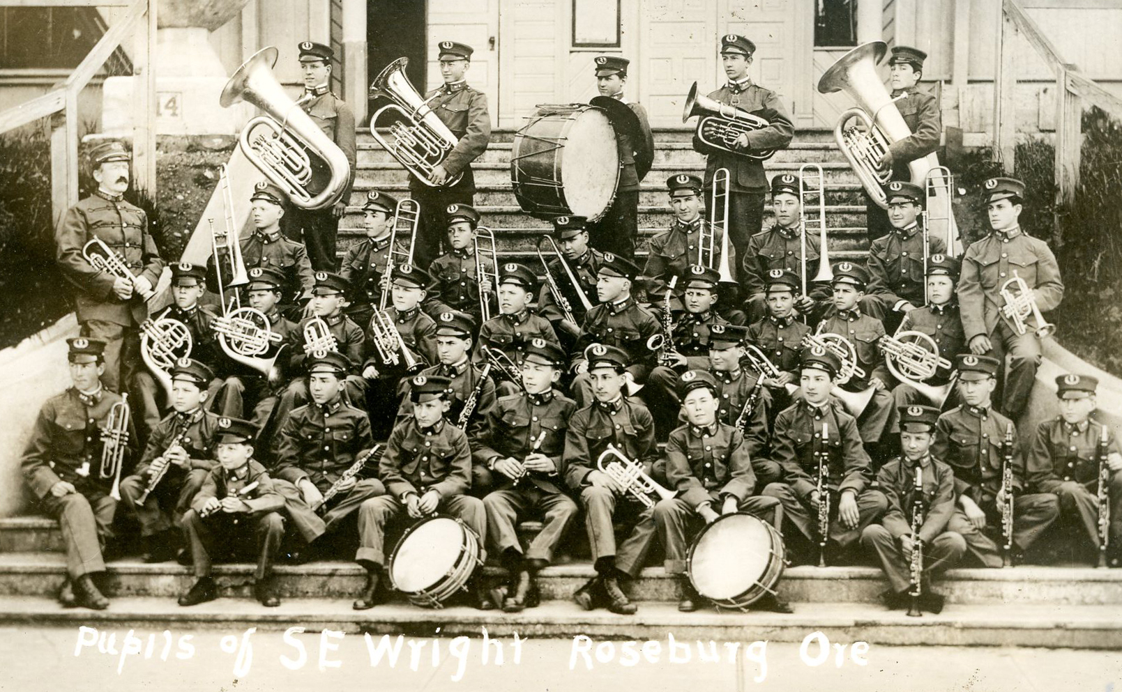
![]()
Roseburg Juvenile Band, 1916.
Oregon Historical Society Research Library, ba015188, photo file 919
-
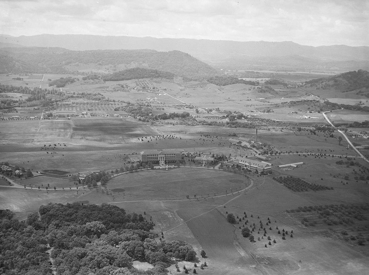
![]()
Roseburg, aerial view, 1947.
Oregon Historical Society Research Library, Al Monner; Org. Lot 1284; Box 27; 1203-4 -
![]()
Damage by Roseburg blast, August 1959.
Courtesy Oregon Hist. Soc. Research Lib., Oregon Journal, 62412
Related Entries
-
![Athapaskan Indians]()
Athapaskan Indians
According to Tolowa oral histories, the Athapaskan people of southern O…
-
![Harold Lenoir Davis (1894-1960)]()
Harold Lenoir Davis (1894-1960)
Born and raised in rural and small-town Oregon, Harold Lenoir Davis was…
-
![Roseburg Blast]()
Roseburg Blast
In the early morning hours of August 7, 1959, a parked truck—loaded wit…
-
![Roseburg Forest Products]()
Roseburg Forest Products
Founded by Kenneth Ford in 1936, Roseburg Lumber Company began as a saw…
-
![Umpqua Community College]()
Umpqua Community College
A sweeping horseshoe bend of the North Umpqua River wraps the 100-acre …
-
![Umpqua River]()
Umpqua River
The Umpqua River, approximately 111 miles long, is a principal river of…
-
![William Christmas Knighton (1867-1938)]()
William Christmas Knighton (1867-1938)
William Christmas Knighton, a prolific and innovative architect, served…
Related Historical Records
Map This on the Oregon History WayFinder
The Oregon History Wayfinder is an interactive map that identifies significant places, people, and events in Oregon history.
Further Reading
Beckham, Stephen Dow. "History of Western Oregon Since 1846." In Handbook of North American Indians. Vol. 7. Northwest Coast. Washington, D.C.: Smithsonian Institution, 1990.
Beckham, Stephen Dow, Land of the Umpqua: A History of Douglas County, Oregon. Roseburg, Ore.: Douglas County Commissioners, 1986.
Douglas County Historical Society, Historic Douglas County, Oregon, 1982. Roseburg, Ore.: Douglas County Historical Society, 1982.
Goeres-Gardner, Diane L, Roseburg. Charleston, SC: Arcadia Publishing, 2010.
Robbins, William G. The Far Western Frontier: Economic Opportunity and Social Democracy in Early Roseburg, Oregon. PhD dissertation. University of Oregon, 1969.
Youmans, Russell C. Douglas County, Oregon: Structure of a Timber County Economy. Corvallis, Ore.: Agricultural Experiment Station, Oregon State University, 1973.
"Trouble in Timber Town." Oregon Business, October 21, 2009.
"The Cow Creek Story." Cow Creek Band of Umpqua Tribe of Indians.