"It would be one of the biggest and finest resorts of the Pacific Northwest. The seal rocks…will vie in fame with the nationally known 'Seal Rocks' of the Cliff House, at the Golden Gate, San Francisco." Those were the dreams of Oceanside's founders, the brothers H.H. and J.H. Rosenberg, when they bought the land from John W. Maxwell in 1921. He had owned and farmed the 160 acres since 1885. Maxwell Point, overlooking Three Arch Rocks Wildlife Refuge, was an ideal site for a hotel, promising to become a second Cliff House.
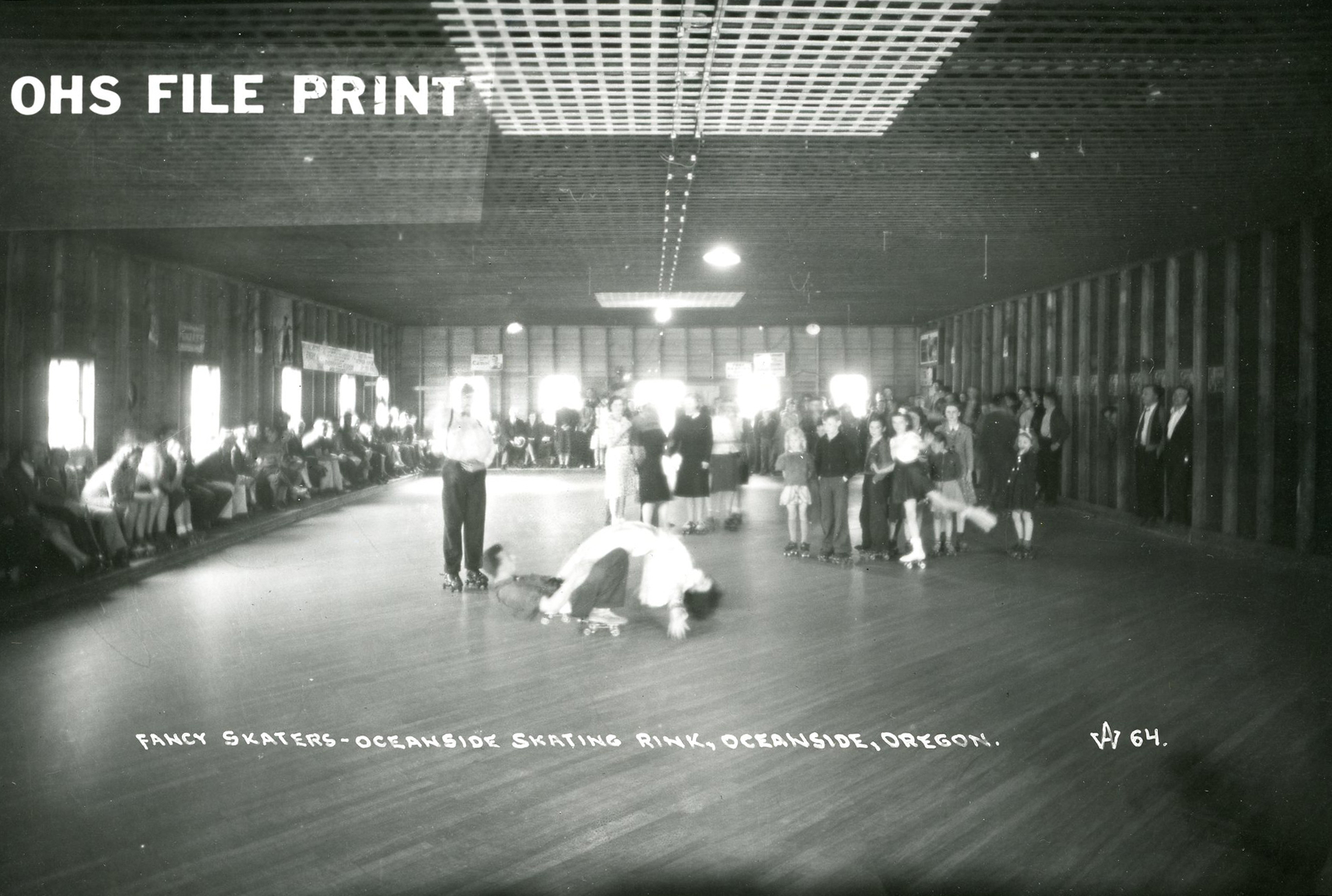
The Rosenbergs officially named Oceanside, located nine miles west of Tillamook, on July 5, 1922, platted the area and sold the lots. The first building they erected was a huge dance hall, later converted to a skating rink. Hillcrest Court (later Oceanside Inn) was another early building, as was the grocery store in 1923. But what really opened up Oceanside was a three-mile wooden-plank road between Netarts and Oceanside, financed by the Rosenbergs, opened on July 3, 1925. By evening of that day, 500 tents had been set up, and Oceanside was ready to play.
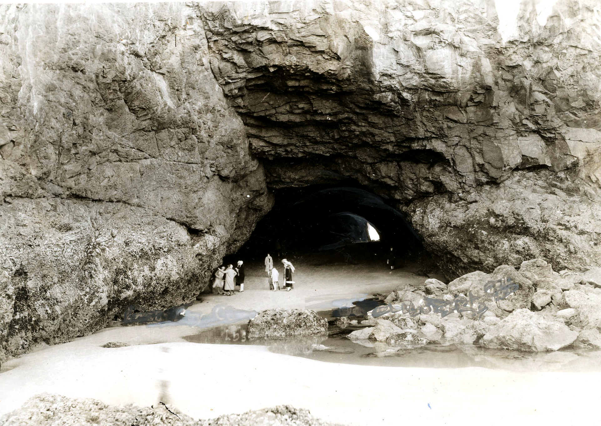
Another big event was the 1926 opening of the block-long tunnel under Maxwell Point, built by the Rosenbergs. It connects Oceanside beach with other beaches to the north, including Lost Boy Cave, and Short Beach and Radar Road, where an Infantry Signal Corps was stationed during World War II. Landslides closed the tunnel in 1979, but concrete extensions opened it up again, and a March 1999 storm cleaned the tunnel out so thoroughly that it resembled that of the 1930s.
The Anchor Tavern dates from the days of the tent city. It first served as the town's community hall and became a pub in 1940, a meeting place for soldiers and townspeople. From 2004 to 2010, it was the subject of a boycott by neighbors because the owner added a third story to the building, blocking the view of the beach for people living above the pub. The boycott ceased in 2010 when Tom Flood Jr. and his partners of the Schooner Restaurant and Lounge in nearby Netarts acquired the Anchor and changed its name to The Schooner Inn & Grill. Oceanside Grocery and soda fountain added a deli in 1977 and became Roseanna's Cafe in 1982. Sunset magazine featured it as having the best location of any restaurant on the Oregon coast, with its unequaled view of the ocean, beach, and Three Arch Rocks.
Viewpoint Motel atop Maxwell Point was demolished in 1968 and replaced by House on the Hill Motel in 1969 (now The Clifftop). The forty Oceanfront Cabins (formerly Minaker Motel) were built in two rows near the beach in 1925, and they still operate today.
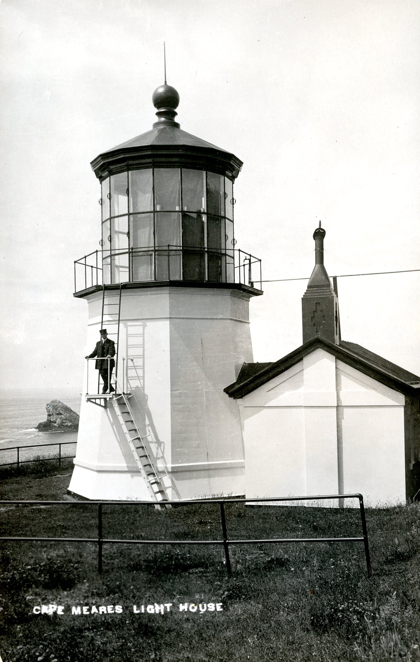
Points of interest near Oceanside are Cape Meares lighthouse, commissioned in 1890-1963, and the "Octopus Tree"—Indians called it the Council Tree—a sitka spruce with six candelabra limbs and a fifty-foot circumference, featured in Ripley's Believe It or Not. Maxwell Mountain high above Three Arch Rocks is a popular launching pad for hang- and paragliders, and it is not unusual to see a dozen or more gliding over the village or racing to Netarts and back.
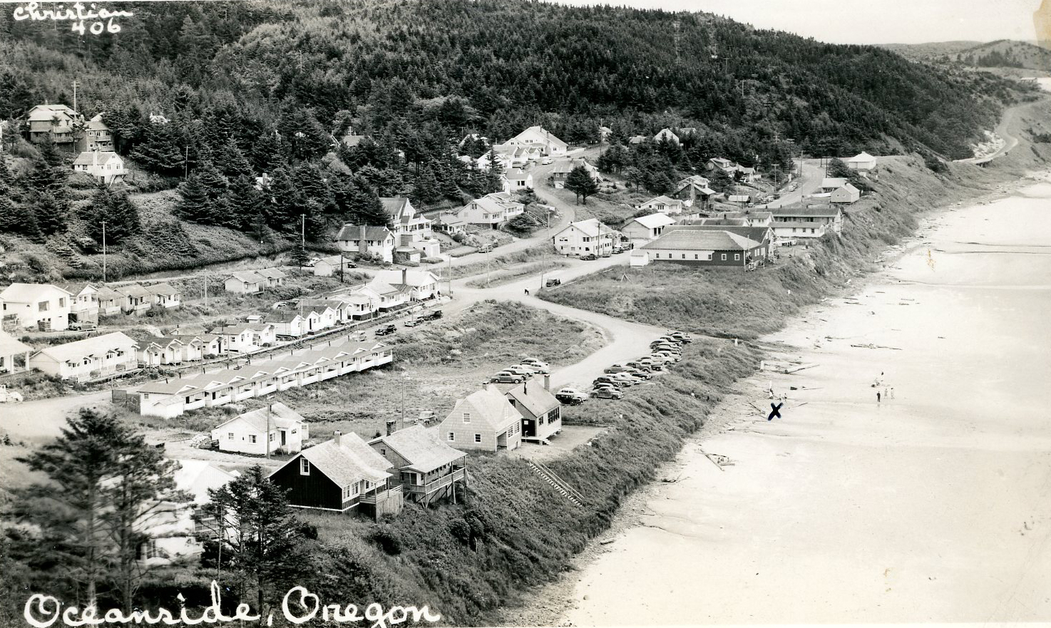
The unincorporated village of Oceanside, population 366 in the 2020 census, forms a natural amphitheater, affording fascinating views from every home. A popular coastal vacation spot, it grows to well over 2,000 occupants in the summer.
-
![]()
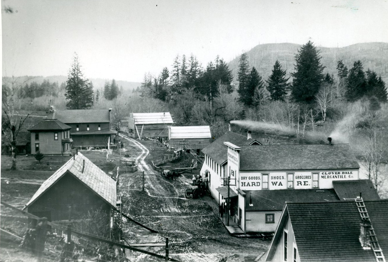
Main Street, Oceanside (now Tillamook Ave and Rosenberg Loop).
Oregon Historical Society Research Library, ba013938, photo file 813b
-
![]()
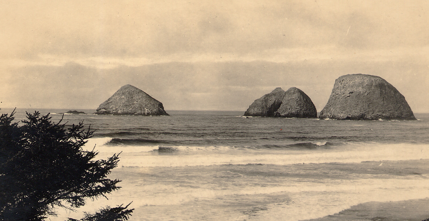
Three Arch Rocks, Oceanside.
Tillamook County Pioneer Museum, 75 -
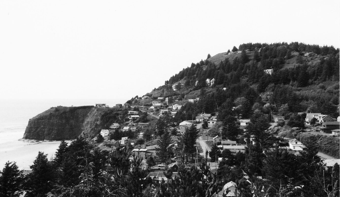
![Oceanside.]()
Oceanside, city of.
Oceanside. Tillamook County Pioneer Museum
-
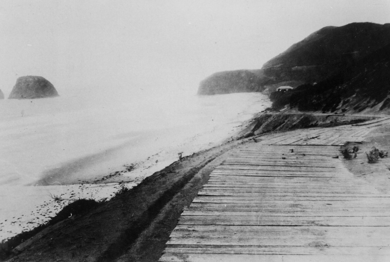
![Wood-plank road to Oceanside (opened July 3, 1925). L to R: Finley Rock, Maxwell Point, Dance Hall.]()
Oceanside Road.
Wood-plank road to Oceanside (opened July 3, 1925). L to R: Finley Rock, Maxwell Point, Dance Hall. Tillamook County Pioneer Museum
-
![]()
Oceanside.
Oregon Historical Society Research Library, ba013942, photo file 813b
-
![]()
"Fancy Skaters," Oceanside skating rink.
Oregon Historical Society Research Library, ba013995, photo file 813b
-
![]()
Oceanside.
Oregon Historical Society Research Library, Orhi87924, photo file 813b
-
![]()
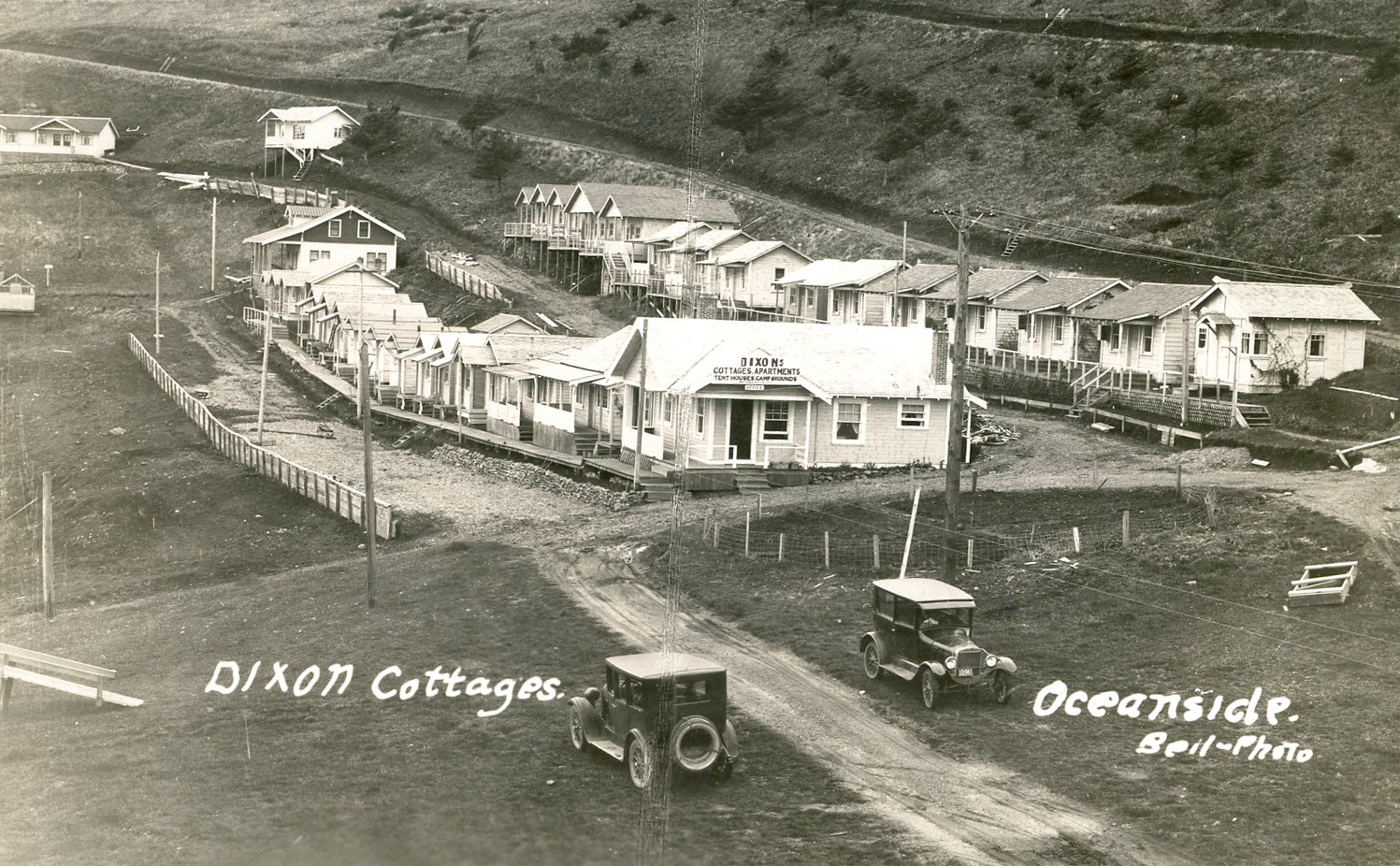
Dixon Cottages on the beach, Oceanside.
Oregon Historical Society Research Library, Journal, ba014006, photo file 813b
-
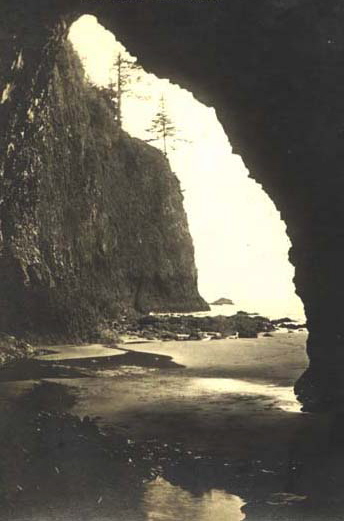
![]()
Lost Boys Cave, Oceanside, 1934.
Oregon Historical Society Research Library, Journal, orhi106119, photo file 813b
-
![Tunnel at Oceanside.]()
Oceanside, tunnel at.
Tunnel at Oceanside. Courtesy Mark Moore, pdxhistory.com
-
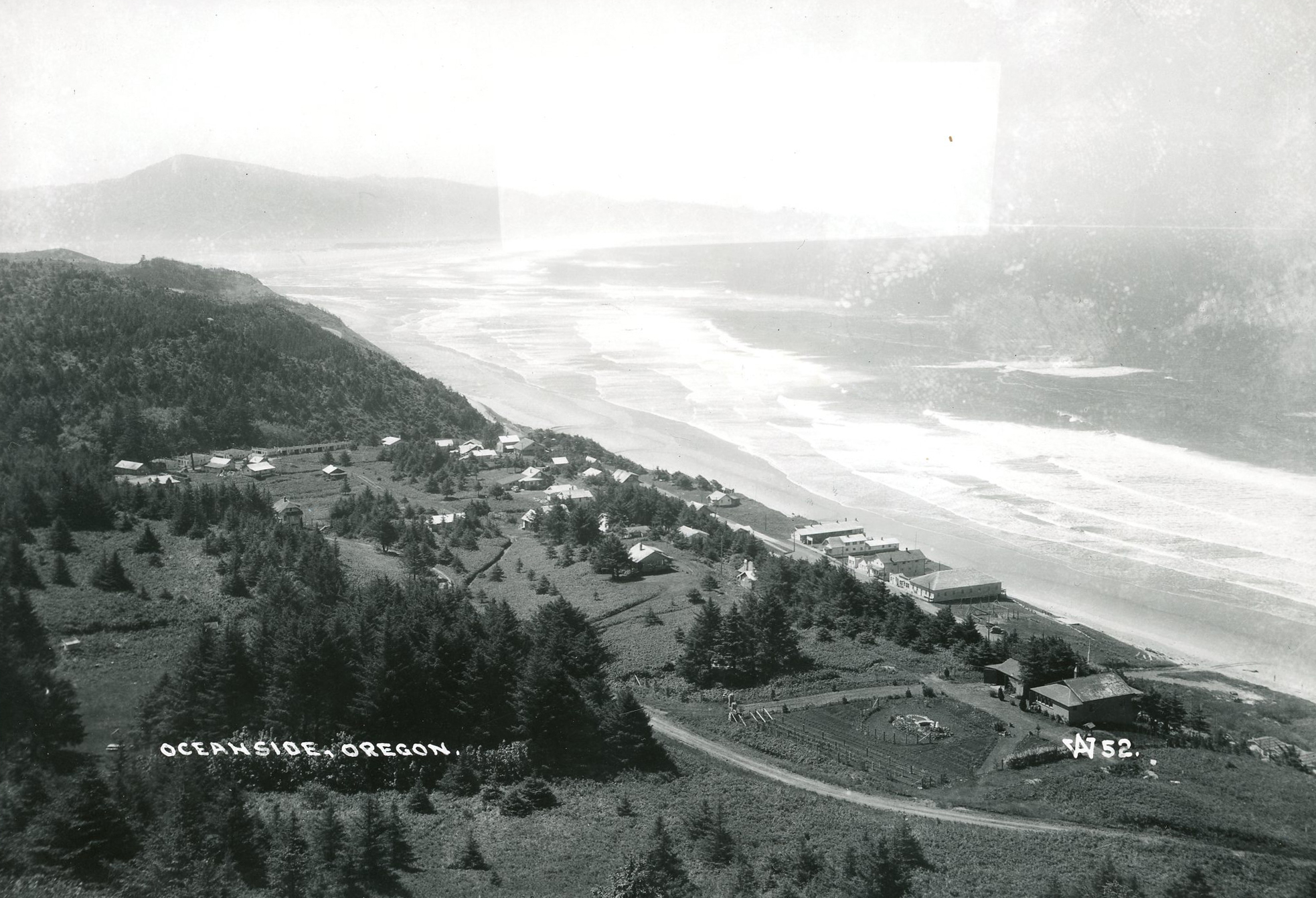
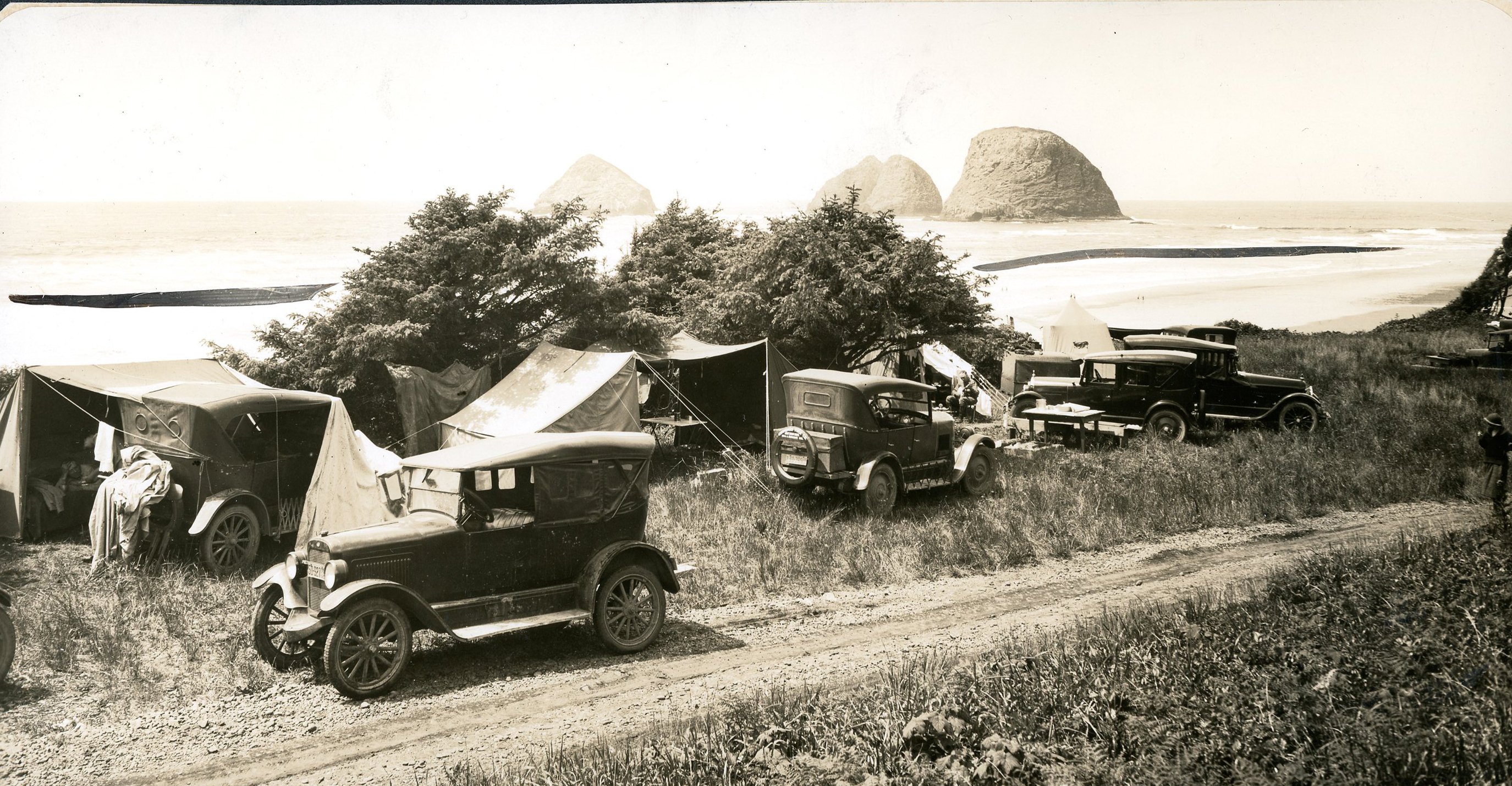
![]()
View of Seal Rocks from the automobile campground, Oceanside, 1930.
Oregon Historical Society Research Library, Arthur Prentiss, ba013932, photo file 813b

Related Entries
-
![Cape Meares Lighthouse]()
Cape Meares Lighthouse
Cape Meares Lighthouse is located atop Cape Meares, a scenic craggy hea…
-
![Three Arch Rocks National Wildlife Refuge and Wilderness]()
Three Arch Rocks National Wildlife Refuge and Wilderness
At fifteen acres, Three Arch Rocks lays claim to being one of the small…
-
![Tillamook]()
Tillamook
Tillamook, the county seat of Tillamook County and its largest city, is…
Map This on the Oregon History WayFinder
The Oregon History Wayfinder is an interactive map that identifies significant places, people, and events in Oregon history.
Further Reading
Church, Foster. "Something about fair Oceanside inspires cartwheels in the street." The Oregonian, Travel Section, April 18, 2004.
Friedman, Ralph. In Search of Western Oregon. Caldwell, ID: The Caxton Printers, 1990.
Metcalf, Mary Evelyn. Oceanside: Treasure by the Sea. Arlington, Tex.: AMS Designs, 2002.