Created by Congress in 1972, the Oregon Dunes National Recreation Area (ODNRA) provides federal management for the largest expanse of sand dunes on the West Coast. Located between Coos Bay-North Bend on the south and Florence on the north, the dunes cover an area approximately forty miles long and one and a half miles wide. The U.S. Forest Service manages the 31,566-acre ODNRA, which includes 27,232 acres of federal land and 4,334 acres under other ownership.
The scenic beauty and dynamic geology of the Oregon Dunes make it a popular area for recreation on the Oregon coast. Off-highway vehicle (OHV) riders use three designated open-sand areas: the Spinreel to Horsfall area north of Coos Bay-North Bend, the Umpqua Dunes area south of Reedsport, and the South Jetty area south of the Siuslaw River near Florence. Opportunities for OHV trail riding also can be found near these areas.
The South Jetty Area offers hikers access to the beach and dunes in areas separated from OHV use. Even more removed from OHV riding areas, the Dunes Day Use Area is a short hike from the beach, with the dunes, wetlands, and tree islands nearby. Large dunes and areas of open sand are accessible west of Tahkenitch Lake and via the John Dellenback trailhead near Eel Creek campground.
Because of the temperate coastal rainforest setting, water is a prominent part of the Oregon Dunes ecosystem. The large lakes east of Highway 101—Woahink, Siltcoos, Tahkenitch, and Tenmile—owe their existence to the formation and development of the Oregon Dunes over the last hundred thousand years or more. The lakes and the creeks that connect the lakes to the ocean offer opportunities for boating, canoeing, and fishing. Waterborne recreation is available on the Siuslaw and Umpqua River estuaries and on several smaller lakes near Florence and Coos Bay-North Bend.
In 1959, Senator Richard Neuberger co-sponsored a bill to make the Oregon Dunes part of the National Park System, with the ultimate goal of creating an Oregon Dunes-Sea Lion Caves National Recreation Area. The bill failed to gain support in Congress, and Sen. Maurine Neuberger subsequently sponsored a bill to create three new shoreline parks, including the Oregon Dunes, at the discretion of Secretary of the Interior Stewart Udall. Udall’s larger goal—the conservation of America’s special natural areas—was met with skepticism by some in Congress, who saw it as an effort to prevent access to natural resources. Maurine Neuberger’s bill, and subsequent versions of legislation involving shoreline protection, also failed because of disagreements about access to public lands. In 1972, a bill introduced by Representative John Dellenback creating the Oregon Dunes National Recreation Area under U.S. Forest Service management was signed by President Richard Nixon.
The Forest Service faces some challenging management situations at the ODNRA. As OHV use increases, the Forest Service has found it increasingly difficult to limit riding to trails in areas otherwise managed to protect natural vegetation, in accordance with the 1994 ODNRA Management Plan. In 2009 and 2010, a working group helped the agency develop a series of designated OHV routes and Management Area boundary changes that were adopted as an amended ODNRA Management Plan.
Probably the most significant challenge the Forest Service faces in managing the ODNRA is the loss of open sand areas to encroaching vegetation. The rapid expansion of vegetation has been caused largely by European beach grass (Ammophila arenaria), a non-native species. First introduced to the Oregon coast in the late nineteenth century to stabilize drifting beach sands near houses, river mouths, and roads, European beach grass quickly adapted to its new setting and expanded its range in the absence of natural biological controls. Forest Service efforts in the mid-1990s reestablished some of the nesting habitat of the threatened western snowy plover (Charadrius alexandrinus nivosus) that had been lost to advancing European beach grass. Its ongoing spread requires regular maintenance of snowy plover nesting sites.
The effectiveness of European beach grass in stabilizing windblown sands has encouraged local residents as well as state and local governments to continue to plant it to help protect highways, roads, parks, campgrounds, houses, and other development. The grass has adapted so successfully to the coast and dune landscapes that its eradication is highly unlikely. Efforts to prevent the loss of remaining open sand areas in the Oregon Dunes National Recreation area will take a concerted and sustained effort.
-
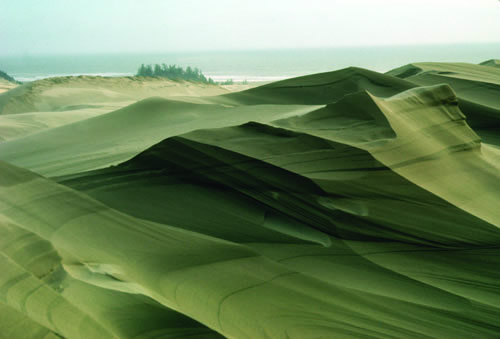
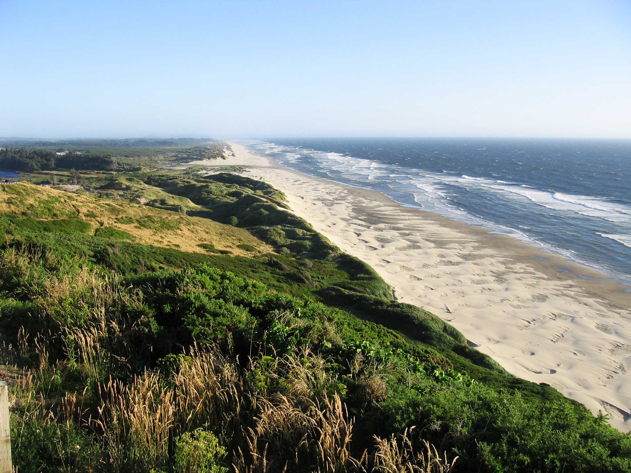
![Oregon Dunes National Recreation Area]()
Oregon Dunes National Recreation Area.
Oregon Dunes National Recreation Area Courtesy U.S. Forest Service, U.S. Dept. of Agriculture
-
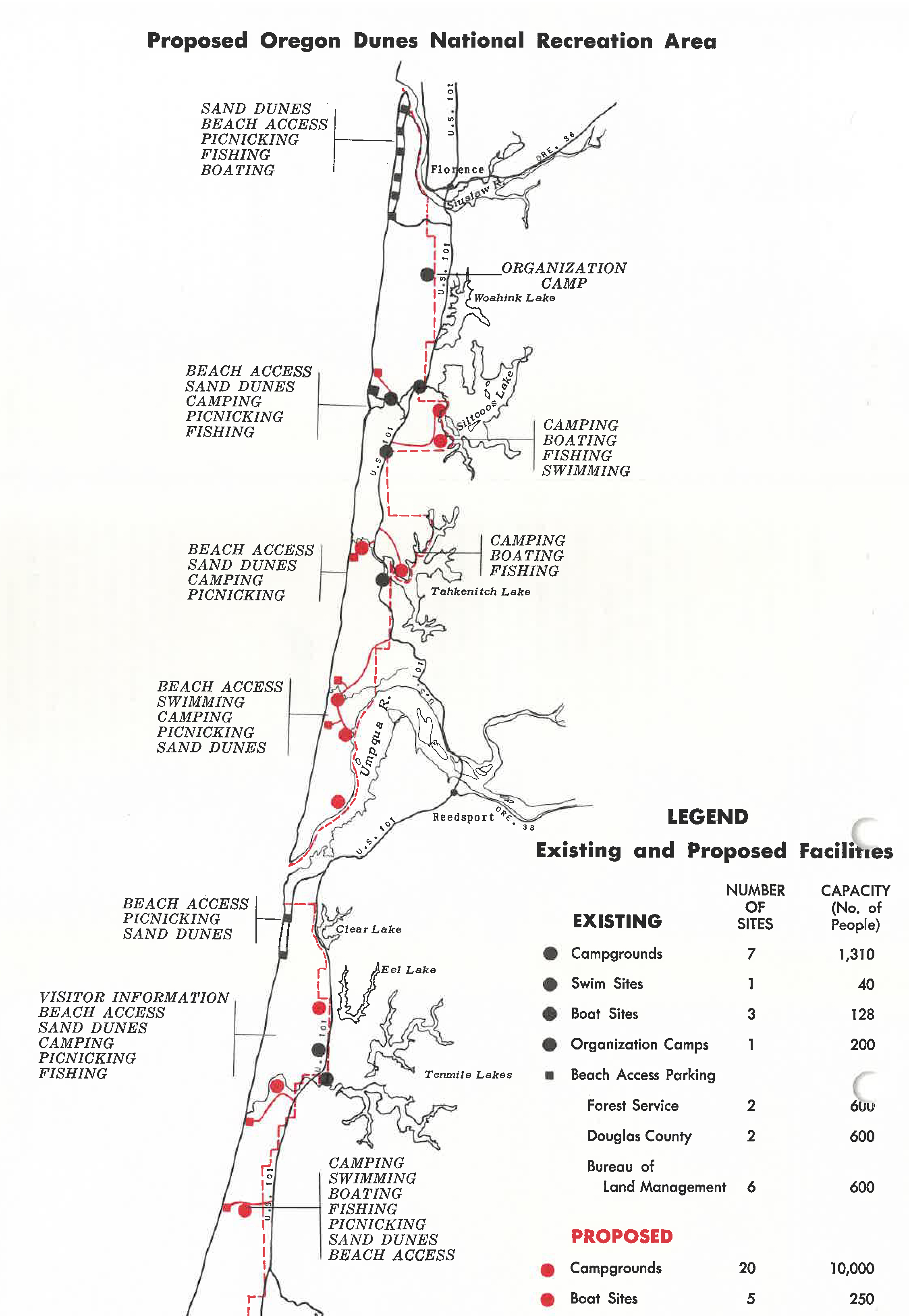
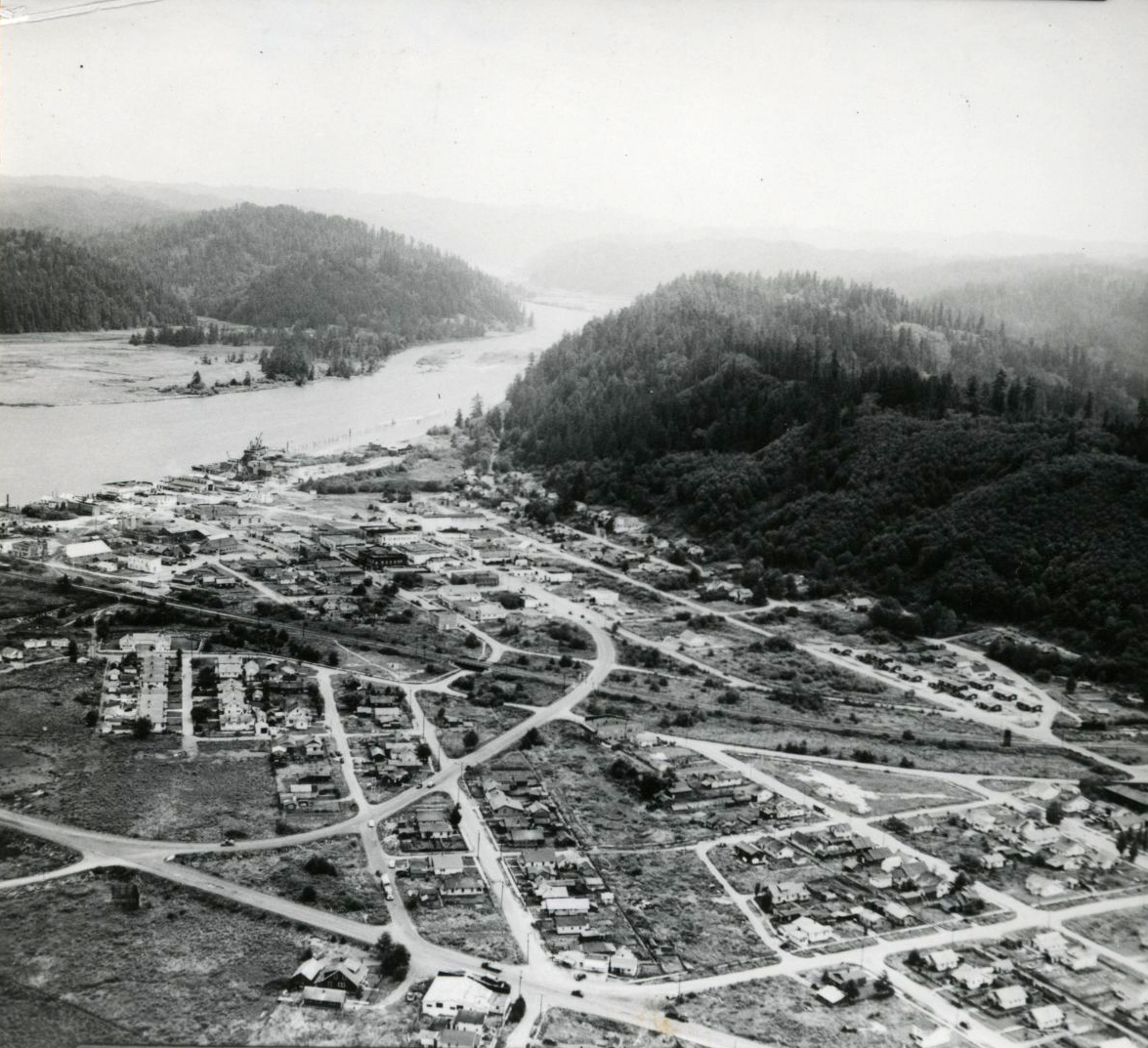
![]()
Proposed Oregon Dunes National Recreation Area.
Oregon Historical Society Research Library, Mss 2386, box 2, folder 33
-
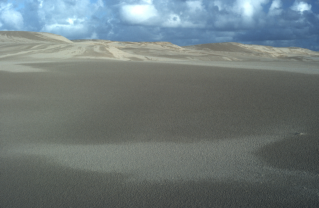
![Sand Dunes near Eel Creek]()
Sand Dunes near Eel Creek.
Sand Dunes near Eel Creek Courtesy Univ. of Oregon Libraries, OIMB_5368
-
![Sand Dunes near Eel Creek, 1988]()
Sand Dunes near Eel Creek, 1988.
Sand Dunes near Eel Creek, 1988 Courtesy Univ. of Oregon Libraries, OIMB_5369

Related Entries
-
![City of North Bend]()
City of North Bend
The City of North Bend is located on about five square miles at the nor…
-
![Coos Bay]()
Coos Bay
The Coos Bay estuary is a semi-enclosed, elongated series of sloughs an…
-
![John Richard Dellenback (1918–2002)]()
John Richard Dellenback (1918–2002)
John Dellenback exemplified the pragmatic bipartisan nature of Oregon p…
-
![Oregon Dunes]()
Oregon Dunes
Miles and miles of windblown sand. The Oregon Dunes stretch for fifty-f…
-
![Reedsport]()
Reedsport
In many ways, the story of Reedsport is a microcosm of the story of Ore…
-
![Richard Neuberger (1912-1960)]()
Richard Neuberger (1912-1960)
When he was elected to the United States Senate in 1954, Richard Neuber…


Map This on the Oregon History WayFinder
The Oregon History Wayfinder is an interactive map that identifies significant places, people, and events in Oregon history.
Further Reading
Oregon Dunes National Recreation Area website
Pavlis, Dina. Secrets of the Oregon Dunes. Florence, Ore: Windy Acres Enterprises, 2008.
Western Snowy Plover. Oregon Fish & Wildlife Office. http://www.fws.gov/oregonfwo/Species/Data/WesternSnowyPlover/