Today, the curve of St. Helens Road in northwest Portland skirts the edge of a shoreline that no longer exists, leaving a visual echo of a riparian marsh once located there. The crescent-shaped marsh, known as Guild's Lake, was likely an oxbow cutoff of the Willamette River formed by changes in sediment deposits and river flow. It was fed by hillside runoff and linked to the equally marshy Kittredge and Doane lakes. The lake was named for settlers Peter and Elizabeth Guild (pronounced "guiled") and was the setting for the 1905 Lewis and Clark Exposition.
At approximately 250-acres, Guild's Lake remained connected to the Willamette River by an underground water table, and it rose and fell with seasonal fluctuations. Balch Creek meandered out of a canyon into Guild’s Lake until city workers diverted it into an underground sewer pipe in the early twentieth century.
In 1905, to prepare the area for the Lewis and Clark Exposition, contractors flattened slopes and deepened the lake by damming its outlet and pumping in water. After the fair closed, the lake reverted to its natural shallow, marshy state. The February 12, 1906, Oregonian reported that the "bare mud flat" became less appealing to Portlanders who visited the site. An effort by some prominent Portlanders to save the fairgrounds and marsh as a park failed to get much support.
In 1905, land developer Lafayette Pence began filling in Guild’s Lake for industrial use, using giant mining hoses to sluice dirt from nearby hillsides. Two years later, the Lewis and Wiley Hydraulic Company took over the development project and by 1913 created a fifty-acre industrial center on filled-in lakeshore land. In the early 1920s, the Port of Portland worked with area landowners to fill in the rest of Guild’s Lake and adjoining wetlands with silt dredged from the Willamette River.
The Northern Pacific Terminal Company established a railcar switching yard on newly filled land in the 1920s, but the Depression and World War II delayed extensive development. During the war, the Housing Authority of Portland built temporary housing on the fill to accommodate a large influx of workers to the city. Industries moved into the area in the 1950s. In 2001, the Portland City Council adopted the “Guild’s Lake Industrial Sanctuary Plan” to protect 1,625 acres in Northwest Portland from nonindustrial use.
-
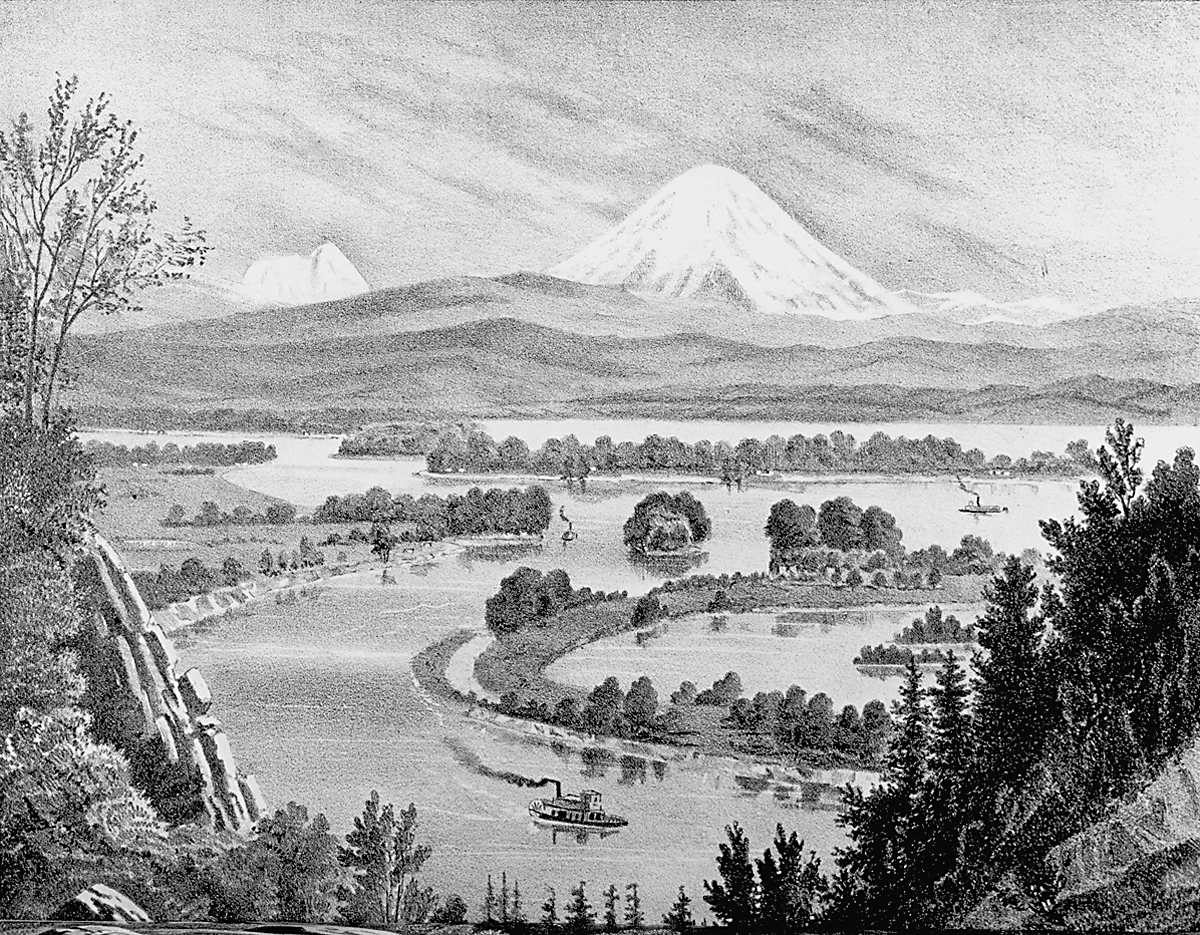
![]()
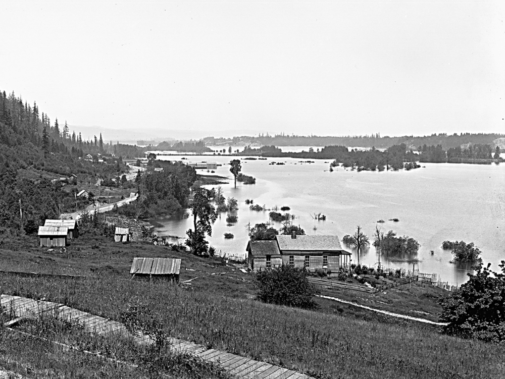
Guild's Lake, future site of Lewis and Clark Expo. site, view north from Willamette Heights.
Oreg. Hist. Soc. Research Lib., OrHi 36769
-
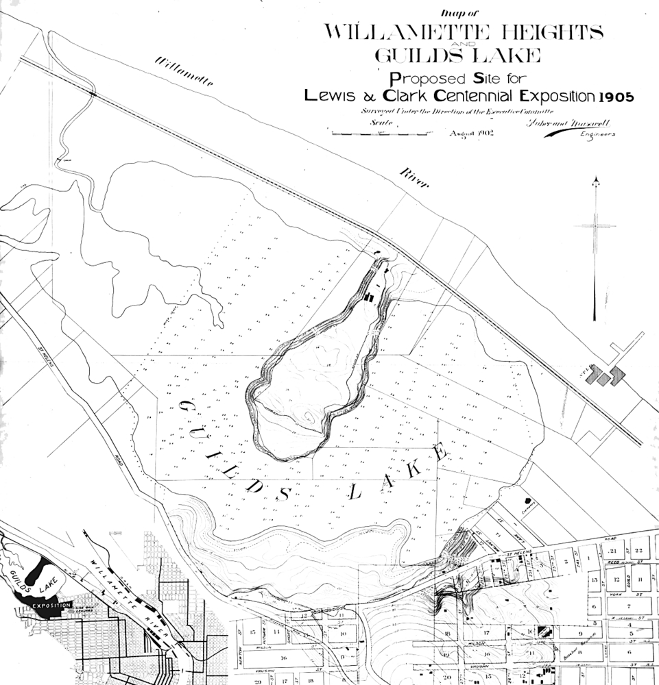
Map of Guild's Lake.
Map of the proposed site of the Lewis and Clark Centennial
-
![]()
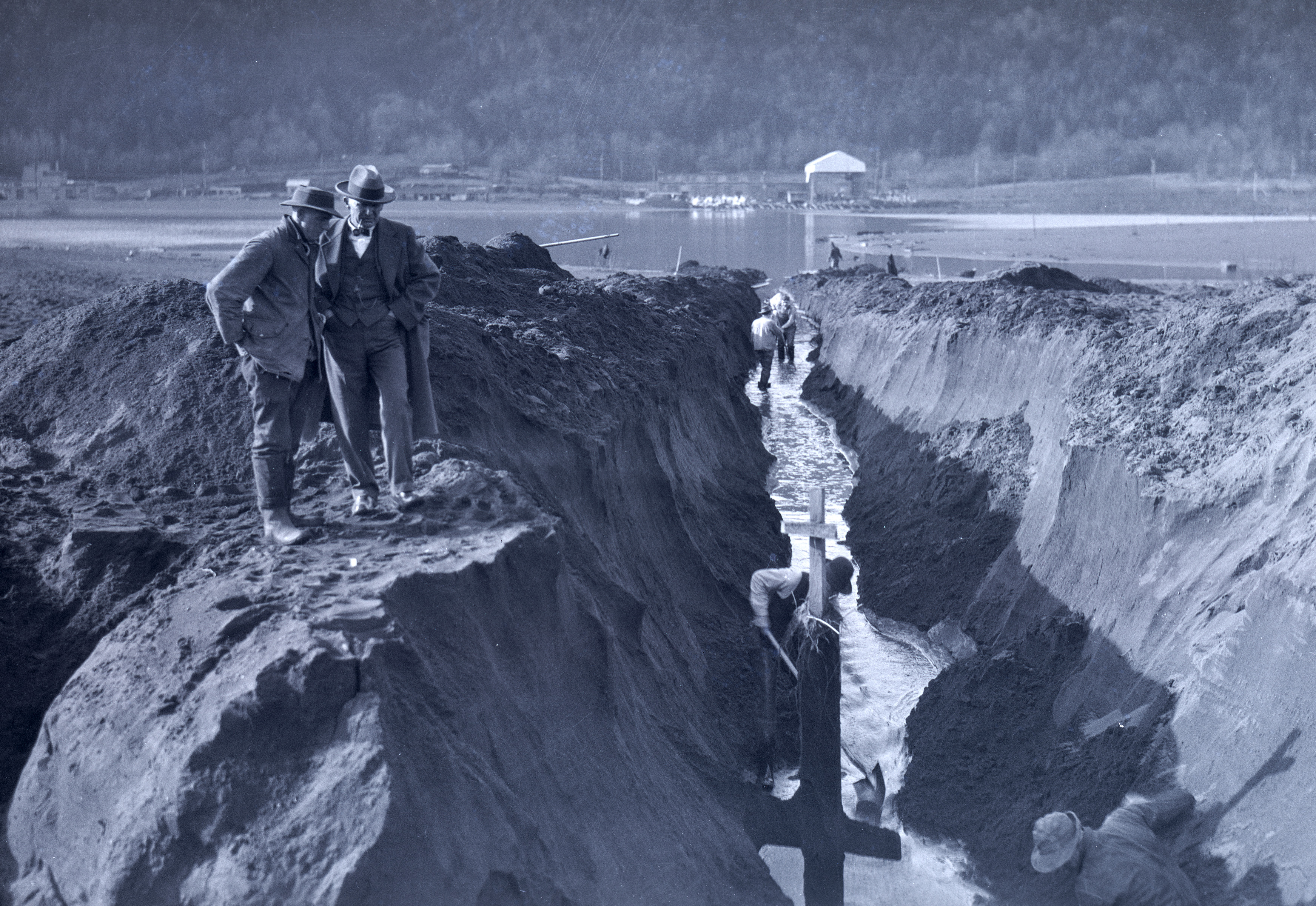
View west into ditch to drain Guild's Lake, Feb. 1926.
Oreg. Hist. Soc. Research Lib., bb006683
-
![]()
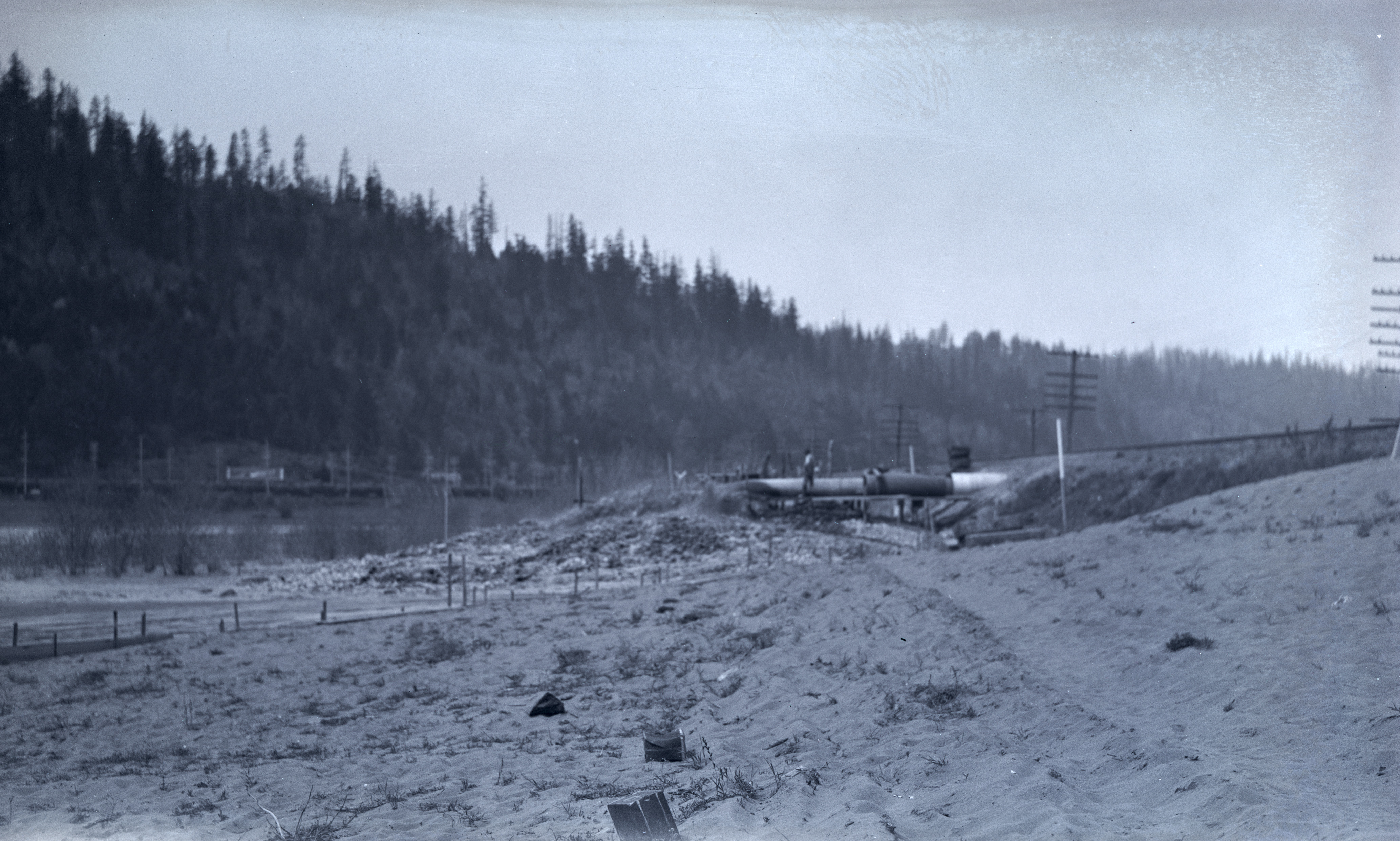
Dredge draining the Willamette's discharge in Guild's Lake at Landing No. 7, April 21, 1924.
Oreg. Hist. Soc. Research Lib., bb006685
-
![]()
Dredge draining Willamette's discharge in Guild's Lake at Landing No. 7, April 21, 1924..
Oreg. Hist. Soc. Research Lib., bb006684

Related Entries
-
![Housing Authority of Portland]()
Housing Authority of Portland
The Housing Authority of Portland was created in 1941 in response to th…
-
![Lewis and Clark Exposition]()
Lewis and Clark Exposition
Portland staged its first and only world's fair from June 1 through Oct…
-
![Portland]()
Portland
Portland, with a 2020 population of 652,503 within its city limits and …
-
![Port of Portland]()
Port of Portland
The Oregon Legislature created the current Port of Portland in 1970 by …
-
![Willamette River]()
Willamette River
The Willamette River and its extensive drainage basin lie in the greate…
Related Historical Records
Map This on the Oregon History WayFinder
The Oregon History Wayfinder is an interactive map that identifies significant places, people, and events in Oregon history.
Further Reading
"Guild’s Lake Industrial Sanctuary Plan." Bureau of Planning, City of Portland, December 21, 2001.
“Guild’s Lake Quietly Transformed Into Industrial Center.” Oregonian, September 28, 1913.
Dibling, Karin, Julie Kay Martin, Meghan Stone Olson, and Gayle Webb. "Guild's Lake Industrial District: The Process of Change Over Time." Oregon Historical Quarterly 107:11 (Spring 2006), 88-105.
Tucker, Kathleen D. "'We Want Smokestacks and Not Swamps': Filling in Portland's Guild's Lake, 1906-1925." M.A.. Thesis, Portland State University, 2005.