The unincorporated community of McKenzie Bridge is located along the McKenzie Highway (Route 126) at milepost 50. The location, according to Oregon Geographic Names, has "long been an important crossing of McKenzie River, and was named for the stream.”
McKenzie Bridge is the only community between Blue River and Sisters along the McKenzie Highway. The community has several stores and small fishing resorts along the highway, cabins along the river, state facilities, and the St. Benedict Lodge—a religious retreat and church founded for the Benedictine monks in 1940.
The McKenzie Bridge area was a favorite camping spot for Native people who traveled from the Warm Springs Reservation to the upper McKenzie to fish, hunt deer, and pick huckleberries. The lower McKenzie River was a good location for fishing for salmon and picking hops.
In 1869, John Craig built the first bridge at this location by felling two trees across the river and covering them with crude puncheons. A wooden covered bridge was constructed in 1878, but three years later it floated away in a flood. Another covered bridge built in 1881 was replaced in 1907 by a wooden bridge a short distance downstream. In 1929, a steel and concrete bridge was built. It was dynamited in 1945 to make way for a new bridge and was replaced by the present bridge in 1968.
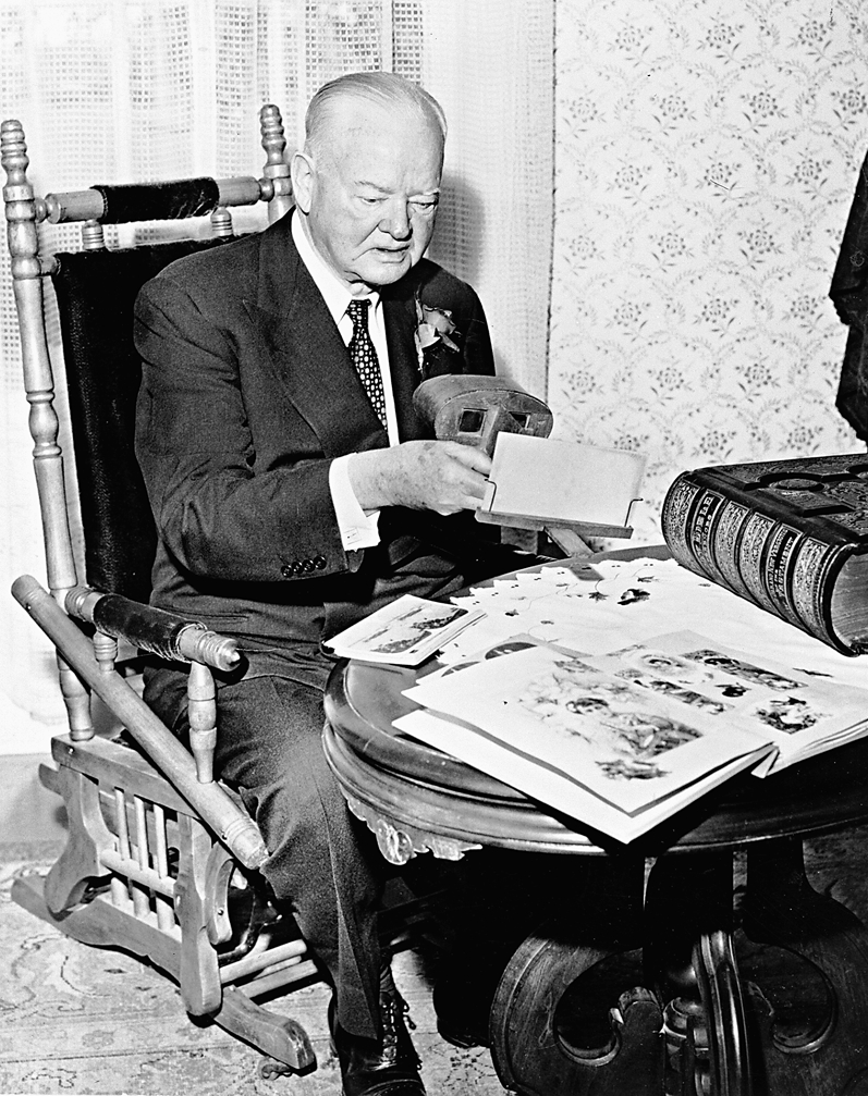
For years, McKenzie Bridge was the last stop for mail and passenger stages from Springfield and Eugene. In 1885, George "Uncle" and Melvina "Auntie" Frissell built the Log Cabin Inn, which was destroyed by fire in 1906. The hotel guests, who had their food and belongings burned in the fire, were put up by local residents until a rescue wagon arrived from Eugene three days later. A new inn built in 1907 operated until March 29, 2006, when it, too, was destroyed by fire. More than twenty new cabins are now available at the site for rent and sale. Visitors at the inn included Clark Gable, President Herbert Hoover, and the Duke of Windsor.
A ranger station was built at McKenzie Bridge and was the location of one of the Civilian Conservation Corps camps for Camp Belknap in the 1930s. A new McKenzie River Ranger Station is located a couple of miles east along the highway.
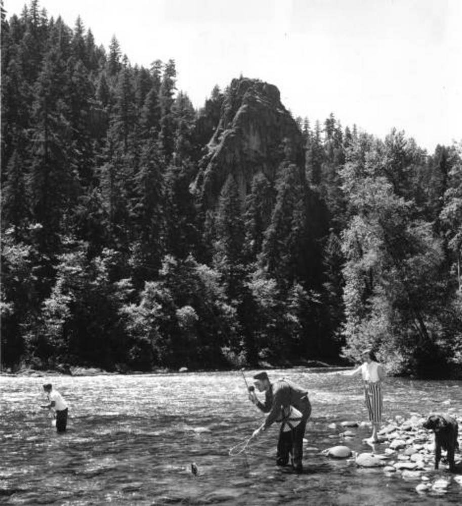
Not far from McKenzie Bridge are Tokatee Golf Course, Cougar Reservoir, Clear Lake (the headwaters of the McKenzie River), and the Scenic McKenzie River Highway (Route 242), which is open only in the summer. Outdoor activities such as fly fishing, hiking along the McKenzie River Trail, river boating, rafting, and kayaking continue to draw recreationists to the area.
-
![]()
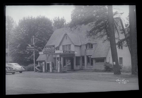
Brewster's General Store in the community of McKenzie Bridge, c.1940.
Oregon Historical Society Research Library Digital Collections Org Lot 1275; Box 3; S-281.
-
![]()
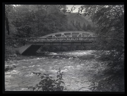
McKenzie Bridge, McKenzie Highway, c.1940.
Oregon Historical Society Research Library Digital Collections Org Lot 1275; Box 2; S-275.
-
![]()
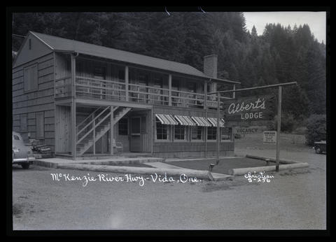
Albert's Lodge, McKenzie River Highway, Vida, c.1940s.
Oregon Historical Society Research Library OrgLot1275_B2_Christian_S-256
-
![]()
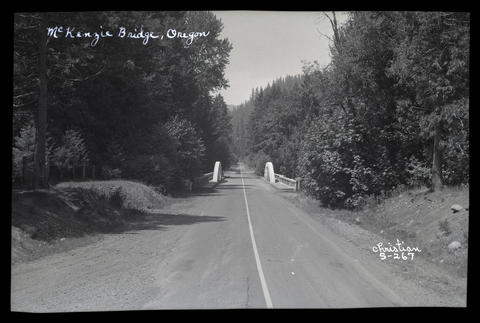
McKenzie Bridge, Oregon. c.1940.
Oregon Historical Society Research Library Digital Collections Org Lot 1275; Box 2; S-267.
-
![]()
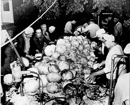
Parishioners Of Visitation Church In Verboort prepare three tons of cabbage for annual Sausage-Kraut Dinner in 1963.
Oregon Historical Society Oregon Journal Collection 015196
-
![]()
Brewster's General Store in the community of McKenzie Bridge, c.1940.
Oregon Historical Society Research Library Digital Collections Org Lot 1275; Box 3; S-281.
-
![]()
McKenzie Bridge, McKenzie Highway, c.1940.
Oregon Historical Society Research Library Digital Collections Org Lot 1275; Box 2; S-275.
-
![]()
McKenzie Bridge, Oregon. c.1940.
Oregon Historical Society Research Library Digital Collections Org Lot 1275; Box 2; S-267.
-
![]()
Albert's Lodge, McKenzie River Highway, Vida, c.1940s.
Oregon Historical Society Research Library OrgLot1275_B2_Christian_S-256
Related Entries
Related Historical Records
Map This on the Oregon History WayFinder
The Oregon History Wayfinder is an interactive map that identifies significant places, people, and events in Oregon history.
Further Reading
McArthur, Lewis A., and Lewis L. McArthur. Oregon Geographic Names (7th ed.). Portland: Oregon Historical Society Press, 2003.