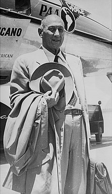
Gerald W. Williams
Gerald W. Williams was the national historian for the USDA Forest Service. He received his Ph.D. from Washington State University, taught at Indiana State University, and was the recreation research director for the City of Eugene. He worked for the Forest Service on the Umpqua National Forest and the Willamette National Forest, and was an adjunct staff member with Grey Towers National Historic Landmark. He was chief historian for the Forest Service, led the national history program, and was editor of History Line. Jerry retired from the Forest Service in 2005 and was elected as a distinguished Fellow of the Forest History Society in 2015. He collected hundreds of photographs, film, and materials connected to Oregon's forestry history, which he donated to OSU's Special Collections and Archives for public use. He passed away in 2019.
Author's Entries
-
Bagby Hot Springs
Bagby Hot Springs is located in the Mount Hood National Forest about seventy miles southeast of Portland. The springs, whose hot mineral water Indians may have used as a curative, were named in 1881 by Robert W. Bagby, a prospector and miner who lived near Molalla. According to some …
Oregon Encyclopedia
-
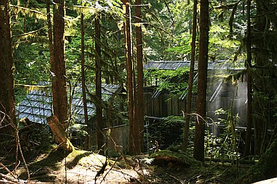
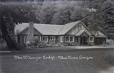
Community of Blue River
Blue River is located forty miles east of Springfield along the McKenzie Highway, near the confluence of the Blue and McKenzie Rivers. The community was founded by Samuel Christopher Sparks and Robenia Bringle Sparks. A Confederate soldier during the Civil War, Samuel left his family in 1874 and headed west …
Oregon Encyclopedia
-
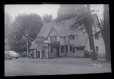
Community of McKenzie Bridge
The unincorporated community of McKenzie Bridge is located along the McKenzie Highway (Route 126) at milepost 50. The location, according to Oregon Geographic Names, has "long been an important crossing of McKenzie River, and was named for the stream.” McKenzie Bridge is the only community between Blue River …
Oregon Encyclopedia
-
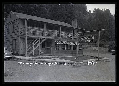
Community of Vida
The unincorporated community of Vida is located along the McKenzie Highway (Route 126), just east of Goodpasture Covered Bridge. The community development at Vida is modest, with gas station, cafe, store, post office, and several state offices and storage buildings. At one time, Vida was an important link between the …
Oregon Encyclopedia
-
David T. Mason (1883-1973)
David T. Mason was a professional forester, one of the first in Oregon. Almost single-handedly he moved the timber industry from the practice of cutting timber and leaving the land to recover on its own to one based on a model of applied forest science. He also saw the need …
Oregon Encyclopedia
-
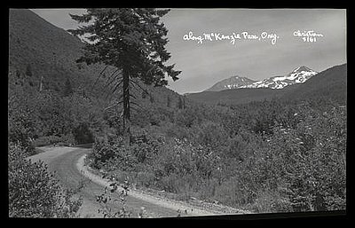
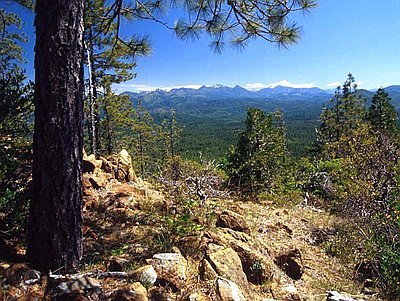
McKenzie Pass
The McKenzie Pass summit, named for the McKenzie River, is located on the scenic McKenzie Pass Highway (Route 242) just west of the Dee Wright Observatory. Until the 1860s, the pass was an Indian trail that was later used for driving cattle over the Cascades. Few immigrants to the …
Oregon Encyclopedia
-
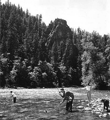
McKenzie River
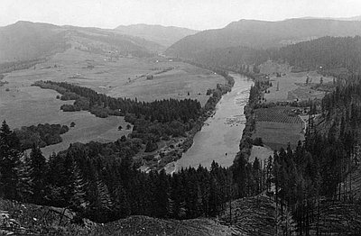
The McKenzie River, on the western slope of the Cascade Range, starts on the east at the volcanic Three Sisters and extends approximately ninety miles to the west. The main McKenzie River is joined by the South Fork below the town of McKenzie Bridge, the Blue River at the town …
Oregon Encyclopedia
-
National Forests in Oregon, 1892 to 1933
The first forest reserves in the state were established in 1892-1893, although management of the federal forests did not begin until the summer of 1898. The origin of the Cascade Range Forest Reserve dates from the summer of 1885, after William G. Steel visited Crater Lake near the southern end …
Oregon Encyclopedia
-
Santiam Pass
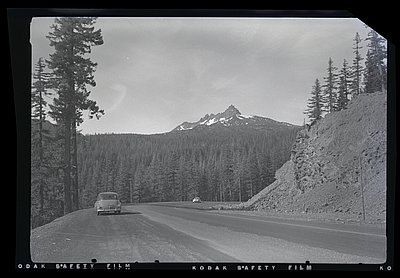
Santiam Pass, at an elevation of 4,817 feet, is a major highway crossing of the middle Cascade Range. Located on U.S. 20 at milepost 80.8, the pass crosses the Cascades Crest south of Mount Jefferson and north of the Three Sisters. Beginning in 1861, when the first Santiam Wagon Road …
Oregon Encyclopedia
-
Spruce Production Division
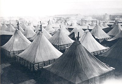
In 1918, during World War I, almost thirty thousand U.S. soldiers were assigned to the Spruce Production Division (SPD) as part of the federal Loyal Legion of Loggers and Lumbermen (4L), a government-created union of loggers and sawmill owners formed to counteract widespread labor strikes by workers in the industry. …
Oregon Encyclopedia
-
Umpqua River
The Umpqua River, approximately 111 miles long, is a principal river of the Oregon coast, draining an expansive network of valleys in the mountains on the western slopes of the Cascade Range. The river, whose entire length is in Douglas County, is formed by the confluence of the North …
Oregon Encyclopedia
-
Willamette Pass
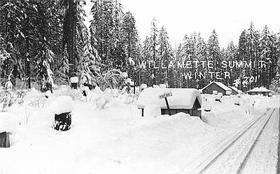
Willamette Pass, a 5,128-foot-high mountain pass in the Cascade Range, has been an important transportation route between the Willamette Valley and central Oregon for over 150 years. At least three crossings of the Cascades have carried the Willamette Pass name, each in a slightly different location. The confusion over the …
Oregon Encyclopedia