Mt. Angel is a small community of about 3,392 people in 2020, approximately eighteen miles northeast of Salem. Indians had worshipped on the butte, called Tapalamaho, for generations, traveling from Klamath country to the southeast and from east of the Cascades. The first white settlers in the area included William and Jane (Graves) Glover, in 1847, and Benjamin and Rachel (Tompkins) Cleaver in 1850. Benjamin Cleaver established on his land the plat that would eventually become the city of Mount Angel. John H. and Catharine (Graves) Palmer settled in 1853 on Mt. Angel itelf, which the settlers then called "Graves Butte."
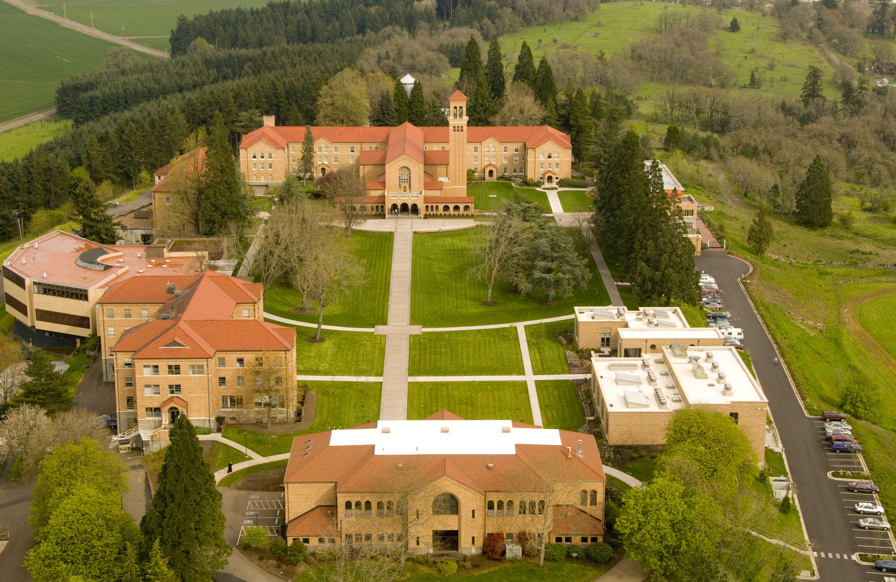
In 1881, Father Adelheim Odermatt, from the Benedictine Abbey of Engelberg, Switzerland, arrived with a contingent of Benedictine monks. A large group of Bavarians followed and settled in the area. A Benedictine abbey was completed in 1884, with a pilgrimage chapel on the summit called Lone Butte. The butte and community were renamed Mt. Angel (the English translation for Engelberg), and Father Odermatt started a school for boys. The Queen of Angels Sisters, also from Engelberg, moved to Mt. Angel in 1888 to provide teachers. They established Mount Angel College, which closed in 1973.
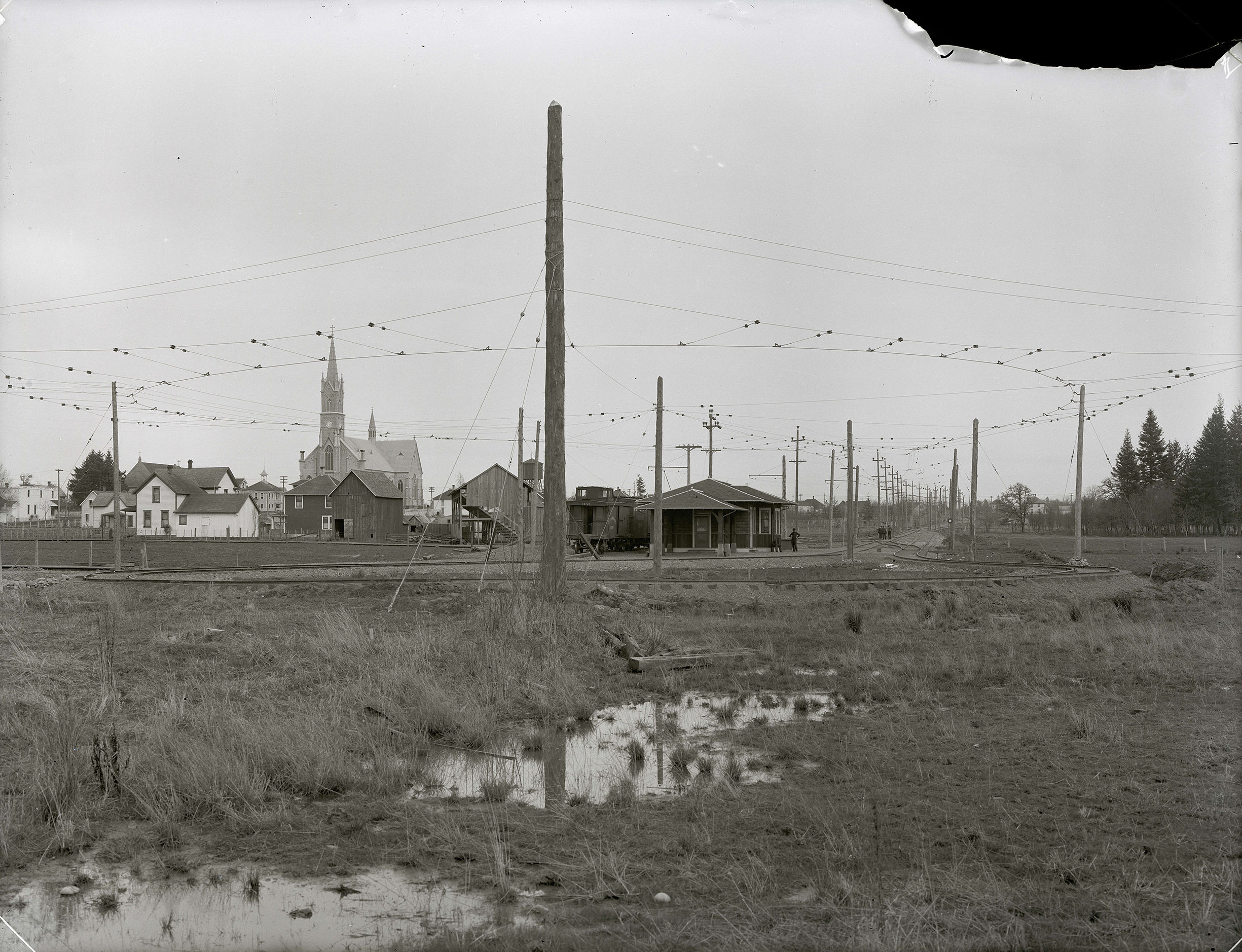
A railroad station named Fillmore had been built at the site in 1881. A year later, a post office was established, and the town was named Roy. The city of Mt. Angel was incorporated on February 10, 1893, with the new post office of St. Benedict located at the abbey.
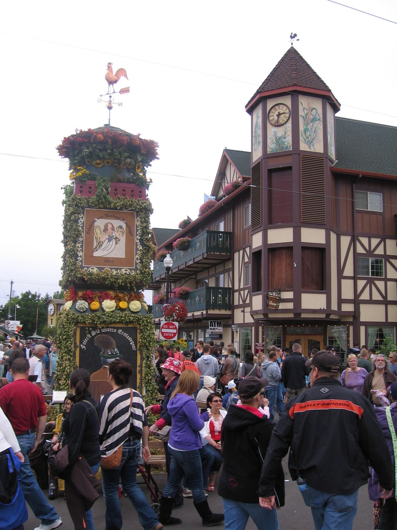
The considerable German influence in Mt. Angel is evident in its Bavarian-style storefronts and in its boast that it has the largest Glockenspiel in the United States. The town’s four-day Oktoberfest, held every year since 1966, is the largest folk festival in the Northwest.
Mt. Angel’s economy is based on both agriculture and industry. Farmers grow berries, Christmas trees, and row, seed, and grain crops, and several businesses operate in the industrial zone next to the Southern Pacific line.
-
![Fruchtsaeule (l) and Glockenspiel (r) at Mt. Angel Oktoberfest, Sep. 2011.]()
Mt. Angel Oktoberfest, Sep 17 2011.
Fruchtsaeule (l) and Glockenspiel (r) at Mt. Angel Oktoberfest, Sep. 2011. Photo James V. Hillegas-Elting
-
![]()
Depot at Mt. Angel, c.1916.
Oregon Historical Society Research Library, OrgLot151_PGE144-26 -
![Mt. Angel Abbey, looking east.]()
Mt Angel Abbey, aerial, looking east.
Mt. Angel Abbey, looking east. Courtesy Mt. Angel Abbey
-
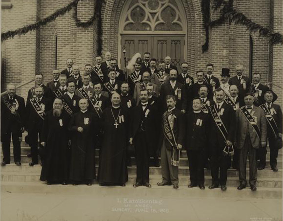
![]()
I. Katolikentag, Mt, Angel.
Courtesy University of Oregon Libraries -
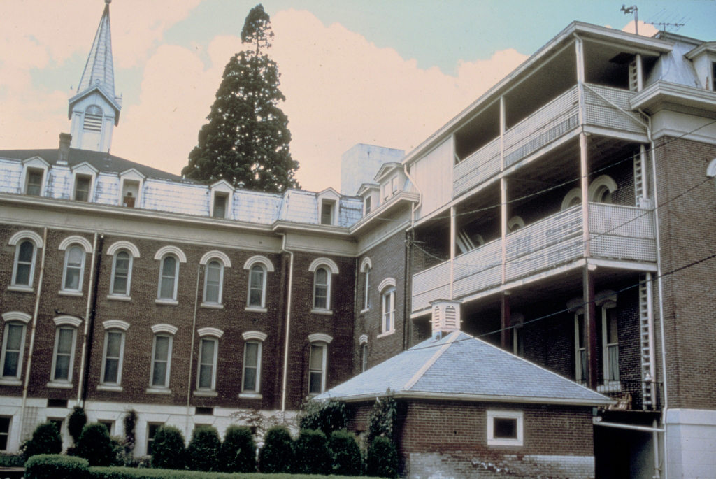
![Queen of Angels Priory Convent, 840 S. Main St., Mt. Angel.]()
Mt. Angel, Queen of Angels Priory Convent.
Queen of Angels Priory Convent, 840 S. Main St., Mt. Angel. Univ. of Oreg. Libr., Architecture & Allied Arts Libr.,
-
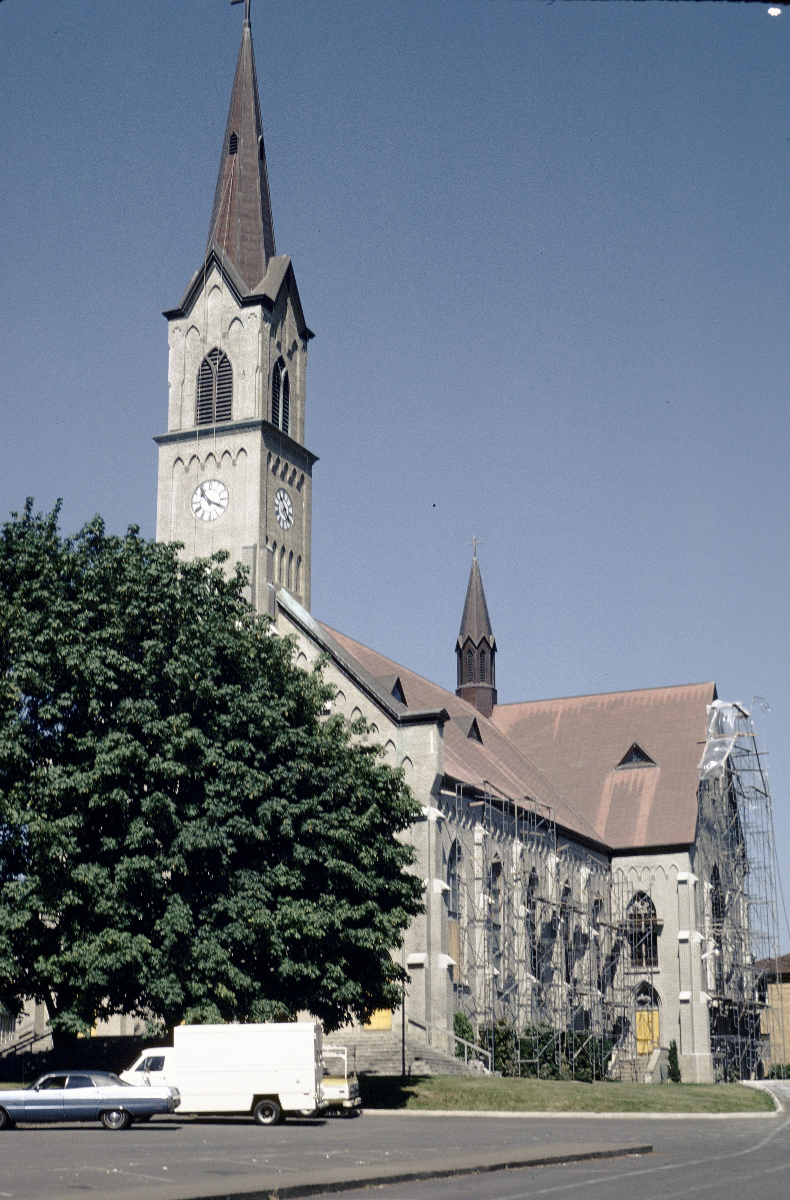
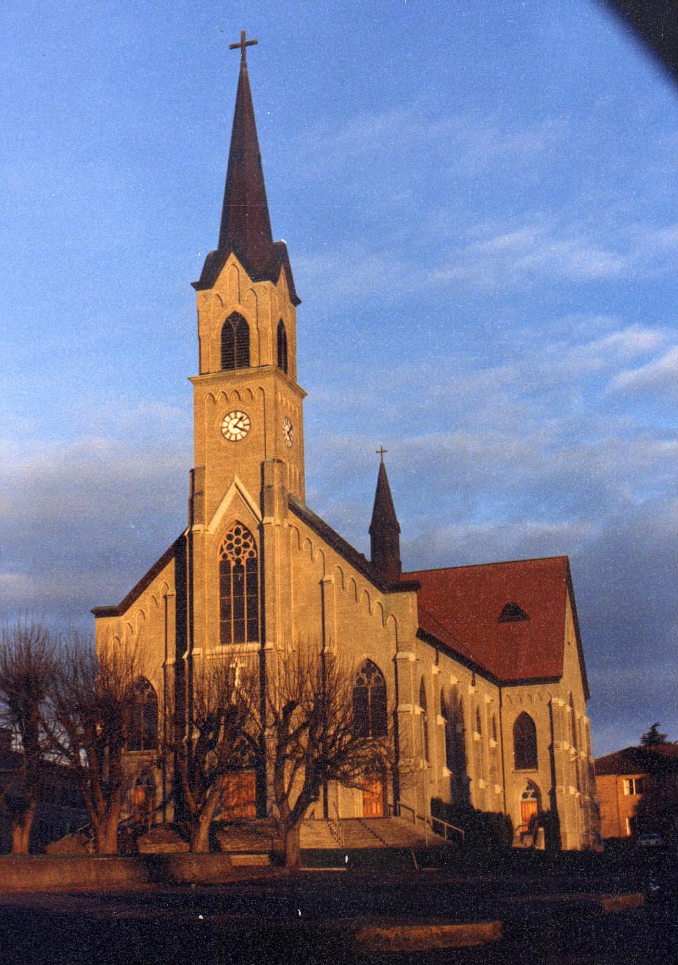
![Saint Mary's Catholic Church, 575 E. College St., Mt. Angel, June 1980.]()
Mt. Angel, Saint Mary's Church, Jun 1980.
Saint Mary's Catholic Church, 575 E. College St., Mt. Angel, June 1980. Photo Marion Dean Ross, Univ. of Oreg. Libr., Architecture & Allied Arts Libr.,
-
![Saint Mary's Catholic Church, 575 E. College St., Mt. Angel, July 1978.]()
Mt. Angel, Saint Mary's Church, interior, Jul 1978.
Saint Mary's Catholic Church, 575 E. College St., Mt. Angel, July 1978. Photo Marion Dean Ross, Univ. of Oreg. Libr., Architecture & Allied Arts Libr.,
-
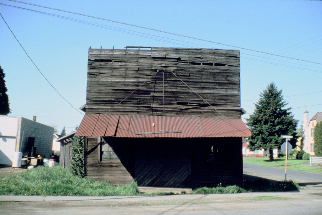
![Windischar's General Blacksmith Shop, 110 Sheridan St., Mt. Angel.]()
Mt. Angel, Windischar's General Blacksmith Shop.
Windischar's General Blacksmith Shop, 110 Sheridan St., Mt. Angel. Univ. of Oreg. Libr., Architecture & Allied Arts Libr.,
-
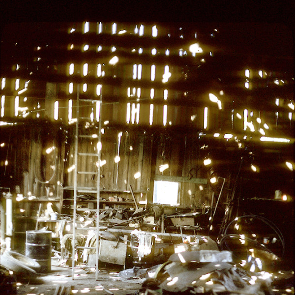
![Inside Louie Weissenfel's blacksmith shop, Mt. Angel, May 1979.]()
Weissenfels, Louie, blacksmith shop, interior, 1979.
Inside Louie Weissenfel's blacksmith shop, Mt. Angel, May 1979. Univ. of Oreg., Randall V. Mills Archives of NW Folklore, OFA_79_DK_A29_1
-
![St. Mary's Roman Catholic church, Mt. Angel.]()
Mt. Angel, city of, St. Mary's Church, 2004.010.0259.
St. Mary's Roman Catholic church, Mt. Angel. Photo Al Jones, courtesy Marion County Historical Society, 2004.010.0259

Related Entries
-
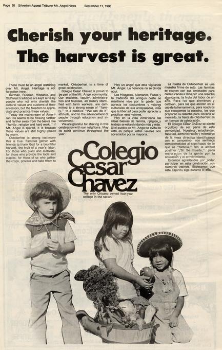
![Colegio César Chávez]()
Colegio César Chávez
Colegio César Chávez, located in Mt. Angel in the lower Willamette Vall…
-
![Mount Angel Abbey]()
Mount Angel Abbey
Mount Angel Abbey, in the town of St. Benedict, Oregon, is a community …
-
![Mount Angel Abbey Library]()
Mount Angel Abbey Library
Housed in a building designed by Finnish architect Alvar Aalto, the Mou…
-
![Mt. Angel Oktoberfest]()
Mt. Angel Oktoberfest
Mt. Angel, a Willamette Valley community largely composed of descendant…


Map This on the Oregon History WayFinder
The Oregon History Wayfinder is an interactive map that identifies significant places, people, and events in Oregon history.
Further Reading
Marion County Historical Society. Marion County History, Vol. 15. Salem, Ore.: Marion County Historical Society, 1998.