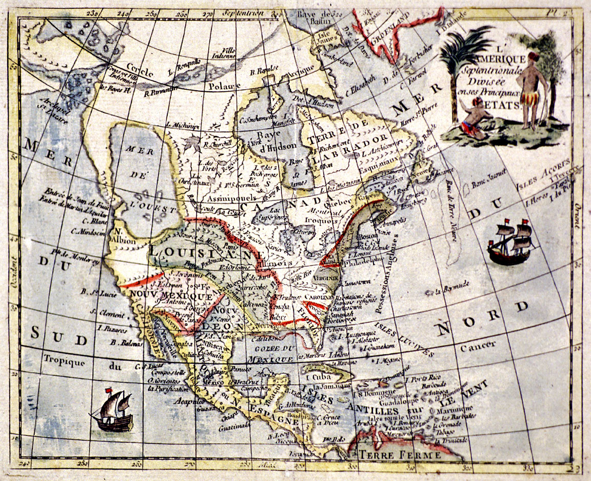
2. L'Amerique Septentrionale
The full title for this French map is L’Amérique Septentrionale Divisée en ses Principaux Etats and translates as “North America divided into its principal states.” Although the name of the cartographer and the exact date of the map’s publication are unknown, its similarity to the 1752 map by Frenchman Joseph-Nicolas de l’Isle suggests that it was produced in the 1750s.
This colorful map illustrates the state of European knowledge about North American geography in the mid-eighteenth century. Eastern Canada, the Atlantic seaboard, the Great Lakes, the vast territory of Louisiana, and the Spanish possessions are relatively well represented. However, the northwestern regions are wildly inaccurate, demonstrating a reliance on imagination rather than factual information. Present-day Oregon and Washington correspond to Francis Drake’s “New Albion,” with a gigantic Mer de l’ouest (western sea) located in the plateau and Rocky Mountains regions. Farther north, a series of fictive rivers and lakes comprise the mythical Northwest Passage, then referred to as the “Strait of Anian” by the Spanish.
View source2 of 7