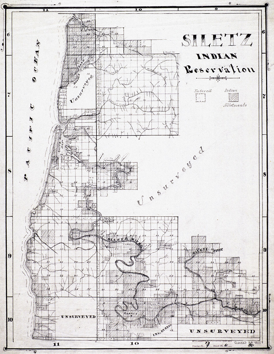
Siletz Indian Reservation, 1900
This map, produced by the Willamette Pulp and Paper Company, shows what remained of the Siletz Reservation in 1900. Each of the small squares on the map represents a 160-acre quarter-section. The darkened quarter-sections in this map represent Indian allotments, while the light-colored quarter-sections marked with dashes on the border represent non-Indian land claims.
The federal government established the Siletz Reservation and the adjacent Grand Ronde Reservation in 1856. Shortly thereafter, several thousand Indians from the coast and the interior valleys of western Oregon were forcibly removed to the two reservations.
View source3 of 8