
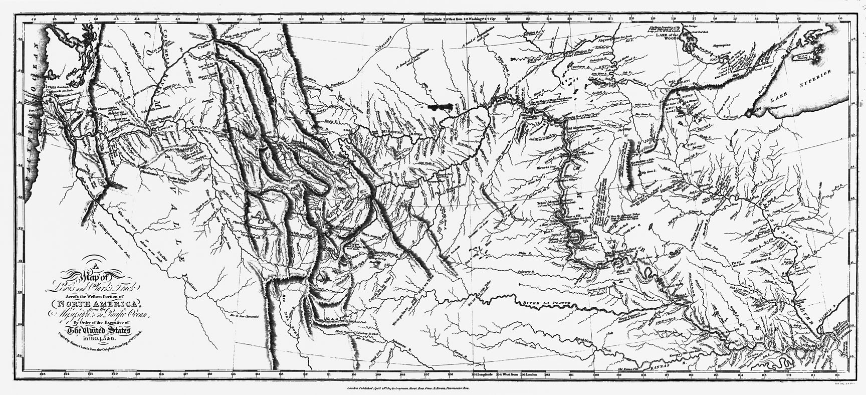
2. Map of Lewis and Clark's Track
This important map titled A Map of Lewis and Clark's Track Across the Western Portion of North America from the Mississippi to the Pacific Ocean marks the culmination of the Lewis and Clark Expedition, which explored western North America from 1804 to 1806. It also marks the end of the long sought after Northwest Passage, a fabled waterway that many Americans and Europeans hoped would provide an easy passage to the markets of Asia.
At the beginning of the nineteenth century, it was generally thought that the headwaters of the Missouri River were in close proximity to the headwaters of the Columbia River and that only a plateau or a gentle “pyramidal height-of-land” separated the two water systems. Lewis and Clark proved this long-held theory wrong. Rather, they found that a series of rugged mountain ranges divided the continent. Moreover, the streams descending the western slope of the Rockies proved to be unnavigable, shattering the myth of the Northwest Passage for good.
View source2 of 12