Few ghost towns in Oregon have such colorful histories as the small towns, mining camps, and settlements in the Illinois River Valley in Southwestern Oregon. This was one of the first areas in Oregon where gold was discovered following the gold strike at Yreka, California, in 1850. Many of these towns held a fleeting importance in the past, but there is little indication today that they ever existed. The most prominent towns were gathered around the mining areas that saw greatest activity starting in the 1850s; some still existed into the 1920s. They were mentioned on regional maps of the day, and some even slipped into world atlases based upon the map makers' reference material.
The towns (All Hours, Allentown, Alloysius, Anderson Station, Bour, Deering, Dryden, Grass Flat, Frenchtown, Mooney's Place, Sebastopol) arose as settlements where miners lived while looking for gold; many of them were no more than tent cities or itinerant camps that had set up post offices and were soon after abandoned upon the discovery of a new strike or richer "diggings" over the next ridge. Others were supply centers for the nearby gold and copper mines and had more amenities. A few of these towns were even moved when everywhere else in the gulch or canyon had been mined and the only place left was the ground under whatever stores or hotel there were.
Althouse was first established as a trading post in 1852 by A.G. Walling, E.J. Northcutt, and B.J. Bell. Walling would later become recognized for publishing The History of Southern Oregon in 1883. Althouse, named for the Althouse Brothers of Albany, Oregon, became the site of a post office in 1877. In 1899 the post office was moved and its name was changed to Holland, after an early settler, James E. Holland. Oregon: End of the Trail (1940), written by the Oregon WPA Writer's Project, tells that "a few crumbling chimneys and fireplace heaps are all that remain of this once prosperous mining community."
Browntown was established in 1853, and at that time was the largest town in the area. It was located near the mouth of Walker Gulch on Althouse Creek, about three miles from the Holland Store, and was named after "Webfoot Brown," the storekeeper. As the mining in that location played out, the town was moved upstream to the mouth of No. Seven Gulch and Althouse Creek in 1876 and was re-named Tigertown. Oregon: End of the Trail tells: "Near Althouse is the site of Brownto[w]n, scene of a placer strike that yielded much gold including one nugget valued at $1,200. The forest has reclaimed the old camp."
-
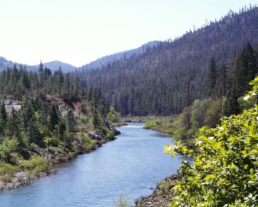
![Main stem of the Illinois River.]()
Illinois River.
Main stem of the Illinois River. Phot by Gordon Lyford
Related Entries
Related Historical Records
Map This on the Oregon History WayFinder
The Oregon History Wayfinder is an interactive map that identifies significant places, people, and events in Oregon history.
Further Reading
Hill, Edna May. Josephine County Historical Highlights, Grants Pass: Josephine County Historical Society, Josephine County Library System, 1976.
McArthur, Lewis. Oregon Geographic Names, 7th ed. Portland: Oregon Historical Society, 2003.
Oregon: End of the Trail. Prepared by the Oregon office of the Federal Writer's Project, Oregon State Board of Control, 1940.