With the acquisition of the Oregon Country in 1846, the United States was faced with an enormous challenge to administer what had become a significant part of the nation’s federally owned public domain. American Indian title, preemption settlement, existing land claims, and the great westward migration were urgent matters to be addressed. The responsibility rested with Congress, but a key federal agency, the United States General Land Office (GLO), would be summoned to administer, survey, and initiate disposition of the public domain lands.
The Oregon Territorial Act of 1848 contained no provision to grant or sell lands and was silent regarding preemption settlement, but the Donation Land Act of 1850 came to the rescue to create the Office of Surveyor-General of Oregon, provide for the public land surveys, and make donations of public lands to the settlers. Among its major achievements were the legitimization of land claims made by settlers prior to 1850 and the reward and inducement for additional immigration to Oregon. The act also initiated the GLO’s direct involvement in the Oregon Territory.
The United States recognized the need to provide for the orderly settlement and disposal of public domain lands as early as 1785, when the Rectangular Survey System and procedures for maintaining land records and recording land patents were initiated. By 1812, these responsibilities were all placed in the hands of the General Land Office, a newly created agency within the Treasury Department. In 1849, the GLO was moved to the Department of the Interior, where it would remain for ninety-seven years.
The GLO’s headquarters was in Washington, D.C., and field offices were established wherever there was a significant requirement to survey lands and accommodate the needs of settlers. On May 5, 1851, the first surveyor-general of Oregon, John B. Preston, opened a GLO survey office in Oregon City and initiated the Willamette Meridian rectangular survey. The first GLO district land office was opened in Oregon City on December 11, 1854, under the management of Dr. Ralph Wilcox as register and James Guthrie as receiver. As Oregon’s population increased, additional district land offices were established at Roseburg, The Dalles, and several other locations.
In addition to the Donation Land Act, the GLO administered a number of other public land-disposal authorities, including the Sale-Cash Entry Act of 1820 and the Homestead Act of 1862. Amendments to the original Homestead Act included the Enlarged Homestead Act of 1909 and the Stock Raising Homestead Act of 1916. Although the GLO experienced incidents of land and timber fraud in Oregon, the homestead laws are historically recognized as the most important means by which the public domain was transferred into private ownership. Another significant public land law is the General Mining Act of 1872, which vested the control of mineral lands to the GLO. One of the few nineteenth-century public land laws not yet repealed by Congress, it contains a mandate to establish an orderly process for locating mining claims and mining various minerals.
To obtain ownership of public domain lands, citizens had to satisfy the requirements of several laws and regulations, including locating available land, filing their claims and applications with the local GLO district land office, paying required fees or purchase money, receiving permission for entry and settlement, and meeting residence and improvement stipulations.
If the lands were surveyed and Indian title was extinguished, then the GLO could issue a final certificate that authorized issuance of a land patent to transfer title. The land patent was and continues to be the primary title document used to convey public domain lands into private ownership. Because of the prerequisite to clear Indian title and survey lands, the first land patent in Oregon was not issued until 1858. The GLO’s authority to convey lands by land patent was overshadowed by the exclusive authority of Congress to transfer title directly by means of land grants to aid the State of Oregon and to promote development of the public domain through the construction of railroads and wagon roads.
During the 1860s, the Oregon & California Railroad was granted 3,728,000 acres of public domain lands to aid in the construction of a railroad from Portland to the Oregon-California state line. In 1916, 2,891,000 acres—most of it valuable timberlands—were revested to the United States under administration of the GLO because the railroad company failed to properly dispose of the lands. In 1937, the O&C Administration was established to administer the revested lands.
Beginning in the late nineteenth century, federal public land policy began to shift from disposal to retention of lands in federal ownership. The president, the secretary of the Interior, and Congress all used their authority to withdraw and reserve lands for public and national security purposes and for the protection of natural resources. Some examples include the GLO forest reserves, which were transferred to the U.S. Forest Service and became part of the National Forest System in 1905, and the creation of national parks and monuments. An example of natural resource protection is the Taylor Grazing Act of 1934, which provided for the management of surface resources and the requirement for livestock grazing permits on the western public range lands, including much of eastern Oregon, which had been open to unrestricted use during the turbulent homestead era.
In 1946, the GLO merged with the U.S. Grazing Service and the O&C Administration to create the Bureau of Land Management (BLM). Although the GLO no longer exists, its mission continues under the umbrella of the BLM. Considering the distinctive nature of the Donation Land Act, the revested O&C Railroad grant lands, and incidents of land and timber fraud, Oregon has proven to be one of the most challenging of the nation’s thirty public domain states.
-
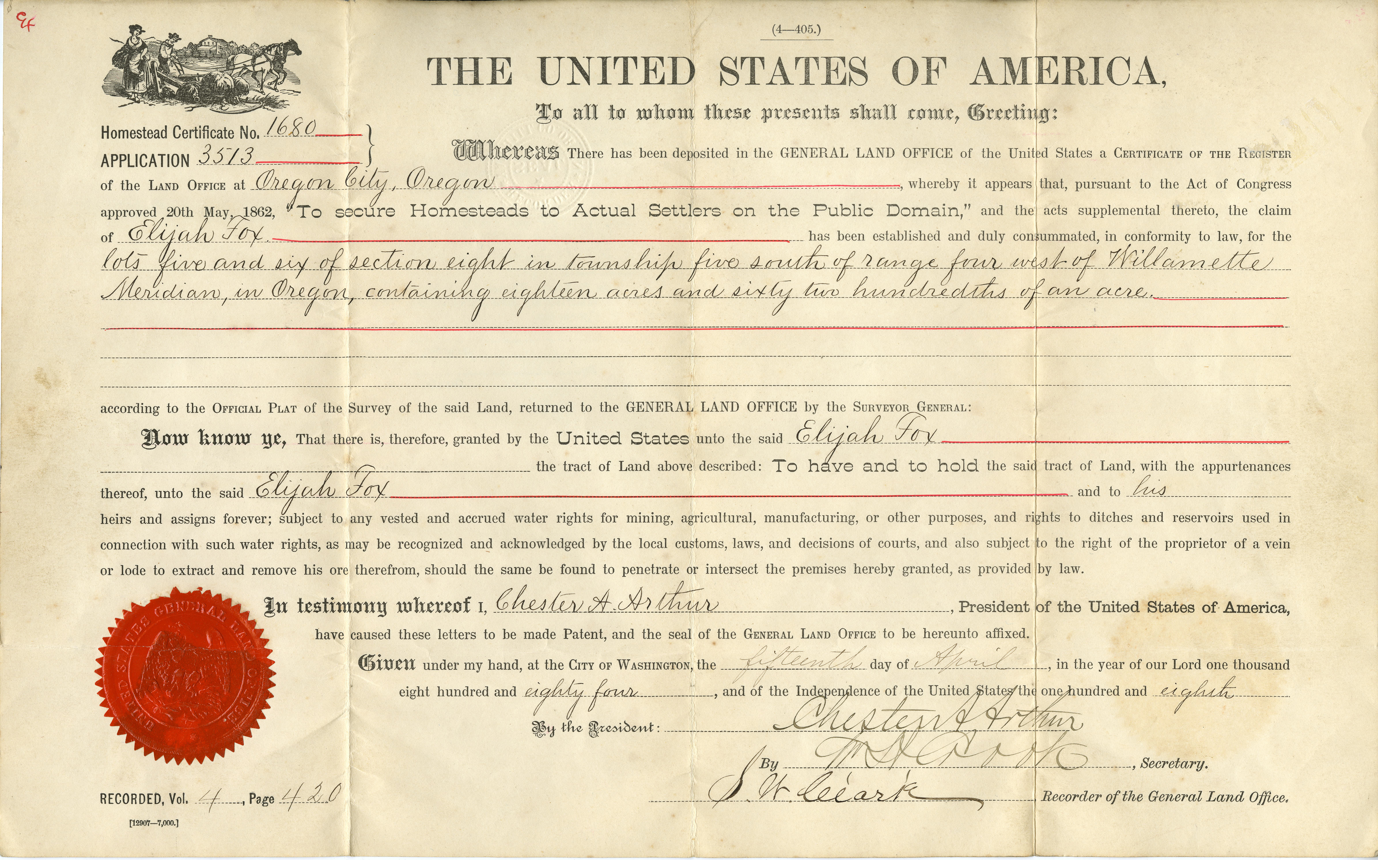
![]()
A General Land Office certificate, April 1884.
Courtesy Oregon Hist. Soc. Research Lib., Mss1501, box 4, acc26528
-
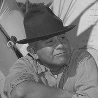
![John B. Preston, first Surveyor-General of Oregon, about 1860.]()
-
![Disposition of the public domain in Oregon, 1858-1976.]()
US GLO, Disposition of Public Domain.
Disposition of the public domain in Oregon, 1858-1976. Compiled by Champ Vaughan


Related Entries
-
![Oregon Donation Land Law]()
Oregon Donation Land Law
When Congress passed the Oregon Donation Land Law in 1850, the legislat…
-
![U.S. Bureau of Land Management]()
U.S. Bureau of Land Management
The Bureau of Land Management (BLM) administers over 15.7 million acres…
-
![Willamette Stone and Willamette Meridian]()
Willamette Stone and Willamette Meridian
Land surveys accomplished under the U.S. Government's Rectangular Surve…

Related Historical Records
Map This on the Oregon History WayFinder
The Oregon History Wayfinder is an interactive map that identifies significant places, people, and events in Oregon history.
Further Reading
"Land Office History." U.S. Department of the Interior, Bureau of Land Management, Oregon/Washington.
Atwood, Kay. Chaining Oregon, Surveying the Public Lands of the Pacific Northwest, 1851-1855. Granville, Ohio: McDonald & Woodward Publishing Company, 2008.
O’Callaghan, Jerry A. The Disposition of the Public Domain in Oregon:Memorandum of the Chairman to the Committee on Interior and Insular Affairs, United States Senate, transmitting a dissertation submitted to the Department of History and the Committee on Graduate Study of Stanford University. Washington, D.C.: U.S. Government Printing Office, Nov. 1960.