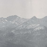
The Wapato Lake National Wildlife Refuge, approved in 2007, is a noncontiguous patchwork of Pacific Northwest rainforest near Gaston, in Washington and Yamhill Counties. The refuge, which includes Wapato Creek from the southwest and Ayers Creek from the southeast, is managed by the Tualatin River National Wildlife Refuge. It is named for Wapato Lake (also known as Lake Wappatoo), a 740-acre complex ecosystem for native plants (such as wapato) and for birds, fish, and other wildlife. A thousand swans and other waterfowl visit the lake area each year, with historic numbers in the tens of thousands.
The U.S. Fish and Wildlife Service has been working to restore Wapato Lake as a national wildlife refuge since 2000, when a group of farmers asked the government to buy their land and manage it. The U.S. Forest Service approved a plan in 2007 calling for an expansion of the Wapato Lake Refuge to 4,310 acres. The first acreage was purchased in 2008 through a grant from the Migratory Bird Conservation Commission, which works to increase the acreage available for migratory waterfowl, especially tundra swans and Canada geese, and allocates funds to national wetland conservation projects approved through the North American Wetlands Conservation Act (1989). The commission approved funds for additional acreage purchases for the Wapato Lake Unit in 2009 and 2011.
The refuge restoration project was also supplemented by the Bonneville Power Administration through mitigation funds. The BPA first purchased land in 2009, and in 2010 purchased 227 acres along Wapato Creek to buffer and mitigate the natural area from development in the nearby cities of Sherwood, Tualatin, and Tigard. The Wapato Lake Unit, originally part of the expansion of the Tualatin National Wildlife Refuge, was named the Wapato Lake National Wildlife Refuge in 2013.
People lived in the vicinity of the lake beginning about fourteen thousand years ago, and as many as ten villages of the Tualatin Kalapuya were located within a few miles of Wapato Lake before 1856. The Tualatin, the most northern of the Kalapuya peoples of the Willamette Valley—also known as the Atfalati, Tualaty, and Wapato Lake Indians—called the lake antua’lati. They occupied the area from the Tualatin Range at present-day Portland to the Coast Range. The territory of the Yamhill Kalapuya was their southern boundary; their eastern boundary was the Willamette River.
The bed of Wapato Lake is composed of Labish soils and provides some of the most nutrient-rich soils in the Willamette Valley. It was a prime growing area for wapato, a nutritious bulb that thrives in wetlands. In the fall, the Tualatin harvested great quantities of wapato, also called Indian potato, and traded it with Clackamas people at Willamette Falls for dried salmon. The time for gathering wapato is immortalized in their annual calendar, collected by ethnologist Albert Gatschet in 1877 at the Grand Ronde Reservation, as “2nd month: atcha’lankuaik; commencing to get the sagittaria-root from the lake (Ma’mptu); Gaston Lake, Or.” The Tualatin also had legends about the lake. One story collected by Gatschet and linguist Melville Jacobs in Kalapuya Texts (1945) was about amu’lukw, a monster living in the lake who had a spotted horn, kept dogs, and frightened children.
In 1850, resettler Donald McLeod claimed 640 acres along the lower west side of Wapato Lake, and in 1852 he began to build a log cabin. Chief Kiakuts of the Tualatin had his own claim there, where people camped and gathered wapato bulbs. He confronted McLeod, and two days later, Kiakuts and Kuyape-i (Black Jack) tore down the cabin. In the case brought against the Tualatin in U.S. District Court, the judge dismissed the charge of “unlawful assembly to do unlawful acts” and told McLeod to leave the Indians alone because it was their land. In 1855, the Tualatin signed the Willamette Valley Treaty and agreed to remove to the Grand Ronde Reservation with at least twenty-eight other tribes.
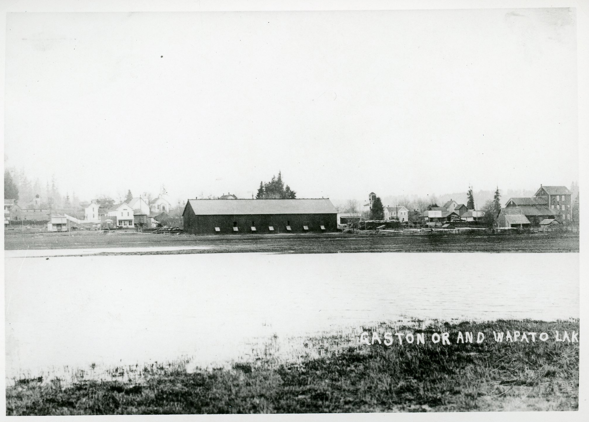
Joseph Gaston, who settled at Wapato Lake in 1880 after retiring from the railroad, partially drained the lake to create what he hoped would be a farming empire. He did not succeed. Beginning in 1911 and continuing into the 1950s, a private partnership of farmers led at times by G. Blaine Brown successfully drained the lake; in 1952 the farmers created a corporation to manage the land. The Water Improvement District, formed in the mid-1930s helped these local farmers construct water conservation projects, including pumps, dams, dikes, ditches, burrows, roads, and bridges. The constant need to maintain the water management projects continued to burden farmers. The effect of water conservation left the lakebed somewhat dry in the summer, and the loss of wetland negatively affected waterfowl habitat and species diversity.
During the early twentieth century, several Japanese Americans settled on Wapato Lake, where they grew onions, corn, and wheat and established dairy farms. They were among the thousands of people incarcerated in detention centers or camps during World War II, and most lost their land and never returned to the area.
In 2009-2010, the U.S. Fish and Wildlife Service began working on a fifteen-year comprehensive plan for the Wapato Lake National Wildlife Refuge. Until the land acquisitions for the refuge are completed and restoration work begins, the land is being offered for use by local farmers.
-
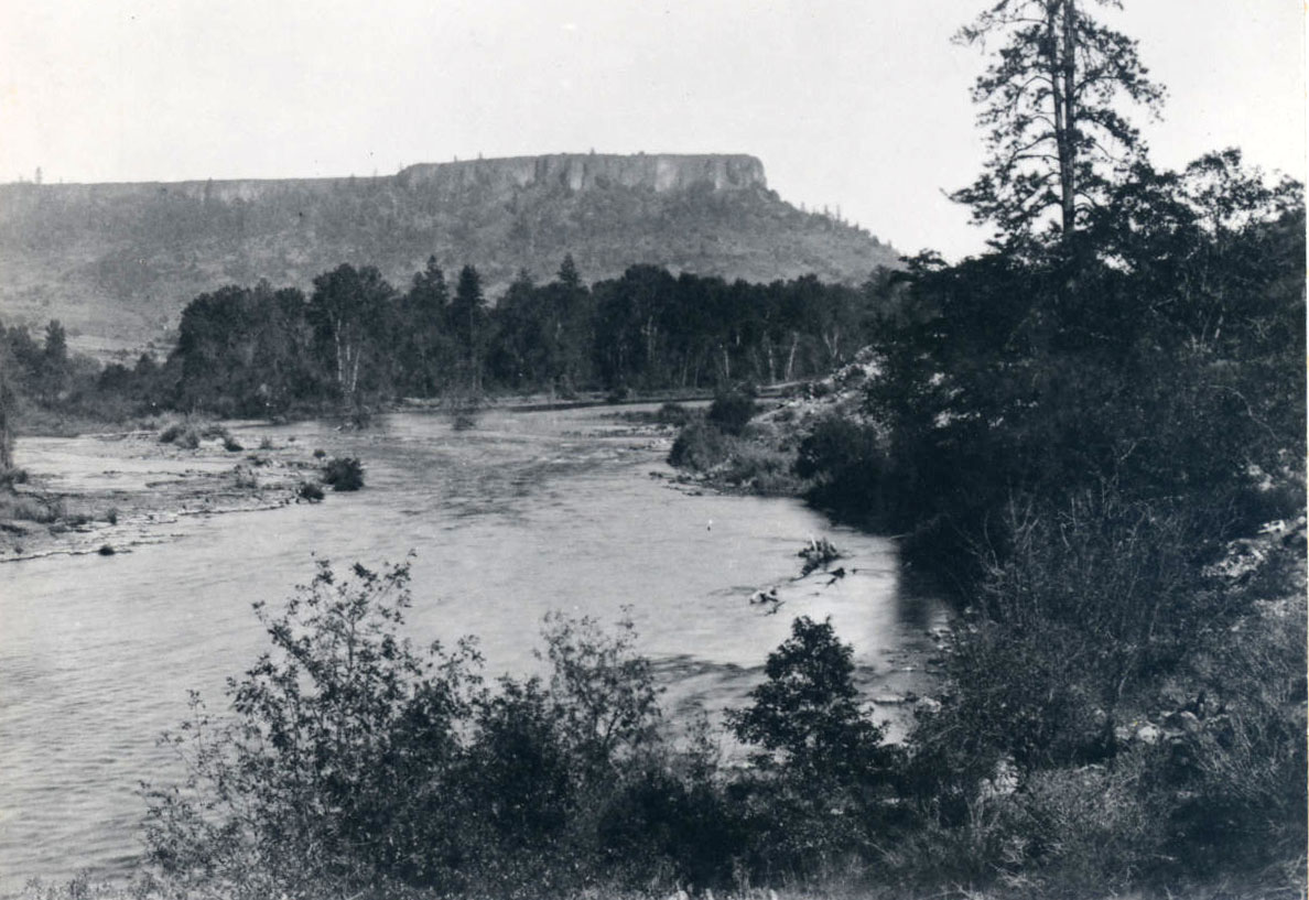
![]()
Wapato Lake and the town of Gaston.
Courtesy Oregon Hist. Soc. Research Lib., 44672
-
![]()
Tundra swans on Wapato Lake.
Courtesy U.S. Fish and Wildlife

Related Entries
-
![Confederated Tribes of Grand Ronde]()
Confederated Tribes of Grand Ronde
The Confederated Tribes of Grand Ronde Community of Oregon is a confede…
-
![Kalapuyan peoples]()
Kalapuyan peoples
The name Kalapuya (kǎlə poo´ yu), also appearing in the modern geograph…
-
![Three Arch Rocks National Wildlife Refuge and Wilderness]()
Three Arch Rocks National Wildlife Refuge and Wilderness
At fifteen acres, Three Arch Rocks lays claim to being one of the small…
-
![Tualatin peoples]()
Tualatin peoples
Tualatin (properly pronounced 'twälə.tun in English) was the name of a …
-
![U.S. Bureau of Land Management]()
U.S. Bureau of Land Management
The Bureau of Land Management (BLM) administers over 15.7 million acres…
-
![Willamette Valley Treaties]()
Willamette Valley Treaties
From 1848 to 1855, the United States made several treaties with the tri…
Map This on the Oregon History WayFinder
The Oregon History Wayfinder is an interactive map that identifies significant places, people, and events in Oregon history.
Further Reading
Holman, James. "Plan to restore Wapato Lake wetlands takes big step." Portland Oregonian, June 26, 2008.
Christy, John A. "Historical Conditions at Wapato Lake, Washington and Yamhill Counties, Oregon." Tualatin Riverkeepers.