Santiam Pass, at an elevation of 4,817 feet, is a major highway crossing of the middle Cascade Range. Located on U.S. 20 at milepost 80.8, the pass crosses the Cascades Crest south of Mount Jefferson and north of the Three Sisters. Beginning in 1861, when the first Santiam Wagon Road was being built to ease travel between central Oregon and the Willamette Valley, the opening of the pass facilitated settlement and cattle ranching in the grasslands beyond the Cascades.
The pass has been known by several names, including Lakes Pass, Minto Pass, and Hogg Pass. In 1891, Judge John Breckenridge Waldo referred to the location as Minto Pass, in reference to pioneer John Minto. Minto Pass now refers to a more northerly location along the crest of the Cascade Range. The name Lake Pass was applied early and is a reference to the pass’s proximity to Fish, Clear, and Suttle Lakes. Hogg Pass, located nearby, was selected by Colonel T. Egenton Hogg for his ill-fated Corvallis and Eastern Railroad, which would have connected Newport and Boise, Idaho. The U.S. Geographic Names Board adopted the name Santiam Pass in 1929, the name having already been used on the Santiam River in reference to the Santiam Indians, a Kalapuyan tribe that inhabited the area before they were forcibly relocated to the Grand Ronde Agency.
The Santiam Wagon Road was officially known as the Willamette Valley and Cascade Mountain Wagon Road. It was a government-granted, privately owned toll road that began near Albany and ran eastward over the Cascade Range to Ontario in eastern Oregon. By 1867, construction was advanced to Fish Lake, and in 1868 the road was pronounced open. The last toll was charged in 1921. Four years later, the road was sold to Linn County to become part of the South Santiam Highway, which opened in 1939. The old Santiam Wagon Road is listed on the National Register of Historic Places (2010).
Hoodoo Ski Area, which opened in about 1940 and operates under a U.S. Forest Service special-use permit, is located just south of the summit.
Today, the Department of Transportation designates two Santiam Highway routes: the South Santiam (U.S. 20) and the North Santiam (Route 22), which separate west of the Santiam Pass summit at milepost 74.7. In addition, the Clear Lake Cutoff directs traffic on the McKenzie Highway (Route 126) from McKenzie Bridge past Clear and Fish Lakes to the South Santiam Highway.
-
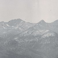
![]()
Three Fingered Jack from Highway 20, Santiam Pass, c.1953.
Oregon Historical Society Research Library Digital Collections Org Lot 1275; Box 1; 457.

Related Entries
-
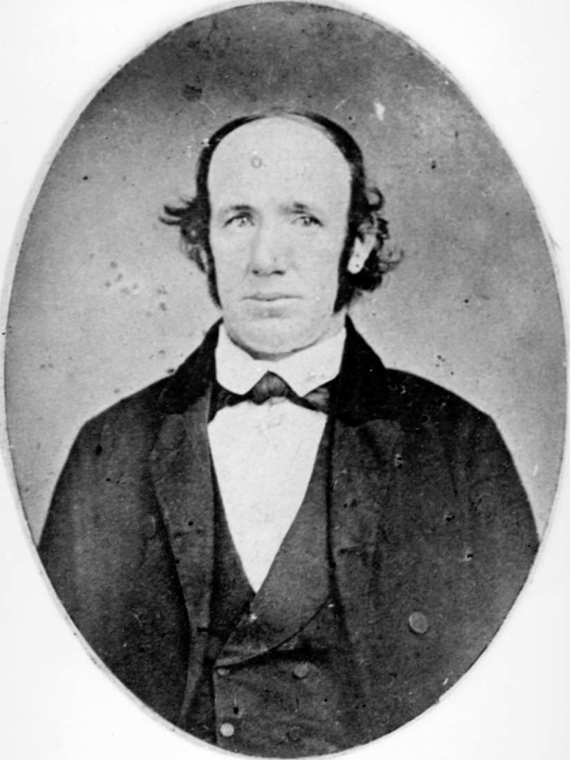
![John B. Waldo (1844-1907)]()
John B. Waldo (1844-1907)
John Breckenridge Waldo was the first Oregon Supreme Court chief justic…
-
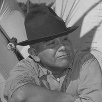
![John Minto (1822-1915)]()
John Minto (1822-1915)
John Minto described his sudden decision in 1844 to strike out for Oreg…
-
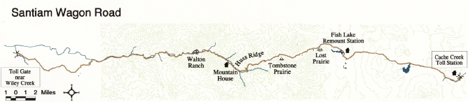
![Santiam Wagon Road]()
Santiam Wagon Road
The Santiam Wagon Road was a vital commercial link connecting the Willa…

Map This on the Oregon History WayFinder
The Oregon History Wayfinder is an interactive map that identifies significant places, people, and events in Oregon history.
Further Reading
McArthur, Lewis A., and Lewis L. McArthur. Oregon Geographic Names. 7th edition. Portland, Ore.: Oregon Historical Society Press, 2003.