The Fort Yamhill Blockhouse is one of the few architectural remnants from the era of wars and treaties with Native people in western Oregon, from 1849 to 1860. The U.S. Army constructed the building at Fort Yamhill, near present-day Valley Junction, in March-April 1856. In 1911, preservationists moved the structure thirty miles northwest to a park in Dayton to save it from demolition and as a commemorative of Joel Palmer’s tenure as Oregon superintendent of Indian Affairs (1853-1857).
The blockhouse is a substantial two-story building with vertical log walls and evenly spaced rifle portals on both floors. The 2.5-by-3.5-inch portals were cut through from the inside log face in beveled shape from an 8-by-6.5-inch opening. The outside dimension of the floors were 22 by 22 feet, with the second story centered diagonally on the first floor to provide four outward defensive viewpoints. Six rifle ports were cut on each side of the first and second stories, with four windows—2 feet 11 inches by 4.5 inches—centered on the second floor, each with an iron bolt closure.
The army built the blockhouse as part of a strategy to limit contact and conflict between Native people and Oregon’s resettlement communities, especially near the newly created reservations. The structure stood at the boundary of the Grand Ronde Reservation and private farmland, on a serviceable road that facilitated the shipment of goods from Dayton, Corvallis, Oregon City, and Portland to supply the fort and reservation.
In late April 1856, Lt. Philip H. Sheridan (later a heroic Civil War general and General of the Army) arrived at Fort Yamhill to replace Lt. William B. Hazen and complete construction of the blockhouse and at least twenty-four other buildings at Fort Yamhill. Sheridan employed Indians from the Grand Ronde Reservation as construction workers. The army assigned four officers to Fort Yamhill to oversee a garrison of some eighty soldiers.
Unlike other blockhouses built during the 1850s, such as the three at the Cascades on the Columbia River, the Fort Yamhill structure was not designed as a sanctuary for whites under siege from Indian attackers. Rather, it served as a guardian of the reservation to guarantee controlled access and prevent conflict between people on the reservation and in nearby farming communities. Sheridan built two other blockhouses in 1856, one at Fort Hoskins on the Luckiamute River northwest of Corvallis and a second at Yaquina Bay on the central Oregon Coast.
When the Civil War required transfer of federal forces to the east in 1861, the U.S. Army retained the blockhouse, garrisoned with volunteers, because of the potential threat posed by pro-South sympathizers. By 1866, the army had decommissioned the fort and put the buildings up for auction, but the blockhouse was left in place. The Grand Ronde Reservation later moved the building to the Indian agency and used it for storage and sometimes as a jail. The blockhouse had deteriorated sufficiently by 1910 and demolition seemed its assured fate until Dayton residents moved it to Dayton in 1911, sustaining it as a commemorative attraction.
-
![]()
Yamhill Block House.
Courtesy Oregon Hist. Soc. Research Lib., 59159
-
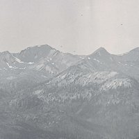
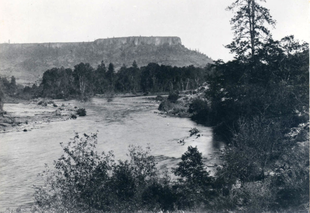
![]()
Northwest view of Valley Junction from Fort Yamhill.
Courtesy Oregon Hist. Soc. Research Lib.
-
![]()
Moving the blockhouse to Dayton, 1911.
Courtesy Oregon Hist. Soc. Research Lib., 62682
-
![]()
Sheridan's house at Fort Yamhill, 1936 (renovated).
Courtesy Oregon Hist. Soc. Research Lib.


Related Entries
-
![1st Oregon Volunteer Infantry]()
1st Oregon Volunteer Infantry
During the 1860s, the major military-Indian conflicts of the Pacific No…
-
![Confederated Tribes of Grand Ronde]()
Confederated Tribes of Grand Ronde
The Confederated Tribes of Grand Ronde Community of Oregon is a confede…
-
![Joel Palmer (1810-1881)]()
Joel Palmer (1810-1881)
Joel Palmer, who first saw the Oregon Country from a wagon in 1845, spe…
-
![Philip Henry Sheridan (1831-1888)]()
Philip Henry Sheridan (1831-1888)
Before he gained fame as commander of the cavalry forces of the Army of…
-
![Willamette Valley Treaties]()
Willamette Valley Treaties
From 1848 to 1855, the United States made several treaties with the tri…


Map This on the Oregon History WayFinder
The Oregon History Wayfinder is an interactive map that identifies significant places, people, and events in Oregon history.
Further Reading
Levens, Turner F. “When Sheridan was in Oregon.” Was HQ 16 (July 1925) 163-185.
Sheridan, P.H.. Personal Memoirs. New York: Charles L. Webster and Co., 1888.
Lockley, Fred. “Reminiscences of Mrs. Frank Collins, Nee Martha Elizabeth Gilliam.” Oregon Historical Quarterly 17 (Dec 1916): 367-368.
Cooper, Grace E. “Benton County Pioneer-Historical Society.” Oregon Historical Quarterly 57 (March 1956): 83-93.
Fort Yamhill Draft Master Plan, July 29, 2004, Oregon Department of Parks.