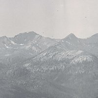
Hillsboro, the seat of Washington County, is in the Tualatin River Basin west of Portland. The earliest people in the area were Atfalati, who gathered at Chatakuin—today’s Five Oaks—to settle disputes, arrange transactions, and carry out community affairs. The first Europeans and Americans arrived in the late 1830s: retired Hudson’s Bay employees; former mountain men, including Joe Meek; and missionaries such as John Smith Griffin. Within a few years, a second wave of immigrants had arrived by way of the Oregon Trail. The area around their farms became known as East Tualatin Plains.
Agriculture, commerce, and government have defined the town of Hillsboro since its beginnings. At the 1843 meeting in Champoeg, where Oregon’s first provisional government was formed, Joe Meek, A.T. Smith, and David Hill played prominent roles. As a result of their influence, East Tualatin Plains became the seat of the Tuality District, which was later divided into four Oregon and ten Washington counties. Hill and Isaiah Kelsey sold or gave portions of their Donation Land Claims to create the first town plat in 1850. Hill died later that year, and the tiny town was renamed Hillsborough in his honor. The abbreviated name Hillsboro’ became Hillsboro when the post office was reestablished in 1892.
Sternwheeler steamboats on the Tualatin River in the 1860s and Ben Holladay’s Willamette Pacific Railroad in the 1870s allowed farmers to export their crops to Portland and beyond. Flour and lumber mills were built at the railroad station south of town. The misbehavior of the workers in the town’s four saloons earned nineteenth-century Hillsborough the nickname Sin City. At the same time, cultural amenities such as brass bands, literary societies, and temperance groups were started.
Downtown Hillsboro’s most prominent landmarks, the Porter Sequoias at the county courthouse, were planted in 1880. During the 1890s, wooden buildings were replaced by brick and stone, and the city created districts for power and water. Rural influences remained in the annual stallion shows held downtown, the horse-breeding farm and racetrack at the former county fairgrounds, and the country estates of prominent Portlanders Simeon Reed and William Ladd, who bred imported European sheep.
The town grew, doubling in size between 1900 and 1910, and city leaders sponsored an exhibit at the 1905 Lewis and Clark Centennial Exposition in Portland. Hillsboro was a working city, with mills and factories processing grain, dairy products, and lumber. There were also two theaters and a Carnegie library.
Two interurban train lines arrived in 1908 and 1912, opening up new markets for local agriculture. East of Hillsboro, the Oregon Nursery Company platted the company town of Orenco, which thrived for thirty years. Determined to erase its former Sin City image, in 1913 Hillsboro voters prohibited the sale of liquor in town, six years before the Volstead Act ushered in Prohibition.
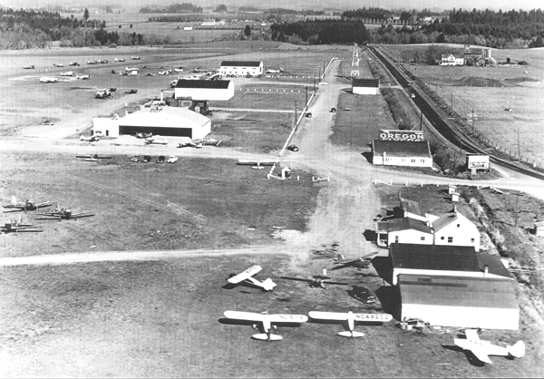
During the Depression, the interurban rail lines shut down, and WPA and CCC programs built a new post office and improved Shute Park. Times improved during World War II, when employment in Portland’s shipyards fueled housing growth. The city received another economic stimulus when the federal government funded extensive improvements to the fledgling Hillsboro airport as a national defense project.
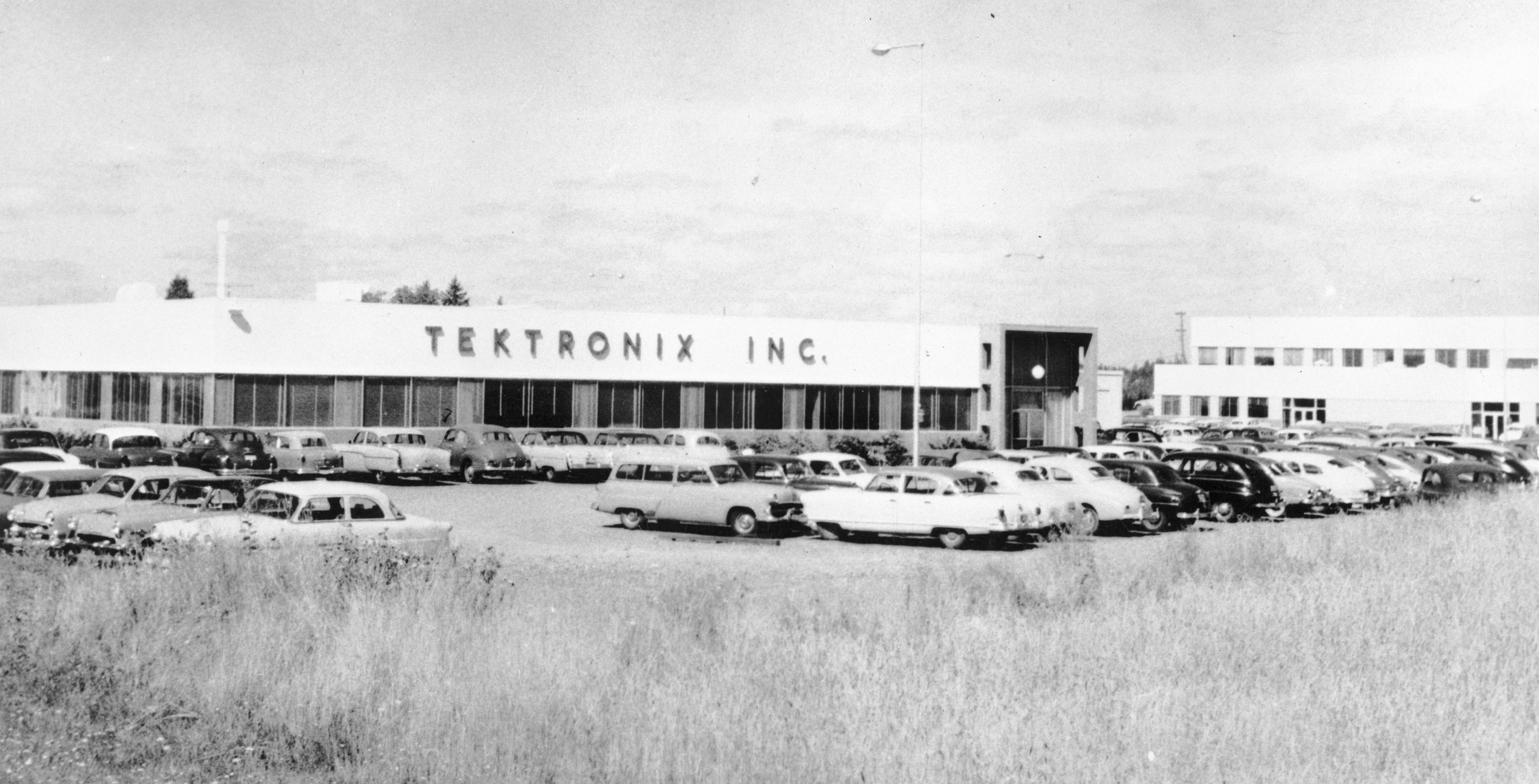
By war’s end, Hillsboro’s agricultural economy had shifted from subsistence crops to food processing and nursery stock, but a larger transformation was coming. In 1951, just east of Hillsboro, Tektronix began manufacturing oscilloscopes. It was the first seedling in the Silicon Forest, the concentration of high-tech firms along the Sunset Highway that brought a new wave of immigrants from around the world. Since then, Hillsboro’s industrial base has broadened to include biotech and sustainable energy manufacturing.
About 106,447 residents lived in the city limits in 2020. The new LEEDS Gold City Civic Center and the Washington County Courthouse and Public Services Building anchor the downtown, and the Tuality Community Hospital shares its campus with the branch campus of Pacific University’s Health Professions. Outlying neighborhoods such as Orenco, Reedville, and Tanasbourne include residential developments and commercial centers, including the Streets at Tanasbourne.
Hillsboro continues to be the center of the Silicon Forest and the hub for regional commerce, government, and agriculture in Washington County.
-
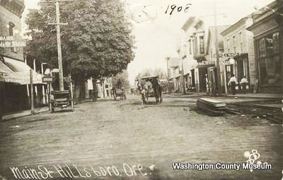
![Main Street Hillsboro, 1908.]()
Main Street Hillsboro, 1908..
Main Street Hillsboro, 1908. Courtesy Washington County Museum; Item Number LP1972.0867--920
-
![Planking Main Street Hillsboro, 1880s.]()
Planking Main Street Hillsboro, 1880s..
Planking Main Street Hillsboro, 1880s. Courtesy Washington County Museum; Item Number LP1987.0179.0013--13197
-
![Five Oaks, Hillsboro, about 1960.]()
Five Oaks, Hillsboro, about 1960..
Five Oaks, Hillsboro, about 1960. Courtesy Washington County Museum; Item Number LP1972.1210-1270
-
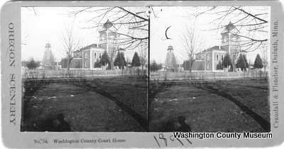
![Courthouse, young sequoias and watertower, about 1900.]()
Courthouse, young sequoias and watertower, about 1900..
Courthouse, young sequoias and watertower, about 1900. Courtesy Washington County Museum; Crandall & Fletcher photographers; Item Number LP1986.0137--10758
-
![Red Electric line on Main Street Hillsboro.]()
Red Electric line on Main Street Hillsboro..
Red Electric line on Main Street Hillsboro. Courtesy Washington County Museum; Item Number 102-DR
-
![Hillsboro Airport in the 1940s.]()
Hillsboro Airport in the 1940s..
Hillsboro Airport in the 1940s. Courtesy Washington County Museum


Related Entries
-
![Silicon Forest]()
Silicon Forest
The Silicon Forest is the name applied to the cluster of high-technolog…
-
![Tektronix Inc]()
Tektronix Inc
Tektronix, one of Oregon's most prominent and innovative high-technolog…
-
![Tualatin peoples]()
Tualatin peoples
Tualatin (properly pronounced 'twälə.tun in English) was the name of a …

Map This on the Oregon History WayFinder
The Oregon History Wayfinder is an interactive map that identifies significant places, people, and events in Oregon history.
Further Reading
Buan, Carolyn M. This Far-Off Sunset Land: a Pictorial History of Washington County, Oregon. Virginia Beach, Va.: Donning Company, 1999.