
Blue River is located forty miles east of Springfield along the McKenzie Highway, near the confluence of the Blue and McKenzie Rivers. The community was founded by Samuel Christopher Sparks and Robenia Bringle Sparks. A Confederate soldier during the Civil War, Samuel left his family in 1874 and headed west with a wagon train bound for California. He wound his way northward, arriving in the Willamette Valley in January 1875. Twenty years later, the Sparks family moved to the upper McKenzie River, where they purchased two adjoining homesteads of some 320 acres. The property included the present site of Blue River and reached west to the present-day McKenzie High School. Reportedly, the Sparks home was located just west of the Blue River.
Gold had been discovered in the McKenzie River and its tributary, the Blue River, in either 1860 or 1862. Miners had discovered gold-bearing quartz ledges in the upper reaches of the Blue River drainage, and mining operations began in about 1890. The Lucky Boy Mine turned out the largest amount of gold and silver.
A covered bridge spanned the Blue River at the northern edge of town, serving as a collection station for the McKenzie Toll Road between Springfield and central Oregon from 1891 to 1895.The bridge washed out and was replaced in 1909. The new bridge also washed away in high water and was replaced by a concrete bridge in 1928.
Between 1900 and 1903, the Sparks family built a sawmill, hotel, and livery stable and established the town of Blue River. In its heyday from the late 1800s until the 1920s, Blue River had five saloons and a red-light district that catered to the miners. The Blue River Mining District had a short life, however, and the primary mining operations closed down in 1924.
Still, the community prospered with the advent of logging from the Willamette National Forest. There were many opportunities for logging and sawmilling after World War II, and several sawmills in Blue River cut old-growth logs that were brought on log trucks from the nearby forest. The community thrived on lumber jobs until the 1980s. The construction of Cougar Dam and the Blue River Dam in the early 1960s provided more jobs for the community, but the high-paying jobs disappeared once the dams were built. Blue River was bypassed by a new highway in the 1960s.
In 1967, Frances O'Brien, a former schoolteacher, persuaded the town to start a library in Blue River. The town bought an old Civilian Conservation Corps (CCC) Camp Belknap building from the Forest Service for a dollar, dismantled it, and reconstructed it in Blue River. The library, which was featured in a 60 Minutes program, is open twenty-four hours a day, library cards are not required, and books are checked out on the honor system. Community members constructed a larger library building in 1983.
On September 7, 2020, the Holiday Farm fire swept through the region and destroyed town." The community is currently preparing plans to rebuild. Before the fire Blue River had a population of about 850 residents and was the largest community in the upper McKenzie Valley.
-
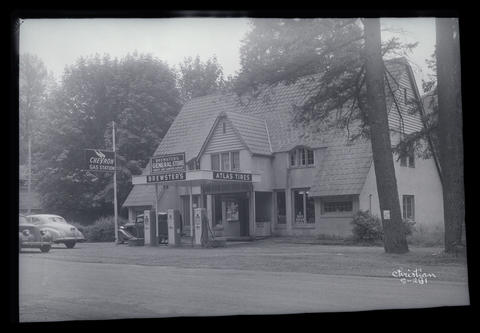
![]()
Blue Mckenzie Lodge, Blue River, c.1950.
Oregon Historical Society Research Library, Org. Lot 1275
-
![Gold miners Bill Nesmith and C.L. Marshall wait for stage at Blue River, Oct. 1911.]()
Blue River, men at, 1911, bb008634.
Gold miners Bill Nesmith and C.L. Marshall wait for stage at Blue River, Oct. 1911. Oreg. Hist. Soc. Research Libr., bb008634
-
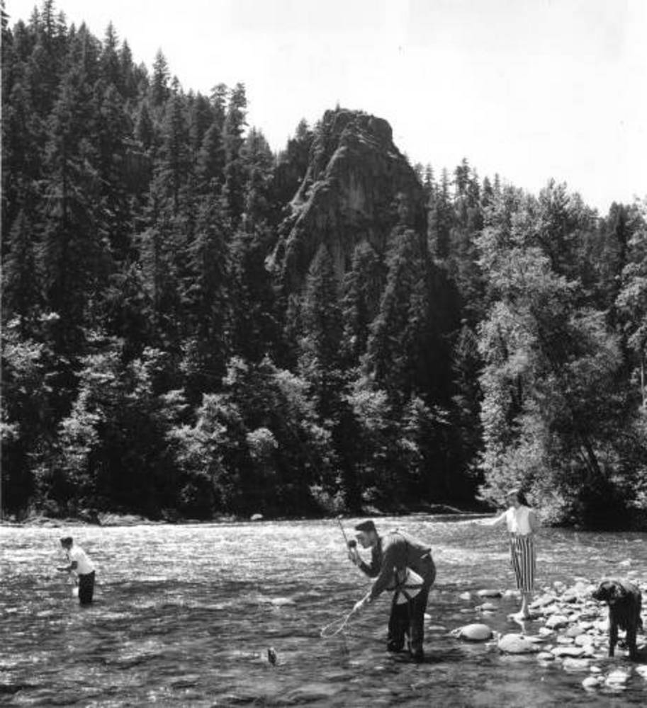
![]()
Blue River, McKenzie Highway, c.1950.
Oregon Historical Society Research Library, Org. Lot 1275 B3


Related Entries
-
![Community of McKenzie Bridge]()
Community of McKenzie Bridge
The unincorporated community of McKenzie Bridge is located along the Mc…
-
![McKenzie River]()
McKenzie River
The McKenzie River, on the western slope of the Cascade Range, starts o…
Related Historical Records
Map This on the Oregon History WayFinder
The Oregon History Wayfinder is an interactive map that identifies significant places, people, and events in Oregon history.
Further Reading
McArthur, Lewis A., and Lewis L. McArthur. Oregon Geographic Names (7th ed.). Portland: Oregon Historical Society Press, 2003.